Friday, April 30, 2010

Andreis - Pala Barzana

The climb to Pala Barzana from Andreis is shorter but steeper than from Poffabro (see Pala Barzana ). Either way though, it's a good work out and very close to home.

After the 4km tunnel, you turn off the main road and head gently uphill. A kilometer and a half later you turn off the road to Andreis and start up a 9% slope. After the little village of Bosplans the road does a kilometer or so of 9-15%. I was panting but remained seated for the climb. The grade eases up a bit (down to 7-8%) and winds on up to the forcella. Suddenly the forest canopy opens into a grassy meadow, surrounded by higher rocky peaks.

I had a snack there, then headed down the well-engineered road to Poffabro. It passes through a fir tree forest, then into faggio and other deciduous trees. It is more exposed to the sun than the climb from Andreis, but both have wonderful panoramas. Lovely streams with snowmelt criss-cross the road- the sound is enchanting.

After descending through Poffabro, I reached Bus di Colvera and stopped to enjoy the rushing white water. Very special place.

So try the climb both ways- you'll love them both.


Looking up from Forcella Pala Barzana at Monte Raut


Spring foliage above the tornanti


Mountain stream


Map of the climb


Ride profile


Wednesday, April 28, 2010

Valcellina

I've been looking for bike paths for my wife to ride on her hybrid, so thought I'd explore a couple in Valcellina I saw here: http://www.barcis.fvg.it/fileadmin/documenti/PistaCiclabileValcellina.pdf

The first area I checked was below Lago di Barcis. Near Molassa, Fiume Cellina enters a deep narrow gorge only a few meters wide at points, where the rock has been carved into smooth round shapes by the rush of water (La Forra). Now there's a dam so the flow is reduced, but imagine a hundred years ago in Spring, how violent the turbulence would have been. Only a short portion of the original road has been made into a year-round pista ciclabile. The main portion down to Lago di Ravidis (near Montereale) is closed due to rock falls, except for August and weekends in September. I rode it once about ten years ago (tossing my bike over the fence then climbing over) but security has been tightened and I'm getting old. I'll try it again when it opens later this year.

So after completing this brief pista, I rode to Molassa, then up over Monte Dint. The views were gorgeous, and the ride was very pleasant, despite a stretch of 14% grade. I then took the road along the back shore of Lago di Barcis, past the turnoff to Piancavallo I climbed last week, to the suspension bridge across the upper end of the lake. Before I reached the bridge, a side road caught my eye, so I explored it. It passes through the Val Pentina, with beautiful wilderness scenery to the end of asfalto after several kilometers. I then rode back and crossed the suspension bridge.

Here I joined the main road toward Claut and Cimolais (see write up in February http://dolomiti-friulane.blogspot.com/2010/04/valcellina-passo-san-osvaldo.html ). The Cellina was full of snowmelt, a brilliant blue-green color. At Claut I looked for another pista ciclabile, which starts just past the bridge over the Torrente Settimana near the Palaghiaccio. It's a nice bike path, which heads up a slight grade through the pine-covered plain toward Cimolais. At one point it gets very steep- reading 19% on the Garmin. Then it rejoins the main road, which isn't heavily trafficked and has very smooth pavement (great for biking). At Cimolais I found the last pista- my favorite. It's through woods along the edge of the plain, almost level for several kilometers. Then it heads downhill to the mainroad junction to Claut and Cimolais. Maybe I'll bring my wife's bike up here in the car sometime so she can try it.

All downhill from there. A bit of headwind but counterbalanced by the downslope, so no problem. At Barcis the road levels out, but once you reach the 4 km tunnel it's downhill again with a tailwind from the ventilation system- feels like your flying.

An easy ride through spectacular scenery on a warm April day (didn't even put on the windjacket on the descent or in the tunnels). Best of all, Valcellina is only 4 or 5 km from my house.


Water-carved rock in the Forra


Forra Cellina


Jagged dolomite peaks above Andreis


Monte Raut


Waterfall on tributary of Pentina


Monte Sestiere from Val Pentina


Glacier remnant(?) above Val Pentina


Alpine flowers Val Pentina


Fiume Cellina, foreground, rushing into Lago di Barcis


Gap through the mountains- to Passo San Osvaldo


Peaks above Cimolais


Upended sedimentary layers north of Claut


Map of piste ciclabile in Valcellina


No GPS data- appears to have dumped.


Sunday, April 25, 2010

Monte Rest- Sella Chiampon

Passo Monte Rest and Sella Chiampon are two routes to Carnia, a mountainous region of northern Friuli which stretches to the Austrian border. While Passo Monte Rest is a very well constructed road with long switchbacks, grades between 7-9%, Sella Chiampon is a narrow, crooked, steep mountain lane. Doing them both in one day is 2000 meters plus of climbing, so you get a good workout while enjoying the spectacular scenery.

After riding to Meduno, then up past Lago dei Tramonti and Tramonti di Sopra, the climb begins. Great road through forested slopes, with lovely views of the vertical cliffs of Monte Rest- hundreds of meters of bare rock straight up. At the passo I rested a few minutes, then headed down the other side. The north side has fantastic views of the Tagliamento valley and surrounding mountains. The north road has shorter, crooked-er switchbacks and is steeper than the road up the south side.

After crossing the Tagliamento, the road turns upward again for a few hundred meters climb. A lady walking down the road shouted "Coraggio!" to spurn me on. The road then winds down through Socchieve, back across the Tagliamento to Preone and the Sella Chiampon climb.

It's a rough narrow lane through the beautiful forest of Val di Preone. After hanging along the cliffside awhile, the road descends to cross Rio Saezza. Now the fun begins. As Passi e Valli in Bicicletta- Friuli puts it " The climb has an unusual profile, characterized by a stretch of 1.7 km in which you must overcome 4 switchbacks with an elevation change of 197 meters, where the median gradient is 11.6%, rising to 20% at times." www.ediciclo.it I remained seated and ground away at the cranks until the grade hit 14%, then I stood the rest of the way. Luckily there wasn't too much loose stone on the surface and I was able to complete this section without the rear wheel spinning or me falling over. Eventually it eased back down below 10% so I could sit down and start riding normally. This continues until the Sella. Shortly afterwards the forest opens into a lush green valley surrounded by mountains- absolutely gorgeous.

I was ready to coast all the way to Pinzano now, but it wasn't meant to be. At the end of the meadow- the road was suddenly covered with fallen rocks, tree limbs, piles of leaves. It appeared to be closed. I continued along it slowly, dodging fallen rocks. I had to dismount once for a particularly bad stretch of debris. The views were mind-boggling down into the sheer-walled gorge of the upper Arzino. Eventually I reached the junction with the road from Selle Chianzutan, and here there was barrier and notice that the road I'd been riding was closed. Nothing at the other end though! And Via Michelin didn't know either. Turned out ok- and I hope it's just temporary, it's a wonderful road .

From here, zoomed down the Val Arzino through San Franceso, down the tornanti at Anduins, rode the rollers through Pinzano to Lestans. Even got a little tailwind on the flats toward home. Thinking about doing the ride again someday in the opposite direction....

Monte Valcalda from Ponte Rio Novarchis


Rio Novarchis


One set of tornanti on Monte Rest


Looking west toward Cimon di Agar


Northward mountains of Carnia


Fiume Tagliamento


Fiume Tagliameto below mountains of Carnia


Waterfall Rio di Grasia

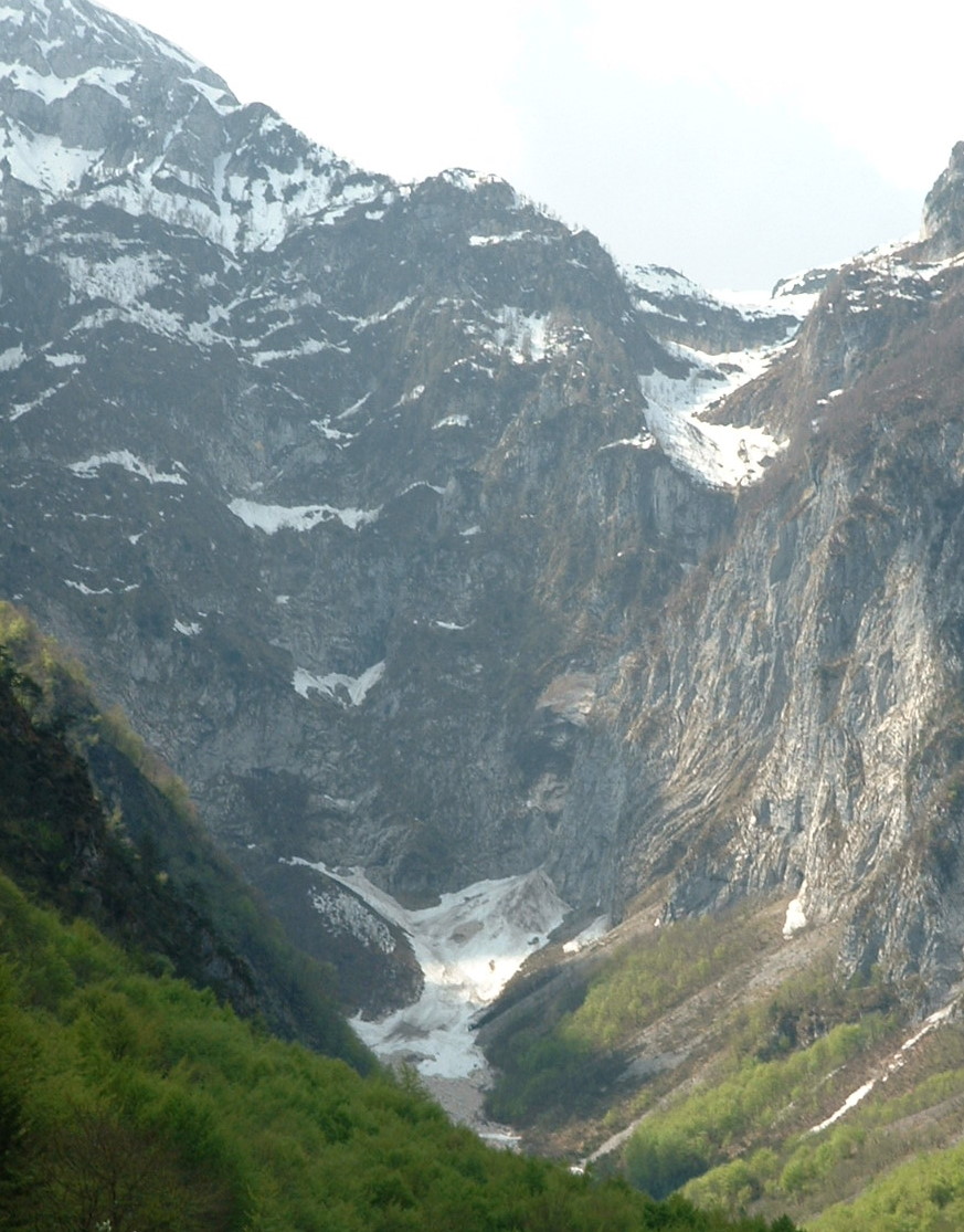
Looking south up Rio Saezza


Rio Saezza down toward Preone


Meadows after Sella Chiampon


The meadows and surrounding mountains


Ride profile


Map


Wednesday, April 21, 2010

Piancavallo da Barcis

Wonderful climb from Lago di Barcis (400 meters) up to Piancavallo (1310 meters). The ride is through deserted wilderness along Torrente Caltea, cascading down from the altopiano. Miles of forest and karst stone outcroppings, completely silent except for the rush of snowmelt in the gorge and birdsong.

The road is very good on the lower half, with well-made tornanti to ease the grade, though it still has stretches of 8-10%. Higher up though, the pavement is broken up by frost heave, with many loose pebbles. Luckily the grade also eases a bit on these higher sections, so no traction problems.

At Piancavallo there was some remaining snow, but the skiers are all gone- a ghost town. I tried taking the road up over Col Alto down to Castaldia, where the parapendia jump off the slopes, but the road was snowed over above 1388 meters. So I rode back down to Piancavallo, then zoomed down the 1200 meter descent to Pedemonte, at Aviano. From the rushing wind of the descent I couldn't hear much on the remaining 200 meter climb home. Great ride.


Mountains above Lago di Barcis


Fiume Cellina gorge below Barcis dam


Torrente Caltea waterfall


Looking back from Piancavallo toward mountains above Barcis


Monte Cavallo, center, looming over Col Alto


Too much snow on road to Col Alto- try again later


Map


Ride profile


Monday, April 19, 2010

Lago Santa Croce - Il Cansiglio

Beautiful climb up to Lago Santa Croce, and then onward up to Il Cansiglio. After a long warm-up on Via Pedemontane Occidentale to Vittorio Veneto, I headed up the climb to San Floriano, Nove, Lago Morto, Fadalto, and finally Santa Croce. Really gorgeous panorama there ( see previous visit in January http://dolomiti-friulane.blogspot.com/2010/04/lago-di-santa-croce.html ).

I rode along the east shoreline to Farra d'Alpago, then turned upward again, through Cornei, Borsoi and Tambre. It's a wide smooth road, with a few stretches of 8-9% grade. At Tambre it seems to level out, then over to Spert and a long downhill into Val Perosa. The worst stretch of the climb is coming out of this little valley- long stretch of 10% and a few hundred meters of 12-13%. After that it levels out at Campon around 1000 meters, and then the big meadows open up at Pianosteria and Piancansiglio. It's magnificent, with pastures surrounded by forests of fir and beech trees, and further out, the mountains.

Then a long easy climb above the meadows through the forest to La Crosetta, 1127 meters ( see previous visit in March http://dolomiti-friulane.blogspot.com/2010/04/il-cansiglio.html ). From here it's a long curvy descent to Sarone. The road is nice and smooth until Giardino, then gets gradually rougher. Still not bad. After Sarone I did the remaining climbs up the hills to home, and then I was very tired.


Lago Santa Croce from Sella di Fadalto


Across Lago Santa Croce toward Belluno


Looking north from Lago Santa Croce


Meadows near Pianosteria


Looking north from il cansiglio


Monte Pizzoc 1536 meters- add to 2010 goals


Map


Ride profile


Thursday, April 15, 2010

Orton - Monte Prat

This ride has two climbs- first from Travesio through Clauzetto to Orton. Then a second climb from Val d'Arzino near San Francesco to Monte Prat. Riden together, they're an excellent workout.

After the flat ride to Travesio, I headed up Val Cosa and the switchbacks ascending to Clauzetto. From there, the road ascends through fir tree and beech forest to the meadows of Orton at 700 meters (see http://dolomiti-friulane.blogspot.com/2010/04/orton.html ). Wonderful views of the surrounding mountains. I decided not to descend through Pielungo, instead opting for the back road through Pecol. I couldn't find it at first, and rode up a 60 meter 15% climb by mistake. It wasn't too bad because I was standing the whole way, but still felt foolish. I plummeted back down to Orton proper, found Via Fratta and headed down the rough back road to Val d'Arzino. I think I'll stick with the better Pielungo route next time, but this one did have some lovely views of Monte Cuar and Forno.

After a short ride up Val d'Arzino, I turned onto the unmarked road to Monte Prat. It's a very well-made road through wilderness, with long switchbacks keeping the grade down to 7-8%. Great views back toward Pielungo and the Arzino gorge. At 894 meters it tops out in a large meadow below the twin peaks of Monte Cuar. A flock of circling grifoni eyed me expectantly near the cliff face. I headed gradually downhill through forest to the lovely rolling meadows atop Monte Prat. From there, a wonderful wide, smooth road with beautiful curves winds down toward Forgaria. The 2006 Giro d'Italia descended this road- it really is perfect. Right before San Rocco the road suddenly becomes rough, narrow and uneven. It continues down through Forgaria, until the bridge at Flagogna. After a few rollers through Pinzano and Valeriano, it's pretty flat all the way home. Great ride!


Mont Taieit from Orton


Mountains to the west from Orton


Sheep safely grazing at Forno


Monte Cuar from Battaias


Gorge with tributary of Fiume Arzino near Ringans


Meadow at top of climb 894 meters


East peak cliffs of Monte Cuar


Monte Chiampon


Meadows atop Monte Prat


Monte Cuar looming over the meadows of Monte Prat


Tagliamento from Monte Prat descent


Loop map


Monte Prat climb and descent


Ride profile