Friday, October 31, 2014

Pala d'Altei Hike

I parked at Montereale's Osservatorio Astronomico (682 meters), let Honey and Teddi out of the hatch and started hiking.  A gravel and concrete road winds around the hillside to about 1000 meters, where you turn left on a trail through a wooded section  Later you exit the woods and follow a grassy/rocky path up to Casera Rupeit (1275 meters).  The pups and I continued ascending, as the trail skirts around the cliffs of Pala d'Altei's western end and finally crests a small pass (1411 meters) dividing Zuccul Forador from the forest descending steeply down to Valcellina and Lago di Barcis.  You can climb up to the top of Pala d'Altei (1528 meters) if you wish but the girls and I were beat so we headed down.  Honey did a great job retracing our path, even finding some smooth bypasses around places where I had gone directly over rock piles. Nothing like being outsmarted by a 12 pound pooch.  

Great hike with glorious clear, calm weather and wonderful hiking companions.


Lago di Ravedis from trail around 900 meters.

Beautiful Zuccul Forador about 1400 meters

Pala dAltei (on left) from the southwest 

Monte di Mezzo (1425 meters)

Close up of Pala d'Altei's cliff face from the west

Monte Fortel (1436 meters)

Monte I Cameroni (1470 meters)

From the pass looking northeast across Valcellina gorge at
Monte Ressetum in the distance

The trail junction by the little pass

Pala d'Altei from the north: no cliffs on this side

Teddi resting from her ascent

Honey rearing to go, as always

Pala d'Altei from Casera Rupeit to the south (cliffs in the distance)

View from Casera Rupeit of Monte Raut, Jouf, Fara,
with Julian Alps on the horizon


Wednesday, October 29, 2014

Val Postegae MTB

Nippy morning- a few degrees above freezing.  I took Marilyn to get some blood tests, then brought her home and decided to drive to Cimolais instead of riding from Giais.   After parking I pedaled up the beautiful road along Torrente Cimoliana to the turnoff for Rifugio Pordenone.  Instead of turning toward the rifugio I continued straight on the gravel path to Casera Meluzzo, a shelter in a gorgeous wooded, grassy valley like the Ponderosa.  The valley turns east and becomes the gravel riverbed of Torrente Postegae.  Eventually the gravel path ended and the CAI trail appeared to head up along the lower slopes of Cima Brica.  But I was done  climbing for the day so I took some photos of Monte Pramaggiore (2478 meters) and turned back to the car.  Fun descent along the gravel and dirt road.  This area is a must see for anyone in or near Pordenone Province.   


Monte Castellato (2336 meters)

Pala Grande (2385 meters)

Towers peaking over the corner of Cima Meluzzo 

Looking up Val Monfalcon

From Val Postegae looking back at the
 forest of campanili along the horizon

Looking east up Val Postegae toward
Monte Pramaggiore, dusted with snow


Monday, October 27, 2014

Pian delle Femene

Pian dei Grassi and Pian delle Femene are two favorite climbs above Vittorio Veneto.  Today I tried to combine the two with a short connector at 1000 meters.

I warmed up on Via Pedemontane and entered Vittorio Veneto from Anzano.  I turned left onto the Valdobbiadene road and then turned right at Longhere onto the road marked Fais.  This is an excellent climb up through Borgo Olivi and Menegon and onward through the wooded mountainside toward Pian dei Grassi.  At 1000 meters I took a left onto a dirt road marked Valle Storta, which soon turns to concrete and descends steeply.  This connector road is great except for a short section of dirt/exposed rock which was tricky on the skinny-tired road bike.  If you climb it instead of descending, definitely use a MTB.

At 900 meters elevation you join the Pian delle Femene road which climbs upward a few km to 1127 meters.  I had some extra time so checked out the paved road toward Le Pose.  I'll try to MTB down that further another time.  Fast descent to Revine Lago and then the long ride home.  Now my legs are too tired to ride to school tomorrow.


Start of the connector at 1000 meters

Pian dei Grassi road continuing on up to 1181 meters

Pretty country house along the connector road

Junction with the Pian delle Femene road

View up the connector road

View east from Casera Lovere (beyond Pian delle Femene)

Forest lane toward Le Pose

View north down Canale di Limana

View west across the grassy hills

View northeast toward Casera Grava

View of Pian delle Femene area from the descent


Saturday, October 25, 2014

Stavoli Palar MTB


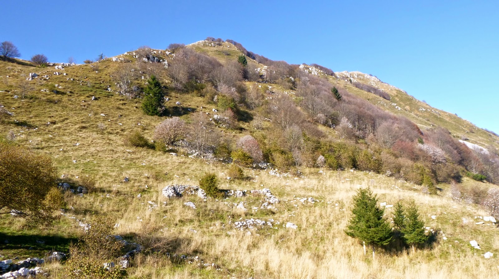
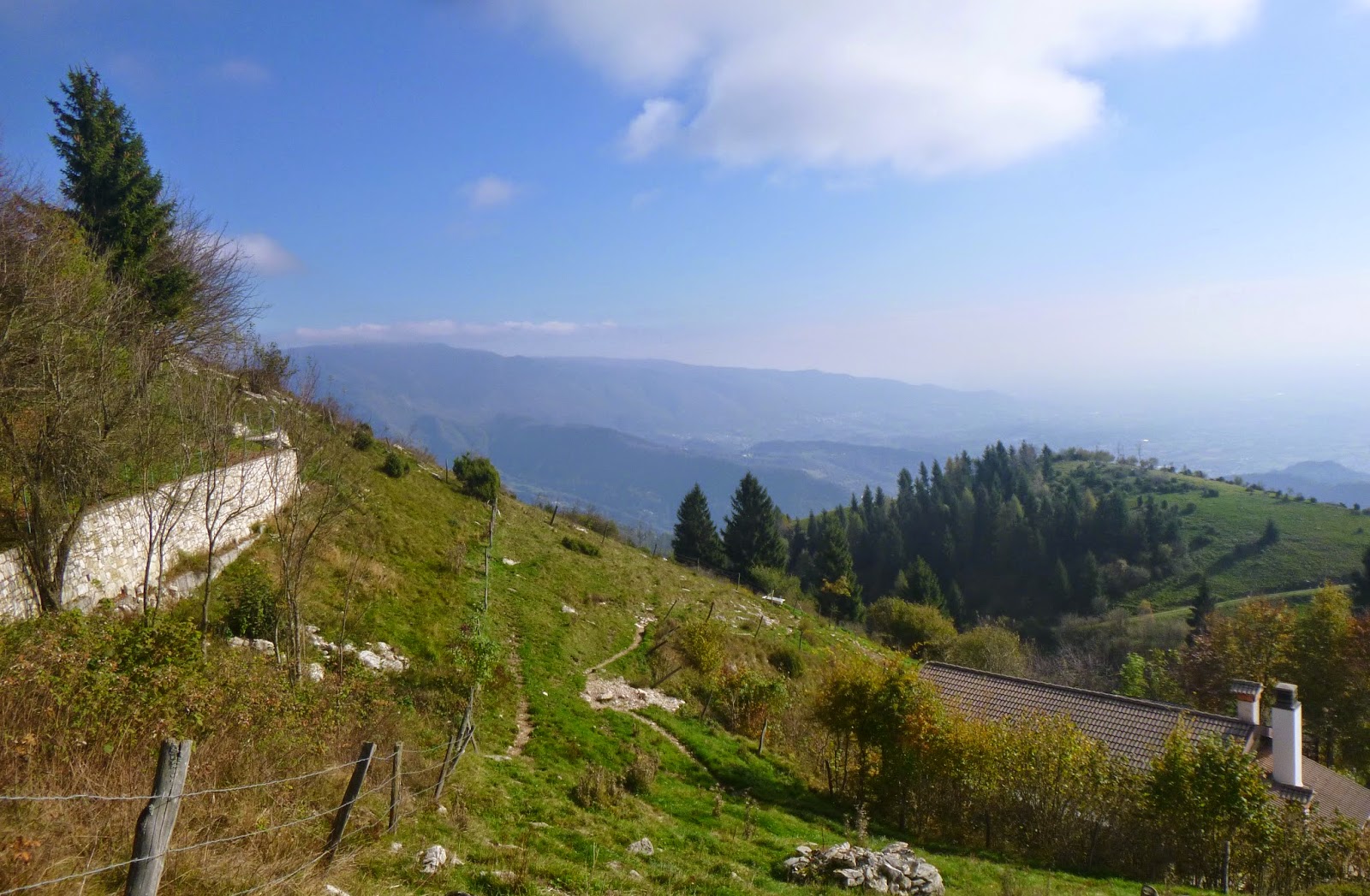
I drove past the Grifoni Riserve at Lago Cornino to Alesso, west of Lago di Cavazzo.  I parked, got on my bike and turned left onto the narrow road marked loc. Armentaria.  It starts climbing steeply immediately: 3.5 km averaging 12.6%, at times reaching 20%.  The pavement ends and a nice gravel road continues gradually rising.  There's a great lookout point with 300 degree panorama at 7.5 km:  tree-covered mountains in all directions.  This valley is almost completely undeveloped, with only a handful of houses on thousands of acres.

The gravel road ascends to Forchia Armentaria at 800 meters.  Here you take the right fork and begin descending.  The loose gravel isn't too bad when descending, and they've concreted/asphalted some of the worst sections.  This descent continues to around 480 meters, with some saliscendi to keep you from getting complacent.  After crossing Torrente Palar you ascend steeply upward again, till Stavoli Palar around 520 meters.  Like me, a friendly Italian MTBer was concerned with the disparity between the map and the actual road, but we both  made it eventually.  

The climbout is another killer, 2.3 km averaging 12.3% with points of 18.5%, about half of it on gravel.  I'm omitting the saliscendi ascent because it's too complicated to calculate.  Once you make it to Forchia Armentaria it's a fun ride from then on.

I want to come back here and try a dirt road that heads up to Monte Flagjel around 1300 meters.  Also another looks like it connects with Valarzino near San Franceso.   Splendid area for riding.    


Start of the climb in Alesso

Monte Chiadins to west 1051 meters

Northwest Monte Piombada, 1744 meters

Close up Piombada

View down Valle di Palar toward Alesso;
left, Monte San Simeone, 1505 meters

Close up Alesso

Stavoli Palar

Downstream Torrente Palar

Toward headwaters of Torrente Palar


Monday, October 20, 2014

Casera Losa MTB

I parked at Ampezzo (560 meters) and rode over Passo Pura (1482 meters)- 8 km averaging 9% gradient.  Then I descended to Lago di Sauris at 965 meters, quite cold on this overcast morning.  Across the high dam and a brief ride along the shore line brought me to the turnoff for Lateis.  Newly asphalted and switch-backed to ease the gradient, the road arrived in a little town seemingly transplanted from Bavaria or Switzerland.  The road steepens and then as I climbed out of town the gradient reaches the mid- to high-teens.  It finally levels briefly at Forca Frumeibn (1423 meters).  As you descend the pavement ends, but it's very hard-packed dirt and should be road bikeable.  

A large cement mixer was ascending as I swooped around a curve so I hopped off and held my bike on the steep edge: the large truck went by with a few inches to spare.  The dirt road enters a meadow with a house, a little chapel and a very old barn at Stavoli Hinter d'Olbe.   Now asphalt returns and I bore right across Rio Temberle, and after some saliscendi, crossed the guado of Rio Piellinis.  Very large eroded landslide area on the mountainside upstream.

Now begins another long steep climb.  The pavement ends again, but this gravel road is a little too rough for a road bike: I was glad I'd brought the MTB.  Eventually you exit the forest and arrive in alpine pastureland.  The clouds now broke up and glorious warm sunshine illuminated the mountains.  I couldn't resist continuing to the area near Casera Losa (1740 meters), in a conch surrounded by grassy peaks.  My drop-dead time to head back passed but I had to spend another 15 minutes exploring the area.

Descent was fast and once I reached the lake I headed down through the tunnels and high bridges through Torrente Lumiei gorge.  The porphyry-block pavement was wet so I was worried about sliding down in the steep tunnels.  Luckily I made it unscathed and reached the car at Ampezzo.

Must try this again and connect with the Passo Forcella climb from Mione, near Ovaro.  Only lacked a few kilometers today but had to get home to stay out of the doghouse. 


Lateis house

Lateis hay drying barn

Stavoli Hinter d'Olbe barn with
curved beams like a ship's ribs

Wood carving of Sant' Antonio

Chapel of Sant'Antonio; note hex head
wooden peg joining

Glorious alpine pastureland near Casera Gerona 

The gravel road from Casera Gerona toward Casera Losa

Valley below the alpine pastures

Casera Losa

The dirt road toward Passo Forcella