Thursday, July 30, 2015

Passo San Boldo - Nevegal

From Vittorio Veneto I pedaled the road bike up over Passo San Boldo and its crazy cliff-face switchback/tunnels.  Then down toward  San Antonio Tortal, where I planned to take the main road to Valmorel.  But from the corner of my eye I saw a sign for Pianezze on a road heading steeply upward and had to try it.  It was a beautiful ride through tall fir trees interspersed with large grassy meadows  A km or two was unpaved but the hard-packed dirt was perfect for a road bike. 

You end up in Pianezze, but it turns out you're in a bowl valley so you must climb steeply to get out.  Luckily the pavement has resumed so you can get traction.  Near Pranolz you reach the main road which carries you through Melere down to Valmorel.  You now descend steeply to Val Lamon, through Tassei and again up steeply through Piandelmonte to Ronce.  Here you follow another hard- packed dirt road winding through the forest to Nevegal.

Fast descent on the main road to Quantin, right turn by cemetery down to Roncan, then right toward Cornolade and Lago Sante Croce, Fadalto and Vittorio Veneto.  Wonderful ride but hard because of all the saliscendi.  Quite a workout.


Passo di San Boldo

View near San Antonio Tortal of Dolomiti Bellunesi 

View northwest from road for Pianezze 
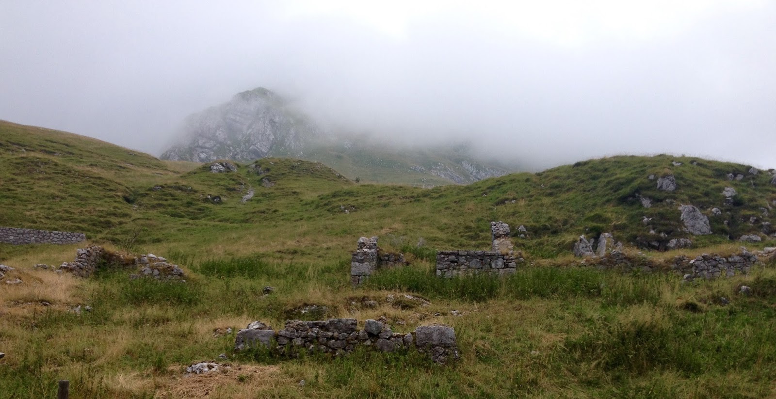
Rifugio at Pianezze 

From above Valmorel looking north


View from Cornolade road of beautiful Alpago and surrounding peaks


Steep climb from Tassei to Ronche


Tuesday, July 28, 2015

Monte Arvenis MTB

The famous climb for Zoncolan leaves Ovaro passing a turn off to the right marked Lenzone.  After leaving the village of Lenzone Via Monte Arvenis begins climbing very steeply up the forested mountainside.  Surprisingly the road is paved, roughly in places but no problem for a road bike.  The gradient is the problem, as on Zoncolan.  Before long I was in 24-36, like Sisyphous pushing my wheel up the precipice.  It levels out around 1500 meters, pavement ends and you pass by Malga Arvenutis.  The dirt road comes to a junction where going straight takes you to Malga Arvenis Alta.  Instead I went right, climbing up to 1600 meters, a wide grassy altopiano.  Soon you arrive at Malga di Claupa and take the rough dirt road climbing to your right, around and over Monte Tribil. The high point at 1716 meters has views stretching to the Tagliamento River and beyond.  After Monte Cucasit the road begins descending, ever steeper and rougher down a bouldery uneven rocky road till you  finally arrive in the meadows of Aiers.  Having survived the wilderness roads, I rewarded myself with a fast descent through the forest on narrow paved lanes to Tarlessa and Trava to Chiassis, where I'd parked the car along the old road from Villa Santina to Ovaro.    Great ride, with many variations.


View from Monte Arvenis road looking west

Malga Claupa 1634 meters

View was from Monte Tribil 1716 Meters

Westward traverse along the grassy monts

View toward Tagliamento to east

Arrival in Aiers, having survived the rocky descent

Pretty Aiers meadows

Church above Trava

Tough climb


Sunday, July 26, 2015

Keen SPD sandals

To be honest I was a little unclear on the concept of a sandal with bike cleats when I heard of it.  It's generally cool here so hot feet isn't a big problem.  Then our heat wave of the century arrived and wouldn't go away.  I was riding up at Monte Pizzoc a couple weeks ago and a guy on a mountain bike stopped to ask directions.  I noticed he had some kind of open shoes and thought that might be cooler.

So I started researching and this brand (Keen) seemed well recommended.  I bought some and finally installed the cleats today.  I'd also just changed the front brake pads so thought I'd combine the ops ck.  

These sandals work great and are nice and cool.  I'm thinking they'd also be good for stream crossings, which usually leave you riding with squishy socks for hours afterward.  I'll still use the Alp X's for hard climbs but for moderate rides these will be perfect. 


SPD cleat


Nice tread

Outboard side

The inner side


Saturday, July 25, 2015

Casera Teglara MTB

Two "new" trails in Val Arzino.  From San Francesco I rode up the highway toward Sella Chianzutan. At the first switchback, turn left on gravel road and cross the bridge over the river.  The road climbs maybe 60 meters along the mountainside above the river heading upstream. You can see Pozzis through the fir trees. You descend and join the trail from Pozzis, then continue to Cascate del Arzino.   Surprised by the volume of water in the falls: 30 km away we are having a drought.

Soon you join the paved road toward Sella Chiampon.  Once you arrive take a left onto a gravel road with several trail signs, one for Casera Teglara (CAI 826).  It begins ascending steeply with concrete in some stretches and doesn't let up.  This beautiful fir forest has very little development and few visitors.

I finally arrived at Casera Teglara in the grassy highlands, where a shepherd was directing his dogs herding sheep.  Quite stormy looking so I soon departed.  A few hundred meters downslope a strong gust-front blew through the trees and I was certain I'd get soaked.  But it held off until I was on the paved road toward San Francesco where I got a light shower.  Fantastic ride.  


Upper cascata del Arzino

Downstream

View toward Malga Vallon about 1200 meters

Casera Teglara 1570 meters

The flock

View to south

View north

Looming thunderheads


The climb


Thursday, July 23, 2015

Torrente Mesaz MTB

Lago del Vajont is a popular tourist area, with the towns of Erto and Casso in the aftermath of a horrific dam disaster 50 years ago.  Usually I follow the main highway on the north shore of the lake, but today I revisited the isolated south shore road.  They've paved the last remaining dirt sections, but otherwise it is as remote and beautiful as ever.  

After Passo Sant'Osvaldo I descended to the turn off for the south shore, sharply to your left.  It descends, crosses Torrente Tuara and then follows the shore line along forested slopes.  There are a few tiny settlements where people grow hay and raise farm animals.  

Eventually you cross Torrente Mesaz and head uphill along the lake.  I missed my turnoff for the trail at first and continued around Lago del Vajont within 2 km of the junction with the main highway.  Realizing my error I turned  around and found trail CAI 905: a large flat-stone paved lane heading steeply upward.  The stonework soon ended and it became a steep gravel road.  Great workout.  After a few km it ends where the foot trail descends to Rifugio Citta'.  Good views from here of Mesaz gorge, Erto and surrounding peaks.  Highly recommended.  


Warming up on road to Cimolais

Upper Vajont lake basin

View northwest of Erto and peaks

Beautiful gorge of Torrente Mesaz


Bridge over Torrente Mesaz

Middle Vajont lake (water backed up behind landslide)

View from end of trail, looking down Torrente Masaz,
across remnant of lake basin toward Erto


Monday, July 20, 2015

Casera La Pala MTB

This is another climb from the south shore of Lago di Barcis up the precipice of Monte Longa.  Today  I started from Portuz, immediately after the dam.   The road is briefly paved, then turns to dirt/gravel with concreted steep bits.  Like the road from Vallata the landscape is beautiful: tall fir trees immersed in shade on the north-facing slope.  The road switchbacks to and fro until 1200 meters where you reach Casera La Pala.  It's a hiking/snowshoeing hut, very quiet and private, high on the mountainside.

From here I explored some, then rode to Casera Monte Longa, a similar place.  It was my destination a few weeks ago though I never made it all the way to the casera.  Today after visiting the hut I headed down a shortcut to the descent road.  I'd been warned in Fred's blog about nettles along the path and he was right: they stung the heck out of me.  But I did determine that this was not a good shortcut when biking: far too steep and narrow for carrying or pushing a bike. 

The descent was wonderful with lots of gravel switchbacks, then at 700 meters the steep paved road.  Arriving at Vallata by the lake, I recrossed the dam, through the tunnels and home.   Beautiful ride.  Will try some more of the other dirt roads up here soon: there are several more I've never ridden. 


Casera La Pala


Monte Ciastelat from Casera Monte Lunga

Casera Monte Longa


The steep climb from Portuz to Casera La Pala


Saturday, July 18, 2015

Monte Paularo MTB

Paluzza is north of Tolmezzo on the road to Austria.  If you turn east you climb along Torrente Pontaiba through Treppo Carnico and Ligosullo.  There's a turn off to your left here for Castel Valdajer, built in 1460.  It's a beautiful area with tall fir trees and fantastic views of surrounding mountains through the gaps.  After the castle, pavement ends and the road turns to hard-packed dirt/gravel.  In fact I road biked here in 2010 all the way to 1400 meters where the road got too rough.

Today on the mountain bike I went much higher, leaving the forest and entering grassy alpine landscape.  Continue switchbacking up to 1800 meters and after the alpine lake you'll see trail signs for Monte Paularo.  I pushed the bike up this last stretch to 2043 meters.  Great panoramic views from here, as well as World War I trenches.  I rolled the bike back down and headed on the trail for Malga Pramosio.  

I've read several accounts of riding this loop and they make it sound like this middle section is no problem, but I had to push my bike most of the way from Monte Paularo to Malga Pramosio.  It was a narrow hiking path with lots of bouldery sections, and steep ascents alternating with steep descents.  I'm guessing the writers of those accounts were expert riders because I could only ride about 20% of it, mostly toward the end.  Eventually it descends down to Malga Pramosio at 1520 meters.  There's a huge stone quarry below it, which I inadvertently rode to.

The long descent back to Paluzza is a switchbacking gravel road with summer weekend traffic heading up toward the malga.  Then you ride briefly down the main road from Austria until Paluzza.  This is a great ride but next time I'll return from Monte Paularo back down the road to Castel Valdajer.  Much easier and quicker.


New steeple on Ligosullo church;
Monte Zoncolan in background 

Creta Grazaria (above Sella di
Cereschiatis north of Moggio)

Castel Valdajer

Waterfall along the switchbacks
above Castel Valdajer

Looking south toward Monte Tersadia

Alpine Lago di Dimon

West toward Dolomiti peaks

Monte Dimon from top of Monte Paularo

Deep gorge north of Monte Dimon

WW I trenches atop Monte Paularo

Another view of trenches

Malga Pramosio

Climb from Treppo Carnico to base of Monte Paularo summit