Showing posts with label Monte Crostis. Show all posts

Wednesday, August 8, 2012

Monte Crostis - Panoramica delle Vette

An overcast  morning in Comeglians, with Monte Crostis wearing a corona of clouds high above.  Not perfect, but maybe the clouds would keep the sun from baking me.  I warmed up by heading away from Crostis, down the west bank of Torrente Degano to Ovaro, across the little dam,  climbing up to the main road, and back to Comeglians at 532m).  From here the real climb begins, easily for a km or so, then more intensely. Your surroundings for this climb are lovely- dense forest, views through the gaps of mountains to the west, and a series of villages far below in Val Degano.  At 890m you reach Tualis, a pretty little town in a sunny spot on the mountainside.  By this time two different ladies had each greeted me with "Bon di!" and then "Bravo!"   Very friendly folks here.  

After Tualis the traffic became practically nil.  The climb continues through the forest up a long series of switchbacks.  I passed a few mountain bikers, a young guy on a Scott bike passed me (later giving me my 3rd "Bravo" of the day when I arrived at the top).   On one hard stretch I had wandered over across the center of the road when I saw a mountain biker descending slowly toward me.  I apologized but he said "Vai tranquillo"- che simpatico.  I was able to return the favor to another mountain biker struggling upslope and veering erratically, and like me he seemed happy that everyone was treating each other cordially.

This section of steep but shady slope, with nice switchback ends to rest in, comes to an end around 1500 meters, as the trees get smaller, more sun-exposed and the road starts following the contours of the steep mountainside.  The worst section is a kilometer of over 13% average gradient at times hitting 18%, which had me gasping so hard a passerby would probably have forced me off the bike and started administering chest compressions.  This wall of death mellowed some around 1800-1900 meters, and then you just keep going on fumes until the top, at 1934m.

The environment here is grass- and wildflower-covered rocky hills.  To your right the meadows descend very steeply.  I was quite chilly and donned my windjacket.  Now you begin the strada sterrata known as Panoramica delle Vette.  It traverses the mountainside for several kilometers toward the east, with great views (on a clear day) and a close-up experience of wild alpine terrain.  I hit a pointy rock apparently, which cut a hole through my sidewall.  I tried booting it with a bit of plastic, but it was useless- the tube stuck out through the hole like a bulging aneurysm.  Nothing to do but press on and hope it would last a few km.

While I was changing the tube some tourists were animatedly talking and pointing toward some marmots downslope a bit.  It was good to see them still around since the improvement of the road for Giro d'Italia last year.  I was concerned the increased traffic would drive them away.

I finally reached the resumption of asphalt above Ravescletto (1871m).  The descent has been vastly improved by the 2011 Giro preparations- there are barriers along the steep drop-offs, they've repaved the worst stretches, etc.  I descended cautiously, not using my rear brake to prevent heating the rim and tube.  At Ravascletto (958m)  you join the wide, smooth main road, which has some great sweeping curves, still fun despite my one brake handicap.

I may try this next month in the opposite direction-  when I ascended it last in 2010 the road coming up from Ravascletto was a deteriorating mountain lane- much better now.

Looking back at end of climb (1934m) from Panoramica delle Vette

Bright green lichens on their rock

Monte Crostis summit (2251m)

Looking down at the twisty descent

A hole in the cloud cover illuminates the slopes

Monte Zoncolan ski area across Sella Valcalda


Circuit ridden clockwise


The climb

Panoramica delle Vette

Descent (on the right)


12.7km of 10.8% average gradient

The above-10% grades

Saturday, May 7, 2011

Monte Crostis da Comeglians

Monte Crostis from Comeglians is a very special climb.  For one thing, it includes 13.5 km of essentially uninterrupted climbing, up 1412 meters at an 10.4% average gradient.  That's more than any single climb I've done.  The environment is also very special- dense fir forest from 530m up to around 1300m, then some grassy slopes and sparser trees, and finally a grassy bald alpine zone.  Other than one or two little villages near the beginning, it's remote and wild.  

I started from Comeglians (530m) and rode around a bit to warm up- down to the bridge across Torrente Degano, across Torrente Peserina, and through some small frazioni of Ovaro.  Then back to Comeglians, and I began the grade toward Mieli (654m).  The morning air was cool in the shade of tall, red spruce trees covering the slopes, above rushing whitewater.   Up further to Tualis at 890m: a picturesque village that looks right out of Austria- with characteristic church steeple.  Above Tualis I reached a construction barrier- they're trying to fix the roads up for the Giro d'Italia's first-ever climb of Monte Crostis on May 21, 2011.  I continued on and on, round tornanti, always steadily climbing.  

As I mentioned, the environment changes above 1300m- there are fir trees along the sides of the road with sunny, open grassy slopes.  Still nice and cool at 1030 AM in May, but this would get hot in summer.  The surprisingly constant gradient turns steeper above 1700 meters, averaging 14% for half a kilometer, and reaching pitches of 17%.  After 1800 meters the slope lessens somewhat, until you reach the top at 1982m.  I took some pictures and enjoyed the view, then was surprised when a guy on a road bike arrived.  The climb had been deserted until now.  After a bit I said ciao and started the second phase of this ride- Panoramica delle Vette.

This is a dirt road which travels mostly level along the slopes of Monte Crostis for 5 km.  It is a treeless alpine zone, with sheep, marmots, birds, tall grass, red rock outcroppings, and this time of year, streams and waterfalls full of snowmelt.  When I rode this in the opposite direction last year, it was very rough- covered with red rock chips from the local cliffs, lots of ruts and single track with little boulders, etc.  In preparation for the Giro, they've rebuilt it with a layer of grayish chipped rock and dust, trucked in from below I guess.  Very smooth for a dirt road.

All the construction doesn't seem to have disturbed the marmot population, which were darting across the road, digging holes (tunnels?), and shrieking.  One very fat marmot ran across the road and dove into a drainage hole in a rock retaining wall.  I was surprised he was able to fit, but he squirmed in somehow.

At the end of Panoramica delle Vette the third phase begins- the paved descent to Ravascletto (958m).  This was a crumbly mountain lane last year when I climbed it, but they are working hard to get it paved before the Giro arrives.  Several brand new smooth asphalt sections were fun to descend, but further down there was much scraped-off pavement with 3-4 inch vertical transitions.  I slowed enough for most of these or jumped them, but one I hit square on at speed- thought I blew the tube for sure but no, it held up.


Edited to add: Just noticed a news report that Alberto Contador mentions possibly changing wheels (or bikes) for the descent of Monte Crostis because of the rough road.  Ok, it's not just me- I feel a little better now.  

Finally joined the main road at Ravascletto and rocketed down the steep curves to Comeglians.  That was fun.

This is a great climb I've always aspired to, so I was very happy to complete it.  Additionally, Panoramica delle Vette is a must ride if you love alpine grassland environment.  Not to mention the views of surrounding peaks and valleys.  Quite a spectacular day.


Looking north up Val Degano,
Monte Crostis (2251m) upper right 

Facing southwest, Mieli in foregound

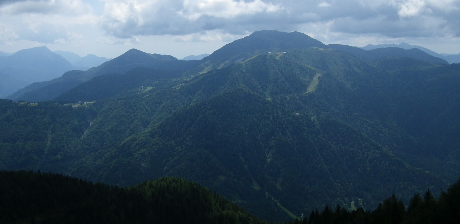
Across Val Degano to a row of peaks
in Dolomiti Bellunesi 

Hazy shot of Monte Zoncolan across Sella Valcalda  

Panoramica delle Vetta road hugging the slopes of Monte Crostis

Westward view of the Dolomiti

Snowmelt cascading along Panoramic delle Vette

Alpine flowers near waterfall

Another snowy waterfall, with light green
lichen-covered boulders

Looking east toward Monte Paularo (2043m)


Start of climb up to Tualis (890m)


From Tualis to 1300m

From 1300m to 1700m


The top (1982m), upper left, and the start of Panoramica delle Vette

Panoramica delle Vette continues through grasslands

Descent on twisty paved road begins 

Descent continues to Ravascletto

Fast twisty main road descending from Ravascletto

The final curves coming into Comeglians

Climbing 1412 meters in 13.5 km: 10.4% average gradient


The steepest bit, above 1700 meters: 17.2% 


Wednesday, July 21, 2010

Sella Valcalda - Monte Crostis

Another double-header today; first Arta Terme (506 meters) to Sella Valcalda (958 meters). Then the main event- Sella Valcalda to Monte Cristis (1934 meters).

Sella Valcalda was the warm-up for Monte Zoncolan in the 2010 Giro. It isn't bad, but has a healthy 3km stretch of 10-12% toward the top. I climbed standing on the steeper parts to save strength for the ascent to come.

After riding around a bit to cool down at Ravascletto, the ski resort at Sella Valcalda, I headed up the big slope toward Monte Crostis. It's a narrow mountain lane through wonderfully shady fir forest. The gradient dithers around 8-10% mostly, with two stretches of 13% about 1 kilometer long each. So the average grade works out to 9.1% for 10 km, taking you from 958 meters up to 1870 meters. It's strenuous but I took it easy and stood often to avoid lower back strain. Didn't seem as bad as my guidebook made it sound "Salita di estrema difficolta".

Around 1650 meters the road exits the shady fir forest and enters a grass covered alpine zone. A bit warm in the sun (even at 10 AM) but not bad. After some long switchbacks in the open, the pavement ends abruptly at 1870 meters. I read through several Italian cycling forums and opinion was divided on whether the rocky, unpaved "strada panoramica delle vette" was cyclable on a roadbike. The first stretch certainly was ok- tightly packed and mostly small red stone chips. There were some quite rough rocky stretches too. My advice is don't bring fancy wheels or tires or a bike you don't want the paint chipped. Other than that you'll be fine- I didn't fall on 6 km of this road, though I did a lot of standing and changing my line to avoid the worst stone piles.

At one point I came across a man and a cute black and white spaniel. I heard a loud whistling, like when someone puts 2 fingers in their mouth and blows hard. I figured it was the guy calling the dog, but no. I looked toward the source of the shrieking sound, and about 40 meters upslope was a big marmot standing on a boulder. I noticed the dog wasn't cooperating with the man, and I asked if the dog was scared of the marmot. The man said no, it was his friend's dog and wasn't used to him. So he put the dog on a leash for a walk up the grassy slopes. I pointed out the marmot and the man, whose vision was better than mine, noted it had a little juvenile marmot with it. So I'm presuming the mother was trying to scare off the dog to protect her baby.

Eventually the strada sterrata joined the paved road coming up from Tualis and Comeglians. This is the highest paved road in Friuli, at 1934 meters. There is a sheep and goat farm in the meadow below so you can hear the babies calling. To the west, beautiful views of the mountains toward Cortina ( though quite hazy and partly cloudy by now). It was cool looking down at the little towns along the Val Degana.

Very steep curvy descent to Tualis at 890 meters. This route would be a harder climb- maybe I'll do it someday. At Tualis I took the cliff-hanging road via Salars to Ravascletto, then down the hill to Arta Terme.

Great ride- do it on your mountain bike or a rugged road bike. You won't be disappointed.

I'm afraid many of my fotos were unusable as the sweat vapor in my jersey pocket seems to have steamed up the inside of the lens- I couldn't wipe it off. It apparently dried off on the sunny strada sterrata. Still quite hazy skies today- my apologies.


Looking down the forested slopes from strada panoramica delle vette


Mama marmot and baby


On the lookout for predators


Cows and horses enjoying a picnic in the alpine meadows


The level roadbed of the strada sterrata


Looking down through the haze at Tualis and Comeglians


Vertiginous grassy hillsides with scenic gravel road


Val Degana and mountains toward Cortina


Cloudy peaks to the west


The grade on the paved road from Ravascletto up to 1870 meters