Friday, September 30, 2011

Pian dei Buoi

Pian dei Buoi is a lovely meadowy area on the shoulders of the Marmarole Group above Lozzo di Cadore, with fantastic views of surrounding peaks.

I left early and arrived around 0800 at Lozzo di Cadore (753m) on the Piave River north of Longarone.  The climb starts almost immediately, but luckily I lost my way and warmed-up briefly riding around the town.  The initial section is not too steep, and many people were taking their morning walks on this pleasant narrow lane through the forest.

Soon the road steepens to 7-10%.  Felt great in the cool morning air- really a wonderful climb.  It continued like this for around 10km, until the deteriorating road surface gives out completely and it becomes a dirt road at 1700 meters.  Still it's rideable with a skinny-tired road bike- no problems.

Now the road enters the beautiful rolling meadows of Pian dei Buoi (Plain of Oxen).  I continued on the dirt road a bit further until the trailhead for Rifugio Ciareido, where a family of asini were enjoying their sunny morning.  The dirt road reportedly continues for another 6 km to Col Vidal (1880m), a pre-WW I fortress said to have spectacular 360-degree views.  I'll have to try to reach the end of the road next year, as I was in a hurry to get home for a prior commitment.

The descent was quite rough- can't get up much speed because of bad pavement, drainage channels, narrowness and twistiness.  But the ascent and scenery are so good it makes the descent worth enduring.  I'll certainly be returning in 2012.


Monte Antelao (3264m)

Marmarole Group (2932m)

Monte Ciareido (2504m)

Pian dei Buoi meadows and distant mountains to northeast

Mountains to north

Mt Sorapiss (3205m)

Asino family
Fluffy baby asino

Baby asino's fluffy ears

Lower part of climb from Lozzo di cadore

Upper climb to Pian dei Buoi


Wednesday, September 28, 2011

Vršič da Trenta

In May I climbed Slovenia's highest pass, Vrsic (1611m), from Kranjiska Gora to the north. It was a good climb, but not real steep. I noticed the descent on the south side seemed much steeper. So today I decided to try it before the snow arrives next month.

I drove across the Slovenian border to Boveč (450m) and started the 20km warm-up to Trenta. It's a gorgeous secluded ride along the Soča River, surrounded by forested mountains. At Trenta you enter Triglav National Park, and begin the climb. It features a couple of dozen tornanti scaling the steep slope, with lengthy stretches of 13-14% and short bits even steeper.

At the summit it was quite cold, with a surprising number of mountain bikers. Not so many road bikes. Plummeting down the tornanti was fun, and I was well-refreshed for the rolling ride back to the car. This is a challenging climb with wonderful scenery- check it out.

Edit: surprised to see this video about the Soča River on TV this morning:
http://www.afneurope.net/Home/ArticleDisplayDD/tabid/649/Default.aspx?aid=20868

Warning of things to come
Panorama to the west
Close up of Mangart (2679m)


Slovenian for
"No poseurs allowed next 22km"

The headwaters of Soča River

The Soča flowing through narrow gorge-
a sign said water levels rise 10m during spring snowmelt!

Took this from a shaky suspension footbridge over the river

The twisty climb

9% average gradient for 9km
The steepest stretch


Saturday, September 24, 2011

Passi Falzarego e Valparola

Returned to the  border of Dolomiti Bellunese and Alto Adige today after a week of rain, scheduling conflicts etc.  Felt good to be back in the mountains.

Passo Falzarego is at the crossroads of Cortina- Alta Badia and the road from Caprile.  I decided on the southern approach from Caprile (998m) because it starts closer to home.  The road begins climbing a set of switchbacks almost immediately, so I didn't warm up sufficiently.  It was quite a chilly, shady morning so I tried standing in the pedals to generate heat, but the grade was only 7-8% so standing didn't help much.  Around 1500 meters you emerge from the mountains' shadow and cold is no longer an issue.  Now you begin the actual ascent of the pass, with a series of 17 tornanti carrying you through meadows, forest and finally rocky alpine-scape to Passo Falzarego (2117m).  Some lovely peaks here- Sass di Stria  and Lagazuoi (2752m) standing out.  Continued another couple of kilometers upward to Passo Valparola (2192m).  Wonderful views from the pass to the north, south and west.

I headed down the descent into Alta Badia- first beautiful San Cassiano then La Villa (1420m).  The shady curves were damp- it had snowed earlier in the week,  and though the roads were cleared I worried there might be black ice from snowmelt and low temps at night.  No problems though.  


After La Villa the road climbs gradually toward Corvara (1522m).  Here I repeated the climb over Passo Campolongo (1875m) as on the previous ride of Sella Ronda.  At Arabba (1600m) I headed down the rolling main road toward Digonera and Livinallongo (1470m).  From here it's a fun descent down into the gorgeous valley of Torrente Cordevole to Saviner di Lasta,  Rocca Pietore and Caprile. 

This is a fun ride, not too steep.  I'd love to ride it clockwise someday, as the climb from La Villa to Passo Valparola looked quite inviting. 


Lovely villages in the meadows west of the climb from Caprile

Marmolada glacier from afar

Lagazuoi (2752m)

Sass di Stria cliffs, right

Cloud capped reddish mountain to northeast 

View south from Passo Valparola

Lavarella (3055m) on descent toward San Cassiano 

Close up of tower on Cima Del Lago (2654m) 

Sound of Music town in meadows below Pieve di Livinallongo

Another gorgeous village above Val Cordevole

Gruppo Sella capped by clouds 

Torrente Cordevole

Climb from Caprile to Passo Falzarego

Over the pass to Passo Valparola, down to La Villa, then up
to Corvara and Passo Campolongo

Arabba to Livinallongo and Caprile

Left Passo Valparola, right Passo Campolongo

Tuesday, September 13, 2011

Monte Croce Carnico - Nassfeldpass

Passo di Monte Croce Carnico and Nassfeldpass are two Austrian border crossings north of here.  I thought I'd connect the two of them with a brief ride in Austria and make a loop of the two climbs.

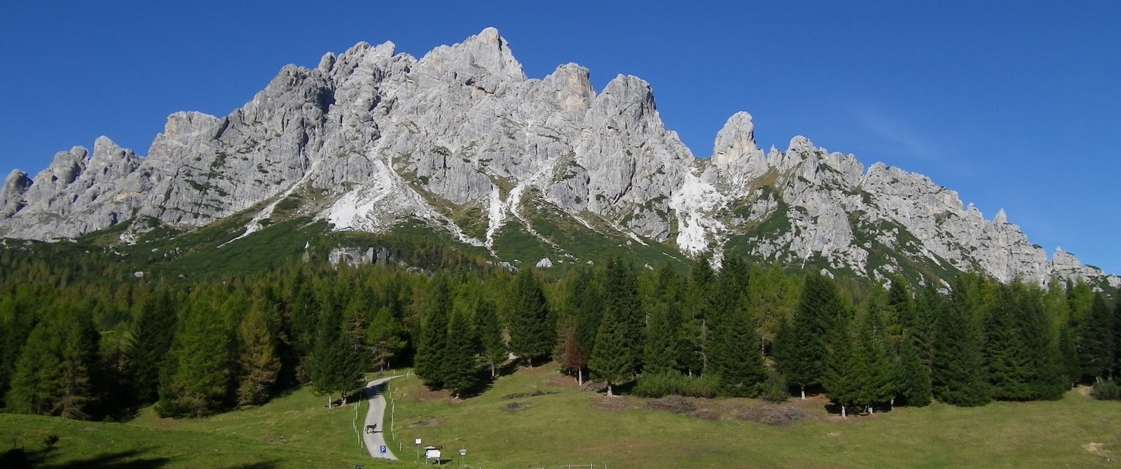
I drove to Tolmezzo, arriving about 7 AM.  From here you follow the main road along Torrente But through Arta Terma and Paluzza.  Now the gradient steepens a bit as you follow the gorge to Timau.  See pictures of this area I previously took at Pian delle Streghe.  Timau is a pretty town, though a bit frightening because of the huge rock faces towering over the houses.  It's been here for centuries though so maybe I'm being silly.

After more gentle climbing you reach a very well-engineered scala of 12 switchbacks up the cliffs to the pass, with great views of the valley below and surrounding mountains.  The pass itself was windy and cold, shaded by a tall peak on either side- Creta delle Collinetta (2238m) on the left and Pal Piccolo (1866m) on the right.  

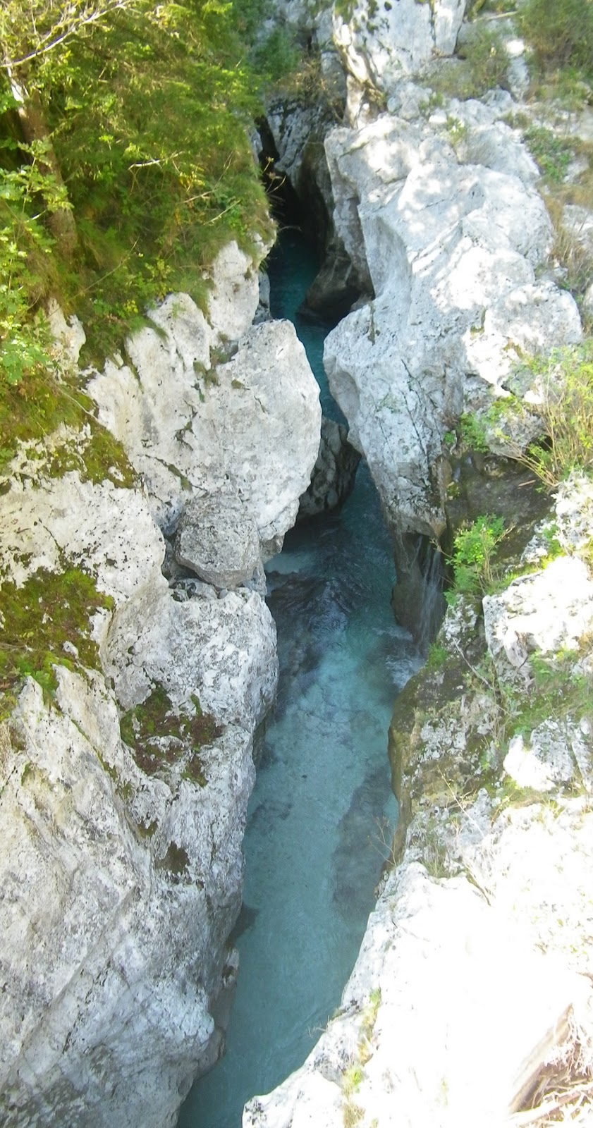
Now you enter a steep downhill tunnel with poor pavement- luckily there wasn't much traffic.  You exit into a lovely hanging meadow with a little lake and nice views of the mountains above.  The road continues steeply downward, with buckled asphalt and sharp curves.  There are a few flat and gently ascending stretches to keep you from getting too frozen.

At the bottom you arrive in Mauthen, and turn onto a country road through Würmlach.  Lovely country houses here, with impossible quantities of flowers tumbling from their window boxes.  After crossing the Gail River you reach Dellach and join the main road which is rather busy.  I saw some bike paths on the other side of the Gail which might actually save you time by avoiding the ride to the main road, but I had no map and didn't want to get lost. 

This stretch in Austria seemed longer than I expected, but was very gently rolling and not difficult.  At Tröpolach you turn toward Nassfeldpass.  I started out spinning up the beautiful twisty road through dense fir forest, by waterfalls and the tumbling white water of Tröglbach.  Soon the gradient steepens- above 13-14% I stood in the pedals, panting like a freight train.  This steepness doesn't abate- continuing for kilometers.  Overall it averages 8.6% over 11km, including the easy first kilometer and the easy last 2 km. 

For some pictures of the lovely pass, please see my previous climb from the Italian side- Passo di Pramollo.  Now for the descent- I was happy to see fresh asphalt as I started, then realized it was a short stretch and for the next 2-3 km the road was either stripped of its old pavement in preparation for paving, or so freshly paved that asphalt was sticking to the tires, frame etc.  This is bad because the sticky tar catches bits of glass, sharp stones etc which can cause a flat.  Fortunately I escaped that fate, the road work ended, and it was smooth sailing down to Pontebbe.  Can't wait to try this again once the paving's finished- it will be a wonderful plummet. 

Now began the longest stretch of the ride- slightly downhill (with occasional steep descents) for an hour or two along Torrente Fella then Torrente Tagliamento.  It's a wonderful road, wide and smooth with most of the traffic opting for the adjacent autostrada.  Toward the end it flattens and even has slight uphill grades from Carnia up to Tolmezzo.  I was so tired driving home it seemed the car was on autopilot- luckily it knew exactly where to go.

San Pietro di Carnia above Zuglio,
 Torrente But

Creta di Timau (2217m) cliffs above Timau

Close up of Gamspitz (1847m) above Timau

Monte Coglians (2780m) highest peak in Friuli

Looking down the scala climbing
Passo di Monte Croce Carnico

Monte Terzo (2034m) south of the pass

Monte Pezzacul (2178) with Monte Crotis peeking over the ridge

Monte Floriz (2184m)

From Austria, Creta di Collinetta (2238m)

Close up of Creta di Collinetta


Gamskofel (2526m)

From Gailtal bridge, the range between Austria and Italy

From Gailtal bridge, Schaatzbühl (2090m)

Dellach below Reisskofel (2369m)

GPS track running clockwise

Easy climb up Passo di Monte Croce Carnico
www.salite.ch


Hard climb up Nassfeldpass