Sunday, September 28, 2014

Sabotin

 I looked down from Sveta Gora last year into the deep gorge of the Soca River.  The mountain on the other side, Sabotin, is not as high as Sveta Gora but it is just as steep and spectacular.  I vowed to try climbing it.  Almost a year later I finally got around to it.  There are several ascending dirt roads and trails on the Italian side of the border but none for a road bike.  When I found out the road on the Slovenian side was paved, I headed for it.

From Vinko in Italy I crossed into Slovenia near Neblo, and continued on the rolling climb through Dobrovo, Drnovk and Smartno to Gonjace.  Here take the left turn marked Plave and begin climbing. After awhile you reach a right turn with a small pyramid, and tourist info sign: this is the road to Sabotin.  The pavement is good and the gradients weren't too bad.  Garmin says I hit 15% but it must not have been for long.  It's a really nice climb.

At end of pavement is a museum and many restored fortifications, part of Pot Miru peace parks along the border.  I checked out the trenches and tunnels the soldiers drilled and blasted into the rock for protection.  I'd like to go back and lock up the bike so I can explore more.  The ride down was a blast, with perfect clear weather today and great views of the surrounding countryside.  Go check it out if you get a chance.  

Pyramid Memorial to WW I soldiers

Looking southwest toward the coastal plain

The view west of beautiful Slovenian hill towns

To the north, Sabotin's escarpment
ends in rock cliffs above the Soca

The entryway into one of the many tunnels the
Austro Hungarians blasted out of solid rock

A larger tunnel

Sveta Gora across the Soca

The sheer-sided gorge of the Soca

A stone trench

Entry from trench into tunnels

View of church/castle in rolling Goriska Brda countryside


Wednesday, September 24, 2014

Forcella Capra Hike

Monte Raut's distinctive promontory is visible for miles across the coastal plain, like a mini-Gibraltor with sheer rock walls on the southwestern side.  Raut is the southernmost massif of the Carnic Alps, a range stretching all the way up into Austria's Carinthia region.  Then from Monte Raut south to the Adriatic Sea is flat as a billiard table.    

I drove to Pala Barzana (840 meters) and began hiking north, climbing through pleasant woodland.  Crossing a heavily-eroded open area I encountered an elderly Alpino veteran, with grey beard and green feathered cap, green coat and a heavy wooden staff.  Later I looked back and he was perched on a ledge overlooking misty Andreis, a very pretty view. 

Before long the steep slope emerges from the forest and you're climbing through grassland.  After awhile you reach the dreaded Vallonit, a scree slope you clamber up gaining 300 meters of elevation.  I didn't mind going up this as much as descending- very tricky.   Along the way low flying clouds moved in and obscured the sun.   Eventually I reached some cliffs and traversed past a tiny cave, which I kept in mind in case I needed shelter from a hailstorm.  After this I found a handy via ferrata cable bolted into the steep rocky route for maybe 80 meters- very helpful.  

Back on the alpine pillow grass slope I joined a trail ascending the ridge from Pian delle Merie near Poffabro.   Things soon got steeper and rockier again on the final 300 meters or so of hiking/scrambling up to the dorsal ridge of Forcella Capra at 1824 meters.  Even with the cloud/fog the view was impressive: the summit of Monte Raut (2025 meters) further west on the semi-circular dorsal.  To the north Crenal de Basson with the trail leading down to Lago Ca Selva (my next route to attempt Monte Raut).  

I descended slowly because the outboard side of my left knee was aching and I was afraid I'd wrench it.  Everything went well though and no injuries- left leg just needs a day off tomorrow.  This is a wonderful wild area so close to home it's a shame not to come back.  Maybe I'll try a little snowshoeing from Lago Ca' Selva this winter.


Orangish-red berries covering trees below Il Vallonit

My hailstorm shelter cave; note the concrete Disney dwarf figure
someone hauled up this slope and mounted on a concrete base! 

The trail coming up from Pian delle Merie

This cross is above a high vertical cliff facing southeast 

The "back" side of Monte Raut summit

To reach the summit you must scramble up this steepish rock;
maybe next time I'll have enough energy/courage

Crenal de Basson to the north

Ruins of Casera di Pala Barzana dairy


Monday, September 22, 2014

Mrzla Rupa MTB

I had a big giro planned, from Dolenja Trebusa to Oblakov Vhr, down the highway to Idrija, up the steep climb to Vojsko, and down through Gorenja Trebusa back to Dolenja Trebusa.  Then Sunday the weather forecast changed, with storms in Trebusa until 1000 Monday.  I decided not to drive down super early if it was going to be raining.  Then on the drive down there were roadwork delays on Slovenian highway 102 all along the way.  I reached Dolenja Trebusa and started riding at 1000.

The  rain had stopped and the skies were brightening, so I decided to ride up to Gorenja Trebusa.  Beautiful scenery through here, with waterfalls all along both sides of the gorge. I couldn't get a good picture of them though; you'd need climbing ropes to get close enough for a good photo.  At the meadowy area around Gorenja I decided to climb up to Mrzla Rupa, as I had last year in Trebusa .  The road is steep but paved at first, then hard-packed dirt and finally a looser surface.  Excellent workout.  At the junction with the road to Vojsko (899 meters) I turned around and headed back down.  The descent was fun and I made it back to the car by 1230.  Made it home in 2.5 hours, half an hour quicker than this morning's drive  Will return later for the climb from Idrija, possibly via Gorizia and Lokve.      

Near Dolenja Trebusa: the right fork takes you to
Preval Drnulk (760 meters)

Looking north from Gorenja; the left takes you
up to Preval Drnulk

Gorenja pastures along the Trebuscica

More Gorenja pastures looking west 

Gorenja from a distance

Close-up of church


Saturday, September 20, 2014

Mulattiera Valle Bornass MTB

Today's one of those days when it looks like it could start pouring rain any second.  I decided to stay close to home so I could hastily retreat if the clouds burst.  I rode down Via Pedemontana to Pedemonte and turned right on the road toward Piancavallo.  At 300 meters elevation turn right onto the dirt road.  It soon begins climbing fairly roughly and steeply, so you get the fun of constantly switching to the best track, with instant feedback if you make a mistake.  

At 420 meters there's a junction so I stopped.  I mistakenly chose the Percorso Circolare Santuario to the left, which is a nice hiking/running trail but steep and muddy, so my rear knobby was spinning (even when seated) and tearing up the trail.  So I retraced my path and resumed the gravel road to the right.  It got very steep at times so I had to walk a few meters but not bad.   Eventually I arrived at a restored casetta (570 meters) and then joined the paved road from Rifugio Bornass toward Costa.  There are MTB trails descending here but after walking a few meters down to preview them, I knew they were beyond my skill level: steep, muddy with half-exposed small boulders to weave through.   Maybe I'll try going up that way first to get some practice.    

This is a good ride and very convenient to home.  I'll have to do some variations soon.

Junction with Percorso Circolare Santuario running tail:
stay on the gravel road to the right on your MTB 

Casetta near the junction with Rifugio Bornass road

Rifugio Bornass road

Beautiful trail map made by the volunteers of MTB Ornedo Club


Wednesday, September 17, 2014

Planina Razor MTB

Tolmin, Slovenia is starting point for 3 big climbs in Triglav National Park: Cadrg, Tolminske Ravne, and Planina Razor.  The last of these I climbed with my road bike a couple years ago, but couldn't complete the final 6.5 km with skinny tires.  Today the weather's beautiful, so it's time to try it with a MTB. 

I parked at Tolmin and rode briefly to Poljubinj (225 meters). The paved road up to Planina Stador (1040 meters) is a good workout with glorious views of the Soca River and lush green countryside.  After some climbing on dirt alternating with concrete  pavement, the road begins rolling along the contours of the  mountainside without gaining additional altitude.  At Planina Lom, a dairy where you can buy a meal, the road begins ascending in an area with open grassland.  This continues until Planina Razor (1310 meters), on steep grassy slopes ascending to rocky peaks.

I had read about a MTB trail descending to Tolminske Ravne, a pastural area visible far below.  The trail is marked Mulattiera (mule trail) and was beyond my MTB skills at first.  I was prudent and walked down the steepest, rockiest parts, and coasted with one foot unclipped on the iffy bits.   The rideable stretches eventually arrived more frequently and after awhile I was able to ride safely.  It later levels out, turning into a lovely forest trail.  Finally I reached the open grassland at Tolminske Ravne, and soon was descending the paved road along the gorge of the Zadlascica, then a brief climb up the other side of the gorge and an easy coast to Tolmin.  Fun!    


The view east from Planina Lom

The grassland zone between Planina Lom and Planina Razor

Far below to the west, Tolminske Ravne
in a grassy niche in the mountainside 

The gorge of Torrente Zadlascica, Kozlov Rob (hill where
 Grad Tolmin perches), and mountains to southwest

Planina Razor, with clouds hiding the mountain above

A fontana along the Mulatteria to Tolminske Ravne

I was so glad to arrive at Tolminske Ravne.  I survived!

Veliki Stador 

Tolminski Kuk, left

Vogel to the east

Look closely and you can see the dairy at Planina Razor


Sunday, September 14, 2014

Passo della Forcella MTB


Steeper than Zoncolan?

I first heard of this climb a few weeks ago.  Apparently it had been recently paved and improved, so my first thought was to try riding the road bike up it.  Then I saw the altimetria and knew I would need MTB gearing for the attempt.

Today the rain finally stopped so I had to give it a try.  I parked at Villa Santina (325 meters) and crossed Torrente Degano to Raveo. This west side of the river is less trafficked, more scenic and hillier than the main road.  I continued north through Cella to Luint, where the route turns south again for Mione.  It's a tough climb just to reach the village of Mione at 730 meters, then you find the fountain with the rooster, where the real climbing begins,

The road is a narrow lane immersed in red fir forest.  It's smooth fresh asphalt, with well-designed drainage channels to prevent wheel damage.  It really is one of the best roads I've climbed around here, surprising given its remoteness.  I continued twisting up the hill without respite until about 1200 meters when I stopped to pant.   I restarted and made it up another steep stretch, to 1400 meters where I stopped again.  I decided to push the bike awhile but that was not much easier.  I started riding again and gave it all I had to about 1600 meters and then I was done for.  After a break I slowly pushed the bike up the even-steeper concrete section.  A guy herding cows teased and ask why I wasn't pedaling.  He likely walks up and down this road every day, pushing cows uphill when they want to stop for a nap.

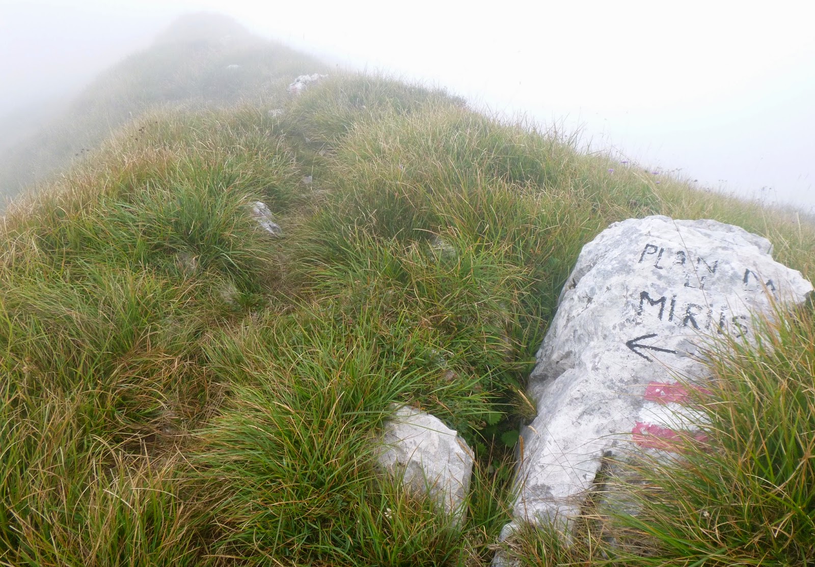
The pass at 1800 meters is grassland with great views in every direction.  I took some pictures, caught my breath, and put on my cold descent gear.  Luckily I had bled the brakes the other day because this was one long brake-torture test.  They held up though.  At the bottom I crossed Torrente Degano to Ovaro and rode the busier east bank highway back down to Villa Santina.  Luckily all downhill so my legs survived.

Try this climb if you get a chance- you won't be disappointed.  


Pieve di Gorto near Cella

The iron rooster atop Mione's fountain


View from pass of mountains to the west
Close up view to west

View to north (below pass)

Close up to north of Monte Crostis (right)

Zoncolan ski area to the east

To southeast Torrente Degano and Tagliamento


Very old iron cross at pass, grape and wheat designs 


Read this just before descending