Saturday, October 19, 2013

Lama di Som MTB

I've ridden past this junction dozens of times but never turned onto it.  Then yesterday I was searching for some info and found an itinerary of this ride, so I had to try it.  I rode my MTB down Via Pedemontane to Sarone and headed toward Il Cansiglio.  Around 490 meters I turned sharply right onto a paved road marked Lama di Som.  It's a nice rest after the steep climb toward Il Cansiglio:  bordering trees provide cool shade from the southern exposure as you wind along a hillside toward northeast.  After a km or so the gradient turns steep briefly (13-14%) but then mellows out again.  I continued past Lama di Som to check out end of pavement: around 690 meters elevation the road joins a steep dirt road on the left toward Malga Pizzoc, Candaglia, and Piancavallo.  If instead you go straight you arrive at a lovely house with paved lane ascending steeply through a gate.  Not sure if it continues- an exploration for another day.

Back at Lama di Som, I found beautiful pastures with a few farmhouses.  I'd like to drive back here with Marilyn and the pups- great place for a peaceful walk.  I backtracked a little till I reached the turnoff for Polcenigo.  This is a very cool gravel road with lots of switchbacks leading down to Coltura.  I was blithely coasting downhill when I met a group of tired mountain bikers slowly creeping upward.  Maybe next year I can try climbing this, though it will need to be early Spring or late Fall, as most of the slope is sun-exposed and would be deadly in July-August.  Fun ride!


When you see this sign, get ready to turn onto
Lama di Som road 

Turn right here

End of pavement, start dirt road to Malga Pizzoc

Nice house where the paved road went
through a gate uphill

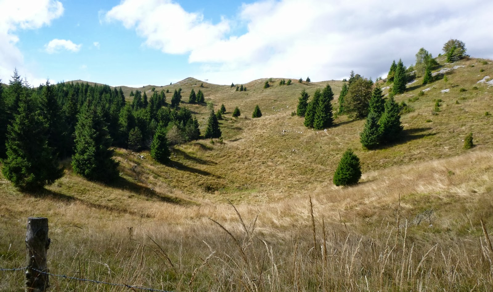
Lama di Som green pastures 

Turnoff on dirt road to Polcenigo

Eye-catching pink berries along the sunny dirt road

Looking back at the green pastures of Lama di Som

The steep twisty dirt road

Lovely old house along the dirt road to Coltura


Thursday, October 17, 2013

Čadrg

Čadrg is one of 3 climbs from Tolmin, in Slovenia, into Triglav National Park.  All 3 have absolutely beautiful scenery accompanying a great workout.

I started from Kobarid, a few miles up the Soča River from Tolmin, warming-up on the road along the east bank.   Just before you get to Tolmin take a left toward Zatolmin, and continue on the narrow farm road marked Hudičev Most (Devil's Bridge). You descend down near the edge of the Tolminka River gorge, where you can see tourist information, parking, trailheads, etc.  Follow the narrow paved road along the gorge edge, with railings to keep you from taking a plunge.  Through a very short tunnel and then you arrive at the bridge, very high above the water.  Make sure you've downshifted because you're about to hit a wall.

The next half km averages 15%- I just stood and panted.  Continue climbing to a 180 degree turn at the junction for Zadlaz, then climb the briefly-easier sun-exposed slope to Laz (423m).  Here starts the steepest bit, which my Garmin recorded as 22%.   

The remaining 3 km of climbing is a peculiar mix of 10-13% stretches punctuated with 15-20%
ramps to prevent you getting into rhythm.  All told, from Devil's Bridge to Čadrg you average 9.4% gradient for 5.5 km.  At Čadrg you pass by some farmhouses which I think rent rooms in summer.  Very picturesque with bell-wearing cows, sheep, goats, pig wallows, chickens and ducks wandering about.   The road finally ends in a farmyard at 741 meters, though you can continue on trails with a MTB.

Fantastic views up here with surrounding mountains, autumn leaves, the gorge down to Tolminka River.  I'll try to return next year on MTB and connect this ride with  Tolminske Ravne and Planina Razor, some of the prettiest vistas I've found anywhere.

      
Veliki Stador (1899m) 

Grušnica (1570m)

On left Visoč Vrh (1482m)

Javor (1363m)


Looking down Tolminka gorge toward Tolmin

The view straight down from Devil's Bridge


Sunday, October 13, 2013

Milies, Mariech, Posa Puner MTB

I've dreamed of this mountain bike ride for months:  ascending the massif of Monte Cesen from west or north, then crossing the mountain top to descend the south side.  I decide to try ascending a new route from Segusino, ride to Rifugio Mariech, take the trail to Posa Puner and descend via Madean.

I parked at Maine and warmed up climbing to Combai.  Then down to Valdobbiadene, north along the Piave River to Segusino, and the climbing begins.  This is a pretty tough little climb: in 7 km you gain 574 meters, averaging 8%. Maybe I was just rusty from lack of riding.  Pavement ends at 770 meters a little past Milies but I continued on the gravel road, climbing another 4 km averaging 10.7%, with stretches of 21% to Malga Molvina, 1206 meters.

This was a killer, but I did get a little break when I reached Forcella and couldn't figure out which way to go.  The map I'd printed of this section was missing from my backpack (later found it stuck to the back of my other map- apparently I was too knackered to figure that out on the climb).  So I picked the right fork, which was very hard climbing but not as long as I expected, leveling out at 1200 meters instead of 1500.  Too tired  to reverse my course, I decided to keep on going to see where it went.  Beautiful views of the prosecco vineyards below as it hugged the mountainside.  Amazingly it soon arrived at a paved road.  The only one I knew of around here is Valdobbiadene to Rifugio Mariech, so I turned left and headed up the hill.

At 1500 meters I reached the rifugio, socked in with fog, and found the dirt road toward Posa Puner through a pasture full of horses and cows.  This road was great until I reached Casera Forconetta (1393 meters).  They had signs marked Posa Puner which I followed but the road soon turned to a cow track through the woods with no signs.  With all the rain the cows' hooves had sunk up to their ankles, leaving a mire of mud, cow manure, and lucky for me, a raft of freshly fallen leaves.  As long as I stayed on this thick layer of leaves I didn't sink.  This "trail" descends to a little valley and finally reaches a little gravel road ascending upward to Casera Federa (1330 meters).  Now the road becomes wide and gravelled, climbing up to 1383 meters on the flank of Monte Cimon.  Beautiful views here of Dolomiti Bellunesi, Col Visentin, Monte Pizzoc, Monte Cavallo, Laghi Revine, the prosecco vineyards, Piave River, and Il Montello.  Also hang gliders zooming around a few hundred meters below.

I descended to Rifugio Posa Puner, continued down to Casera Budoi, and then the twisty forested curves of Madean to Combai.  Combai was now packed with visitors for the chestnut festival.  Great ride- now my legs feel like lead.

Monte Miliana (1270m)

Monte Vallina (1067)

Milies, cloud covered Piave valley, and
Monte Grappa massif in the distance

Casera Federa on the trail from Mariech to Posa Puner

Rifugio Posa Puner, with Dolomiti Bellunesi in background 


Along the Monte Cesen massif toward
Col Visentin and Monte Pizzoc 


Prosecco vineyards

Piave River valley


Sunday, October 6, 2013

Montefosca

I climbed Montefosca from Val del Natisone in 2011 but always wanted to return and climb from Fraccadice (near the Slovenian border) to the 872 meter pass above Montefosca.  Today the rain stopped so I jumped at the chance.

From the car park at Ponte di San Quirino I rode the back roads to northern Cividale (making only one wrong turn up to Il Castello restaurant, a dead end).   Then I headed north on the main road to Faedis, turned right and began climbing toward Canebola and Bocchetta di Sant'Antonio.   I quickly overheated and stripped down to bike shorts and my thin windjacket with no jersey (I'd brought only a thick long sleeve jersey).  This is a beautiful wide road with switchbacks and ramps climbing the gorge of Torrente Grivò.  After Canebola you climb a bit more until the crossroads at Bocchetta di Sant'Antonio (800 meters).  From this little chapel in the middle of nowhere you can go to Madonnina del Domm, Porsuz or Subit, or my choice today, Montefosca.  The road descends through forest and pasture to 650 meters at Piano di Fraccadice, on the Slovenian border.

Here the fun begins- a couple of chilometers averaging 10% with stretches of 16%.  The road surface seemed much better than I remember when descending it- maybe they've roughly paved it since then.  The surroundings are peaceful meadows and forest until after the steepest part, when it rises and falls and curves until the pass.  There were a group of hunters here with beautiful dogs and shot guns.  I made sure it was ok to continue so I didn't get mistaken for a deer (though I think they were hunting birds).  You descend steeply and twistily to Montefosca, a hillside town with a beautiful view of Val Natisone and surrounding mountains.  After a wonderful false flat along the ridge for several chilometers you dive down through the forest to Pulfero on the Natisone, then back to the car.  Great ride. 

Bocchetta di Sant'Antonio (800m)

Piano di Fraccadice: turn right for the climb to Montefosca
or go straight a few hundred meters to Slovenia

Hillside town Montefosca looking up Val Natisone to Slovenia

Dente di cane

More dente di cane


Tuesday, October 1, 2013

Casera Mason il Vecchio MTB

After a busy, rainy week finally a chance to ride.  I mountain biked down Via Pedemontane to the turn for Sarone and headed up.  The sun was quite warm, felt great.  Shortly after the road from Villa di Villa joins the main road to Il Cansiglio, I took a right turn marked Casello della Guardia.  Beautiful paved lane ascending through beech forest.  It turns to dirt below Casello della Guardia: here go straight, avoiding the right turn to Malga Fossa di Sarone.  The road climbs, passing a left turnoff marked Casera Busabella- I'll try that another time.  You descend, climb some more to another left marked Rifugio Maset, another future exploration.

The forest opened up and the sun beamed down on me.  I crossed some rolling grassland and reached Malga Col dei Scios, a working cheese making farm which is open until winter, I guess.  From here I continued until I reached a barred, unmarked turnoff to the left in a beech grove.  From the map I figured this was the road to Casera Mason il Vecchio, a pretty forest house in the woods not far from Casera Ceresera.  Now I returned to the main road leading to Val Fritz and Piancavallo.  The skies above the ridge were deep blue, but I looked down and saw the top of a layer of overcast covering the  plains.  Soon I was descending through it, cold from the water vapor and windchill of riding.  I rode down through Bornass and tiptoed around the washed out road by the stream.  Jumped in a hot tub to thaw when I arrived home.  Fun ride!

Turn off main road right here (1000m)

Continue straight, don't turn right (1063m)

Don't turn here- saving Casera Busabella for next time

Don't turn here to Rifugio Maset- next time? (1250m)

Malga Col dei Scios- buy cheese here! (1330m)

Rolling grassland near Col dei Scios

Unmarked left turn to Casera Mason il Vecchio (1300m) 

 Casera Mason il Vecchio (1343m)

Looking down at the overcast below, near Val Friz (1560m) 

Monte Sauc (1645m) above Casera Campo