Sunday, June 30, 2013

Krn

Last week we visited the Tuscan coast for a few days, with no bike riding but plenty of walking.  So I was a little rusty today but after a nice warm up along Val Natisone from Ponte San Quirino to Kobarid, Slovenia I felt good as new.  At Kobarid I found the road that crosses the Soča River on Ponte di Napoleone, then followed the river to Ladra, where the climb begins.  Up through Smast and Libušnje and then Vrsno.  Here the road coming up from Kamno intersects, and a steep half kilometer of 15% begins.  

When the grade eases up, the road starts traversing almost level for about 2 km, with some beautiful shady beech forest to cool you off.  This comes to an end at a stream crossing, and you hit a kilometer of killer 13%-17% average gradient up to Krn.  This was the toughest part of the climb.  Above Krn the steepness lessens to a mere 9-10% average for a couple of km till end of pavement at Planina Kuhinja.  From here you can hike up to the top of Monte Krn (2245 meters)- see http://www.hribi.net/izlet/planina_kuhinja_krn_/1/150/280 .

I coasted back down and after Kobarid I felt rested so I rode fast as I could back to Ponte San Quirino.  This is a wonderful climb and I'll be back to try some variants soon.  

Looking back at Val Natisone from road to Ladra 

Beautiful church at Libušnje above Soča River

Vrh nad Peski, 2176 meters
Maselnik, 1903 meters

View down the Soča valley toward Gorizia

Monte Matajur, 1385 meters 

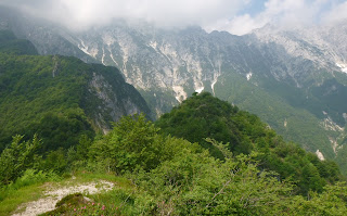
Monte Krn on left, 2245 meters

View north up Soča gorge from Ponte di Napoleone

View to the south


Saturday, June 22, 2013

Rifugio Dolomieu

Rifugio Dolomieu is a mountain house at 1500 meters on Monte Dolada, towering above the north end of Lago di Santa Croce.  It's a tough climb but sometimes I can do it without stopping.  Not today- it whooped me.  I had to stop 3 times and hang my head over the handlebars to hyperventilate.  But I lived and made it to the beautiful forest at end of pavement.  There were more cars parked here than usual and I noticed a bunch of hangliders and parapendio pilots on the grassy knoll behind Rifugio Dolomieu.   It was a contest where people fly through a series of waypoints before landing.

Made it back down without a flat tire- that's a first in the past 2 weeks.  Great ride home despite threatening thunderclouds.  I shall return.

Rifugio Dolomieu at 1500 meters

Looking down the steep slope at Alpago valley.  Monte Teverone in
background- I saw the east face of it from Monte Medol  the other day.

A few of the picturesque villages of Alpago- a wonderful place


Thursday, June 20, 2013

Monte Medol MTB, Hike

Hot and humid today so I headed for a cool spot in the mountains north of here.  I mountain biked up through Barcis and Valcellina to Arcola.  Here I turned left, crossed the river and began the climb up Val Prescudin to Villa Emma, a forestry service house.  This is a beautiful shaded area with lovely grass, picnic tables, birds singing.  Very peaceful because no cars are permitted.

I turned onto the dirt road up Val di Tasseit, which ends in a 200-meter-long 15% ramp.  At the top (745m) is a little flat spot, and here begins the hiking trail up Monte Medol.  First it crosses Rio Tasseit, then climbs steeply through shady beech forest to 1124 meters.  Great views of the surrounding mountains up here, as well as some beautiful low flower bushes, which I thought might be rhododendron, but not sure.  Descent was fast, but be careful because the path is steep and covered in dry beech leaves, quite slippery.

Descending with a suspension fork was great- I wish I had a lighter version of this for my road bike.  The cold tunnels south of Barcis had fog in them from the condensing humid air- it felt like light rain when going fast.   


Rhododendron (?) with fat bumblebee

Bee visiting a different bunch

Crep Nudo 2200 meters and cloudy

Monte Teverone 2328 meters

Another shot of Teverone

Torrente Prescudin with another gravel road to explore

Monte Venal 2212 meters

Not much to look at but Monte Medol offers great views from the top 

Rugged eroded smaller peaks along Val di Tasseit

Monte Messer 2230  meters in right background

Monte Santander 2184  meters


Wednesday, June 19, 2013

Castello di Montereale Valcellina MTB

A short mountain bike ride this morning to Montereale Valcellina, the next town to our east.  Above the town and slightly north is a wooded hill which I've read has ruins of a 12th century castle.  I rode around awhile looking for a way up, then gave up and went through the short tunnel Magredo toward Lago di Ravedis.  At the exit of the tunnel is a very well made packed gravel road, which unfortunately was barricaded.  There's a gap to walk through so I  went in.  The road is level along the cliffs above the lake.  They are installing wooden handrails/barriers along the road, which appeared almost complete.  Hopefully it will open to the public soon.

This road curves following the contour of the hill at its east end, then begins descending.  There's also a marker for a Sentiero Naturalistico e Storico, so I stopped, locked up the bike and climbed the trail.  At the top is a long stone wall, the north side of the castle.  The inner buildings have fallen to ruin, with only low stone walls delimiting their shape.  There was a round bastion at one corner in pretty good shape, and at the highest point of the hill, the base of the tall square tower.  There was a lovely olive or brownish/yellowish snake basking in the sun at the tower, but she slithered away when I approached.  Tried to get a picture but she was too fast.

I then descended on a single track trail which later joins the previous well-made gravel road, so kind of a waste of time.  But it did have some rock shelves with maybe a one-foot drop where I quickly appreciated the advantage of front suspension- I wasn't catapulted over the handlebars.

This is a great place to visit- and only 15 minutes from home.  Be back soon.        

East end of long north wall

Little shrine with west end of north wall in background

Bastion at northeast corner of castle walls 

Lago di Ravedis from castle

Castle wall with  lago

Close up of lago

Monte Fara 1342 meters

Looking east across Torrente Cellina

View south toward Montereale

Remnant of tower at northwest corner of castle


Monday, June 17, 2013

Madonna della Neve

Vito d'Asio is a hillside town over by Clauzetto and Castelnovo del Friuli.  I noticed a road up into the mountains from there so had to check it out.  After climbing up through Clauzetto and the short ride over to Vito d'Asio I turned left on Via Maggiore Ceconi.  This heads up past the church (530m) and then goes steeply across the grassy meadows above town.  You reach a junction with gravel road headed west toward Pradis di Sopra and paved road continuing upward marked Madonna della Neve.  I had read that Madonna della Neve is a church on top of a mountain above Anduins.  They have a festa there in August.  So I kept climbing and then dove down to a little hollow with sign pointing to the church.  I rode all around this area (775 meters) and hiked some as well looking for Madonna della Neve but never found it.  I think they must mow a path to the church through the waist-high pasture grass in August for the festa.  Maybe I'll try again in September.

Just before descending to the hollow I'd seen a rough  road ascending steeply to the north.  So now I tried that and was very challenged to complete but did arrive at the end at La Forchia above some cliffs at 852 meters.  On the way up there I came across 4 wild goats, which you can tell from deer because their hindquarters are more square, they're a little shorter/stockier, and they have short unbranched horns with little rings every inch or two.  I couldn't get a picture because they fled for their lives.

On the way back down I looked back while passing through some meadows and saw Madonna della Neve on the mountain top- will return for a closer view.  Fun ride. 

San Michele Arcangelo a Vito d'Asio

Sign pointing to the mysterious Madonna della Neve

That little dot on the mountain top is Madonna della Neve

View of Anduins, Monte Prat, and the Tagliamento in the distance


Saturday, June 15, 2013

Valle Friz MTB

-Dove vai?

-Alla strada sterrata da Piancavallo al Cansiglio

-Ah, per questo hai comprato la bici di montagna?

- (sheepishly) Sì

My neighbor Nerina always can read my mind.  Maybe because she has two sons about my age.

I set off down to Costa and rode up the back way to Rifugio Bornass, then continued on the main road to Castaldia.  Normally from there I take the Col Alto road, but today I stayed on the main highway.  It's actually very nice when traffic is sparse like this morning, immersed in green forest all the way up to Piancavallo.

At Piancavallo I headed southwest toward Sauc, Casera Campo, and finally on the dirt/gravel to Casera Valle Friz.  This is a beautiful little pastoral zone at 1515 meters.  A sign said they raise organic sheep and goats.   From here the gravel road continues to Col della Palse, where I ascended from Mezzomonte a few weeks ago.  The forest gets thicker here, with beautiful fir trees.  A charming little farmhouse at Casera Costa Cervera was covered in bright flowers, with  a small herd of very clean, healthy-looking cows basking in the sun, chewing cud.

The road continues southwestward, generally descending but with some saliscendi as well,  past more rural eateries: Malga Folador, Malga Brusada, Malga Pizzoc and finally Malga Coda di Bosco.  At this last you join the main road down to Sarone, then home.

The mountain bike worked great- about the only minor complaint I have is the soft seat, but I have a spare I can install.  It's the perfect bike for these mountain dirt roads, so I'll be trying to explore more of them in future.  This ride today was fantastic and I can't wait to return.

Casera Valle Friz


View of the forest above Mezzomonte

Steep slopes loggers used to slide  trees down to Coltura

Toward the malghe above Caneva and Sarone

A primitive rock wall to keep livestock from wandering away

Contented cows at Casera Costa Cervera

Thursday, June 13, 2013

Canal di Cuna

Another glorious day so I made another attempt on Canal di Cuna.  It is a hidden valley in the mountains east of Tramonti di Mezzo which I've tried twice to reach.  After the beautiful ride up Val Tramontina I turned east at Tramonti di Mezzo and headed up a narrow mountain lane.  After some easy scenic riding you reach a killer stack of switchbacks; very steep, badly paved, and full of wheel-destroying drainage grates- my kind of place!  I gaspingly made it to the end of pavement, and then continued riding in the gravel until 790 meters.  I stopped and donned some Pearl Izumi X-Alp Enduro bike/hiking shoes I'd carried in my backpack, and pushed the bike up the gravel road to Forchia Zuviel at 897 meters.  In an abandoned settlement of stone buildings, I locked my bike to a signpost and started the hike down to Canal di Cuna.

This is a wonderful forest, so isolated I couldn't hear a single human sound, no chainsaws, distant traffic, nothing.  I did hear one prop plane in the distance on the climb back up.  It's tough to escape from airplanes.  The trail is very well constructed, with switchbacks to reduce the gradient. It levels out around 590 meters and after crossing a stream you enter a meadow.  Here you find the restored Chiesa di San Vincenzo.  For centuries families lived in Canal di Cuna, but eventually the population dwindled as people moved away.  After it was abandoned some of their descendants came back to visit, and finally restored the ruins of the church.

I climbed back up the way I'd come, taking 30 minutes to ascend 300 meters.  Came across a pair of large deer, the only souls I saw for 3 hours after leaving Tramonti.  My plan to descend by bike on the gravel road was pretty harebrained and I ended up flatting (3rd time in 2 weeks).  No big deal and maybe it made me extra-cautious on the rock-strewn switchback road down to  430 meters.    I stopped to fill a water bottle at the Spring of Life and Experience, which is a pretty fancy name out here in the middle of nowhere, but the water is excellent.   

Rode fast as I could all the way home.  Legs and fitness are feeling best so far this year.  Next time I think I'll drive to Tramonti and ride the mountain bike up to Forchia Zuviel.  The road isn't suited for a road bike past end of pavement at 700 meters.  Still a fantastic ride in this clear cool weather.


Beautiful Torrent Chiarchia 

Torrente Chiavalara's noisy whitewater cascade

Some of the ruins of old stone houses at Forchia Zuviel

Restored Chiesa di San Vincenzo in Canal di Cuna meadow

Viewed from the banks of Torrente Comugna, which
flows east to join Torrente Arzino below San Francesco

Tuesday, June 11, 2013

Palughetto

Splendid morning, so I headed for Malga Mezzomiglio above Lago di Santa Croce.  After Vittorio Veneto and Fadalto you skirt the east shore  of the lake until just before Farra d'Alpago, where you turn right at Villaggio Riviera.  Nice switchbacks at first, then after the village of Pianture you hit a 20% wall.  I made it without stopping but I was gasping and sputtering.  A shorter slightly less-steep wall follows after a brief break.  Then the real fun- 3 or 4 long traverses each with hundreds of meters of 10-13%.    I finished the last of these (from 850m to 1000m) gasping again.  This is a tough climb.  Now a series of shorter switchbacks begins, nice because you can catch your breath in the ends.

The agony ends at 1,187 meters where I turned off on the gravel road for Palughetto.  You could also continue on to the meadows of Malga Mezzomiglio on the paved road instead.  This gravel road was very hard packed and was no problem on 23mm road tires.  I did hop off and put on Bike Skinz cleat covers for about 100 meters near the cabin in the pictures- the road was a little too steep and rough for me there.  Afterwards I continued pedaling to the junction with Strada del Taffarel, where I continued toward Palughetto and Campon.  The road soon becomes paved and descends through tall shady forest.  At Palughetto there's an archeology dig where scientists study the earlier human inhabitants of the Cansiglio.  People have lived and hunted up here for millennia.

I reached the main road at Campone, no cars, crystal blue skies, red spruce forest all around.  This is heaven.  Then you come around a curve and the whole grassy green plain opens up before you, like the opening shot of The Big Valley or a 1950's western. After pedaling to La Crosetta I descended to Sarone, and noticed some big clouds to the east.  Sure enough near Gargazzo they cut loose and dumped heavy rain on me for the next half hour.  It wasn't as bad as it sounds- actually made me ride faster than I would have otherwise.  In a change of pace, there was no rain in Giais, so I quickly dried out when I got home.  Wonderful ride!   

Monte Dolado from start of gravel road, 1200 meters

Cabin along gravel road  to Palughetto

Wood carved coturnice (rock partridge) and cane di caccia

Left is Strada del Taffarel leading to Monte Pizzoc, right descends to Malga Mezzomiglio

Casa Forestale at Palughetto; archeological dig nearby