I woke up at 0400 and drove away at 0700. It was nice and cool out. I parked at Comeglians and headed up the beautiful twisty road along Degano river gorge toward Forni Avoltri. The gorge is covered in very big fir trees, so it's shady and damp, with white water frothing below. Flanking the gorge are mountains covered in trees, or pastures, or exposed faces of dolomite rock. Pretty villages perch on the steep slopes here and there.
The climb lessens a bit at Rigolato, so if you want a flatter warm-up, this might be a better starting point. The gorge widens out under open sky, though still walled-in by mountains on both sides. There's a kilometer-long tunnel, wide and well-lit, then you arrive at Forni Avoltri. Take a right at the sign for Collina.
Here the first and longest steep stretch begins- 1.5 km of 9-12%. In keeping with my new plan, I stood and climbed it. Felt good, though it seems kind of jaunty, like I'm going "Look at how I bounce up and down!" I'll get used to it, I guess.
The road flattens a bit and crosses a lovely stone arch bridge over Rio Frassenetto. You continue up an easy slope through 4 little villages, with beautiful wooden balconies covered in flowers. The last village, Collina has some confusing signage, and everyone seemed baffled. It was even mentioned in the guidebook, but I still got it wrong. I rode up a very steep drive and met a hiker who told me how to go. After a short descent I climbed standing up the steep grade to Rifugio Tolazzi, at the end of the paved road. Looming above is Monte Coglians, on the Austrian border, at 2780 meters the highest peak in the Carnic Alps. I noticed the hiking trail was paved in cement the first 200-300 meters, so I rode that up to 1416 meters. It averaged 20% with points of 24%, but thankfully it was short.
When I descended from the cement road, I encountered a fellow on a mountain bike I had passed way back at Rigolato. He had a big smile when he saw me, I imagine because he was laughing that a bonehead on a road bike would try climbing this wall.
The descent was relaxing- I stopped frequently to admire the waterfalls, mountains, valleys etc. Later after Rigolato, the curvy descent down the gorge to Comeglians was wonderful. Great ride!
 |
| Church above Rigolato with Angel Gabriel windvane |
 |
Monte Coglians, 2780m on Austrian border
|
 |
Monte Capolago (just west of Monte Coglians)
|
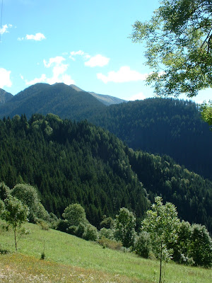 |
| Monte Crostis above forested valley |
 |
| Monte Pièros and peaks along Veneto border |
 |
| Tumbling mountain stream under stone arch bridge |


