Saturday, August 25, 2012

Passo Furcia (X2) - Passo delle Erbe

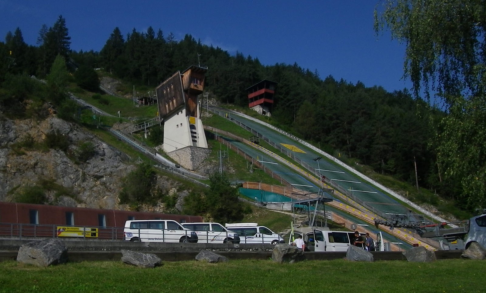
Just down the road from Prato Piazza and Lago di Braies, the next climb rising from Val Pusteria along the Austrian border is Passo Furcia.  It's a frequent Giro d'Italia climb and after riding it today I can see why.  The north side starts easily near Valdaora (1020m), climbing through brilliant green pastures with views into Austria.  Then after Gassl (1135m) you hit 2 km with average grade of 9.5%, including a half kilometer of 13%. It slacks off again before Sorafurcia (1340m), where you face 1.5 km of 12.3%.  Again it cools down to 6.9% or so for the final stretch up to the pass at 1789m.

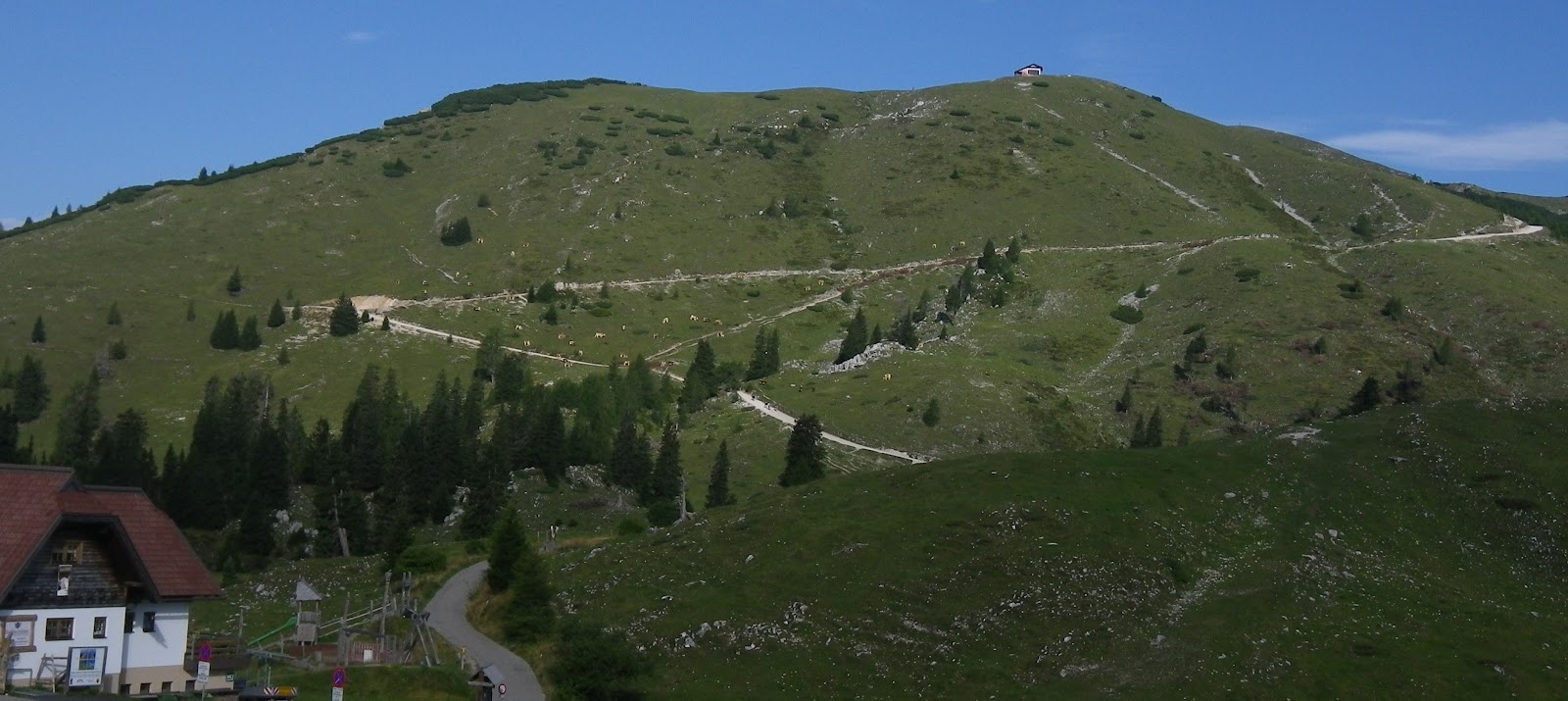
After passing a few ski lifts you head downhill.  More great views from here of the grassy mountainsides and towns like San Viglio far below.  You finally end up in the town of Longega at 1005m, in the upper end of Val Badia.  Here you begin another panoramic climb through beautiful pasture country up through Rina (1375m), down a dip to 1330m then up again to the junction for Antermoia (1455m).

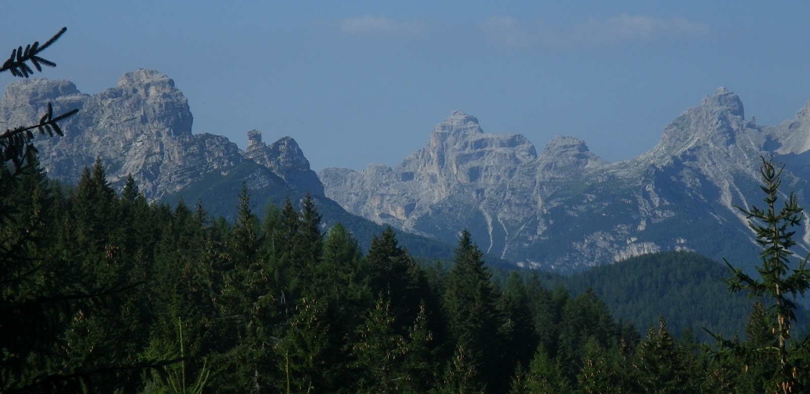
More fun starts here, with some 12% ramps on the climb out of Antermoia, followed by 5km of 9.5% to Passo delle Erbe (2004m) .  Looming over the last few kilometers is Sasso Putia (2875m), with its very distinctive profile.

The ride down is fun.  After Longega you gradually climb on the main road from Brunico to Corvara, quite busy this time of year.  Then you turn upward through San Vigilio (1191m) and climb back up the grassy slopes.  The difficulty varies between mild to hard until Raro Miso (1375m) when it becomes consistently hard- 3.5 km of 10.4% average gradient.  This comes after you've completed challenging climbs up Passo Furcia from Valdaora, and Passo delle Erbe from Longega- quite tiring.  

Highly recommended!

Sasso Putia with Gruppo Sella in left background,
from descent of Passo Furcia

Pieve di Marebbe from Passo Furcia descent

Corte  di San Vigilio from climb toward Antermoia
(hazy!)

Sasso Putia from climb toward Passo delle Erbe

Sasso Putia from just below Passo

Man mowing pasture above Antermoia

 View of Rina from above

View down Val Badia  from Costalungia

Passo delle Erbe center, with Passo Furcia on either side

The over 10% stretches


The ride

Passo Furcia from Valdaora  to Longega

Passo delle Erbe from Longega
214 kph sounds a tad high

Thursday, August 23, 2012

Passo Cibiana (X2) - Zoppè di Cadore

These 3 climbs are close to home: just up Valcellina, across the Piave River at Longarone, and a short drive to Forno di Zoldo (812m).  I worried a bit when exiting the long tunnel near Barcis- it suddenly was raining.  It continued raining all the way over Passo Sant' Osvaldo and halfway up to Forno di Zoldo, but happily stopped just as I parked above Lago di Pontesei.  I warmed up for only a couple of kilometers before reaching the right turn for Cibiana.  The climb begins gradually at first almost like a continuation of the warm up, but at Villanova (890m) it tilts upward.  After a steep  kilometer of 11.7% average grade, you cross the lovely meadows at Cornigan (1240m) and climb steadily through fir forest to the pass at 1536m.  

The road was still damp from showers earlier in the morning so I descended quite slowly, particularly through the town of Cibiana di Cadore where people were out and about in the streets.  At the bottom of the gorge you cross Ponte sul Boite (774m) and climb fairly steeply to Venas di Cadore (852m).   Here you join the main road between Pieve di Cadore and Cortina.

I turned around and climbed back up to Passo Cibiana, with a 4km stretch above Cibiana di Cadore  averaging about 10%.  Then I descended to Fornesighe (965m) and turned off on the road for Zoppè di Cadore.  After a brief traverse to the beautiful hillside villages of Dozza and Bragarezza (930m) you begin the climb to Zoppè.

This was a very surprising road- wide, well-paved, wonderfully-engineered switchbacks.  For some reason I'd envisioned a rough, steep, narrow mountain lane.  The approach gives ample views of the pretty mountainside town of Zoppè, with the imposing dolomite peak Pelmo (3168m) towering above.  At 1470m you reach the top of the town with gorgeous views down the spruce forest-covered valley.  

I descended back through Forno di Zoldo, then down to the car by the lake.  I definitely want to return and get some photos, because my camera battery died before reaching Zoppè.  I'd also like to return to Passo Cibiana and explore a road leading up to Monte Rite (2160m), though I'm uncertain how high the road goes.  


Marmarole viewed on descent from Venas di Cadore to Ponte di Boite 

Antelao (3264m) from Cibiana di Cadore


Panorama to southwest from Cornigan

Close up of the mountains to south

Close up of Monte Civetta (3220m)

Monte Civetta from meadows of Cornigan 

The mountain backdrop to Cornigan's pastures

Lovely flowers Cornigan

Forno di Zoldo chiesa on hill above town


The ride
Climb from Forno di Zoldo to Passo Cibiana

Climb from Venas di Cadore to Passo Cibiana


Climb to Zoppè di Cadore

The "3 summits" (first 2 are opposite sides up the same climb) 

A view of the 10%-and-above gradients

4km stretch of 10% from Cibiana di Cadore to Passo Cibiana

Tuesday, August 21, 2012

Dobratsch - Villacher Alpenstrasse

Another climb unknown (to me) until I saw it while researching Grossglockner.  The climb starts right on the outskirts of Villach, a city on the Austrian border with Italy.  Almost immediately it turns steep, so I rode downhill from the Alpenarena ski jump ramp to some lovely horse farms below.  After warming up I began the ascent at around 550 meters.

This side of Dobratsch (2167m) is covered with dense spruce forest.  The road switchbacks upslope, passing the top of the ski jump ramp and continuing up the seemingly endless wooded mountainside. After the switchbacks the long constant 10% straight stretches begin.  There's a bit of variation between 9-12% but the gradient continues unabated.  A brief dip at the Alpengarten(1403m) and then more constant 10%.  You come out of the forest into alpine meadows around 1650m and reach end of pavement at 1730m.  

From here there is a dirt road/hiking trail to the top of the peak.  I took a few pictures and then headed downhill.  Wonderful descent, the pavement is smooth and wide, traffic was light early in the morning, an absolute blast.   I'll be returning here, maybe with Marilyn to see the Alpengarten.  

Note: the south side of the Dobratsch is a very long, high vertical cliff which you see for miles while driving toward Villach.  I did not get a picture while driving but you can see it here http://www.villacher-alpenstrasse.at/en/der-dobratsch/   


The top of the ski jump ramp

Ski jump ramp from below (astroturf instead of snow)

Monte Canin (2587m) center, Jof Fuart (2666m) near Altopiano Montasio, right

Jalouc (2645m) left and Mangart (2677m) right, in Slovenia

Hiking trail to Dobratsch summit (2167m)


The warm-up and the climb

Remarkably constant gradient for 16.5 km

Sunday, August 19, 2012

Cima Sappada - Val Sesis

I rode this climb a couple of years ago and finally got around to revisiting today.  It's up in the corner of Venteo, Friuli and Austria, a sparsely developed area with wild, stark landscape.

I started from Comeglians (532m) about 0600 and warmed up on the moderate grades along Val Degano, in the shadow of Monte Crostis.  At Forni Avoltri (888m) the forest opens into steep grassy mountain slopes which the road traverses at a manageable gradient.  This changes after a crosscountry ski area at 1040 meters, with a sudden half kilometer of 15.8% through the forest.  Afterwards the grade eases a bit but still often exceeds 10%.  As you enter Cima Sappada (1290m) the road flattens out and you can catch your breath.  Don't get comfy though- you're just getting started.

Take the right turn marked variously Val Sesis or Sorgenti del Piave.  After winding through the village you climb easily through the forest and follow whitewater streams upward.  You hit the first surprise after about 2km- a serpentine section writhing up very steep mountainside.  I stood and pedaled my heart out for almost a kilometer.  Now it eases to a more human gradient for a couple of km.  Beautiful waterfalls, rapids, tall red spruce and stony peaks above.  Another killer serpentine stretch hits and feels like it will never ease up, but it finally does after close to 2 km.  More easy riding for a few minutes, then yet again a twisty steep stretch for another kilometer and a half.

You've entered the alpine grassy zone now- glorious scenery in all directions.  The road finally levels out some and you ride past a busy hiker parking area, then reach end of pavement at Rifugio Sorgenti del Piave (1830m).  There's a 2-hour long trail (CAI 136) from the hiker parking area traversing to Val Visdende, a paved road ascending from San Pietro.  The trail is too rough for a road bike, but one could hike it and carry/push the bike, or better still come up on a mountain bike.  I'll instead try to simply climb up from San Pietro and return back down- maybe in September?

The ride down is tricky this time of year due to traffic- the road is often too narrow for 2 cars to go by one another, particularly in the corkscrew-like serpentine sections, so they stop and figure out who's going where.  Italian cars/SUVs have been getting bigger- not up to US magnitude yet, but much larger than little subcompacts of 20-30 years ago,  while the roads are the same size as ever.  After you survive the descent to Cima Sappada it's a fast downhill ride to Comeglians, again slowed by traffic, but maybe it's better I wasn't going full-speed downhill into those curves.  Might have had a little too much fun.    

Monte Siera (2443m) towering above Cima Sappada

Waterfall to your left as you ascend

Another view of the falls

Monte Chiadenis (2459m)

Monte Chiadenis from a different angle 

Monte Peralba (2694m)

Monte Lastroni (2449m)
Dolomiti Bellunesi to the south

Waterfall on your right as you ascend
Contadina made of hay

Il suo marito

Hay sposi riding in their wedding sled

See all the over-10% gradient above that line

The ride

The climb up Val Sesis