Monday, June 30, 2014

Torrente Rot

The brake bleed kit finally arrived so I bled my mountain bike's brakes and changed the paper-thin front pads.  I took a test ride and the fronts were rock solid but the rear still squishy.  Worse yet my test ride had a muddy climb and the rear tire was so worn it just spun without forward motion.   So I bought a new tire and re-bled the rear brakes.  Today was final test ride.

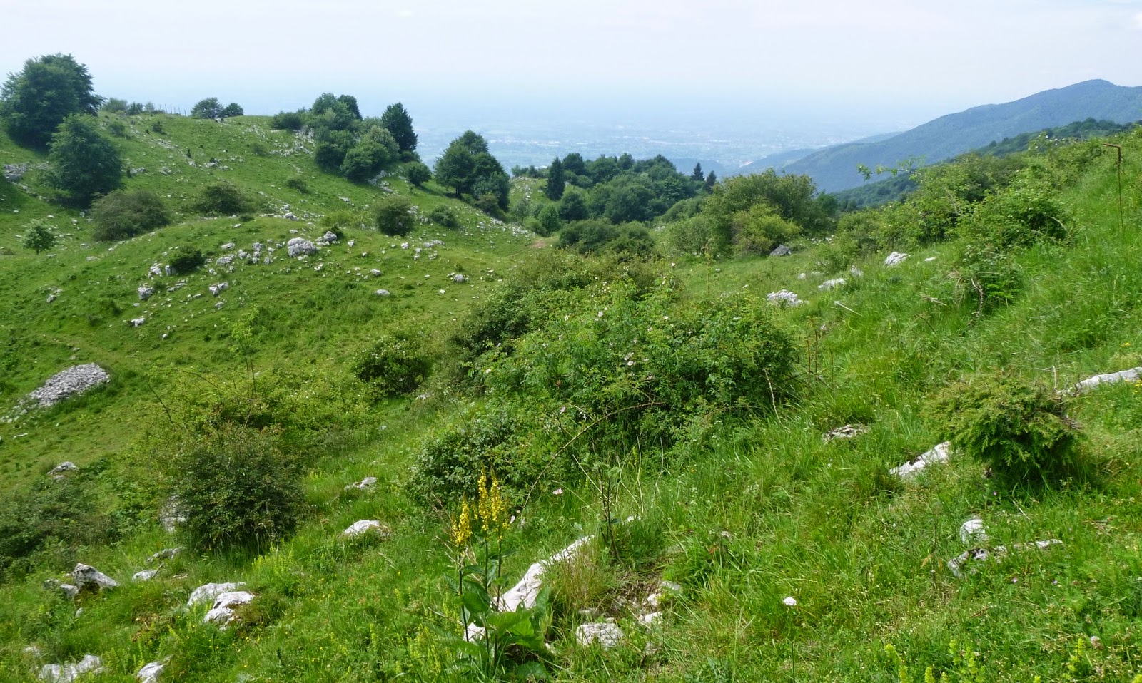
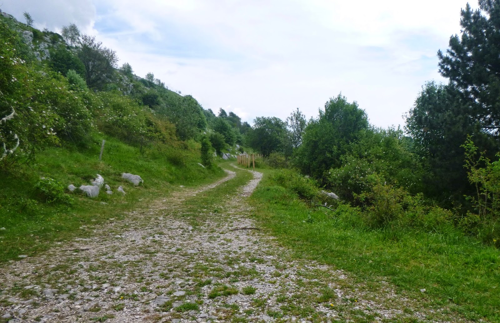
I left Giais heading west on a gravel path.  The forest here is interrupted by clearings where hay is grown: 3-4 foot-high grass and wildflowers surrounded by woods and mountains.  Sometimes along the edge of the clearings you'll find a path exiting, and you try them all till you find one that goes through.  After awhile I reached Rio Stentore which is rocky and steep both down and up: being a newb I got off and walked.  The forest singletrack continues until an area northeast of Marsure called Tamarethe.  This is wide open grassland tilted upward toward Forcella di Giais.  I rode across to a gravel road and headed upslope to a fork.  Right takes you up Sentiero Costa Longa to the Forcella.  Left takes you to the Chiesetta degli Alpini.  I went left following a very narrow path along the little canyon of Torrente Rot.  Again a skilled rider might be able to ride most of this, but even walking my left foot was often plunging through the thick grass and dangling in empty space momentarily before recoiling in terror.

I crossed the boulders at the bottom: luckily there's no water this time of year, though in early Spring it's probably a roaring torrent.  The climb out wasn't bad, except for one section where you must carry the bike on your outboard shoulder to avoid  plummeting.          

Before long I reached the lovely grounds of the Chiesetta degli Alpini.  They keep their memorials very neat.  I descended on a grassy path straight downslope to Via Cantore in Marsure (near tennis courts).  From here I rode home.   New rear tire is very grippy- no slipping in mud nor sudden lunging sideways off a round rock.  And the rear brakes are much firmer, but will need new pads in a couple months. 

View from a forest clearing where hay is grown

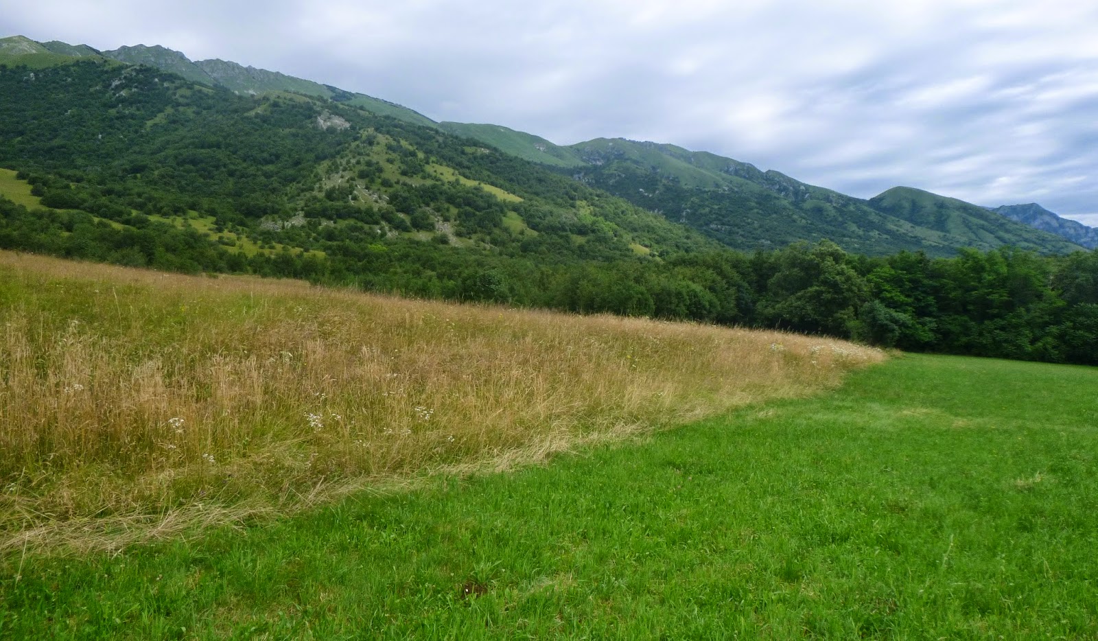
From Tamarethe, looking northeast

Trail junction

The path along Torrente Rot gorge

Crossing the torrente looking upstream

Carry your bike here and lean away from the edge

Across the gorge toward Giais campanile

View from higher up of Giais church and mountains to east

Chiesetta degli Alpini

Marsure's church

World War I artillery piece

Fontana di Giais

Costa Longa descending to Marsure

My new tire


Thursday, June 26, 2014

Banjšice

My ride today started at Gorizia, the first time I've ever visited the city.  It's nice and clean, with shade trees, parks, and sidewalk cafes.  Didn't know where anything was, so I warmed up by riding around getting my bearings.  Eventually I saw a neighborhood called Rožna Dolina I remembered from the map and started my ride.  After a steep diversionary climb up to Loke, I got back on course, past Castle Kromberk and up through Breg to Ravnica (3 km averaging 10%, constantly varying gradient).

After Ravnica I started to head up the wrong road, to Lokve, but realized it, turned around and descended to Grgar, hidden in a valley behind Monte Santo (Sveta Gora).  Here I began my principle climb of the day to Lokovec, above Cepovan valley.  

The road has decent pavement and isn't too steep for a few km, then at 476 meters you turn off left toward Lokovec.  This road is well-paved with a constant 10-12% gradient for 3km: a really good workout.  At 800 meters it reaches the altopiano of  Banjšice.  This is a fantastic place: remote, silent, natural and wild.  Very glad to visit here.  Alas I got confused on my map and couldn't complete the route I had planned on descending through Bate and Grgaske Ravne, but it will be fun to return and try again.  As it was, I did a great deal of gravel road riding and the road bike and skinny tires survived intact.
  
The return route I used instead was north to Lokovec settlement at 847 meters, with much steep up and down riding.  Then a long killer descent to Cepovan (very torn up old road), then back down the beautiful valley to Grgar.  From there down to Solkan on Soča River and along the river bank to Gorizia.  Have to come back soon.    
Kromberk Castle built in 1609

Banjšice high plain, karst outcroppings and beautiful milk cows

View across the altopiano- mountains are on the other side of
Cepovan valley, above Gorenja Trebuša

This dense beech grove with mossy karst was the dead end
of a beautiful gravel road I got lost on


Sunday, June 22, 2014

Valli del Torre - Soča River Loop

I drove to Nimis (200 m), parked the car, and began pedaling up Val Cornappo.  After a couple of kilometers I took a left toward Ramandolo.  Very quickly the road begins snaking through vineyards at a steady 7-9%: it would be wise to do a longer warmup.  The gradient finally flattens at Chialminis (660 meters) and I descended stepwise to Villanova, Lusevera, and Vedronza (310 m).

Here you begin a very gradual easy climb up Valli del Torre, then head east to Passo Tanamea (839 m).  Very fun descent with fast chicanes along Rio Bianco and Torrente Uccea to the bridge on the Slovenian border (540 m).  Another climb out, this time to 700 meters, followed by fast descent to Žaga (330 m).  This is the main road along the Soča River, so quite busy on a Sunday with motorcyclists, vans hauling trailers full of rafts and kayaks etc.  Beautiful views of the surrounding mountains, though overcast and hazy.

At Kobarid I turned away from the river and headed west toward Val Natisone.  Shortly afterward, I turned right toward Breginj.  Very peaceful easy climb: I could hear the chorus from the church at Cred- very different harmonies than I'm used to hearing in the US.  The road heads north on the flank of Stol, a tall long ridge separating the area from the Soča River.  After Breginj at 608 meters you head steeply down toward the Natisone on a very rough road.

Crossing the bridge at 381 meters you start the last climb.  First you reach Platischis (625 m), then Passo Sant'Antonio (758 m), afterwards dropping down to Campo di Bonis and reascending to Taipana (739 m).  Long fast descent  to the Cornappo and then to Nemis.

Good workout- now I'm exhausted.


Ramandolo vineyards

View from Villanova

Torrente Torre toward Monte Musi

Torrente Torre toward Tarcento

Wild valley of Učja River  

Mountains above Žaga

Mountains northwest of Žaga

Breginj church


Natisone River flowing south


Friday, June 20, 2014

Col Alt

I rode the lower part of this climb to Chiesetta Alpina on Monte Castelir in January and vowed to return on my MTB to try the upper portion.  Unfortunately my MTB is waiting for a brake bleed kit, so I took the road bike instead.  After warming up on the ride to Caneva and Sarmede I turned toward Rugolo and climbed up to 250 meters.  Then turned right toward Rugoletto and Villa di Villa.  Quickly turned again, left this time at the Chiesetta Alpina sign.  Be sure to turn right at 310 meters instead of going straight ahead on a 15% stub that dead ends, like I did.

Now a pleasant surprise: the pavement on this climb was horrible last January.  As luck would have it they have paved this with fresh smooth asphalt up to 780 meters.  Miraculous really, and makes this into a road bikeable climb.  The new pavement improves traction tremendously and avoids much wasted power.  Unfortunately not enough for me though because at 530 meters I stopped to hyperventilate awhile.  Good thing too because the remaining killer gradient to Chiesetta Alpina crushed me.  I barely kept from falling over, and once I stopped my stomach felt twisted in a knot while I recovered- I couldn't drink or eat.

Finally I returned to the land of the living and resumed the climb toward Col Alt.  This road winds up through beautiful forest and a settlement of restored stone houses till 780 meters.  Here the climb leveled out and the road grew rougher to about 806 meters (Casera Dal Cin).  Then the road turned to gravel: I rode some of it, and then put on cleat covers and hiked.  After cresting at 820 meters it turned downward, passing a nice alpine pond with lily pads and very loud frogs at 798 meters.  The road winds past more restored stone houses and finally reaches Parco Carbonai and Strada del Patriarca, the old paved road from Villa di Villa to Il Cansiglio.  Fun descent to Villa di Villa, then home.  I will return on the mountain bike soon and ride up to the summit of Col Alt (866 meters) and visit the monument to resistance fighters who fought the Nazis. 

Info about the adjacent trail: http://www.prealpitrevigiane.it/descsentiero.asp?id=22

The fresh asphalt from Chiesetta Alpina to Col Alt

One of the restored stone houses above 700 meters

Trees near 780 meters

Casera Dal Cin


Beautiful decoration on the casera's door
Stella alpina and ginziana painted on shutters

Parco Carbonai picnic ground

Junction with paved Strada del Patriarca

Col Alt (866m) with monument at the summit

Castello di Cordignano ruins above Villa di Villa


Wednesday, June 18, 2014

Korada

Korada is a mountaintop World War I battlefield along the Isonzo (Soča) River in Slovenia, just across the border from Italy.  I drove to the Italian village of Vinco and rode my bike into Slovenia at Neblo (71 meters elevation).  Vineyard-covered rolling hills extend in all directions as far as you can see.  After taking a wrong turn up a pretty valley, I returned and started up the climb proper.  First you reach the village Belo, then the road steepens to 10-11% for a couple of kilometers to Nozno, followed shortly by the junction with the roads coming from Drnovk and Vrhovlje.  The road has a very regular gradient now: 7-9% with no let up.  Finally nearing Korada it lessens and becomes more or less level skirting the hilltop (714 meters).  

I continued to a gravel road and tried it briefly, but the skinny road tires were no match.  I put on cleat covers and hiked briefly around the grassy wildflower meadows.  I returned on the main road and then tried a concrete road that ended after about half a km.  Now down the steep descent to Gonjace, Smartno, Zali Breg and Drnovk.  This was the most fun part of the ride- fast, curvy, rolling hills.

Must return soon- this is a great cycling area.


Soča River from near Korada

Korada meadows looking north

Toward the northeast

The view west


Monday, June 16, 2014

Val de Lama MTB

I rode down to Dardago then climbed up past San Tome to the trailhead for Val de Lama at 550 meters.  The trail is too steep so I pushed the bike uphill.  The trail did get somewhat less steep later but it was technical and I thought I'd fall and break the bike or my body.  So I kept pushing.  This continued past the turn off for Troi dei Mui at 750 meters which descends to Mezzomonte, past the  ruins at Ciavalir (1019 meters), until the pastures just below Casera Val de Lama at 1100 meters.  A good MTBer could probably have ridden some or most of that.

The pastures are gorgeous, with wild roses, karst stone, free ranging asini, wildflowers and grass.  I rode to the junction with the paved road descending from Col di Palse.  From here I rode down nice and easy, as the front disc brake was a little gimpy.  I need to work on that.  Anyway I made it down the hill and then home.  I would not recommend biking up this trail, although a skilled technical rider should be able to descend most of it.  Still I enjoyed the fantastic scenery and got a good workout.   Not a bad day.


The cliffs above San Tome.

Too steep to ride up the trailhead

Turn off for Troi dei Mui at 750 meters

Old house ruins at Ciavalir (1019 meters)

Wild rose 1100 meters

Little herd of asini at 1100 meters

Casera Val de Lama 1100 meters

View southwest from casera

The dirt road from the casera joins the paved road to Mezzomonte