Thursday, July 31, 2014

Giau da Cortina

I climbed Giau from Selva di Cadore a few years ago but never got around to doing the other side.   So today I tried it.  On the drive up to Cortina it showered intermittently, and I was worried about getting caught on the pass in a storm.  I parked in a pay per hour lot at Cortina and a lady walked maybe 100 meters from her car to tell me there's a free lot just down the street.  Very kind of her.  After shifting the Mini down there, I started the bike climb up toward Falzarego.  After a few km I reached Pecol and turned left for Giau.  Very good road- lots of switchbacks to ease the gradient.  At the top the crowd was much smaller than on my last visit, no motorhomes, tour buses, motorcyclic hordes: instead, just a few tourists.  I'm thinking the weather has frightened people away.

The descent was very cold despite arm warmers and vest.  I'll try to remember my leg warmers next time.  This is a good climb- much easier than the other side, but with the same wilderness feel.  Highly recommended.


View to the west

To the northwest

Nuvolau

Gruppo Sella in distance

Marmolada, with her glacier 

Cortina in valley with Sorapiss in background

Nuvolau from the east

Ponte Lastoi de Formin to southeast

Close-up of towers along the ridge


Sunday, July 27, 2014

Monte Pizzoc

Our weather has been stormy off and on so I tried to work in a short local ride this morning.  On the road bike I cruised down to Sarone and headed up to La Crosetta at 1100 meters.  From here a little dip down toward Il Cansiglio and a left turn toward Monte Pizzoc.  This beautiful road climbs through a forest of large beech trees up to around 1400 meters, where the forest opens into alpine pastures, then on up to 1550 meters where the road ends.  Great views up here even with the cloudiness.  Descent and ride home were fun too- didn't even get cold.  And best of all- no rain.

View west toward Vittorio Veneto, prosecco area,
and Monte Cesen in distance

Northwest: Col Visentin, Bellunese dolomiti

To east: Il Cansiglio grassy altopiano, Monte Cavallo in distance

Wildflowers at summit

Looking down at the Cadolten area I recently rode the MTB to from Fregona


Friday, July 25, 2014

Strada della Venezia delle Nevi MTB

I've wanted to ride the upper part of this climb from Dardago for years.  The lower portion I've climbed frequently: it's one of the best road bike training climbs around here, from Dardago continuously ascending for 5.6 km to end of pavement at 561 meters, averaging 7%.   

Today I took the MTB instead and continued past end of pavement up a very rocky road for 8 km to 1183 meters.  Not terribly steep at 7.6%, but the continuous trail of softball-sized (and bigger) stones wore me out.  It doesn't turn into a a normal dirt road till the last couple hundred meters before Sauc.  By then I was slowly tweedling along in 24-36 gear on a 7% grade- I was toast.  Then, smooth easy spinning on pavement slightly uphill revived me, and I rode up the hill to Col Alto at 1347 meters then down through Castaldia and Bornass to Costa di Aviano. 

I may try it down hill next time.  Beautiful ride,


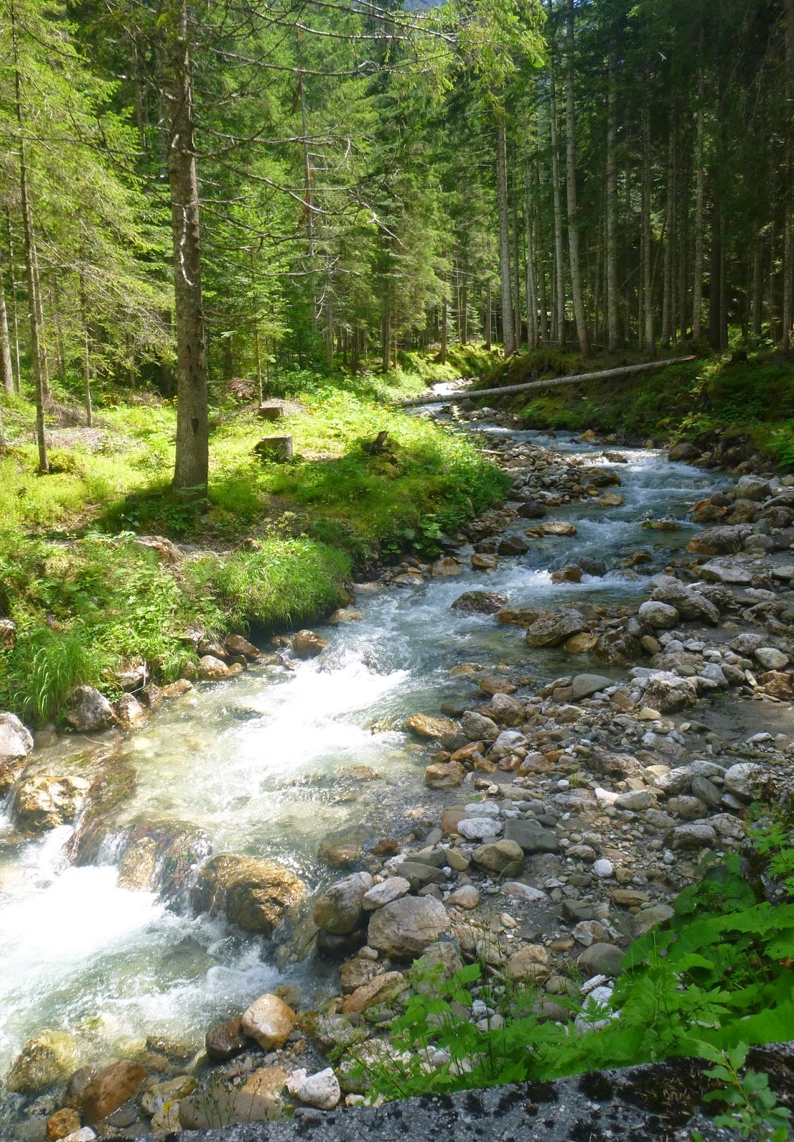
From 715m, looking down at Torrente Cunaz at base of
Croda di San Tome

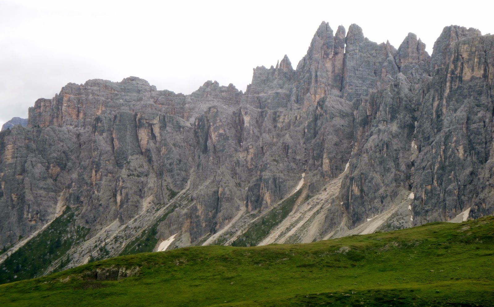
Looking up at the imposing Croda

Looking south a huge fissure in the croda; hopefully
I'm not hiking down there when the cliff face calves

A landslide at 960 m; the road was privately built back in the '60s
 and isn't maintained by the government

From 960 meters the top of Croda di San Tome


Return of pavement at Sauc, 1183 meters
(if you are descending this road isn't marked). 


Tuesday, July 22, 2014

Marziai Via Castello MTB

I was planning a ride from Lentiai to Rifugio Mariech via Col Artent, when I noticed an entirely new climb from the west on the map.  And it seemed to be paved almost to the top.  I had to go check it out.

 I drove to Segusino on the Piave River northwest of Valdobbiadene.  From here I rode along the east bank of the river to a tiny town called Marziai.  I found Via Castello and continued climbing up past the church.  Soon I was in a dense forest with sheer mountainsides plunging down to whitewater streams below.  It's quite steep but not bad on a mountain bike: then the asphalt ends and a homicidal stretch of concrete road continues into the forest above.  I climbed it seated because the road was damp with rain and whenever I stood I lost traction.  Finally I was spent and started pushing the bike up.  Even that was hard- I had to stop and take a rest from pushing several times.

After a seeming eternity the road flattens back into the meer teens and I resumed riding.  Shortly afterward, the pavement ended and I started up a series of slippery white rock switchbacks.  Then it flattened out and I reached the dirt road from Col Artent to Rifugio Mariech at 1171 meters.  This was an easier road with very loose stone in many parts but rideable.  

Before long you emerge into rolling alpine pastureland and the high spot around 1500 meters at Rifugio Mariech.  Fun zoom down to Valdobbiadene and back to the car at Segusino.  I will try this again after a dry spell (maybe late summer, fall) when I can stand on the steeper gradients.  Or simply ride to end of asphalt and turn around.  Too beautiful not to revisit.


I could barely even push the bike up this; in winter
it would make a good luge run 

Looking back: the photo flattens the +20%

Capella del Monte Garda at 1170 meters

Rifugio Mariech at 1500 meters

From near Mariech: prosecco vineyards, the Piave River,
the Adriatico on the horizon.

East toward Revine Lago, Monte Pizzoc

Monte Grappa to the west


The principle climb


Saturday, July 19, 2014

Forcella Clautana MTB

I tried climbing to Forcella Clautana in May, but the snow was still too deep on Monte Ressetum.  Today I took a slightly different route, climbing from Lesis toward Casera Pradut, rather than Matan to Casera Ressetum as in May.  Both routes are gravel roads with loose stone, and concrete or asphalt on the steeper sections.  This road is still a killer gradient but seemed slightly less difficult than Casera Ressetum- maybe all in my head.

At the trail junction (1381 meters) of Pradut and Colciavas, turn left toward Casera Colciavas.  There are several rough gravel switchbacks to climb so you must pedal while seated to avoid tire slippage.  The casera at 1513m is slightly above the road and I skipped it today.  The gravel road finally climbs to 1552 meters and then begins to descend.  There are several loose-gravel switchbacks on the descent, then you arrive at Forcella Clautana at 1432 meters.  I caught a glimpse through the trees of Lago Ca Selva to the east- a route I'll attempt another day.  Today instead I headed down Strada degli Alpini trail toward Casera Casavento.  This is fantastic cliffside single track built by Italian soldiers before World War I.  I'm a chicken, so I rode slowly almost the whole way, stopping at landslides and rockfalls to walk.  There are great views from up here.

Eventually I made it to Casera Casavento at 980 meters.  Many cows and asini in the pastures here.  I headed down the gravel road until pavement resumes at 870 meters.  A fast trip down the tornanti then along Torrente Cellina to Lesis.  Want to come back and try some of the possible variations- this is great MTBing country.  


On paved road along Torrente Cellina:
turn right towards Pradut

This is the junction after the killer gradient;
head toward Colciavath

Forcella Clautana Monument

Detail of carving on porphyry column 

After the Germans routed Italians at Caporetto, many retreated
via Strada degli Alpini to Piave River and new front line

Monte Ciampons

Casera Casavento far below

Looking back toward Monte Ressetum

Monte Domanzon

Ciol de la Galina waterfall

Ciol de Ciasavent shooting off a cliff before falling to the large
boulders below and exposed dinosaur fossilized footprint 

Baby asinino near Casera Casavento coming over to visit

Enjoying a scratch between the ears

The principle climb

Thursday, July 17, 2014

Marmarole MTB

The Marmarole are a group of mountains west of the Piave River with less tourists in summer than  some other areas of the Dolomiti.  A favorite climb here is the road from Lozzo di Cadore to Pian dei Buoi.  The road winds 11.5 km up the shady mountainside above Lozzo at an  8.5% average gradient.  This was a military road constructed after 1900 to haul materials and cannon up to Col Vidal fortress.  The incline had to be gentle enough for teams of mules to haul extremely heavy loads.  The one imperfection last time I climbed it 3 years ago were the frequent drainage channels you had to jump or slow down for on descending.  Now they have repaved most of the upper half of the climb and the channels are gone.

At the top the road turns to dirt, but is roadbike-able (I climbed it with the Merckx in 2011).  This time I used the MTB because I wanted to try the dirt descent to Val da Rin and Auronzo.  The map I printed off the web was kinda sketchy but a very nice Italian MTBer stopped and took a good map out and showed me the best way.  The descent was very steep loose rock but at least was dry at first.  Then I stopped to chat with another MTBer pushing his bike up from the bottom (there are descriptions online of riding up this, but I don't see how it's humanly possible).  He said the trail below was brutto because it was full of mud and water from all the rain.  He was right, it sucked, but it didn't seem too bad after last week at Val Visdende.   

Eventually I reached Val da Rin, forded across and headed down the paved road to SR48 west of Auronzo.  Easy ride from here on main roads down to Lozzo di Cadore.   Will come back and try to explore Col Vidal fortress next time.  

Rolling Pian dei Buoi pastures

Monte Ciareido, left

Dolomiti peaks on horizon

View to northwest

Val Poorse

Cimon di Froppa above Val da Rin meadow

Tuesday, July 15, 2014

Tre Cime di Lavaredo

I've been waiting for the weather to break at Tre Cime di Lavaredo and today I got my chance.  I drove up to Palus San Marco, on the road from Auronzo to Misurina and hopped on my road bike.  This road takes you from 1100 meters up to Lago Misurina at 1750 meters in about 11 km.  It has some 12% stretches but the nice views of  Cristallo keep your mind off the effort.  

After Lago Misurina the first steep segment takes up you to Lago d'Antorno, then you coast down to the toll booth (€24 per car) and there the real climb starts.  I  stood on everything 12% and above: almost made it from Palus San Marco to the end of the climb without stopping, but I ran out of gas on the long steep stretch of 16-17% shown below.  After a break I went on up to Rifugio Auronzo where pavement ends at 2320 meters.

I locked the  bike to a flag pole and started hiking.  Last time up here in 2011 I vowed to come back and hike around to the other side of the Tre Cime.  So I installed my SPD pedals on the Viner road bike, rode up in my Pearl Izumi X Alp bike/hike shoes and hiked around to the back.  The scenery was well worth the effort.  I was short on time so didn't do the full circle around the Cime, but that gives me a reason to come back again.  I won't wait 3 years next time.   
      

On the left, the gradient that done me in

View east toward Lago d'Auronzo

The Cime from the east (on trail to Rifugio Laveredo)

From a bit further east

Mountains to southeast

From northeast

Vertical walls

Mountains to northeast

More formations to northeast

Refugio Locatelli

To north

Panorama from Forcella Lavaredo

Close-up from trail I returned on (close to base of Cime)

Too close

If you look closely climbers are up there

Panorama to south with Lago Misurina

Lago d'Antorno