Madean is a popular climb starting from Combai (between Vittorio Veneto and Valdobbiadene). It ascends Monte Cesen up to Casera Budui (1218m), with the option of continuing down 200 meters to Pianezze and then up to Rifugio Mariech (1510m). Today I just did the short version.
They've re-paved much of the narrow mountain lane, so it's now a joy to descend as well as climb. Previously you had to hold the brakes with a death grip all the way down, lest you get a flat, slide down an embankment, or simply rattle your teeth to death. It was cloudy and cool so thermal runaway wasn't a problem- perfect day for climbing through dense forest. At the top it opens up into alpine meadows, with great views of surrounding villages apparently floating in a sea of prosecco vineyards. The descent was very long, because after you reach Combai you continue downhill several more kilometers through Miane and on toward Cison Valmarino. I was happy to reach some rolling hills again so I could warm up a little.
Next time I'm out this way I'll try Valdobbiadene to Rifugio Mareich, Pianezze to Casera Budui, then down to Combai. Should be a blast.
Hazy view toward Revine Lago, Passo San Lorenzo
(on right), and Monte Pizzoc in background
Combai (400m) seen from 1200 meters
Guia (Valdobbiadene), with its famous prosecco vineyards
My neighbor Silvano has noticed me riding a lot and is determined to slow me down.
When I got home he handed me this freshly made ciambella cake.
What a dilemma- you're dreaming of a climb in the mountains, but you need to take a family member to an appointment in the afternoon. Then voilà, you remember you have a world-class climb 7 km from your house. Col Alto/ Piancavallo gains 1200 meters in 15.5 km. Not bad, but there's a 3.6 km stretch averaging 9.6% in the lower half, exposed to full sun surrounded by rock faces. So try to start early morning in summer.
This morning was the first clearness we've seen after several days of rain. At 0700 when I left there wasn't a cloud in the sky and the seeing was very crisp. After the quick 7km roll down to Pedemonte I headed up. It pretty quickly hits 10%, but didn't feel bad. The "worst" stretch, on the long switchback before you turn toward Bornass, wasn't as tough as usual. I thought I had misremembered and there must be another switchback, but no I'd already completed it. From there on things get slightly easier. Especially nice on the back road from Caldastia to Col Alto. Everything bright green from the rain, the skies cobalt blue (with the beginning of some puffiness here and there). A large flock of sheep was in the meadows and I got some fotos and video. Then I realized they were headed for the road ahead and might block my way. So I hurried and beat them by a nose. On upward through the beech tree forest to Col Alto where I turned around.
I descended and when I reached the sheep they were grazing on both sides of the road, with a few wandering on the pavement. I asked the shepherd if it was ok to pass and he nodded yes. Apparently he also imparted this to the on-rushing Belgian sheep dogs, who stopped just short of my leg, sniffing rather than chomping it. These are big fluffy black dogs- our neighbor had one she called a Belgique, so I'm guessing they're called Pastore Belgique.
I continued on down the wonderful switchbacks and then cruised upward to home. I looked back and the area where I'd ridden was now completely engulfed in cloud.
Meadow around 510 meters, looking west
Valle della Stua, from 1030 meters looking west
The dirt road from Dardago/Val Artugna winding toward Piancavallo
Valle della Stua toward Caldastia
Baracca del Sauc near Piancavallo
Turn off for Col Alto left, Valle della Stua center
Rolling meadows to east from 1200 meters; the
helicopter is scanning the area above Giais-Malnisio firing range
to ensure no hikers, berry-pickers etc are in line of fire
Lovely ride through the prosecco vineyards again today. From Colle Umberto we rode through San Fior di Sopra and on toward San Pietro di Feletto. There is a short steep climb called Cà del Poggio averaging about 10% for 1.3km, with gradient at points reaching 18.5%. Then down the lovely switchbacks below San Pietro di Feletto and a rolling stretch down to Cozzuolo. Cloudy skies kept it nice and cool. Good ride.
Sometimes you return to a familiar climb and you discover the place all over again. Today my routine local ride to Lago Ca' Selva was like that. As Jack puts it "Eppure esistono salite belle ed impegnative anche vicino a casa, e può capitare che passino anche un paio di anni prima di salire sulla vetta di certe montagne; ed ogni volta che ci si torna si scopre il gusto dell'esplorazione, dell'impresa, della scoperta e la fatica pare sempre più di quella reale. La bicicletta non dovrebbe trasformarsi in routine, per non perdere il gusto della prima volta." http://jackciclista.blogspot.it/2012/05/come-la-prima-volta.html
It began normally enough- I warmed up through Maniago then through Bus di Colvera toward Poffabro and down Val Muie to Navarons. At Lago Tramonti dam I turned and headed toward Chievolis. Here the climb starts up Val Silisia, as usual a good workout. At the first mid-ride summit a family of deer were having lunch. The mother stayed by the gorge cliff-edge, while 3 babies (quite clumsy and cute) and a yearling crossed the deserted road for some food. I stayed away and used zoom to take a foto, then the mother got spooked, headed downslope, and the yearling and babies jumped over the guardrail to follow.
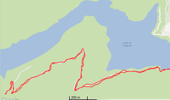
The Lago Ca' Selva dam was peaceful as always. I thought I'd cross over and go a few hundred meters up the dirt road toward Forcella Clautana. Suddenly the dirt road gave way to pavement, not new but still in good condition. Not sure why I haven't seen this before- I may have and I've forgotten (my memory is pretty spotty). The narrow road begins climbing, getting steeper and steeper until 653 meters near Panuch. There is a trailhead here. Then you descend through a stupendous beech tree forest with big dolomite stone cliffs. On the other side of the narrow lane is the back end of Lago Ca' Selva, normally hidden from view. I finally reached the bottom of this descent and continued to the stream crossing at Val Bassa, where pavement ended. The gravel road looks pretty good, so I may come back later and try to go further.
Now back over the hill again, down to the lake, up the other hill, and down the road to Cievolis. From here I took the main road through Meduno and Maniago to home.
Note: Had another flat on Vittorio Diamante Pro tire near Val Colvera- I'm swapping it for a Michelin Lithion tonight.
Mama deer, left edge, 2 baby deer in road
Lago Ca' Selva back end from Panuch,
with Forcella Clautana in background
Overview of the climb
The new (to me) paved road to Panuch and Val Bassa
A km of 13.6% to Panuch
On the way back from Val Bassa, a km of mere 12.2%
Previously rode this double climb in June 2011 http://dolomiti-friulane.blogspot.it/2011/06/passo-praderadego-da-gus.html . This time I decided to try it in reverse direction, with Praderadego first, then San Boldo. Definitely easier this way. I was lucky and 2 cycling friends, Doug and Paul wanted to go. We cruised out past Vittorio Veneto and then turned at Valmareno toward the pass. It's a very wild landscape with stone cliffs and dense forest. The previous dirt road section has now been paved and is in perfect condition. We descended the steep north side to Gus, then continued on the main Belluno-Feltre road until Trichiana. The San Boldo climb from this side was new to me and is beautiful and a bit easier. After the pass we descended the scala of tornanti with U-shaped gallerias at the ends down to Tovena. From here Paul, who's a very strong cyclist, wanted to climb Passo San Lorenzo from Tarzo to Vittorio Veneto. Afterwards I was toast but continued pedaling as best I could the rest of the way home. Doug was very kind and accompanied me to Giais to make sure I made it up the hill. Another great ride with perfect weather and excellent company!
View from Passo Praderadego toward Valmareno
and prosecco hills
Another in the series of uncompleted rides revisited, this time http://dolomiti-friulane.blogspot.it/2011/01/canal-di-cuna.html from January 2011. I warmed up through Meduno and along the shore of Lago Tramonti, and then began the steepish saliscendi up to Tramonti di Sotto. As you leave town hang a right on the road marked Tramonti di Mezzo and after more climbing you arrive. As you enter town take the first right, climb some more and then take the first right again (via Canal di Cuna). This is a narrow mountain lane with bad pavement. Continue rolling along and then cross the bridge over Torrente Chiarchia. After a bit the climb proper starts, a long series of steep tornanti. I stood on much of these, careful to cross the drainage grates at an angle, and avoiding the loose stone, wet fir needles and other debris. I continued past the place I had dismounted and started walking last year, and reached end of pavement at 750 meters.
Here I donned a pair of Bike Skins cleat covers to see if they would work for bike-hikes. The gravel is quite deep and washed out with channels, etc. I pushed my bike up to a big open switchback at 807 meters. The Bike Skins worked well but this deep gravel requires hiking boots, I think. I will try driving next time to start of climb, and then hike with boots up to Canal di Cuna. More info on the hike here http://www.cuna.it/.
The descent was slow due to bad pavement. Afterwards I sped up a bit and enjoyed the scenery. At Tramonti di Mezzo there was a small forest fire where I'd ridden through earlier. After escaping the smoke I enjoyed descending the saliscendi to Lago Tramonti, but the winds picked up (white caps on the lake!) and the controvento opposed my progress all the way home. Very tiring, but good resistance training.
Torrente Chiarchia with valley, mountains in background
Torrente Chiavalara tumbling over the boulders
Panorama to west showing valleys of Chiarchia and Meduna,
mountains in background
Monte Caserine Alta (2306m), Monte Frascola (1961m)
Cuesta Spioleit (1687m) to north
Sign pointing to a spring with best water I've ever tasted
I was getting ready to shave when my phone beeped. A text from my teacher "Oggi non ci sarà lezione." Now my lovely commute to Pordenone was cancelled. Our dog Honey gave an opportune jingle of her dog tag- "Hey, we wouldn't mind going for a walk." So we headed out on the grueling circuit through the countryside south of our village. The morning sun was already blazing at 0900, but we deftly kept to the shady side of the farm roads. Quite noisy out, with all the chirping insects, tree frogs and songbirds. Alas, I don't have an iPod so I had to endure it. We made it home just in the nick of time for the girls to take a nap on their bed in the sunspot in the hall. http://www.itinerariciclabili.it/index.php?id=138
This climb is really 2 climbs in one. The first, from Villa di Villa to La Crosetta gains 1037 meters in 15 km. After a short descent the second, Monte Pizzoc gains 438 meters in 6.5 km, reaching altitude of 1549 meters.
I warmed up on Via Pedemontane to Caneva, then headed toward Sarmede. At Villa di Villa you just keep heading uphill. You climb along the rim of a cava or open pit mine and then enter a zone of cespugli or scrubby trees. They give a little shade here and there, quite welcome on this hot morning. Finally around 700-800 meters altitude you enter a deeply shaded forest of beech and spruce trees. Always feels like cool, refreshing twilight along this stretch. The pavement through here is pretty torn up- better suited for a mountain bike. At 980 meters you join the well-paved road coming up from Sarone-Caneva, and continue through the shady woods until La Crosetta at 1118 meters.
After a short downhill stretch you turn left and hit the steep start of Monte Pizzoc climb. They have repaved much of this road since I was last here and it's excellent, both to climb and descend. Before you had to dodge crumbling pavement, craters etc which made fast descending terrifying. This is one of the prettiest forests around here- very tall, wide beech trees with lots of space between them. The trees give way to alpine meadows at 1350 meters, with great panoramas on clear days. You continue grappling up the slope until 1530 meters where pavement ends. I continued on dirt to the flat summit at 1549 meters.
The fast descent felt great. I continued down to Sarone, where it was quite hot, and on toward home.
Terraced meadows at 450 meters
The hazy valley of Revine Lago and Cison di Valmarino
Col Visentin 1763m
Il Cansiglio with Monte Cavallo in background
Beautiful area between Vittorio Veneto and Monte Pizzoc
I need to explore this
Rode clockwise
1450 meter climb in 22 km
(including the short descent after La Crosetta)
Our rainy weather finally broke for a few hours so I took a quick flattish ride up to Meduno, down to Travesio, across through Sequals to Arba and home. Nice tailwind heading out but I paid on the way home- all headwind. Good workout though. Hopefully we'll get another patch of sun on Thursday morning so I can head for the hills.