
A long easy ride through some spectacular scenery. Cruised down to Vittorio Veneto, passing a plethora of riders heading up the Strada Pedemonte Occidentale, including a large club ride. Climbed up the gentle slope to Sella di Fadalto 487 meters, then Lago di Santa Croce. It was a bit cloudy so I didn't take many pictures of the lake, but it was gorgeous as always.
The stretch through Ponte nelle Alpi to Longarone has pretty scenery but is too heavily trafficked, with trucks, tourists towing campers, etc. Maybe a Sunday in Spring or Fall would be better though. There are some narrow bridges where a trailer blown sideways a bit by a strong wind gust could easily knock you off into the gorge. I would recommend driving to Longarone and then climbing to Vajont dam, or riding from Montereale to Longarone, and then turning back. Riding a loop instead of an out-and-back in Summer isn't worth the risk, IMO.
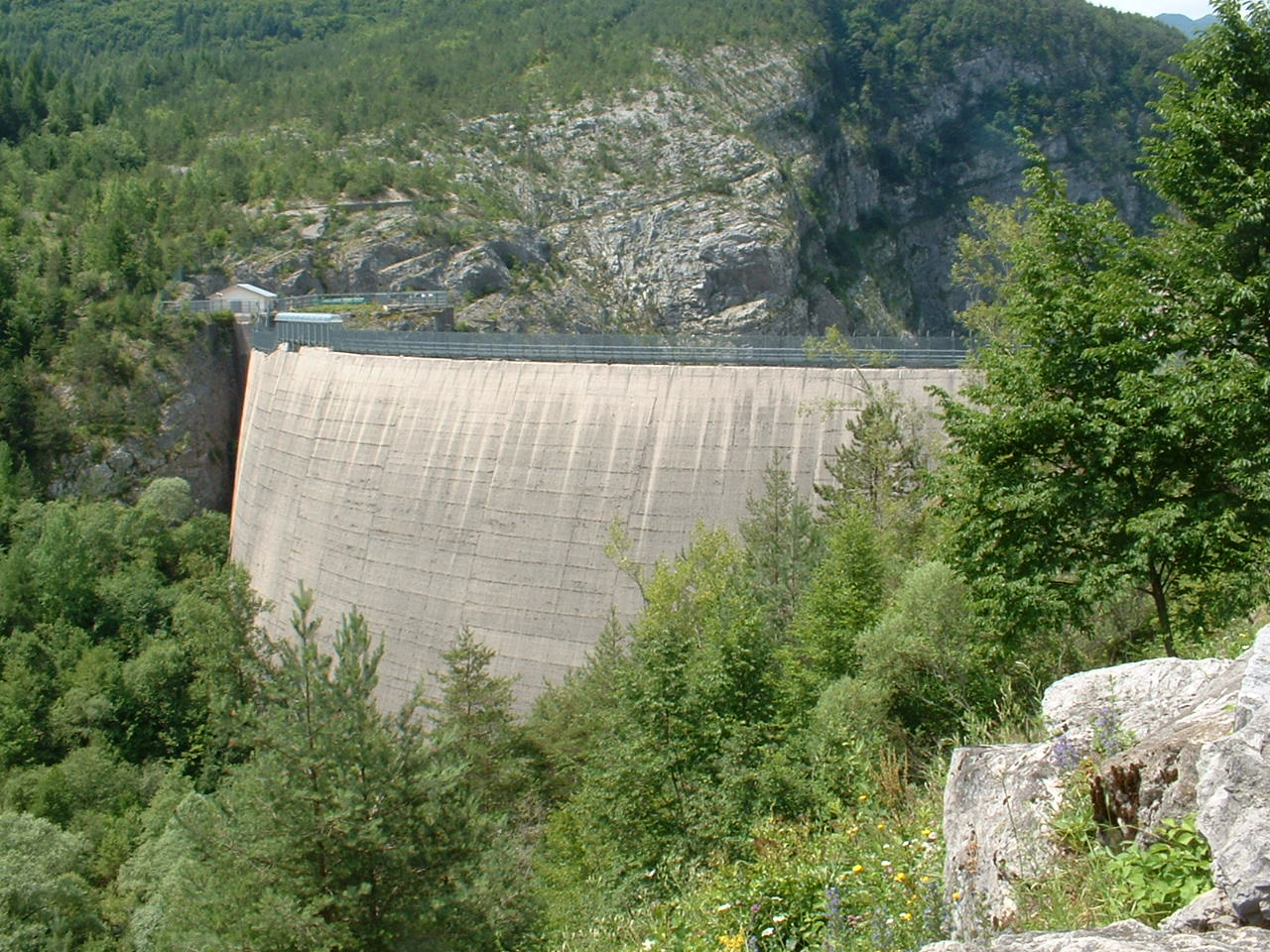
The much more peaceful road from Longarone crosses the Piave River and then heads up some lovely gentle tornanti to a tunnel near the dam. It's a good tunnel, wide, well-paved, with lots of lunetti for fresh air, sunlight and glimpses at the scarily deep abyss below the dam.
After the tunnel you reach the dam. It's a very eerie place. In 1963 the 250 meter deep lake behind the dam was suddenly filled with a huge chunk of Monte Toc, which separated and dropped into the lake. It displaced the water, creating an enormous wave which shot over the dam and rushed down the narrow gorge to Longarone, killing 2,000 people. Pictures afterward of Longarone look like an atomic bomb site- nothing but gravel, mud, debris. Today the dam is disused- the waters of Torrente Vajont bypass the dam and flow directly into the Piave River.
After the dam I rode through the altopiano, past Erto and then up to Passo San Osvaldo 836 meters. Nice fast descent to Cimolais, then down the Valcellina. The river looked great- still plenty of azzurro water, white caps in the rapids, natural music.
I'll probably try this in the opposite direction next Fall on a Sunday. I also see a possible alternate route via Soverzene so I'll see if that avoids the bad traffic.
Punta Trifina a Lago di Santa Croce


No comments:
Post a Comment
Note: Only a member of this blog may post a comment.