Saturday, June 30, 2012

Nevegal - Valmorel - Passo San Boldo

I've been hearing rumors of a road connecting Nevegal with Passo San Boldo for a year or two, so today I thought I'd check it out.  I warmed up from Vittorio Veneto to Lago Santa Croce, with lots of weekend warriors out for their weekly assault on the climb.  I felt sluggish for some reason- I think this may be the slowest I've ridden up this easy hill.  At 0830 even in this shady gorge it felt warm and humid.  After Sella di Fadalto I cruised along the west side of the lake and felt a little more lively.  After the lake is a left turn signed Nevegal, which climbs steeply at first up through Vich to the main road from Ponte nelle Alpi toward Nevegal.  Here you begin a nice moderate climb, with long 7% straight stretches through pretty grassy meadows.  Definitely easier than the steep climb from Belluno to Nevegal, though that one is shadier.  Soon the sun was beating down and I dreamed of reaching the shady forest above.  

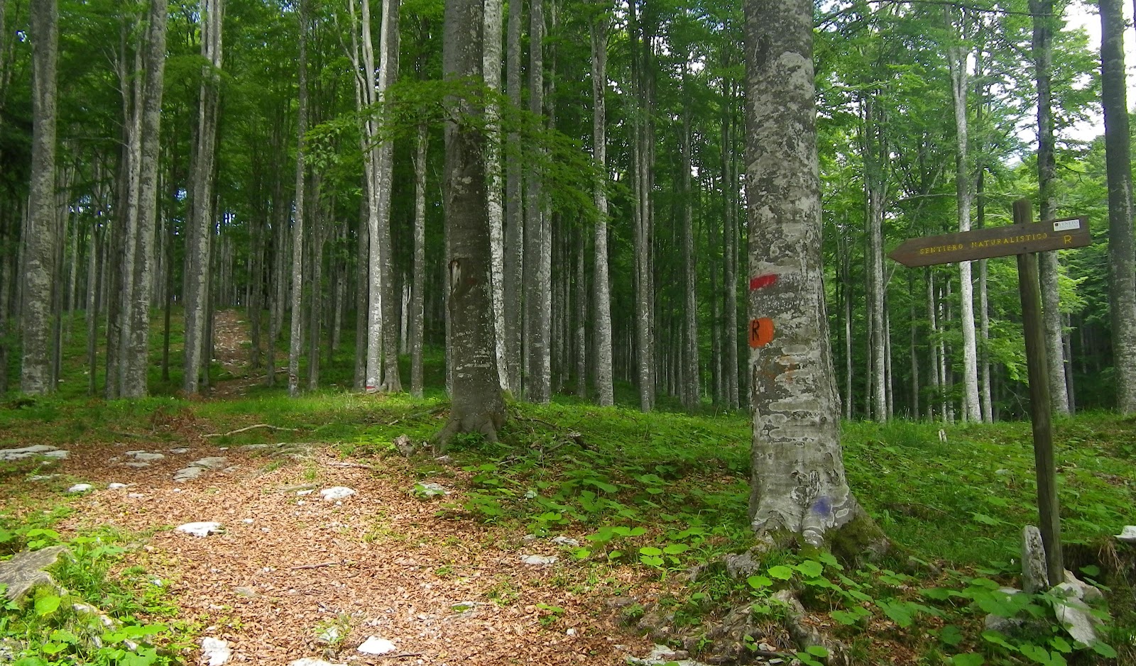
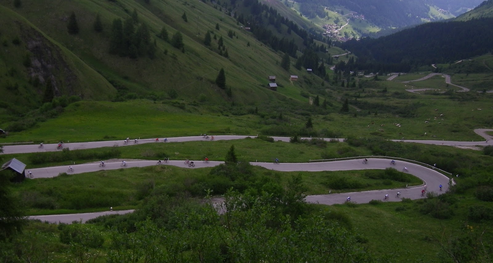
The road from Belluno and the road I was climbing meet in a traffic circle just below Nevegal at 987m.  Just after the circle is a turn off to the right toward Ronce.  Thankfully this road (Via Col de Gou) dives into the spruce forest almost immediately.  It snakes along the mountainside, finally reaching a junction, with Via Ronce to the left.  Via Ronce is a very fine dirt road, hard-packed and pretty much rockless.  It passes peacefully for 2 km through the dense forest until reaching a little cluster of houses in a sunny meadow, where it meets Via Piandelmonte.  Somewhere along here the road reverts to asphalt.  The landscape opens up into broad green pastures, surrounded by spruce-covered mountains.  The road descends steeply, with switchbacks and gorgeous views of the valley of Tassei (568m).

During this long descent I came across numerous riders ascending in the opposite direction.  Some of them were really suffering the steepness and heat.  I thought to myself "I'm glad I'm going this way instead," forgetting I would soon have to climb a similar slope on the other side of the valley.  So now I was struggling up that slope, exposed to full sun, till finally Via Tassei ended at Valmorel (806m).   Here you turn left on Via Valmorel, signed Sant' Antonio Tortal and "Al Peden" cucina tipica, then later becomes Via Peden.   More saliscendi and beautiful panoramas, and then you begin the plummet down to Sant' Antonio at 507 meters.

After Sant'Antonio another long gradual ascent to Passo San Boldo at 706m.  A guy in a bright red Ferrari accelerated loudly to pass me, which I thought was odd since I was only going 10-15 kph.  I think he was just having fun revving it up, like a kid with a motor scooter.  At a subsequent bridge he stopped dead in the middle and was afraid he would scrape his paint on the railing.  All the people backed up in the other direction were motioning to him to let him know he had plenty of room, but he was frozen with fear.  Somehow he summoned the courage and finally crawled through, with at least a foot of space on each side.    

Heavy traffic on the descent so not great fun, but no big deal.  I was hot and tired and just wanted to finish.  Soon enough I was back in Vittorio Veneto.  But now the question is, what will this ride be like in the opposite direction?

Via Ronche strada bianca through the spruce forest

Valley of Tassei from Piandelmonte

Tassei from descent of Piandelmonte

Close up Tassei

Via Peden toward Sant' Antonio Tortal

Gentle switchbacks down to Sant' Antonio


Beautiful mountain lane from Nevegal to Valmorel

Descent to Sant'Antonio Tortal

Nevegal left, Valmorel middle, Passo San Boldo right


Thursday, June 28, 2012

Val Raccolana - Altopiano Montasio

Val Raccolana is one of the prettiest places I've ever visited.  More waterfalls than I've ever seen in one place, spruce-covered mountain slopes, topped by a grassy altopiano with mountain-peak panoramas in all directions.  It's in the northeast corner of Italy, stretching from the Slovenian border to Torrente Fella, the main north-south water course from the Austrian border.  

From Chiusaforte the road starts off with a couple of kilometers of tough gradients (9-11%) but they are mostly short lived.  If you prefer a flat warm-up, you could start in Resiutta, or just drive the first 2 km from Chiusaforte and begin the ride on easier gradient.

As you follow Torrente Raccolana up the valley, numerous high waterfalls spill down the surrounding cliffs.  I lost count but I guess there are 20.  To capture them you would need a telephoto lens, but I snapped a few pictures of the closer ones.

After 11 km of this scenic easy riding the road suddenly heads upward steeply through the spruces, eventually climbing a series of 6 switchbacks, with U-shaped tunnels at the west ends.  Definitely bring red tail light and reflective garment, because it's dark in there and cars can't see you.  Finally after 17km you arrive at Selle Nevea (1162m) a ski area mostly deserted in summer.  Somewhere along this climb my left knee had a sudden sharp pain and I couldn't put any weight on it.  I pedaled with my right leg and let the left knee rest awhile.  I was having my doubts about the tough upper section to the altopiano.  

After the last ski lodge there's a small turn-off to the left for Altopiano Montasio.  This is a narrow mountain lane starting off with 400m of 14% average gradient and multiple 18% ramps.  I stood and panted like a train and made it to the first crest, but immediately the steepness recommenced, over and over until I reached 1400 meters.  Here the gradient lessens to 10% or so, and you enter the treeless altopiano.  A final steep standing slog until 1540m, where pavement ends and you continue on dirt roads.  My left knee never troubled me once on the killer Altopiana Montasio section- it was a miracle healing, so I'll credit Madonna del Ghisallo, the patron saint of cyclists.

Descent was fast and fun.  What a wonderful ride- this will be an annual pilgrimage.     

Monte Canin (2587m) on Slovenian border

Further eastward along Monte Canin

Jof di Montasio (2753m) above altopiano

Alpine meadows with rifugio, looking west

Wildflowers in the meadows

Another rifugio below Jof di Montasio

Looking west down Val Raccolana

Cascata del Rio Repepeit

Cascata del Rio Repepeit

Fontanone Goriuda

Looking northwest from Fontanone Goriuda cave

Fontanone Goriuda pool

Side view of Fontanone Goriuda

Tall view of lower Fontanone Goriuda

Upper cascate Fontanone Goriuda

Overall view

Close-up upper climb to Altopiano Montasio,
tornanti up to Sella Nevea


Steep gradients up to Altopiano Montasio

Altimetria

Tuesday, June 26, 2012

Malga Mezzomiglio - Strada del Taffarel

The climb to Malga Mezzomiglio is very humbling.  If you feel like you're getting fit, stronger, more skillful, etc come ride up this hill.  It starts out innocently enough,  ascending from the east shore of Lago di Santa Croce (400m) with a series of switchbacks through vacation homes, then continues to the village of Pianture.  Here the road suddenly tilts to 16% average gradient for a hundred meters or so, with 18% stretches.  That scorched my lungs pretty good, but I felt like I was recovering a little on the following stretches of 12%, or even "flattish" 10% through the spruce forest.  Around 970 meters I rounded a switchback and faced an 800m long straight stretch of 14% average gradient.  It goes on and on, you think a shadow or a little bump of asphalt you see ahead must be the end, but no, soon as you cross it the tilt gets steeper still.  There is no way to pose like a good climber here, or to fake the strength required to keep rolling forward- you're exposed.

I survived and continued up past 1100m and reached the turnoff for Strada del Taffarel.  This less-steep dirt road turns away from the foggy alpine meadows of Malga Mezzomiglio into the spruce woods and soon reaches a junction- left or straight?  I picked "straight" and the rocky road quickly became too steep for me.  So I hopped off and pushed. Eventually it leveled off and entered a lovely meadow, with clean, happy-looking cows ringing their bells as they walked.  The road petered out and I followed a path up to the right alongside the herd.  This was blind luck, because the man tending the cows was very helpful.  He had a handmade wool cloth hat, shaped exactly like those roundish-cone hats you see people wearing in medieval paintings.  Very cool.  I asked how to get to Strada del Taffarel and he pointed toward a trail through the forest below.  I asked what if I continued on my present path and he said it went to Monte Pizzoc but I couldn't ride on that (pointing at my bici di corsa), stating that a mountain bike was needed, and even then one must carry it on their shoulder much of the way.  So I thanked him and headed toward the trail through the forest below.

This was no longer a bikeable path (though much of it could be ridden on a MTB).  It was narrow, muddy from the constant mist and cloud up here, with much bare rock, fallen trees, etc.  So I carried the bike some and pushed it the rest of the way.  My cleat cover kept getting sucked off by the deep mud, but I managed to recover it.  The path crossed the ridge at 1366m and soon I sighted Strada del Taffarel below.  Unlike last week, the road was now quite muddy and kept clogging up my narrow road brakes.  I just cleaned them out each time and kept going.  This side of the ridge was sunny and cool, perfect riding weather.

After reaching pavement below Monte Pizzoc I descended fast, with no traffic to hinder me.  Then after La Crosetta I took the road toward Vittorio Veneto, and continued quickly sweeping down through the curves.

This was a fun ride of exploration, but I'll have to return soon and ride the missing link from Campon to Malga Mezzomiglio.  Then I'll coast down that 10% grade to the lake, laughing all the way.


Turn-off for Strada del Taffarel

The little valley where I encountered the helpful man with cows 

Helpful man pointed out this path 

Path soon grows rougher with tree-falls, etc 

Ridge line, with red spruce trees on the west slope,
beech trees on the east slope

Hallelujah! Strada del Taffarel

Looking back up the trail


The inevitable cowbell video


Rode clockwise

Ascent toward Malga Mezzomiglio

Close up of the mulattiera (mule track) through the forest


7.5km of 10% average gradient

The worst: 800 unending meters of 14% average gradient

Sunday, June 24, 2012

Sella Ronda Bike Day

Sella Ronda is one of the most beautiful bike rides in the world: four passes in the heart of the Dolomiti.  Twice each year, once in June and once in September, the authorities close these roads to all cars, trucks and motorcycles.  I missed last year's due to weather but later rode the Ronda clockwise by myself.  Luckily this year the route is counterclockwise, so I had the chance to climb each of the four passes from the opposite side.  They seemed completely different in this direction.

I left home around 0500 and drove via Longarons and Forcella Staulanza to Livinallongo.  This provided an easy warm-up to Arabba.  From there I headed up the deserted switchbacks to Passo Campolongo, an easy climb.  Fun descent to Corvara, where a horde of cyclists from Cortina and beyond were getting underway.  From Corvara you climb up to Passo di Gardena (2121m) through beautiful meadows flanked by Gruppo del Sella(3152m) on the left and Gruppo del Cir (3025m) on your right .  An easy descent and climb from here to Passo Sella (2244m) beneath imposing Sassolungo (3181m).  Now comes a fast descent toward Canazei, then you turn left at 1800m and start the climb up Passo Pordoi (2239m).  This was more difficult than I had imagined while descending it last year, but still not bad.

The descent from Pordoi to Arabba is not to be missed- a series of switchbacks that seems to go on forever.  Most fun of the day.

I cooled down on the easy ride back to the car at Livinallongo.  Fantastic ride, with more bikers in 4 hours than I normally see in 4 months.  A blast.

Video from last year's Bike Day http://vimeo.com/11232888

Sunrise on dolomite peak above foggy Vajont

The climb toward Passo di Fedaia from above Caprile

Gruppo del Cir, left; Sass Songher above Corvara,  right

Gruppo del Sella dolomite towers as viewed from Passo Gardena

Val di Fassa and Canazei from Passo Sella

The descent to Arabba from Passo Pordoi
Bikes descending looping road to Arabba

Garmin reading 100 meters low

Counterclockwise