Tuesday, March 8, 2011

Passo di Sant'Osvaldo

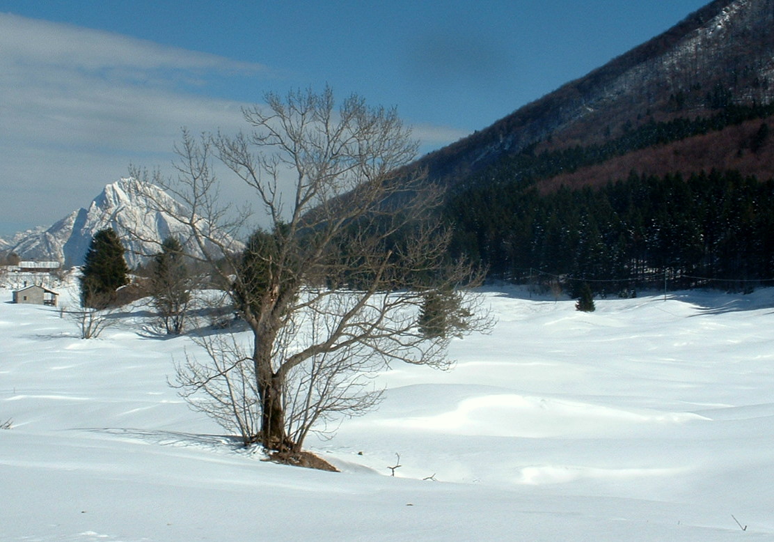
Another favorite local ride- up beautiful Valcellina to Passo di Sant'Osvaldo.  A few minutes after leaving home I arrived in Montereale- here I took a left up the hill toward Barcis.  I passed alongside the new lake behind Ravedis Dam, then entered the 4km tunnel under Monte Fara, emerging at the turnoff for Andreis and the climb to Pala Barzana.

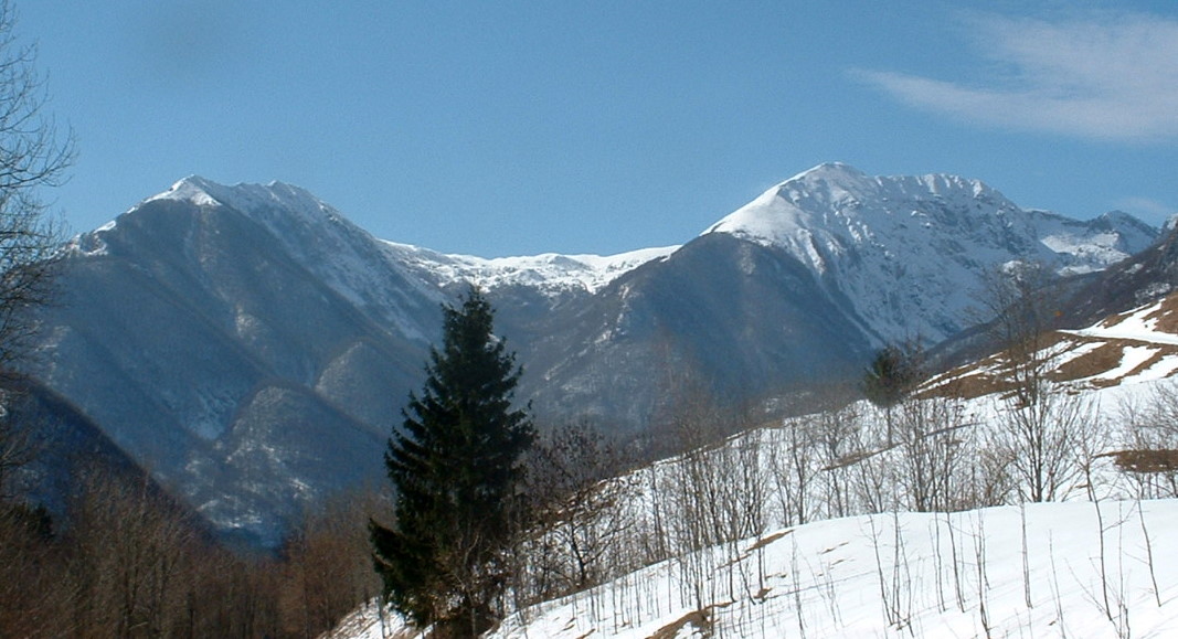
After a couple more tunnels I arrived at Lake Barcis, another beautiful blue-green lake surrounded by mountains.  Here's another great side trip- left across the bridge to the climb to Piancavallo via Val Caltea.  Continuing through the village of Barcis, I passed a little suspension bridge on the left  which leads to another short but pretty climb- Val Pentina.  The main road continues along the white water of Torrente Cellina, where today I saw two lovely dark gray herons fishing in the river.  A bit farther I passed a turnoff to the left for Val Prescudin (see picture below).  I haven't ridden this yet, but I saw a TeleFriuli program called Sentiera Natura, where some Corpo Forestale guys drove up to end of pavement and hiked up Monte Medol- really beautiful.  I'll try to ride it this summer.  After Contron the new suspension bridge appears to be almost completed- this may lead to another good hike or MTB ride (I'll check it out).

A little further on I reached the turnoff for Claut, a nice village with some interesting hikes nearby.  Continuing on the main road, I ascended the piney slope of Pinedo to Cimolais.  Now the actual climb begins- a few kilometers and I was surrounded by deep snow and fir trees at 827 meters.  You can proceed over the pass to Erto and Vajont Dam (where a tremendous landslide in 1963 caused a tsunami which wiped out the town of Longarone) and continue down to the Piave River.   Instead, I turned around and rode home fast as possible.  At Malnisio another carnevale parade was getting started, with a giant Shrek head float- quite frightening.

The side road up Val Prescudin

Monte Messer (2230 m) up Val Prescudin

New suspension bridge over Torrente Cellina above Contron

Snow along road at Passo di Sant'Osvaldo

Sunday, March 6, 2011

Monte Rest 2011

The ride up Val Meduna and Val Viellia to Monte Rest is one of my favorite local climbs.  After the warmup ride to Meduno, you climb a series of rolling hills, and then arrive at Lago del Tramonti.  Besides the beautiful ride along the shore of this blue-green lake surrounded by mountains, you have the option of taking several side climbs:
Val Muie, Lago Cà Selva,  Val Chiarzo, and Canal di Cuna.

But today I stayed on the main road, continued up through Tramonti di Sotto and Tramonti di Sopra and started the climb proper at Ponte Val Viellia.  There was a Road Closed sign, but I figured I'd go as high as I could and turn around.  Other than some branches and fallen rocks the road was fine.

Continued up a couple of dozen tornanti through beautiful forest, silent except for the whitewater  of Torrente Viellia in the gorge below, and numerous small waterfalls on the creeks crossing the road.  Lots of erica, primule, violete and bucaneve on the sunlit roadsides.

There was a little snow along the road above 800 meters, which gradually increased until there were stretches of snow-too-deep-to-ride in the shady southern hairpins.  I hopped off and walked to reach the next sunny dry stretch, but after repeating this a couple of times, even the sunny parts were snowed over.  I stopped at 963 meters, and started donning my cold gear for the descent.  A group of crossscountry skiers arrived, descending from Passo Monte Rest, then took off their skis and continued on foot when they reached the snow-free pavement.  

The ride home was pretty uneventful except for the carnevale parades.  In the country towns they make floats (carri) on wagons which a tractor pulls around.  I passed a number of these, quite harrowing on some of the narrower roads on cliffs above the lake.  Then when I reached Maniago hundreds of costumed people where wandering toward the piazza for the parade.  Clowns and witches seem quite popular this year.


Monte Valcalda, 1908 m, to east

Monte Rest, 1780 m, to north


Primule, violete and bucaneve

Cliffs rising from roadside (730 m) straight up to 1400 m 

Can't go any higher than 963 m
Crosscountry skiers coming down from the pass

Gradient from Tramonti di Sotto to 963 m


Friday, March 4, 2011

Sella Chianzutan da Val d'Arzino

Lovely ride into snowy mountains today.  After a long ride to Pinzano, I headed north to Casiacco, then up the tornanti to Anduins.  Here you enter the narrow gorge of Fiume Arzino.  It's a wonderful place, surrounded by mountains, with the white water of the river far below providing background music.  The road gently climbs through forests along the edge of the gorge, with splashes of early Spring wildflowers everywhere.

As you climb you pass several side climbs, Pielungo-Orton, Val d'Arzino-Monte Prat, and Sella Chiampon-Monte Rest.  I noticed the turn-off for Val Preone has been reopened, so they must have cleared the landslides on the way to Selle Chiampon.

The road eventually turns away from Val d'Arzino, starting a series of long 9-10% tornanti snaking up the snowy beech-covered slope.  Finally the forest opens into wide snow-covered meadows, flanked by mountains on both sides.  I turned around at this point, where the road heads downward toward Tolmezzo.  When I left home this morning I thought I'd continue onward, but I was already beat and chose to take the shorter way back.  The ride home seemed very long.


View of Forgaria (town halfway up Monte Prat),
with snowy east peak of Monte Cuar in background

Lovely waterfall on  roadside stream

Bucaneve (snowdrops) along the road

Fiume Arzino's very narrow gorge

 Fiume Arzino sunlit turquoise water


Monte Flagjel 1467 m, east of river valley

Snowy meadows, Monte Arvenis to north

Monte Piombada 1744 m looking east

Monte Verzegnis 1914 m looking west
MonteValcalda 1908 m and Monte Rest 1780 m
looking southwest 


Grade from Pinzano to Sella Chianzutan


Tuesday, March 1, 2011

La Crosetta da Sarone

Sunny cold First of March, a good day to climb Il Cansiglio, and Monte Pizzoc if possible.  After spinning down the rollers to Sarone, I turned up the hill.  Starts out gently, up to the little pass above Castello di Caneva, then it just keeps climbing incessantly at 9-12% for 10 kilometers.  I stayed seated a bit too long and my right lower back was aching- after that I alternated standing and riding.

Above 800 meters snow appeared along the roadsides, and gradually got deeper until it covered the ground around the beech trees as far as you could see.  Luckily the road itself was completely clear.  Through the trees I could see Mont Pizzoc completely covered with snow.  Have to save that climb (1500 meters) for a later date.  At La Crosetta (1130 meters) I stopped long enough to put on my balaclava for the descent and shoved off.  I stopped to take some pictures but dropped the camera in the snow and it stopped working.  Once I got back down and it thawed out it seems ok.

The long twisty descent was fun and has some great switchbacks and a few chicanes.  Quite cold though.  After returning to Via Pedemontane below Sarone I rode home slowly and steadily, never really thawing out till a hot bath later on.

The Garmin altimeter is acting up- keeps starting out at 235 meters instead of 310.  I'll manually set elevation before starting from now on.

Beech trees in snow obscuring the snowy summit
of Monte Pizzoc

Grade from Sarone to La Crosetta

Map of climb

Note elevation error "-54 m"

Saturday, February 26, 2011

Osservatorio Astronomico Montereale Valcellina 2011

This is another very close climb to our house- less than 5 km away.  At Grizzo in Montereale you hang a left and then take a right onto a narrow lane marked Motel Spia.  After a bit of climbing the grade eases at Motel Spia (which has a restaurant and nice views of Montereale and Torrente Cellina).   Then it tilts to 14% for a couple of stretches, followed by several km of 8-10%.  Excellent workout.

At first you're riding in the woods encircling Monte Spia.  You can see the new dam on the Cellina at Ravedis and the steep river gorge to your right- more about this in a moment.  Then the road starts on long switchbacks along the side of Pala d'Altei, completely exposed to sun on the south.  I got  behind a slow tractor doing logging but he pulled over to let me pass when the road widened a bit- very kind of him.  Then a brief downhill, followed by a climb back into the  woods, through Val de la Roja, and finally end of pavement, after 5 km of climbing, at the astronomical observatory (670 meters).      

Beautiful descent- I tried to ride the dirt road which skirts around to the north to an overlook above the Cellina gorge, but after half a kilometer the road became too steep and rough for skinny road bike tires.  Maybe I will take the dogs for a walk up there tomorrow.  Should be a lovely view.

Frozen water trough

Catkins on hornbeam tree.  These are among the earliest flowers of Spring

Dirt road to overlook of Valcellina

Pala d'Altei, 1528 meters, from Montereale

Pala d'Altei from our house (further southwest) 

The climb from above

The grade, note 14% stretches 

Thursday, February 24, 2011

Rifugio Bornass 2011

The climb to Rifugio Bornass from Costa di Aviano is quite close to our house- starts about 5 km from home.  Normally I would ride down onto the plain to warm up, but today I had to get Marilyn to an appointment.

Immediately at the start you hit the steepest part of the climb- 1.3 km of 12.5% average gradient, with stretches above 15%.  I stood for most of this, which was good because I hadn't stretched and warmed my muscles.  After you pass Santuario di Madonna del Monte, the grade lessens somewhat and you can catch your breath.  The next 8 km to Rifugio Bornass average 5.4%, with several sections of 8-9%.  Not bad at all.

The wintery forest is pleasant to ride through at first, then after crossing Torrente Ossena, the hillside opens up and is exposed to full sun.  Here I found quite a lot of Erica (heather) in bloom.  It's especially colorful given the dead grass otherwise covering everything.

At Rifugio Bornass (a hotel and restaurant at 767 meters) you join the newly paved main road from Piancavallo to Aviano.  Beautiful road with lots of curves-  feels like you're flying!

At the bottom, I turned left and headed up Via Pedemontane toward Giais.  The rolling hills felt easy, and I made it home in time to take the pups for a walk before leaving for the appointment.


Madonna del Monte

Erica (heather) in bloom

Close up of erica blooms


Madonna del Monte with
Pala Fontana (1637 meters) in background

Map of the ride


The grade


Wednesday, February 23, 2011

Palu di Livenza


After a couple of weeks of colds, fever, rain, finally it's over.  Sunny but cold today so I kept the ride short to avoid a relapse.  Headed west on Via Pedemontane Occidentale past Trota Blu ( a restaurant surrounded by lakes, artesian fountains, ducks, swans) then turned left toward Palu di Livenza.

This is an unusual place- to the northwest, a very steep mountain ridge climbs from sea level  to 1200 meters.  At the base of this mountain range, rivers of springwater gush from the rocky cliffs.  In the valley between the mountains and a line of glacier-moraine hills lies a marshy area called the Palu.    

It's a large archaeological site where prehistoric people lived thousands of years ago. People were attracted by the area's abundant food, and plentiful reeds to build with.  It is an UNESCO World Heritage site.

Further along the road you pass behind the hills of San Floreano.  This is a lovely nature reserve of trees, animals, and lots of popular hiking trails.  At the top are meadows and a farm with sheep, horses, orchards, big vegetable gardens.  Also an agriturismo or tourist farm where people stay and enjoy country life.  

After Polcenigo I headed up the back road through Santa Lucia, Budoia and Castello d'Aviano.  The climb up through Marsure was pretty easy, even the 7-8% stretch.  I survived despite my lingering cold symptoms.   But I must remember to take a pack of fazzoletti next time- riding with a cold is quite awkward.


Monument to family blown up by Nazis  in 1945.  After Italy surrendered in 1943,
 the Germans became their enemy and brutally punished the Resistance for the next 3 years

The family's home after the explosion

Among the victims these innocent bambini

The archaeological site at Palu di Livenza

View of the Palu

The northwest side of Parco San Floreano

Castello di Polcenigo

Palu di Livenza

Lower Palu di Livenza

The forest and meadows of Parco San Floreano