Showing posts with label Malga Mezzomiglio. Show all posts

Saturday, July 11, 2015

Monte Milifret - Mezzomiglio MTB


I've been meaning to ride this for years and finally got around to it.  It completely blew away my expectations.  The first step was to climb Monte Pizzoc.  Just for fun I decided to MTB up from Osigo to Campo Cadolten.  I'd ridden it from Sonego last year and was curious how the Osigo route compared.  Climb through Osigo and after the 1st switchback on Via Cansiglio turn off onto Via Pravinera.  This is steep concrete and dirt road, as from Sonego.  At 900 meters you reach Chiesetta di Sant'Antonio, then keep on grappling up a little sun-exposed canyon till you reach the altopiano of Cadolten.  Beautiful green pastures surrounded by tall beech and spruce.  At the Pizzoc road, continue up to end of pavement above 1500 meters.  

Take the gravel road toward Rifugio Citta' di Vittorio Veneto then continue on toward La Croda (bar).  The markings aren't too clear here but luckily I looked up while scratching my head and saw a MTBer on a grassy ridge above.  I found the trail (unmarked except for some Fregona Trails streamers) and crossed the rising grassland.  Now it steepens and you begin technical climbing up the west face of Monte Milifret (which means I was carrying my bike).  My hopes were rising and soon I reached the place I've been wanting to see for so long: the cliffs at the top of the gorge climbing from Vittorio Veneto to Lago di Santa Croce.  I tiptoed out to the edge and it is essentially vertical for maybe 800 meters down.  Wow!

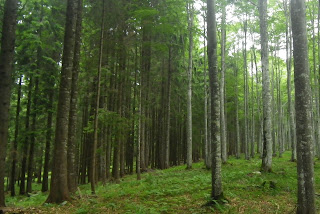
I now pushed/rode the bike along a trail that traverses the eastern side of Monte Milifret.  Still high but now you're traversing slopes above the forest rising from Cansiglio altopiano.  The trail gradually gets easier (less bouldery) and enters red spruce forest with many exposed roots.  At a junction leading to Pian de la Pita I finally got confirmation: I was on the ridge trail Sentiero delle Piaie Longhe Milifret.  This was my goal because last year I tried riding the lower trail H3 from Mezzomiglio and it was an impassable mud bog.  This higher trail was much better.

The trail widens a bit though still rocky and rooty so I was able to ride pretty well.  It then begins descending gradually so I stayed on the brakes.  The woodland abruptly ends and you enter the rolling grassland above Mezzomiglio.  I followed the path and then a gravel road I remembered from years ago, eventually heading toward the junction with the gravel road toward Palughetto.

This joins the main road across Piancansiglio to La Crosetta, then the descent toward Vittorio Veneto and the car.  Must return and explore this area more.  Great snowshoeing in winter too.     


Chiesa San Giorgio, Osigo
Chiesetta Sant'Antonio

Interior of chiesetta


View from above of Cadolten altopiano

Monte Pizzoc from Monte Milifret

Fadalto, Lago Morto, Monte Faverghera

Lago di Santa Croce and Monte Dolado

Monte Milifret cliffs

Trail through the red spruce forest

The grassy alto piano above Mezzomiglio

Saturday, October 18, 2014

Giro del Cansiglio MTB

Started bright and early from La Crosetta  and after a couple hundred meters turned right on to the gravel road to Monte Candaglia.  Beautiful forest road, mostly level along the side of the ridge.  After riding up to Monte Candaglia I continued climbing to the eastern boundary of il Cansiglio, marked with a surveyors stone marker centuries ago.

Back down a bit I turned right on the forest road descending to Val Bona.  The road is rougher with larger stones, covered with leaves so you can't avoid them.  At Val Bona I continued on Sentiero Alpago Natura to Pian Rosada,  where I rejoined the paved road toward Canaie.  I tried a couple of side roads I thought might reach Casera Palantina.  The first climbs up through Val Seraie to around 1400 meters.  From there you'd continue hiking on CAI 984 to Val Friz.

After descending to Canaie I tried another road, climbing up Val de Piera.  This ended around 1300 meters, with the possibility of hiking CAI 922 to Casera Palantina.  I will have to return and hike it some day.

Now I headed back through Pian Rosada to Campon, where I turned right immediately for Palughetto and on toward  Rifugio Mezzomiglio.  Very steep climb but paved mostly so no problem on MTB.

My plan was to try the trail from Mezzomiglio to Monte Pizzoc, but things went awry.  I crossed the grassy ridge above Mezzomiglio and found the trail I needed, H3.  Immediately it became a muddy mire, churned by livestock hooves into an impassable mess.  I tried continuing a ways but it just got worse.  The H3 trail has no pathway, gravel, etc: just markers showing you the way through the mud. I will come back in the dry season and hike this: there is another parallel trail closer to the cliff edge which crosses Monte Millifret.  

Instead, I retraced my steps to another unrideble muddy trail crossing the ridge and descending to Strada Taffarel.  I carried my road bike over this short trail a few years ago after climbing to Mezzomiglio and it was less muddy that time of year.

Finally reaching Taffarel I tried to make up time, with only 4 or 5 mud bogs on the road to contend with.  Then down the Monte Pizzoc road and up to La Crosetta.  Now I'm stanco di morte. 


The turnoff for Val Seraie

End of road in Val de Piera 

Mom and baby asino at Mezzomiglio

Asinino posing in front of Dolomiti Bellunese

Ancient flatrock wall made without  mortar

Strange stack of huge boulders above Mezzomiglio

Tuesday, June 11, 2013

Palughetto

Splendid morning, so I headed for Malga Mezzomiglio above Lago di Santa Croce.  After Vittorio Veneto and Fadalto you skirt the east shore  of the lake until just before Farra d'Alpago, where you turn right at Villaggio Riviera.  Nice switchbacks at first, then after the village of Pianture you hit a 20% wall.  I made it without stopping but I was gasping and sputtering.  A shorter slightly less-steep wall follows after a brief break.  Then the real fun- 3 or 4 long traverses each with hundreds of meters of 10-13%.    I finished the last of these (from 850m to 1000m) gasping again.  This is a tough climb.  Now a series of shorter switchbacks begins, nice because you can catch your breath in the ends.

The agony ends at 1,187 meters where I turned off on the gravel road for Palughetto.  You could also continue on to the meadows of Malga Mezzomiglio on the paved road instead.  This gravel road was very hard packed and was no problem on 23mm road tires.  I did hop off and put on Bike Skinz cleat covers for about 100 meters near the cabin in the pictures- the road was a little too steep and rough for me there.  Afterwards I continued pedaling to the junction with Strada del Taffarel, where I continued toward Palughetto and Campon.  The road soon becomes paved and descends through tall shady forest.  At Palughetto there's an archeology dig where scientists study the earlier human inhabitants of the Cansiglio.  People have lived and hunted up here for millennia.

I reached the main road at Campone, no cars, crystal blue skies, red spruce forest all around.  This is heaven.  Then you come around a curve and the whole grassy green plain opens up before you, like the opening shot of The Big Valley or a 1950's western. After pedaling to La Crosetta I descended to Sarone, and noticed some big clouds to the east.  Sure enough near Gargazzo they cut loose and dumped heavy rain on me for the next half hour.  It wasn't as bad as it sounds- actually made me ride faster than I would have otherwise.  In a change of pace, there was no rain in Giais, so I quickly dried out when I got home.  Wonderful ride!   

Monte Dolado from start of gravel road, 1200 meters

Cabin along gravel road  to Palughetto

Wood carved coturnice (rock partridge) and cane di caccia

Left is Strada del Taffarel leading to Monte Pizzoc, right descends to Malga Mezzomiglio

Casa Forestale at Palughetto; archeological dig nearby 


Tuesday, June 26, 2012

Malga Mezzomiglio - Strada del Taffarel

The climb to Malga Mezzomiglio is very humbling.  If you feel like you're getting fit, stronger, more skillful, etc come ride up this hill.  It starts out innocently enough,  ascending from the east shore of Lago di Santa Croce (400m) with a series of switchbacks through vacation homes, then continues to the village of Pianture.  Here the road suddenly tilts to 16% average gradient for a hundred meters or so, with 18% stretches.  That scorched my lungs pretty good, but I felt like I was recovering a little on the following stretches of 12%, or even "flattish" 10% through the spruce forest.  Around 970 meters I rounded a switchback and faced an 800m long straight stretch of 14% average gradient.  It goes on and on, you think a shadow or a little bump of asphalt you see ahead must be the end, but no, soon as you cross it the tilt gets steeper still.  There is no way to pose like a good climber here, or to fake the strength required to keep rolling forward- you're exposed.

I survived and continued up past 1100m and reached the turnoff for Strada del Taffarel.  This less-steep dirt road turns away from the foggy alpine meadows of Malga Mezzomiglio into the spruce woods and soon reaches a junction- left or straight?  I picked "straight" and the rocky road quickly became too steep for me.  So I hopped off and pushed. Eventually it leveled off and entered a lovely meadow, with clean, happy-looking cows ringing their bells as they walked.  The road petered out and I followed a path up to the right alongside the herd.  This was blind luck, because the man tending the cows was very helpful.  He had a handmade wool cloth hat, shaped exactly like those roundish-cone hats you see people wearing in medieval paintings.  Very cool.  I asked how to get to Strada del Taffarel and he pointed toward a trail through the forest below.  I asked what if I continued on my present path and he said it went to Monte Pizzoc but I couldn't ride on that (pointing at my bici di corsa), stating that a mountain bike was needed, and even then one must carry it on their shoulder much of the way.  So I thanked him and headed toward the trail through the forest below.

This was no longer a bikeable path (though much of it could be ridden on a MTB).  It was narrow, muddy from the constant mist and cloud up here, with much bare rock, fallen trees, etc.  So I carried the bike some and pushed it the rest of the way.  My cleat cover kept getting sucked off by the deep mud, but I managed to recover it.  The path crossed the ridge at 1366m and soon I sighted Strada del Taffarel below.  Unlike last week, the road was now quite muddy and kept clogging up my narrow road brakes.  I just cleaned them out each time and kept going.  This side of the ridge was sunny and cool, perfect riding weather.

After reaching pavement below Monte Pizzoc I descended fast, with no traffic to hinder me.  Then after La Crosetta I took the road toward Vittorio Veneto, and continued quickly sweeping down through the curves.

This was a fun ride of exploration, but I'll have to return soon and ride the missing link from Campon to Malga Mezzomiglio.  Then I'll coast down that 10% grade to the lake, laughing all the way.


Turn-off for Strada del Taffarel

The little valley where I encountered the helpful man with cows 

Helpful man pointed out this path 

Path soon grows rougher with tree-falls, etc 

Ridge line, with red spruce trees on the west slope,
beech trees on the east slope

Hallelujah! Strada del Taffarel

Looking back up the trail


The inevitable cowbell video


Rode clockwise

Ascent toward Malga Mezzomiglio

Close up of the mulattiera (mule track) through the forest


7.5km of 10% average gradient

The worst: 800 unending meters of 14% average gradient

Sunday, April 17, 2011

Malga Mezzomiglio - 2011

Today I rode up the eastern side of the Vittorio Veneto gorge, from Lago di Santa Croce to Il Cansiglio.  After parking at Vittorio Veneto, I rode up the easy climb to Sella di Fadalto (487m) and enjoyed seeing so many bike riders out.  After a quick roll down the east shore of Lago di Santa Croce, I turned right at Villaggio Riviera and started up the tornanti.  Beautiful views of the lake and not too steep. 

At Pianture (590m) the gradient becomes insane- 300 meters averaging 16%, with my Garmin showing 23.5% at the steepest point.  I rode this last year so knew what to expect: stand, pull up on the bars with each half-turn of the crank, inhale both with diaphragm and intercostals, exhale hard so you can suck in another lung-full immediately.   So it wasn't too bad.  After a brief flat bit, you start the worst part- a 6 km stretch which seems to never end.  There is one long straight stretch varying from 12-18%, with no switchback ends to recover in.  On the plus side the fir trees are gorgeous, with glimpses of the bluish-green lake far below.

Finally I entered the sunny meadows, still climbing steeply, until Malga Mezzomiglio, a rustic dairy with its own special cheese.  Lots of people have driven up for a Sunday visit.

I descended rapidly (and coldly) but took it easy in the curves- lots of loose stone.  At the lakeshore I turned south, awkwardly trying to pedal while frozen.  Finally at Fadalto I started the remaining descent, which is very fast because of the great pavement.  Driving home I saw hundreds of bikers- and a race marked off for the afternoon through the pavé streets of Vittorio Veneto- the 56th Frare De Nardi gara.   

View across the gorge- Col Visentin, left;
Monte Faverghera, center  

Watering hole in the meadows at 1200m;
the bowl valley of Alpago surrounded by
mountains in the background

The 23.5% grade at Pianture; note the other 18-19% stretches
8.85 km climbing 881 meters averaging 9.96% 

19 tornanti of the climb


Tuesday, August 31, 2010

Malga Mezzomiglio


This is about the toughest climb I've ever done. It's just as hard as Monte Dolada (Rifugio Dolomieu) but I struggled more on that one because of the heat. It was actually cold in August today, so heat wasn't a problem.

I started with the easy climb from Vittorio Veneto to Fadalto (487m). It was cold for the first half of the climb because temps were down in the low teens and the shadow of Monte Pizzoc kept the sunshine away.

After skirting the east shore of Lago Santa Croce to Farra d'Alpago, I turned at Villaggio Riviera (450m) and began a series of 9-10% switchbacks up to Pianture (586m). Not too bad. Then you hit a 300-meter long wall averaging 16%, with sections of 18%. I rode this standing, and worked on my breathing. Took awhile but I figured out my diaphragm alone wasn't inhaling enough air. So I began each inhalation with a sharp uplift of my intercostals. That did the trick. I practiced it for the rest of the climb and never ran out of oxygen.

After the 16% stretch, there's a brief 6% false flat, and then a long 2.5 km stretch of 12-15%. This was the hardest part- no relief from the steepness. After another short 6.7% false flat, another 2 km of 8-11%. Then you break out of the dense fir forest and ride an easier 7-8% through the alpine meadows to the end of pavement at Malga Mezzomonte (1279m). Beautiful views of the Dolomiti in Veneto, and the Alpago bowl-shaped valley. From up here Lago San Croce was hidden by the slope, but I did see it through the huge fir trees on the ascent- very pretty!

Fun descent- though I held the brakes pretty tight on the 16% into Pianture. Will definitely ride this again.

Sea of dolomiti peaks 

Yet more dolomiti peaks

Monte Dolada

Beautiful Alpago valley & villages

The conca (basin) of Alpago

Newly-shorn sheep cuddling to avoid the cold

Pond with reeds in the alpine meadow

The gradient averages 9.6%  from km 17 to km 26