Monday, June 26, 2017

Col Artent - Malga Garda

Col Artent is a very special climb.  It arises from Lentiai on the banks of Fiume Piave, quite steeply up to the scene of one of the last small battles of WW I.  There is a chapel and gravestones of a few of the final casualties lost in the waning weeks of the war.  

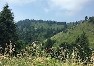
From there I continued on a good gravel road to Malga Garda at 1300 meters.  Great views from here of Dolomiti Bellunese, Piave valley, Monte Cesen, Monte Grappa massif, with unusually good seeing thanks to the temporale Saturday night.  Visit here if you can.

End of pavement coming up from Lentiai


The descent concrete ramp from Malga Garda


The tough climb to Col Artent

Topo map close-up


Saturday, June 24, 2017

Pian delle Femene

We're having a heatwave, temps up in the mid-30's Celsius.  I kind of scoffed at it because I grew up in Alabama and worked in the Air Force on the flightline in the Mojave Desert, Nellis, Korea, and New Mexico.  But it was a bigger problem than I expected.  After the first half hour I was crawling in low gear.  My original target, Col Visentin, quickly evaporated.  Luckily a cloud floated over so I was able to recover shaded and made it up to the top with no more problems.  I descended fast so I could get some sweat windchill going and by the time I reached the car at Vittorio Veneto I had rejoined the living.  Anyway this is an awesome local climb which I would recommend to anyone in the area.

     
Beautiful rolling grassland with firs


Cowgirl leading her horses back to the barn


Tougher than you'd think


Thursday, June 22, 2017

Monte Crostis

The climb from Comeglians to the Panoramica delle Vette is a Carnia classic.  Miles of switchbacks through steep fir-covered slopes, followed by wide-open alpine landscape.   Fedaia handled the climb well, and then deftly switched to gravel bike on the rolling Panoramica delle Vette.  She's an all-rounder.

Next I arrived at the descent to Ravascletto, steep  and well-paved since the Giro d'Italia preparations of 2011.  Unfortunately there've been some landslides over the winter and the road was blocked for repair.  Some motorcyclists had been turned back but I lifted my bike over the barriers and then used the wooden guardrails as a catwalk to reach the other side.  The workers were rappeling on the steep slope to secure chainlink landslide prevention in place.  Hard to imagine how hot that would be even up  in the mountains with the sun beating down.

Eventually the road reaches Ravascletto and the beautiful main highway.  Some great curves on the plummet down this road.

Try this loop if you get a chance.  It's a great experience.


Rhododedron-covered slopes above top of climb 

Gorgeous mountain meadows

Monte Crostis hiking trail


The valley where I started in Comeglians

Wild rhododendron close-up

Monte Coglians again half-hidden behind smaller peaks

Big peaks to the west in Veneto

Looking down at the descent road to Ravascletto


The tough climb from Comeglians

Follow the zig-zags clockwise


Tuesday, June 20, 2017

Zoufplan

This is a wonderful climb up fir-covered slopes, reaching the lower edge of altopiano at 1500 meters then continuing up  miles of sunny grassland to 1900 meters+.  Previously I climbed this on my old Merckx, continuing on the gravel road to an Italian communications post.  Then a couple years later I mountain biked all the way up.  Today climbing with the Legend Fedaia on 28mm tires worked fine but descending was quite tedious.  Once I descended to the paved lower section everything was fine.  Must try this ride if you're in the area.


Monte Coglians hiding behind Monte Tenchia


Monte Zoncolan ski area on left


Lago di Zoufplan;
blue sky reflection if you're at the correct angle

On the right the valley from Tolmezzo to Timau

Toward Timau and Austria; antenna on lower right
was the highest I reached on road bike back in 2011 

Wild rhododendron blooming along the gravel road

The circuitous gravel road down to the shady paved lower section


Blue line shows the switchbacking climb


15 km of 8%, the last 6 km on gravel


Sunday, June 18, 2017

Zoncolan via Priola (almost)

The usual paved routes up Monte Zoncolan are from Sutrio and Ovaro.  Today I'm trying the less-used route from Priola.  I tried to find it last year and missed the turn, plus I later read the road was closed for repairs.  But luckily this time I found the road, and the repair work being done was no problem for a bike to circumvent.

This road is definitely steeper than the beautifully switch-backed highway from Sutrio.  I'm not sure it's comparable to the Ovaro-Zoncolan classic but it's pretty darn steep.  In fact my original intention was to reach the top, but by the time I reached the road coming up from the ski resort I was done.  I stopped to pant and guzzle Gatorade at Rifugio Cocul, then turned around and rode down the same way.  This time I could stop and enjoy all the wild gorgeous scenery up here.  I met only four mountain bikers climbing as I descended, looking stunned to see a road bike up here.

This is definitely a ride I want to repeat next year; maybe I'll be able to reach the top by then.


A rare opening in the dense fir-covered slopes
revealing mountains to the east

Just above Priola, meadows with goats, asini, and tame deer

Another view of mountains surrounding Priola 

Steep, with no flat spots

Close up of the climb (purple line)


Saturday, June 17, 2017

Fanna Off-Roading

Needed to checkout the synchro-shifting capability Shimano has finally trickled down to road bikes and even Ultegra.  So I did a nice local ride to Cavasso Nuovo and Fanna.  Ended up hiking on some steep brushy slopes trying to reach Valdestali church above Frisanco.  No luck but it was fun.

As for the synchro-shift it works but I need to adjust the downshift-point for the large chainring: right now it's one cog below the 32-tooth cog.  I don't want to cross-chain it.   The instructions aren't penetrating my braincase.


The trail above Fanna before it  gets rough


Map showing the church


Tuesday, June 13, 2017

Monte Grappa from Semonzo

My Ediciclo guide says this route up Monte Grappa "è in assoluto una delle salite più difficili e belle delle Prealpi...."   I had my doubts:  how could this route, with cars full of sightseeing tourists, compare to the walls of death on Strada degli Alpini or Salto della Capra?  So I blithely pedaled up the 8% past the "28 tornanti to go" sign.  It was only later, when the predictability ended  and the road transformed into a shape-shifting wolf in sheep's clothing that I saw his point.  Though I never had to stop and rest, I was wrung out by the time I reached the summit: nothing in reserve. Più difficili sounded about right. 

The ride down was glorious, with stops to enjoy the landscape.  My guidebook was right about the beauty of the ride as well.


The enormous ossario on the summit

Beautiful alpine pastureland

Trees in the meadows


Natural hanging gardens on the cliffs
Close up view (campanelle?)


More all along the road

Fedaia resting from her climb


18 km of 8%.  Hard.


The magenta line is the climb