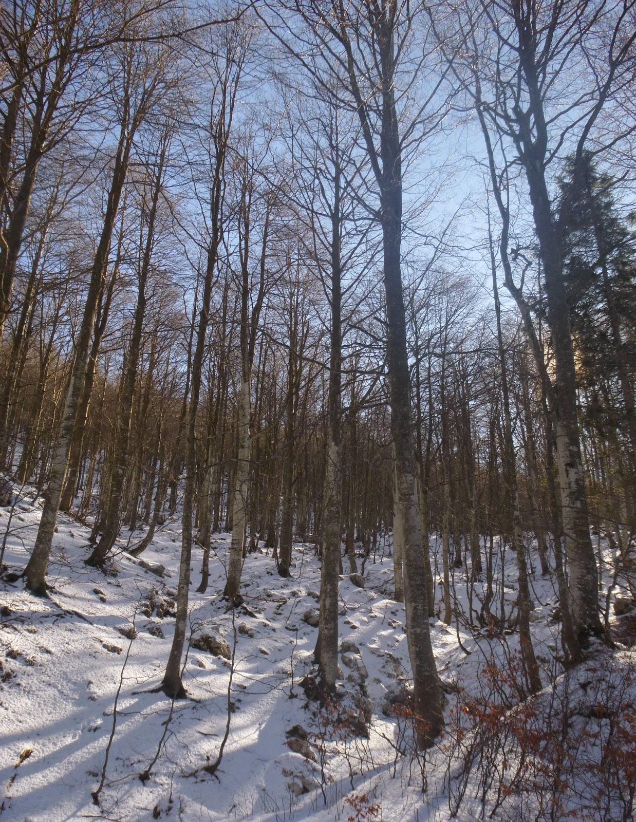
A few more inches of snow on Monte Cavallo over the weekend, so thought I'd see if it's deep enough to snowshoe. At first the trail was packed down so hiking boots were sufficient. At the snow meadow I turned right onto Passeggiata delle Malghe and began climbing. At Casera Casserate I noticed a footpath headed to the west up a little valley, and decided to try it. After a few minutes the snow got deep enough, so I sat on the ruins of an ancient shepherd's hut and donned my snowshoes.
The trail now descends and climbs a series of consecutive conch valleys through Colle delle Lastre until finally reaching the paved road from Castaldia to Col Alto. This road to Col Alto was snow-covered, but enough 4WDs have driven through to pack the snow, so I just hiked with boots. Before long houses appeared and I reached the car. Good workout through beautiful country.
Monte Cavallo Gruppo from Passeggiata delle Malghe
The footpath heading west
Ruin of ancient shepherd's hut; no mortar, just stacked rocks
A cold but sunny, crystal clear day. I intended to snowshoe this route, but the snow was only a couple of inches deep so I hiked instead. From Col Alto I took the Ronciade trail to the east, where last February sled dogs were training with their musher. The trail (a dirt road in summer) meanders through faggio forest until the junction south of Pian delle More. Here I turned right and shortly afterward turned right again onto trail 985. Another few hundred meters and I reached il incrocio di sentieri, where I turned right and continued on 985. This trail rises until reaching a concrete road accessing the repeater towers above Giais. If instead you descend on that road it carries you to Casera Valfredda, where I MTBed in October. I tried at first to continue on 985, but the sun-exposed section of snow had repeatedly thawed and frozen into a downhill ice track. I was certain to break my neck continuing that way, so I turned right and tried another wide trail, still covered with snow and heading uphill to the north. This was excellent with 270 degree open panoramas. At the top it died though, so I finally looked at my map and saw I had a 200-meter high slope to descend unless I turned around and retraced my steps. I gingerly traversed back and forth down the snowy slope, using trees and boulders to keep from tumbling. When nothing else was available I drove my trekking poles into the snow and grappled down. Amazingly it worked. Back on the level trail I went fast to make up time and soon arrived at the car.
Faggio forest rising from the trail
Sun-lit beech trees
Pala Fontana (right); the reflector is visible from our rear window
Crazy weather today so I tried to do a quick local ride. Up Valcolvera, Valdifrina and over Pala Barzana. Weather was holding up pretty well so far, so I continued to Barcis and up the backroad to Piancavallo. Still no rain but skies were menacing ahead. After Piancavallo I climbed to Col Alto at 1360 meters, donned cold weather gear and headed down. Light drizzle down to Castaldia and then slightly harder to Rifugio Bornass. I headed down the back way to Costa and the rain gradually increased. Never absolutely poured, but it was raining all the way home from Costa. I stripped all the wet stuff off on the porch and jumped in a hot bath- good as new. Good ride regardless- still keeping to my 34-27 gear goal. The 30 tooth is reserved for insane steepness only.
Mountains to north of Pala Barzana descent
The valley where Andreis nests
Tortuous sedimentary folding visible in these cliffs near Andreis
I often see dirt roads and trails when biking or hiking and want to explore them further. So today I rode the mountain bike back up to Piancavallo from Barcis to check them out. After ascending the shady back road from the lake I arrived at Pian delle More (1172m) and turned left on a gravel road. This ascends some what steeply (for my newbie mountain biker skills) to the crossroads at 1336 meters. I decided to try going to Casera Ciastelat (1450m), which is by Pala Fontana, directly above our village. After climbing to 1400 meters the road (signed Casera Montelonga) levels out and is easy riding. Then the road ends and a trail continues on to Montelonga, while another trail heads up to Ciastelat. So I would need to return with hiking boots and start the climb from there. Instead I returned to the crossroads and headed briefly back toward Pian delle More, but after only 100 meters or so turned left onto a dirt road to Col Alto. This was the highlight of today's ride- a long shady dirt road along the north side of the ridge above Le Ronciade forest/meadows. Adding to the beauty are numerous karst stone formations, which have some very cool shapes. Also some good views of the mountains from here. Eventually the road arrives at pavement in Col Alto (1290m). I took the shady back way home, down past Pian delle More, Lago di Barcis and the cool tunnels to Montereale. Very lucky to avoid the heat- we're having a record breaking heatwave and trying to stay shady. Fun ride with more to come.
The turn off opposite Pian delle More
The crossroads with 3 routes to choose from.
Lovely road toward Casera Montelonga
The foot trail to Casera Ciastelat
Warning: hidden abyss ( in the karst zone)
Mountains to north: Monte Caulana (2068m) left;
Il Piz (1752m) right
Fallen karst boulder blocking half the roadway (right)
Monte Cavallo ( 2251m) left, in distance;
Le Ronciade meadows, foreground
Lago di Barcis looking east toward Monte Raut (2025m)
I was preparing for a mountain bike ride to Piancavallo this morning when I took the dogs out. When I returned them to their penthouse suite (upstairs hallway sleeping area), they gave me the saddest look imaginable with their big puppy dog eyes. I acquiesced and switched everything over to hiking gear- they were going to the mountains! At Castaldia I turned toward Col Alto and parked at a switchback end above Candaglia. We hiked along the gravel road through the meadows, which were surprisingly wet. In the shady areas large accumulations of pea-sized hail were piled up and slowly melting. We often get big storms in the evening this time of year and it comes down frozen up high. A bit further along a large flock of sheep was stretched across the road. They let us by no problem but one of the shepherd dogs started bothering Teddi. Honey snarled at the much bigger dog, so I picked her up to avoid controversy. We eventually escaped; now I decided instead of going up the steep gravel road to go straight across the meadows on foot paths. Naturally this was a mistake and we ended up scrambling up a scree slope eventually to regain ground. The girls didn't seem to mind at all. They are the perfect companions, never complaining, always eager to surge forward, and very energetic. We rejoined the gravel road which soon became CAI hiking trail 985. It descended to La Ronciade, then we turned right onto CAI 988. This rises to Forcella di Giais (1442m), a pass with great views of the plain (despite the haze) and surrounding peaks. Hike back was uneventful but now there were many more people- they start hiking after the sun is already heating up, and the biting flies are coming out. Much better to go early in the morning, in my opinion. Teddi and Honey had a great hike and seem eager for another soon. The bikes will just have to wait somedays.
Looking back across Candaglia meadows after first kilometer
Big herd of sheep enjoying alpine grass
Honey deciding which fork to take
Teddi examining local flora
View west from ledge on Col Ceschet (1350m)
Eastward from Col Ceschet ledge toward Pala Fontana
Teddi standing against a prop to get better view
of her surroundings
Pala Fontana (1637m) from Forcella di Giais
Lush grassy meadows above Giais
Our village, Giais, from the Forcella (1442m)
Rugo della Fontana, bottom; Col Ceschet, right
View north across La Ronciade, Monte Cavallo in the clouds
The weather forecast called for rain all morning but at sunrise skies were clear. I hurriedly dressed and hopped on my bike, but by the time I left home clouds had moved in and temperatures dropped. I resolved to ride anyway and turn back when the rain commenced. After a 6 km warm-up to Pedemonte I headed up Via Piancavallo, virtually deserted now that ski season's over. This long climb gains over 1200 meters of elevation in 14.5 km, vying with Zoncolan for biggest altitude gain in Friuli. At Castaldia (1100 m) I turned off for Col Alto and traversed through alpine grassland. Around 1200 meters I was surprised to see patches of snow, which I rode through until a deep section stopped me dead and I fell into the soft snow. From then on whenever I hit a snowy stretch I dismounted and walked across. Finally in the beech forest at 1314 meters the snow cover continued as far as I could see, so I turned around. My brakes were iced up so I descended very slowly at first, but soon they thawed and it was fast and fun as usual. It never did rain while I was riding, but started shortly after I returned to Giais.
A warm sunny day and no school so I decided to try my first big climb of autumn. I got a late start because I stayed up in the wee small hours of the morning watching election results, so I wasn't sure I'd have time to reach the top and return home. I kept a steady pace up the mountain until the steepest section, between tornanti 6 and 7 below Rifugio Bornass. There I had to stand for the 13-14% stretch and was breathing very hard. Afterward I returned to slow, steady, and seated. At Castaldia I had to decide whether to go to Piancavallo, Col Alto, or just turn around. It was getting late so I decided to continue part way up to Col Alto. I rode up the long traverse to Candaglia (1179m) took some pictures and turned around. Tried not to go too fast on the way down- hard not to on this wonderful road.
Candaglia, toward Casera Barzan
Fontanuzze with autumn colors; Alpi Giulie in background
What a dilemma- you're dreaming of a climb in the mountains, but you need to take a family member to an appointment in the afternoon. Then voilà, you remember you have a world-class climb 7 km from your house. Col Alto/ Piancavallo gains 1200 meters in 15.5 km. Not bad, but there's a 3.6 km stretch averaging 9.6% in the lower half, exposed to full sun surrounded by rock faces. So try to start early morning in summer.
This morning was the first clearness we've seen after several days of rain. At 0700 when I left there wasn't a cloud in the sky and the seeing was very crisp. After the quick 7km roll down to Pedemonte I headed up. It pretty quickly hits 10%, but didn't feel bad. The "worst" stretch, on the long switchback before you turn toward Bornass, wasn't as tough as usual. I thought I had misremembered and there must be another switchback, but no I'd already completed it. From there on things get slightly easier. Especially nice on the back road from Caldastia to Col Alto. Everything bright green from the rain, the skies cobalt blue (with the beginning of some puffiness here and there). A large flock of sheep was in the meadows and I got some fotos and video. Then I realized they were headed for the road ahead and might block my way. So I hurried and beat them by a nose. On upward through the beech tree forest to Col Alto where I turned around.
I descended and when I reached the sheep they were grazing on both sides of the road, with a few wandering on the pavement. I asked the shepherd if it was ok to pass and he nodded yes. Apparently he also imparted this to the on-rushing Belgian sheep dogs, who stopped just short of my leg, sniffing rather than chomping it. These are big fluffy black dogs- our neighbor had one she called a Belgique, so I'm guessing they're called Pastore Belgique.
I continued on down the wonderful switchbacks and then cruised upward to home. I looked back and the area where I'd ridden was now completely engulfed in cloud.
Meadow around 510 meters, looking west
Valle della Stua, from 1030 meters looking west
The dirt road from Dardago/Val Artugna winding toward Piancavallo
Valle della Stua toward Caldastia
Baracca del Sauc near Piancavallo
Turn off for Col Alto left, Valle della Stua center
Rolling meadows to east from 1200 meters; the
helicopter is scanning the area above Giais-Malnisio firing range
to ensure no hikers, berry-pickers etc are in line of fire