Showing posts with label Monte Dolada. Show all posts

Tuesday, May 5, 2015

Monte Dolada

Challenging climb as always.  I made it up without stopping to rest but paid the price:  I was in limp-home mode for the final two and a half hours.  I will build up my strength and endurance and do this again, riding home normally next time.

It was very cloudy so this was all I could see to shoot;
this is the Italian version of Spanish Moss

Add caption


Wednesday, August 6, 2014

Monte Dolada

A clear day!  Rode down to Vittorio Veneto and up over Fadalto to Lago di Santa Croce.  Past the lake I turned right toward Pieve d'Alpago.  Long climb through Tignes, Pieve and Plois to the start of the real steepness:  Monte Dolada.   Here I finally had to started using the 34-30 gear, yet still I  was struggling.  But I didn't stop once to rest, which may be the first time I made it up Dolada non-stop.  At the end of pavement (1495m) I panted for a moment and then began descending.  Lots of drainage channels to jump but otherwise a good road.  A guy was coming up on a mountain bike making a whirring noise: it had an electric motor.  18% grade or not, that's cheating.  At Pieve I was supposed to take a shortcut I had researched, but I was so tired I completely forgot.  So I went several km out of the way.  

At Puos d'Alpago I began the climb to Tambre and Il Cansiglio.  This is less steep than Dolada but if you're tired it's a good challenge.  After crossing Piancansiglio I climbed up to La Crosetta (1150m) and descended to Sarone.  Felt hot down here after being up high.  The hilly climb home took another hour, and then a nice soak in the bath.  Ahhh.  Good ride.

View of Alpago toward the east from Monte Dolada

Monte Dolada on left: the white house in the trees is
Rifugio Dolomieu, end of the road

Mountains to northwest 

Mountains to northeast

Lago di Santa Croce from below Pieve d'Alpago:
Col Visentin on right, Monte Pizzoc on left


Saturday, June 22, 2013

Rifugio Dolomieu

Rifugio Dolomieu is a mountain house at 1500 meters on Monte Dolada, towering above the north end of Lago di Santa Croce.  It's a tough climb but sometimes I can do it without stopping.  Not today- it whooped me.  I had to stop 3 times and hang my head over the handlebars to hyperventilate.  But I lived and made it to the beautiful forest at end of pavement.  There were more cars parked here than usual and I noticed a bunch of hangliders and parapendio pilots on the grassy knoll behind Rifugio Dolomieu.   It was a contest where people fly through a series of waypoints before landing.

Made it back down without a flat tire- that's a first in the past 2 weeks.  Great ride home despite threatening thunderclouds.  I shall return.

Rifugio Dolomieu at 1500 meters

Looking down the steep slope at Alpago valley.  Monte Teverone in
background- I saw the east face of it from Monte Medol  the other day.

A few of the picturesque villages of Alpago- a wonderful place


Thursday, July 12, 2012

Monte Dolada, La Carota-San Martino sterrata

Monte Dolada is a sort of benchmark for me.  The first time I tried it a couple years ago I couldn't do it- had to stop, rest and hyperventilate several times.  Then last year I did a little better but remember struggling badly.   Today wasn't easy but I never felt overwhelmed, just kept gasping  and grappling away till the top.  

I arrived at Vittorio Veneto early (0630) and started the warm up to Sella di Fadalto.  Quite windy and cool- some windsurfers with parasail kites were hydrofoiling across Lago Morto- they must have been freezing.  Then around the west side of Lago di Santa Croce, past La Secca, take the right turn toward Tignes.  From here steeply upward to Pieve d'Alpago, and higher still to Plois (850m).   Now you head up a narrow farm road through the meadows with a half km of 15% average gradient.  Finally it levels out briefly at La Carota rifugio (1025m) and you can catch your breath while rolling toward the next challenge, a series of long steep switchbacks, the steepest being 1.5 km averaging 13.8%, with no chance to catch your breath.  The agony ends at 1494m, a parking lot for Rifugio Dolomieu.

I rolled back down, bunny hopping drainage channels every 20 meters it seemed.  When I reached the level spot near La Carota on a whim I headed down the backroad toward San Martino.  I had attempted this from the opposite end last year but flatted on the rocks and with no 2nd spare, gave up.  The ride from this end was considerably easier, with even a paved stretch at each end, and also briefly in the middle where it ascends a short wall.  It is also generally downhill in this direction (except for the wall).  It crosses a little bridge over the gorge of Torrente Tesa, which separates Pieve d'Alpago to the west from Chies d'Alpago in the east, then eventually becomes a paved farm road which descends to San Martino (866m).

Fun curvy descent through Lamosano and Cornei to Puos d'Alpago.  Great ride, though I wouldn't advise doing the road from La Carota to San Martino with 23mm slicks- something wider and knobbier would be better.


Early morning Lago di Santa Croce with Monte Dolada in background  

Closer shot of lago and Monte Dolada

Campanile of Pieve d'Alpago, with lago and Col Visentin in background

Lago from Rifugio Dolomieu.  See fungus on tree branches to right-
looks like Spanish Moss in Alabama, but with smaller tufts

Bowl shaped conch of Alpago, looking east

Close up of Alpago villages, meadows, forests 

Monte Teverone (2436m)

Monte Dolada's rocky cliffs, upper left

Cliffs of Montagna del Vescovo

Monte Teverone from near San Martino

Lago and Col Visentin from near San Martino


Rode clockwise

Monte Dolada climb on left, La Carota-San Martino sterrata center 


Tuesday, April 26, 2011

Monte Dolada 2011

Monte Dolada (1939m) towers over the north end of Lago di Santa Croce and the northwest corner of Alpago valley.  At 1495m, Rifugio Dolomieu lies near the top of the forested section- above that lies the mountain's exposed dolomite peak.  The views from the rifugio are spectacular- it really feels like you're flying, looking down at the earth.  

I started driving at 0715 under heavy overcast sky and rain showers.  But a few kilometers west it started clearing and by the time I reached the parking spot north of Vittorio Veneto it was sunny and mostly clear (146m).  It was quite cool and very windy in the gorge, as usual.

After the easy climb up to Sella di Fadalto (487m), I cruised along the west shore of Lago di Santa Croce until the right turnoff for Paludi.  Soon the road turns upward, with a series of easy tornanti carrying you up to Tignes (560m).   Continuing upward to Pieve d'Alpago (690m), the climb begins to steepen.  I tried remaining seated for the most part to save energy for the bigger climb ahead.

Reaching Plois (850m), the real climb begins.  Coming out of town is a half kilometer stretch averaging 15%, with bits of +18%.  This "eases" to 12% average for the next half kilometer.  Now comes a nice flattish spot at La Carota ristorante, where you can catch your breath and stretch while riding.  The road from San Martino di Chies d'Alpago arrives from the right, then immediately you hit the hardest section-  2.25 kilometers averaging 13.5%.  In this section there are 2 or 3 very long straight stretches, with no chance to catch your breath.  I rode this standing  At least the pavement isn't bad, and the drainage channels have been asphalted so they only have a slight dip.  But today this section was covered in tiny flowers from the surrounding trees.  The flowers and dampness caused some traction problems when standing.  After this challenging bit, the average grade eases to slightly above 10% for the final kilometer and a half.

The end of the road at 1495m is covered in beautiful fir trees, with the rocky promontory of Monte Dolada visible overhead.  Through gaps in the trees there are inspiring views of the conch of Alpago, the Lago, surrounding mountains.  But today low flying clouds were heading in, in one case completely obscuring the view of the lake within seconds while I fiddled with my camera.

I headed down carefully, but tried to make time on the straight stretches.  It was a challenge to slow down at the ends while jumping drainage channels, and braking hard on a damp road covered with little flowers.  At one switchback I encountered a mountain biker ascending- the only human I saw above Plois (I did see a deer on the ascent).  Shortly after, I was flying down a straight stretch and apparently hit a rock, blowing my front tire tube.  I changed it by the road and continued the plummet.

After Plois the road is much better and you can descend rapidly.  When I reached the lakeshore, the wind had reversed direction from this morning, and was in my face again.  Cruel fate.

This is a great climb and I'll try to tackle it again this summer.

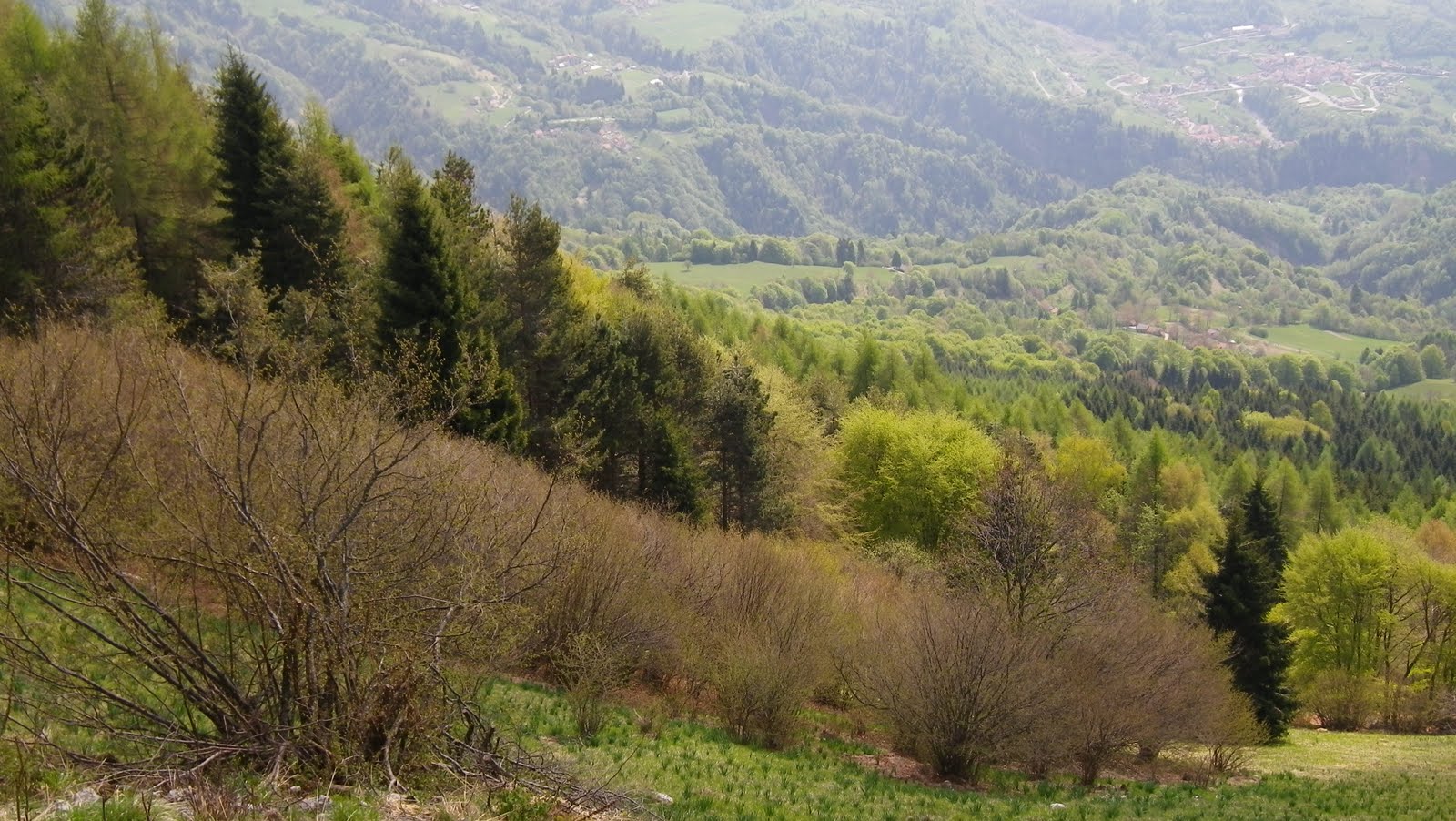
Alpago forest and meadows

Epiphtye (or moss?) growing on tree at 1495m

Lamosano and Torres far below

Chies d'Alpago

Map of the climb

Detail of Plois to Rifigio Dolomieu

Detail Tignes to Plois

The long, steep section above La Carota- 2.27km averaging 13.5%

The gradient from Pieve d'Alpago to La Carota;
note the 18.5% climb out of Plois 

From La Carota to Rifugio Dolomieu (1495m)


Wednesday, July 28, 2010

Monte Dolada (Rifugio Dolomieu)


Toughest climb I've done, hands down.

After warming up on the easy climb from Vittorio Veneto (155 meters) to Sella Fadalto (487 meters), I followed the western shore of Lago Santa Croce to Paludea. Here the climb begins for Rifugio Dolomieu (1494 meters) on Monte Dolada (1938 meters, pictured above on left).

Starts off nice enough- it averages 7% for the first 6.5 km up through Tignes, and Pieve d'Alpago, steepening to one km of 10-11% below Plois.

But the last 6 km from Plois to Rifugio Dolomieu averages 10.7%. This breaks down to one half km of 15%, a stretch of 10-12% followed by another half km of 15%, more 11-12%, and another half km of 15%. The steepness is unrelenting- you keep thinking it must flatten a bit after the next bend, but instead it only gets steeper. I stood in the pedals and tried to inhale enough oxygen to fuel this ascent but on five or six occasions I had to stop and breath for a few minutes to catch up. The problem was finding a place to stop and rest with a wide enough roadway to restart with clipless pedals. I was lucky except for one stop, where I had to walk maybe 50 meters to find a restarting point.

The bottom two thirds of the climb are exposed to the sun, so quite hot. The last third is covered in trees, which helped stave off heat exhaustion. The pavement is mostly good, so no added complications there. Oddly the Ediciclo guidebook rates this climb easier than Monte Crostis or Passo Cason di Lanza. Maybe if I try again in Fall when it's cooler and skip the warm up climb from Vittorio Veneto it will be easier.


Mountains on north shore of Lago Santa Croce


To the northeast, Monte Teverone, 2345 meters


Steepness


Lago Santa Croce from above


To the east Monte Cavallo (2251 meters, on right) and Monte Messer (2230 meters, on left)


This guy scared me zooming down from Rifugio Dolomieu. I was taking a picture of mountains and suddenly heard this whooshing noise as his hang glider swooped directly above me


Beautiful landscape of Alpago


More mountainside villages


The gradient above Plois


Close up of ascent route