A fun ride to Vittorio Veneto, with the lovely climb up to San Lorenzo (415 meters). Afterward descended near Tarzo, then through the rolling vineyards and olive groves to Cozzuolo. Must credit Paul Kim for introducing me to these pleasant Veneto backroads over the past few years.
Apologies again for lack of photos- too hazy.

Cycling Dolomiti Friulane
Saturday, January 30, 2016


Thursday, January 28, 2016
Collalto
I thought I'd try the climb up to Collalto this morning to see if it was snowed over. No, it too is snowless. I was surprised how hard the climb felt, then I realized I wasn't breathing. It seems it would come naturally by now, but no, I must concentrate on taking deeper breaths when exercising hard. Once I get back in the habit I won't have to think about it so much.
Sorry for the lack of pics, it was quite hazy. I saw two beautiful eagles, also a couple of small yellow songbirds. Nice quiet ride.

Sorry for the lack of pics, it was quite hazy. I saw two beautiful eagles, also a couple of small yellow songbirds. Nice quiet ride.
Sunday, January 24, 2016
Passo Monte Rest
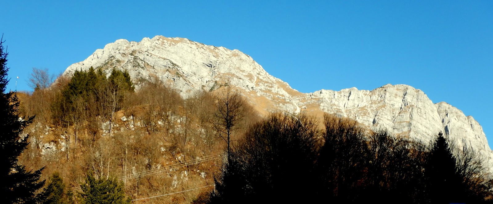
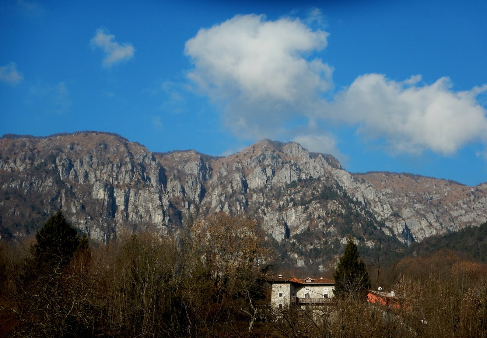
A strange ride for late January in northern Italy. After I climbed above the overcast from Lago di Redona the sky was suddenly crystal clear, windless and though still frigid, felt like October. No snow, no ice, not even frost, just the tawny, golden color of dry grass. As I headed up the switchbacks I met only one soul, a hiker who waved and said "Tag!" I was wearing a balaclava and Oakley's but somehow he knew I had German ancestry.
At the deserted pass there was no snow, and looking at the summit above it was the same. I rode down the north side a bit and noted the Carnic alps have some snow, but sparse. This could all change in a week or two though so there's still hope.
The ride back down and home was fun. I may try this as a loop coming back over Selle Chianzutan. Never did that in winter before.
 |
| Monte Rest, left, and Monte Valcalda, right, from Maleon |
 |
| Close up of snowless Monte Rest |
 |
| Close up Monte Valcalda |
 |
| Summit of Monte Rest from the pass |
 |
| The hill to right of pass has bear caves with surveillance cameras |
 |
| It's a good workout |
Saturday, January 16, 2016
Sesto al Reghena
This is another town I've driven past 100 times but never stopped to see. I rode there in the midst of our first cold snap with temps down below 0℃. Bundled up so it wasn't too bad. Down through Pordenone and Azzano Decimo to Sesto, where I quickly found the castello and Abbazia Santa Maria in Sylvis, a Benedictine Monastery founded in 730 AD. This is a beautiful place and I got so carried away taking pictures I almost froze. Finally I tore myself away and rode as fast as I could to generate heat. I think I was almost back to Pordenone before I felt good and warm. I'll try to return when warmer and also visit inside the Abbazia which has some great artworks.
 |
| The gate tower on west end |
 |
| Lovely ceramic mural piece |
 |
| The east gate tower |
 |
| Peacocks strutting around the grounds |
 |
| The bridge to east gate tower |
 |
| Nice cantilever design |
 |
| Gate and campanile |
 |
| Arched windows of the Abbazia |
 |
| Detail of window arch column |
 |
| The Abbazia |
 |
| The old Municipio (town hall) |
 |
| Some lovely frescoes on east end of Municipio |
 |
| Another angle of the castello gate tower |
 |
| Fiume Reghena |
Friday, January 15, 2016
Casera Pian de la Corona MTB
A short MTB ride from our house to Grizzo, past Monte Spia, The Osservatorio Astronomico, Casera Pian de la Corona to a grassy knob with great views in all directions. From there I descended to a dirt forestry road heading north. This gradually changes from dirt road to a beech-covered mountainside trail, which is mostly bikeable except for some narrow off-camber pitches I had to walk. There are cliffs overhead, lower part of Pala d'Altei. The map shows the trail continuing to Bosco Faedo. On the way back I noticed views of Lago di Ravedis through the trees. I'll come back and explore this more- it's too nearby to miss.
 |
| Our village Giais, under looming storm clouds |
 |
| Monte Faro to northeast |
 |
| Montereale Valcellina |
Friday, January 8, 2016
Monte Prat
Another favorite ride, Forgaria to Monte Prat. Surprisingly crowded today, which I eventually figured out from the banners along the road: Tomorrow and Sunday Italian National Cyclocross Championships will be held here. Lots of teams practicing and team cars, bikes mechanics etc driving up to Monte Prat. I will try to catch it on TV. Great ride.
 |
| Race preparations in Monte Prat meadows, with Monte Cuar and Flagjel in background |
Tuesday, January 5, 2016
Lago Ca'Selva
Overcast and cold with leaden skies: the perfect day for a ride. I rode past numerous falo' bonfire preparations, a Celtic rite which has now been attached to Epifania. At Meduno I headed north then crossed the dam at Redona, then rode along the lakeshore to Chievolis where I crossed Torrente Silisia. Here you head steeply upward for awhile before beginning a series of saliscendi for an awesome workout. Pavement ends at the dam, so I headed toward home. Somewhere along in here it began to sprinkle lightly, just enough to get all my gear wet but not enough to freeze me solid. This is a perennial favorite ride and never disappoints.
 |
| View west, water level very low |
 |
| Normally submerged ancient dwellings |
 |
| Northwest exposed submerged dwellings |
 |
| Close up with stone walls marking old fields and pastures |
 |
| Eastward down rugged, remote Val Silisia |
Friday, January 1, 2016
Strada del Patriarca
Strada del Patriarca dates from the 13th century (at least) when it connected Sacile (controlled by the patriarch of Aquileia) with the road to Austria. To reach it I rode down Via Pedemontana to Villa di Villa. Head up the hill past the turnoff for Sarmede and soon you reach the ruin of Castello di Cordignano. Here you bear right, skirt above a large gravel mine face, and meander steeply through an area with groves of trees alternating with open pastures. Very sparsely populated, beautiful zone. Eventually you reach the beech, fir, and karst forest of il Cansiglio (here the road was recently paved and is wonderfully smooth). Continue climbing steeply to the junction with main road from Sarone to La Crosetta. No snow up here either, just some old thawed/remelted ice.
The ride down through Sarone and home was easy. Peaceful start to the New Year and a great workout with 12.5 km of 8.6%.
The ride down through Sarone and home was easy. Peaceful start to the New Year and a great workout with 12.5 km of 8.6%.
 |
| Castello di Cordignano |
 |
| Parco Carbonai is an abandoned settlement where early settlers cut wood and slow-burnt it to make charcoal; you'll see the turnoff higher up in the beech forest section |
 |
| Transition to beech forest up around 800 meters |
 |
| Snowless Passo di La Crosetta |
Wednesday, December 30, 2015
Piancavallo from Barcis
This is one of the prettiest rides around here. From west shore of Lago di Barcis up the gorge of Torrente Caltea to Piancavallo, all wilderness. And you get a good workout, 13 km of 7.5%. It was a little icy up near the top where previous light snowfalls have melted and re-frozen. A couple of times I had to hop off and walk along the edge for maybe 50 meters where the ice and steepness prevented rear wheel from getting traction. Much less snow than normal for this time of year.
Descended down the main road to Aviano, much less traffic than usual because of fewer skiers.
Descended down the main road to Aviano, much less traffic than usual because of fewer skiers.
 |
| View north of rocky Monte Resettum |
 |
| Closer up |
Monday, December 28, 2015
Passo San Osvaldo
I enjoyed riding through the 4 km tunnel by Barcis on Saturday so much I returned to ride through it twice more, this time from Montereale Valcellina / Lago di Ravedis. I continued past Barcis to Cimolais and climbed up the little pass of San Osvaldo (848 meters). The return ride is one of the sweetest around here: 40km almost all downhill. Hard to describe how good that feels after burning your muscles all the way up there.
 |
| Some of the peaks of Val Cimolana |
 |
| Note the rock towers along the ridge, a local specialty |
 |
| San Osvaldo's little chapel, with the first snow I've seen this year |
 |
| From the pass, more Val Cimolana eye-poppers |
 |
| Close up of rock walls high above |
Saturday, December 26, 2015
Pala Barzana
Pala Barzana is a good training ride from east to west (Poffabro to Andreis), and slightly harder in the opposite direction. Today I took the easy way, up through Bus di Colvera and Poffabro. Quite chilly in the shade of the mountain but the climbing kept me warm. At the top (854 meters) the road was frosty and I felt some slippage so I rode very slowly. Good job too because it got frostier and even a thin dusting of snow above Bosplans.
There were a few sightseers enjoying Santo Stefano but not enough traffic to be a bother. Finally I reached the less-steep and -frosty road by Andreis and tried riding fast as possible to warm-up but it was useless: I was frozen. The 4 km tunnel was a bit warmer and I got a little warmth on the short climb to the tunnel above Montereale. I hurried home and pulled off my shoes and socks to warm my block-of-ice feet by the heater. I'm still feeling a little cold but a warm bath will cure that.
There were a few sightseers enjoying Santo Stefano but not enough traffic to be a bother. Finally I reached the less-steep and -frosty road by Andreis and tried riding fast as possible to warm-up but it was useless: I was frozen. The 4 km tunnel was a bit warmer and I got a little warmth on the short climb to the tunnel above Montereale. I hurried home and pulled off my shoes and socks to warm my block-of-ice feet by the heater. I'm still feeling a little cold but a warm bath will cure that.
 |
| Monte Raut above Pala Barzana |
 |
| Beautiful peaks above Andreis |
Thursday, December 24, 2015
Piani di Clauzetto
The cloud cover broke and I headed for the hills. From Meduno I followed the rolling road along Lago di Tramonti until the turn off for Campone, beside Torrente Chiarzo. Here you begin a winding climb to Piani di Clauzetto (3 km of 7% reaching 686 meters), a curvy rough descent to Pradis di Sotto (526 meters) and a steepish climb to Pradis di Sopra (3 km of 6.5% reaching 722 meters). From there down through Clauzetto and home.
 |
| Cima Lareseit from Piani di Clauzetto |
 |
| Monte Taeit from Pradis di Sotto |
Saturday, December 19, 2015
Montaner
I left home feeling energetic but by the time I reached Caneva I was really feeling the hard climb of yesterday. I avoided the usually hilly approach to Villa di Villa and took the lower route. After Sarmede there was no avoiding the inevitable, so I just stood and gutted out the 1.5 km of 10% (again with +15% ramps). Afterward, I stopped and pretended to photograph the countryside, whilst softly whimpering and moaning in pain.
Once I regained my composure I continued along the saliscendi of the hillside road. It's a beautiful conch valley, with starting points for many steeper climbs up toward Il Cansiglio. At Fregona the road heads downward, leveling out around Cappela Maggiore. Again I was doing my best to stay on the flats, and succeeded all the way to Marsure where again there's just no getting around it.
BTW at the industrial zone of Polcenigo I tried a shortcut to Budoia which ended in a dirt road and a flooded gravel pit. I rode through the woods on some muddy singletrack but the highway bridge in the distance was still on the wrong side of the water. I hiked through the woods carrying my road bike and finally reached the bridge. So don't turn into the industrial zone at the Cimolais sign, wait till you see the SEDIT sign (that road leads to Budoia).
 |
| Olive groves and vineyards in Rugolo |
 |
| Sheep and lambs enjoying the sunshine |
 |
| The view west toward Monte Cesen |
Friday, December 18, 2015
Bornass
I started this ride running some errands: the bank, the post office, etc. But my final stop, the pharmacy, wasn't stocked yet so I killed some time with a training climb. The ride from Costa to Rifugio Bornass is another contender for best training climb of Pedemontane Pordernonese, but with a caveat: it starts with a kilometer averaging 12% up to Santuario Madonna del Mont, with some +15% in there. Once you get past that it's as sweet a climb as you'll find: 7.5 km of 6.1%. A bridge washed out a couple years ago so you must hop off and walk a few meters, but it's really a net plus because no cars come through anymore. At the rifugio I turned onto the wide, smooth beautifully-switchbacked road from Piancavallo to Aviano. One of the funnest descents I know of.
Back down in the "real world" I picked up some prescriptions then headed home. Maybe tomorrow another escape into fantasy.
Back down in the "real world" I picked up some prescriptions then headed home. Maybe tomorrow another escape into fantasy.
Sunday, December 13, 2015
Forchia di Meduno
Another good training climb, this time from Meduno to Forchia di Meduno: 4.2 km averaging 8.1%. There are many options from Forchia: on road bike to Monte Valinis where you can watch paragliders leap off the precipices and try to land in the wind, or you can descend steeply to Campone and go up to Piani di Clauzetto.
If you're MTBing you can continue on the gravel road up to Monte Cereis, with option of rock-scrambling to top of Monte Chiarandeit (haven't tried that yet). Then a bit further down the road is a turn off for Monte Mulon I want to try next year. If we continue snowless maybe I could do that in the next month or two.
If you're MTBing you can continue on the gravel road up to Monte Cereis, with option of rock-scrambling to top of Monte Chiarandeit (haven't tried that yet). Then a bit further down the road is a turn off for Monte Mulon I want to try next year. If we continue snowless maybe I could do that in the next month or two.
 |
| View northwest from Forchia showing gravel road up Monte Cereis |
 |
| Monte Mulon from Monte Valinis/Campone junction |
Subscribe to:
Posts (Atom)