 |
Good exercise |

Cycling Dolomiti Friulane
Tuesday, March 31, 2015


Monday, March 30, 2015
Col Alt
I spun down down to Sarmede, then stood in the pedals on the short climb to Rugolo. Here I turned right on the road toward Villa di Villa, and climbed to the left turnoff marked Chiesetta Alpina Monte Castelir. Almost immediately you start hitting 18-20% ramps, interspersed with restful 15% stretches here and there. I almost made it up the first ramp but a little car came up behind me and the road is so narrow if you wobble you fall. I graciously stopped, allowing him to overtake me while I hung my head over the bars and gasped for air. After a very brief respite the road turns north for the hardest ramp: 1.4 km averaging 15.8%, with stretches of 22.6%. I stopped to "rest" 3 or 4 times: it's all a blur. At 600 meters you pass the turnoff for Chiesetta Alpina and begin the next phase, still often reaching into the teens but with merciful resting ramps of 10-12%. The road winds around through some restored stone houses until eventually reaching Casera dal Cin around 800 meters.
Here the well-paved road ends and I did some gravel biking for awhile. I stopped at the little alpine wetland which was completely grown over and full of loud frogs last summer. I continued down to Casera Col Alt and then began hiking/carrying the bike on CAI 1060. I was hoping to find the war memorial but that will have to wait for another day. After maybe a km of hiking I regained a dirt road at a restored stone house at 750 meters. This road eventually reached Strada della Patriarca, the paved road connecting Villa di Villa to Il Cansglio. The ride home was fun: I wasn't as tired as I expected. Must return soon to explore some more.

Here the well-paved road ends and I did some gravel biking for awhile. I stopped at the little alpine wetland which was completely grown over and full of loud frogs last summer. I continued down to Casera Col Alt and then began hiking/carrying the bike on CAI 1060. I was hoping to find the war memorial but that will have to wait for another day. After maybe a km of hiking I regained a dirt road at a restored stone house at 750 meters. This road eventually reached Strada della Patriarca, the paved road connecting Villa di Villa to Il Cansglio. The ride home was fun: I wasn't as tired as I expected. Must return soon to explore some more.
 |
| Alpine wetland |
 |
| The stone house where I emerged from the wilderness carrying my road bike |
 |
| Junction of dirt road with Strada della Patriarca |
Saturday, March 28, 2015
Brussa
I'd never heard of this beach until Fred at http://www.fred29.it/tempo-libero.html mentioned MTBing around there. I wanted to road bike to it and check it out. It's an easy flat ride, 70 km in 2.5 hours. It took an extra half hour coming back, maybe I was tired.
The last km or 2 of the road is hard packed dirt but is no problem on a road bike. There are a couple of trails to the beach through the pine forest, and then a wide, flat, hard-packed sand beach. This was great to find because the other local beaches are very commercialized: high rise hotels, souvenir shops, snack bars etc. This beach was all natural, a little like Fort Pickens National Seashore at Pensacola. Lots of heron, egrets, cormorants, ducks, seagulls and even a pheasant in the pine woods.
I rode on the beach a few hundred meters on my 23mm slicks till I reached a wooden boardwalk back to the entrance. Very pleasant ride and a new place to explore- I may come back with the dogs in a few weeks.
 |
| Fishing boats a hundred meters off the beach |
 |
| Looking west toward Caorle |
 |
| Looking east toward Bibione |
 |
| Boardwalk from entrance to beach |
 |
| From bridge over laguna looking west |
 |
| From 70 km away: Monte Cavallo Gruppo on left |
 |
| Snowy Slovenian mountains; the very pointy campanile is Cesarolo |
 |
| Brussa's Country Club |
Monday, March 23, 2015
Col delle Palse
Beautiful Spring morning so I thought I'd try a climb. I rode down Via Pedemontana to Polcenigo, turned right at Coltura and climbed up to Mezzomonte cemetery. Here I turned left and rode up the narrow lane toward Col delle Palse. The gradient is difficult so I tried standing to climb more often than usual. Seemed to really help.
Around 1200 meters I ran into a patch of snow or two and didn't think much of it. Then I reached the switchback end and it was too deep to ride. I carried the bike 100 meters then the following long traverse was clear so I remounted. Alas at the next switchback the same occurred- I carried the bike again. Then the road was clear of snow at the base of the killer concrete ramp, so I had to climb it: not as bad as I remembered. At 1320 meters snow was everywhere so I surrendered. Have to come back in a month or two and try again.
Around 1200 meters I ran into a patch of snow or two and didn't think much of it. Then I reached the switchback end and it was too deep to ride. I carried the bike 100 meters then the following long traverse was clear so I remounted. Alas at the next switchback the same occurred- I carried the bike again. Then the road was clear of snow at the base of the killer concrete ramp, so I had to climb it: not as bad as I remembered. At 1320 meters snow was everywhere so I surrendered. Have to come back in a month or two and try again.
 |
| The first portage |
 |
| You can see the Piancavallo-Cansiglio road up there: only 40 meters higher |
 |
| The killer concrete ramp, unfortunately clear so I had to climb it. |
 |
| This is the road continuing upward |
 |
| Nice stand of beech trees in the snow to the east |
 |
The climb |
Saturday, March 7, 2015

Sunday, March 1, 2015
Kanalski Vhr
Back to Slovenia to celebrate the arrival of March. I was eager to check out the new pista ciclabile on the Soča River's west bank which I'd read about on Max's wonderful blog . So I parked at Solkan and started the trail. Really well-made cyclepath, with lots of hikers, dog walkers, toddlers on tiny bikes etc enjoying their Sunday morning.
After the bike path ends at Plave you can continue on small farm roads to Kanal. Here I crossed the river and located the start of Kanalski Vhr climb at Morsko. It's a tough climb as you'd expect in this terrain, 6 km averaging 8.6% with some 14% ramps in the mix. Eventually the climb levels out at a settlement called Kanalski Vhr on the Banjšice altopiano. This area was the scene of horrific fighting and casualties in WW I, and even today seems a little spooky. It's sparsely populated, with miles of rolling hills covered with beech trees, grotesque karst rock formations and deep sink holes. You can hear no human sound, only the fierce winds. Another words, my kinda place.
I wasn't sure if there were any paved roads crossing the altopiano, but it turns out the route through Bate to Grgar is an excellent road. I want to go back now and do it in the opposite direction, maybe descending to Avče from Lokovec (900 meters).
 |
| From new bike path, Solkan railway bridge (longest stone single-span bridge on earth). |
 |
| Old stone train signalman's house; Sveta Gora high above across the river. |
 |
| Close up of Sveta Gora |
 |
| Quality construction of the cycleway; there are stairs for pedestrians with adjacent ramps so you can push your bike (or if you're a maniac like me you can ride down the ramps) |
 |
| Bike tunnel under the railway line |
 |
| Kanalski Vhr altopiano |
 |
| Bate (I looked for Bate's Motel, but there was none) |
 |
| Right turn goes through Grgar to Nova Gorica; left explores the wilds of Banjšice altopiano |
 |
| Solkan Bridge from the road toward Monte Sabotin; the bridge is still in use today |
Thursday, February 26, 2015
School Commute Deviazione
The road I commute to school from San Quirino to Pordenone is closed for construction. The past few weeks I've tried various workarounds and finally hit on the best. A couple of kilometers of strada bianca but it's hard-packed dirt and no problem.
A few km south of San Quirino turn left here:

Coming from the left in this foto, do a quick right and then a left to cross Via Napoleon Aprilis:

Soon the dirt road runs into Via Portolana, which takes you through Villa d'Arco. When you reach Via Villa d'Arco, go straight across and onto another dirt road:

Don't go left here. Take a right and the road then makes an immediate left:

Soon you're back at the junction with SP65 and can head on in to town.
A few km south of San Quirino turn left here:
Coming from the left in this foto, do a quick right and then a left to cross Via Napoleon Aprilis:
Soon the dirt road runs into Via Portolana, which takes you through Villa d'Arco. When you reach Via Villa d'Arco, go straight across and onto another dirt road:
Don't go left here. Take a right and the road then makes an immediate left:
Soon you're back at the junction with SP65 and can head on in to town.
Monday, February 16, 2015
Pieve di Cadore
I was planning to ride to Auronzo and left at 0700, just after sunrise. The Cellina River valley and Vajont dam area were cold, overcast and windy, so I was having doubts about completing the ride. But Longarone was sunny and the Piave River valley clear, so I forged on. After Perarolo the sunny Cavallera switchbacks carried me up to just below Pieve, then on a back road through the forest to town. This is where it got steep. I followed the signs for Lunga Via delle Dolomiti (E1 of the European bikeway system) up above town until I arrived at the cemetery. There was a "closed for maintenance" barrier blocking the path here but I hopped over it and kept going. After an old railroad tunnel the bikeway turns into re-frozen snow ice rink, but I somehow avoided flipping over on 23mm slicks. Some workmen were out in the February cold fixing our bike path, so I figured I'd have to try surviving the nearby main highway, but the guys told me I could continue on the path. Very decent of them. I finally reached the railway station, where trains from Belluno bring skiers in winter, hikers/biker in summer.
On the ride back I had a sudden burst of energy, and went "fast" all the way home. Even the climb from Longarone to Passo Sant' Osvaldo seemed easier. Maybe fatigue-induced euphoria. Good ride.
On the ride back I had a sudden burst of energy, and went "fast" all the way home. Even the climb from Longarone to Passo Sant' Osvaldo seemed easier. Maybe fatigue-induced euphoria. Good ride.
 |
| Frozen Piave River with mountains to north |
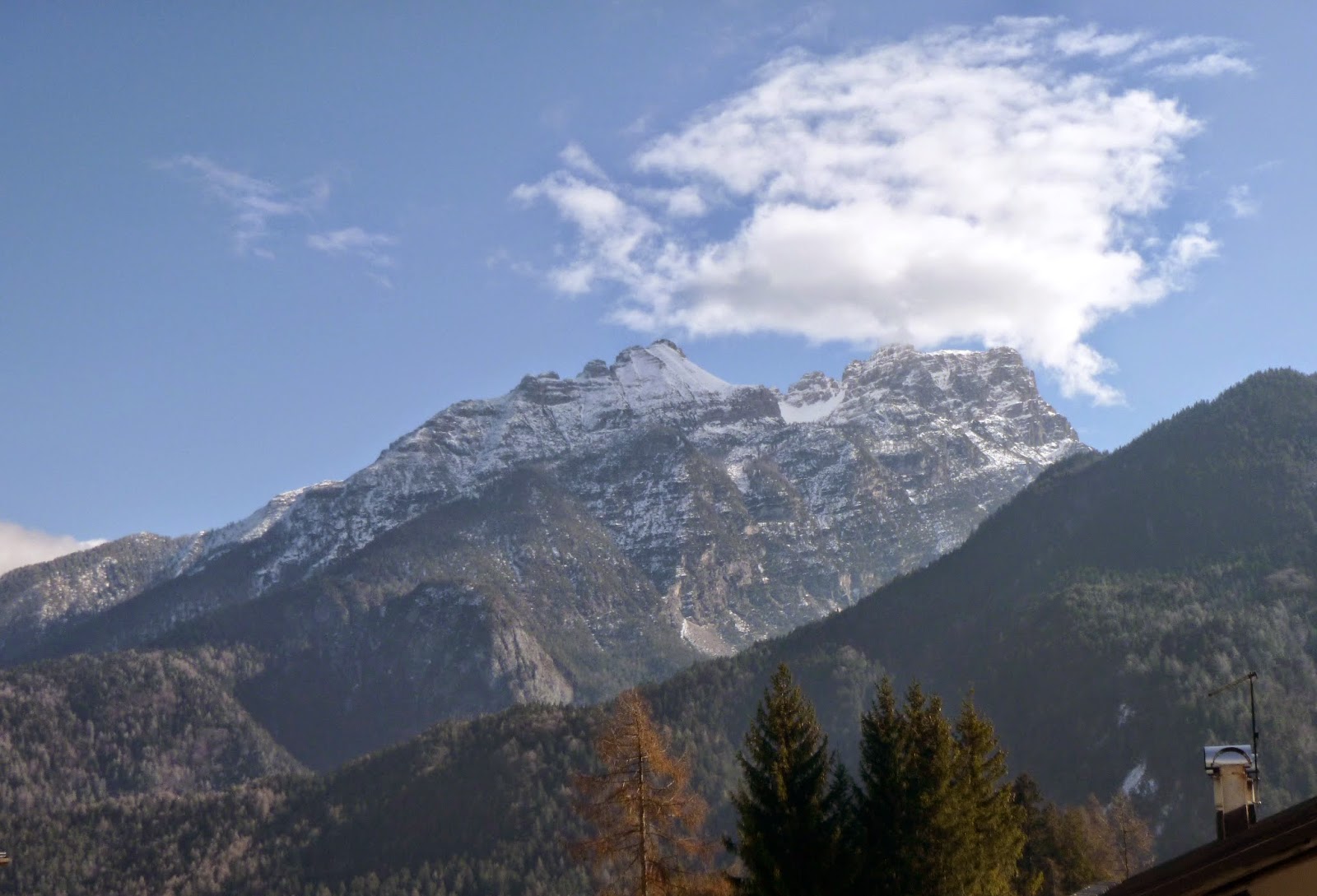 |
| This peak rises to the east |
 |
| The "bike path closed" barrier |
 |
| Exiting old railway tunnel onto slippery icy snow |
 |
| Pieve di Cadore railway station |
Wednesday, February 11, 2015
Colli Asolani - Montello
Always wanted to visit Asolo but never have gotten round to it. So I took advantage of the clear cold weather today for a giro of Colli Asolani and the WW I battlefield Il Montello. I drove to Nervesa della Battiglia on the Piave River and started toward Il Montello. On impulse I turned right at the base of the climb onto the rolling panoramic road along Il Montello's northern flank. This is one of the prettiest, gentlest bike rides anywhere.
The road ends at Crocetta del Montello, where I asked some surveyors how to reach Cornuda. There begins the northern route through Colli Asolani, a rolling mix of hills and valleys covered with vineyards. Reminded me of Refrontolo. Eventually I reached the north side of Asolo and climbed up.
Asolo is a gorgeous hill town. I only saw a fraction of it and definitely will be going back. I descended to the south, which is a much wider smoother road. This main road continues through Maser to Crocetta del Montello, where I searched for the start of the dorsale road. Instead I found Prese XX, which climbs over the western end of the "hump" and comes back down to the plain on the other side. Luckily though, it joined the dorsale (almost in Montebelluna) and I started climbing. This dorsale is a fun ride, 15 km or so of continuous saliscendi, with 20 presi, military supply roads like ribs of a backbone, descending at intervals steeply to north and south. Shortly before Nervesa I inadvertently took one of these presi southward down to Giavera, where I joined the south-side perimeter road, meandering through flat fields and little towns. Back in Nervesa I found the car by the Piave and headed home. Must return soon.
 |
| Locomotive from the war along Monfumo road |
 |
| Castello di Monfumo, Monte Grappa in background |
 |
| North gate into Asolo |
 |
| Sottocastello in Asolo |
 |
| Castle tower from the north |
 |
| Palazzi below the big castle above town |
 |
| Romanesque church in centro storico |
 |
| The church tower seen from the east |
 |
| The big castle above town |
Sunday, February 8, 2015
Pian del Cansiglio Snowshoeing
Drove to Pian del Cansiglio and hiked a loop. First from the Veneto Agricoltura building up a snow-covered road to the left turn for Vallorch. Instead of turning I continued straight up the hill until entering the forest, then turned left on Anello del Cansiglio trail Nice views of the snowy plain, the faggio forest, and snow-topped peaks to the north. I eventually found a gap in the the electric fence and headed back toward the car. The snowshoes worked great on the fluffy snow. Found many more trails to try on future visits.
 |
| The view south with snowy Monte Pizzoc peaking over the hills |
 |
| Vallorch farm buildings |
 |
| Mountains north of Alpago |
 |
| Cold War relic: an anti-aircraft missile battery from the 1960s |
 |
| View up snowy creek bed toward western ridge |
 |
| View from Anello del Cansiglio trail looking east |
Subscribe to:
Posts (Atom)