Friday, July 11, 2014

Val Visdende MTB

I drove up to San Pietro di Cadore early this chilly July morning, then a bit further east turned left toward Val Visdende.  After crossing the Piave River the road switchbacks steeply up to Cimacanale at 1250 meters.  I parked and started riding on a paved road marked Strada delle Malghe, turned left at Pra Marino and continued toward Casera Dignas.  The road is narrow chip and seal, with many sections of pavement washed away.  The climb through the forest is silent and beautiful, with switchbacks when it's steep.  At 1686 meters I reached the casera with grazing milk cows.  

More climbing took me up above the forest into alpine pastureland.  Around 1800 meters the road reaches its westernmost point and turns east, with a steep dirt climb to Casera Campobon at 1920 meters.  A pair of marmots near the dirt road dove into their tunnel.  The menagerie up here includes donkeys, sheep, and deer as well.  This portion of the ride reminds me of Panoramica delle Vette east of Monte Crostis- dirt road running more or less horizontal along a steep slope, with forest far below.  This continues to Casera Cecido at 2014 meters.

At Casera Chiastelin everything changes, as the road becomes single track hiking trail.  Steep, technical, with numerous stream crossings, challenging.  Then at Casera Antola horrible mud (sheep and cow hooves really tear up the trail) combined with a lot of logging debris and steep descending.  Above Malga Chivion the road is being worked on, with tons of large, jagged red rock shards protruding from the roadbed- I was just glad it wasn't mud.

Everything changes again when the trail from Sorgente del Piave joins us, and the road has lovely switchbacks to ease the descent through the forest.  Here I see my first humans (some hikers) since starting the ride 4 hours prior.  The road gets better, then is paved, and finally I reach the car, exhausted.  I will try the Sorgente del Piave-Val Visdende trail next time, warming up on the main road to Cima Sappada.  If I do Strada delle Malghe again I will probably try turning right at Casera Chiastelin and descending the dirt road back to Val Visdende. 


Looking down at steep climb to Casera Campobon

Cima Palombino (2600 m)

Croda dei Longerin (2523 m)

Both peaks to the west, together

Peaks to southwest, Terza Grande (2586 m)

Rhododendron-covered alpine pasture

Monte Peralba (2694 m) to east

The scale of these slopes; Austria borders the ridge line

One of dozens of frigid streams to cross;
I got a foot-soak gratis in this one

Rugged ridgeline to the south

Ruins of old farmhouse in Val Visdende meadow


Sunday, July 6, 2014

Monte Rossa MTB

Val d'Arzino is one of the best kept wilderness areas in northeast Italy.  It's mostly undeveloped, yet pretty easy to access using the road designed and built by the great engineer, Count Giacomo Ceconi.  And that's how I arrived there today, driving up from Pinzano to Pielungo.

I was short on time so I drove all the way to the start of the MTB trail, at Castello Ceconi (an excellent place to visit itself, with park-like grounds where kids can play and families can picnic).  This MTB trail is an excellent workout, climbing constantly for 8 km at 10.5% average gradient, with some ramps of 18%, as it follows the contours of the steep mountain side.  

As the road climbs it changes, becoming slightly looser-surfaced at first, then more and more so.  I gave it my all and kept going up to around 900 meters, then I was toast, so got off and pushed awhile.  Shortly afterward, I arrived at the junction with the trail for Malga Jovet.  After a few minutes rest I hopped back on the bike and started climbing steeply again up to around 1200 meters.  Mercifully the trail levels out here for a kilometer or so, then you arrive at gorgeous open meadows of Malga Rossa (a stone ruin).  I thought about ignoring the time so I could continue to the ridge of Monte Rossa (1350 meters) which has great views from the sheer southern escarpment, but I'd given my word, so I turned around.

The ride down was fun- much faster and easier.  I packed up and got home right on time.  Will return this Fall maybe and  check the view toward the south.


View from trail of Val d'Arzino

The meadows at Malga Rossa (1260 meters)
Wild rhododendron in meadows

View of meadows toward northeast

Another wild rhododendron bush 

Castello Ceconi and park-like grounds


Friday, July 4, 2014

Casera Frascon MTB

The massif stretching from Lago di Santa Croce to Valdobbiadene has some of the prettiest scenery anywhere.  The north side, covered with miles of forest and meadows, slopes gently down to the Piave River.  Today I rode from Visome, across the river from Belluno, up to Valmorel, Malga Montegal, and Casera Frascon.  The shady country lane winds along Torrente Cicogne up to Pian del Monte (573 meters).  This spot was familiar: I descended here on the way down from Nevegal to Passo San Boldo in 2012 nevegal-valmorel-passo-san-boldo .  Like then, I dove down to Tassei then climbed steeply up the other side of the valley to Valmorel at 792 meters.  

From here I headed up toward Passo San Boldo, but instead turned left on a forested mountain road to  Malga Montegal (900 meters).  Beautiful pastures here, surrounded by tall firs.  I decided I would try a trail starting near Malga Canal del Gat.  Pavement ends as you cross the electric fence and head up a narrow gravel forest road to Casera Frascon (1140 meters).  Fun climb.  

From here you can see over the ridge, across the plains stretching to Venezia (today was hazy so the laguna was only a silvery shimmer).  A lady came down from Casera Frascon and hiked toward Pian delle Femene.  This was good because my map wasn't helping.  So I went the same way she did, a narrow single track on the steep slope, pounded into a trench  by the weight of horse hooves.  I pushed the bike on most of it because my pedals kept hitting the raised sides of the trail.  I descended to Pian delle Femene where you could take the paved road to Revine Lago, or the dirt road to Valmorel as I did.  This is a wide, smooth dirt and concrete road so you can go pretty fast.  I missed a turn at Casera Rosset: instead of going to Malga Montegal I ended up in Melere at 840 meters.  No problem- I quickly arrived in nearby Valmorel.  From here I descended to the Piave River via a different route.  First up steeply to 883 meters then down a wonderful smooth, wide, winding road through Valpiana to Giaon.   The car was parked nearby and I headed home.  Next time maybe I'll try the road bike from Limana to end of pavement at Montegal.  Many possible variations in this zone.


Tassei near Torrente Cicogne

Start of the trail from Malga Canal del Gat to Frascon

Malga Canal del Gat from trail

Malga Montegal from trail

Belluno peaks seen from Frascon pond

Hills to northwest

To northeast the roof of Casera Frascon is visible over the hill

Looking down at the hills west of Vittorio Veneto: prosecco country 

The horse trail to Pian delle Femene from Frascon

Hazy Monte Pizzoc on right, Col Visentin with antennas, center left
Looking down Canal del Limana toward Belluno

Monument to Women of the Resistance (WW II)

Asini in paddock at Pian delle Femene
From 883 meters before the descent to Giaon


Wednesday, July 2, 2014

Valle della Venzonassa MTB

I drove to Venzone just north of Gemona on the Tagliamento River.  The town is walled like a fortress, with moat and towers.  Within the walls the old houses have been restored and people live there- fun to ride or walk around and see it all.

After checking out the town I looked for the start of the Valle della Venzonassa climb.   Turns out is on the north side of Torrente Venzonassa- just keep heading east and eventually you run into it.   I was glad I had warmed up touristing around the town because the climb immediately steepens to 10%.  Very quickly you leave all habitation and are in the wilderness.  You are soon high above the river and surrounded by steep forested mountains.  

The road is paved at first, then you dive down a steep side canyon, pass through an unlit tunnel with  a pool of water at the low end- I hopped off and walked along the edge of it.  After the tunnel the road becomes gravel with concrete on the steepest stretches.  You continue climbing on this segment for 3.5 km, averaging 11.7% with max of 21%.  After a little dwelling marked Borgo Prabunello you continue climbing a while longer and finally top out at 823 meters.   Now you descend following the slope's contour through beautiful beech forest until you cross the stream at 605 meters, followed by gorgeous meadows at Plan di Frassin.

Now begins the toughest part.  The gravel road up the south side slope has a bit of concrete at the switchback ends and a few other spots, but is usually very loose surface.  In fact it reminded me of Il Grave above Giais, but much longer.  From the stream crossing up to Forcella Tacia (1011 meters) you climb 3.4 km averaging 11.2% with a max 15.5%, but the loose surface makes it feel harder.

From the forcella descend steeply on concrete to Plan di Tapou, then on a closed asphalt road with many boulders, rock slides, slumps in pavement, etc.   I was within reach of civilization, but the bridge across the stream at Ristorante alle Sorgenti is under repair, so I deviated to a switchback (on the road from Tarcento to Passo Tanamea).  Easy downhill ride on paved roads through Val Torre to Tarcento, then back through Gemona to Venzone.  Love to try this again, maybe continuing on foot to Cuel di Lanis (1629 meters).  From there it's around 1000 meters vertical drop to Val Torre, and on a clear day I'm sure you can see the Adriatico, Trieste.

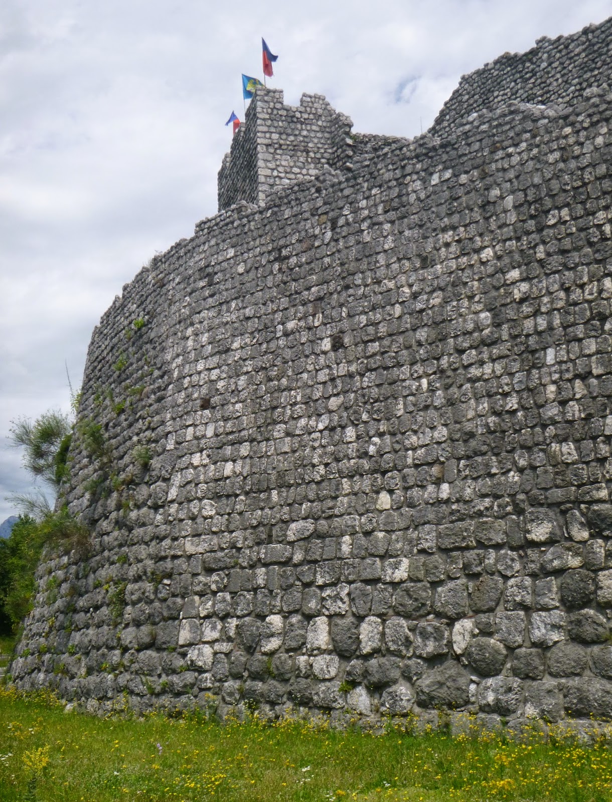
East tower Venzone

Empty moat, with crucifix

Empty moat looking north

West tower, Venzone

The well-hidden start of climb

View up the Venzonassa gorge


The dirt road climbing upward from tunnel


The dark tunnel. with pool

Looking back toward west, showing road gradient

Monte Chiampon (1709 m) from the north

The peaks to the southeast

Peaceful stream crossing at 650 meters

Pretty Plan di Frassin

I emerged from the wilderness onto this
switchback on the road to Tarcento


Tuesday, July 1, 2014

Giais Il Grave

Northwest of our village a huge scree slope scars the mountainside from ages ago.  Locally it's called Il Grave but I see Italian hiking guides calling it ghiaione or pietraia.  I've hiked up it a few times but never biked it as far as I can remember.  From Glera you head up the forest road which then bends left and keeps climbing.  Eventually the trees thin out and you arrive on the exposed slope.  A gravel road of sorts switchbacks up, but the gravel in many (most?) places has been overrun by the perpetually descending scree, which is mainly larger rounder rocks than you want to ride on.  I did pretty well ascending.  I had to hop off and walk up one particularly loose/deep rockslide, but for the most part I just kept going up and over it all.  I quit at 600 meters, where the hiking trail for La Palussa and Forcella di Giais veers off.  You can keep going but it gets steeper, and climbing while standing you will lose traction.

Descending is where I have trouble on these big round loose rocks- my wheels kind of bounce around between them like pinballs.  Those moon buggy balloon tires I've seen on some MTBs might help. Anyway this is a very cool feature, with great views of the plain below and the peaks above.

Giais and surrounding plain

Cortina and Glera, two of our neighborhoods

Looking up at Pala Fontana (hidden by cloud)

A crucifix around 500 meters

An alternate trail to La Palussa in the forest below il Grave