Friday, April 4, 2014

Casa Cadolten MTB

This is a new MTB route up to Il Cansiglio.  It begins in Sonego, a frazione di Fregona, near the left turn for Grotte Cagliaron.   Instead of turning left go straight up the hill on Via Col de Casal.  This is an old dirt road that is so steep they have concreted much of it so the rain doesn't wash it away.  It's so steep after awhile I couldn't climb seated even in the lowest gear, 24x36.  I could climb standing in 24x36 on the concrete but the dirt was too loose to get traction.  So I climbed seated for a few hundred meters, stopped to hyperventilate, then climbed seated some more till I had to stop again.  It was a killer.

Luckily the weather was perfect, cool and not too sunny, which helped a lot.  Finally the road reaches a flattish area around 1200 meters.  The road continues in a rolling profile now, with more concrete on the steeper bits.  Reached my destination Casa Cadolten, a Corpo Forestale outpost.  A little further through the faggio forest I reached the road to Monte Pizzoc and Il Cansiglio.  I put all my cold weather gear back on and descended to La Crosetta and then down to Sarone.  Got scary on the descent when I rounded a curve and some deer were in the road- locked up the rear tire which fishtailed a bit.  The deer hopped over the guardrail and escaped.  Good ride home, though quite warm, so I stripped down to shorts and thin shirt.  I will try this in the opposite direction next time, maybe climbing up the branch from Osigo.   

Just above Sonego, maybe 400-500 meters high

Turn off for descent to Osigo around 650 meters;
today instead I headed uphill

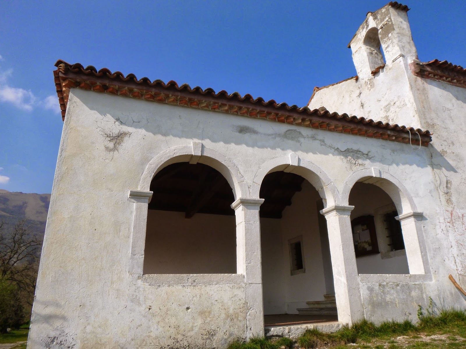
Sant'Antonio chapel around 970 meters
Col Visentin from near Sant'Antonio

Higher up the landscape changes to grassy hilltops


Looking back you see the box canyon you've been climbing up

Finally levels out a little at the trailhead for sentiero 1036a

Casa Forestale Cadolten

High above is Monte Pizzoc

Snowy junction at 1300 meters


The steep section 


Tuesday, April 1, 2014

April Fool's Climb

The ridge road from Frisanco to Valdistali is one of the prettiest rides in our area.  Lots of wildflowers, mountain views,  and a fun rolling profile.  The road heads down steeply at Valdistali toward Fiume Meduna, so I've always turned around and headed back toward Frisanco.  But today I thought I'd see how far down it goes.  It steeply twisted downward and I began to worry, until pavement ended at Forcella.  I put on my cleat covers and searched for a trail to Preplans, a village above the Meduna, but the slopes were almost vertical on 3 sides so I headed back up.  Wasn't as bad as I expected but still a good workout.  I'll try to reach Preplans on the mountain bike from Meduno- apparently there is a little bridge across the river at Paludea, and then a brief steep climb to Preplans. 

Valdistali

Madonna del Stangada church along the ridge


Saturday, March 29, 2014

Piancavallo

Haven't ridden for a week- been helping a neighbor with daily visits to see family in hospital.  So I thought I'd try a quick ride up Piancavallo this morning before driving to the hospital.  I was surprised how out of shape I got in one week- it was harder than I expected.  Luckily I survived.  A little dog like our "chihuahua" Honey welcomed me to the top.  Snow quite deep still- I was expecting it to be melting away.  Fun descent and I regained my strength for the 200 meter dislivello to Giais. 

The mountain from Castaldia (1100m)

Close up from Piancavallo


Friday, March 21, 2014

Dardago, Mezzomonte, Santa Lucia in Colle MTB

First mountain bike ride of 2014: rode up through Dardago to the left turn for Al Ciastelat.  Steeply up the paved road, past the restaurant driveway, then continue to end of pavement, where you take the gravel road to your left.  The dirt road (marked Tagliafuoco on the map) continuously varies from climbing steeply  to descending a bit and even levels off at times.  Some of the steeper bits have been concreted.  Eventually you end up climbing up to Mezzomonte at almost 500 meters and reach pavement again.   I sped downhill to Coltura, then crossed though Polcenigo and Santa Lucia.  Here I got a sudden urge to try and find the way to the church on the wooded hill, Santa Lucia in Colle.  This was a steep concrete road but I made it.  Then I decided to go over the top of the hill, which was even steeper concrete.  The rest of the woodland trails were dirt and moderately inclined.  Looks like a great place for Sunday walks/hikes.

Budoia from almost 400 meters

Dardago from around 400 meters

Santa Lucia in Colle

This church is in a secluded wooded area; you may be startled when the bells start pealing 

The front end of the church


Thursday, March 20, 2014

Colle San Giorgio Hike

I've driven past this place 10,000 times but never hiked up it.  Today the dogs needed a walk close-by so I thought I'd try.  I parked at the gravel road 100 meters north of Via San Giorgio- Via Pedemontana intersection and started hiking upward.  I wasn't on the correct trail so ascended very steeply, but soon arrived at terraced olives and fruit trees on the hillside below the church.  Took some photos and enjoyed the panorama, then headed down the proper trail, which  was bordered by primula and violets on this first day of Spring.  The pups had a great time; I'll try to return with them and Marilyn soon. 


Chiesa San Giorgio atop olive tree terraces

A carved tree still attached to its stump

Close up of church

View of Aviano

Like the arches and tiny bell tower

The entrance

Pala Fontana high above Madonna delle Monte

Giais's church (left background) and Marsure's church (right background)

Sign marking the actual trail

As you can see, the trail was precisely constructed
so two pups could walk side by side


Saturday, March 15, 2014

Lunga Via delle Dolomiti: Longarone - Caralte

I've been wanting to explore the bike path from Alpago to Austria and  today I finally rode a segment.  After riding up Valcellina to Passo Sant'Osvaldo, I descended through Erto to Codissago, across the Piave River from Longarone.  After a brief stretch on the busy main road, the bike route turns off and follows the old roadbed of SS51.  It's a wide, well-paved road, much more scenic than the bustling new route with its long narrow tunnels.   I continued up through Ospitale and Perarolo di Cadore .  Just after crossing Torrente Boîte I made a wrong turn, heading up to Caralte and the junction with the crowded new road.  So I turned back to Perarolo and located the correct road.  It's called Cavallera and has just recently been repaved for the bike route.  I'll come back and continue this route to Pieve di Cadore next time.  May start at Lago di Santa Croce so I can also try another segment which bypasses the narrow bridges between Ponte nelle Alpi and Longarone.  

Snowy Passo di Sant'Osvaldo (830 meters)

View to the east with mountains above Cimolais

Waterfall on the road from Sant'Osvaldo to Erto

Close up

The bike route signs

Tall steel arch bridge spanning the Piave River near Pieve di Cadore

Go straight here; do not turn right

Follow the blue and purple dashed road, not the road to Caralte

Thursday, March 13, 2014

Pala Barzana - Panuch

Decided to check Pala Barzana to see if the pass is open yet.  After the long tunnel I turned right and headed up through Bosplans.   At 690 meters the road was barricaded due to a landslip (frane) so I hopped off and hoofed it for 50 meters carrying the bike along the edge.  The rest of the road and pass is open.  I descended even slower than usual after hearing Joe William's harrowing experience with a rear blow-out above Poffabro last year.  He used his excellent bike handling skills to save his gorgeous new ti Passoni as well as himself, so a happy ending.  I would have probably flipped over a guardrail and down a ravine.

I skipped Poffabro and descended through Valdifrini then continued down Val Muie to Navarons.   At Lago di Tramonti I turned left and skirted the lakeshore to Chievolis.  Here starts the climb up Val Silisia to Lago Ca' Selva.  Crossed the dam and after a brief dirt stretch climbed the steep paved road to Panuch (639m).  Fun ride home.  

Frane at 690 meters above Bosplans

View north from Pala Barzana

Monte Rodolino from 530 meters above Lago Ca' Selva

Panuch trail head- I'll try to hike to Monte Raut this summer

Mountains to west above Lago Ca' Selva


Tuesday, March 11, 2014

Parco San Floriano Hike

Nice little hike for the pups this morning.  I drove to Polcenigo and we hiked around Parco San Floriano, a beautiful foothills park.  Lots of protected meadows and forested habitat for birds, animals and wild flowers.   They had a great time in the warm spring weather.

Mezzomonte across the Livenza

Snowy Piancavallo area to northeast 

Dardago's chiesa to the east

Entrance to 13th century Chiesa di San Floriano 

Trail on the left has been prepared for barefoot hiking

Blaze along the barefoot trail


Sunday, March 9, 2014

Giais Tempietto Longobardo Hike


The pups and I took a stroll down to Cortina and visited the Longobardo church, which has been beautifully restored.  As you can see in this video, previously it was a ruin.  Our village has been here for a millennium or two.

http://youtu.be/tl3NB1ea-4I


The tower
Arched entrance

The sanctuary with apse 

Side view of entrance

Around the corner, Santa Maria Maggiore 

Beautiful oval stained glass window in large house (canonica?)
near the Tempietto.   Note the very thick walls.