Monday, October 29, 2012

First snow

I saw the snow on the mountains behind our house when I woke up,  and later went outside to check the temperature.  My neighbor Nerina asked if I was going riding up there (pointing toward the mountains)-  after 16 years she can read me like a book.  I warmed up via Ponte Giulia (by Vajont) and Ponte Ravedis near Montereale, then began my first steep climb in 2 months.  Despite the 20 km warmup I felt a twang in my right shoulder ligament pulling up on the bars while climbing the 12% above Motel Spia.  After that everything felt fine.  Sunny and cool, autumn colors looked great and the only snow I saw was on Pala d'Altei high above.  At the astronomical observatory (685m) I turned around and coasted back down.  Nice ride!

Pala Fontana from my bedroom window early this morning


Valfredda (left), Pala d'Altei (right) 

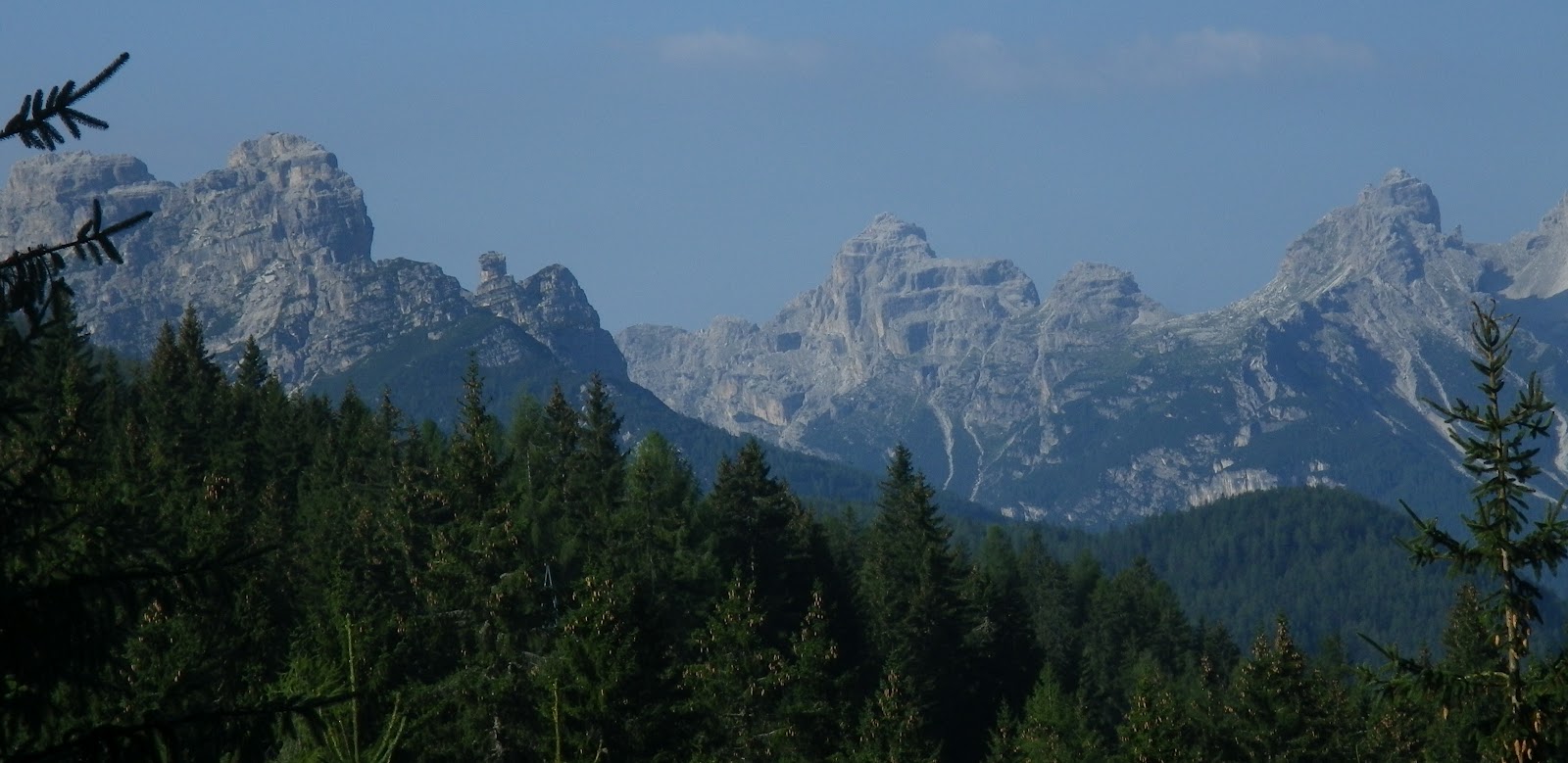
Alpi Giuliani to northeast from observatory

Montereale Valcellina, Ponte Giulia far right background


Tuesday, October 23, 2012

Parco San Valentino- Pordenone

Beautiful warm day so I biked to school for a change.  22 km of downslope, takes me 45 minutes going easy.  I arrived in Pordenone with 45 minutes to kill so I wandered around Parco San Valentino taking pictures.  After school the ride home is all slightly uphill, with a warm October breeze from the northeast.  Took about 90 minutes to get home.  I'll try to commute twice a week weather permitting (I'm a wuss about commuting in the rain).

Red leaf tree

Yellow leaves of sycamore tree

The pond and its surrounding wood

Monday, October 22, 2012

Meduno-Colline di Sequals

Beautiful warm sunny day- rode slightly up grade northeast to Meduno, then south to the colline di Sequals, a small range of morainic hills.   After the pretty town of Sequals, headed west through Arba, Maniago and home.

View northwest from the colline toward Monte Caserine Alte 2306m

Looking east toward San Nicolo


Saturday, October 20, 2012

Valcellina

Valcellina is another great local training ride.  Starts 4km from home at Montereale, with a gradual climb up through the 4km-long Monte Fara tunnel to Andreis and Lago di Barcis, then up the spectacular Cellina gorge to the turn off for Claut.  Or you can continue on to Cimolais and beyond if you wish.  

Today I got a late start because I was helping my neighbor stack firewood, so I turned around just past Cellino, where the gorge widens out and the river bends sharply east  toward Claut.  I love this spot because the river seems to always have fog rising off it here, which on the coldest winter days condenses and freezes on tree branches above the water, forming beautiful glass-like sculptures.  Also here- a big stand of river-bottom vegetation- very unusual around here.  

Looking back down the Cellina toward Monte Provagna

Looking over riparian flora toward Torrente Cellina,
with Monte Diasup in background

Nice panoramic view of Valcellina and mountains


Friday, October 19, 2012

Dardago - Val di Croda

This is an excellent local practice climb- a 10 km warm up to Dardago, then a gradually increasing slope: first a bit of 5-6%, then a long stretch of 7-8%, followed by a healthy portion of 9-12%.  Toward the end it settles down to maybe 6% briefly before turning to gravel.  The setting is lovely of course: trees and cliffs, looming mountains, and today a pretty young lady with long reddish-brown hair descending on her mountain bike.  I took it easy on the descent, struggling to overcome my kamikaze tendencies.  There was one long straight stretch where I spun out the 11-tooth cog, but I forced myself to brake and slow down afterward.
A portion of Croda di San Tomè cliffs- to get the full picture I'd need my hiking boots

Description of some Bronze Age artifacts found in the area


Wednesday, October 17, 2012

Meduno - Navarons - Bus di Colvera

We've had torrential rains this week so I was curious how full the narrow gorge at Bus di Colvera would be.   Just for variety's sake I rode the loop counterclockwise this time.   I started on the easy upward grade via Fanna to Meduno.  From here rolling hills to the turn for Navarons.  The road dives down to the bridge over Torrente Meduna, then steeply upward to Navarons.  From here saliscendi along Torrente Muiè, past Casasola steeply up to the junction below Poffabro.  Fast slight downhill along Torrente Colvera, then turn right on to the old road just before the tunnel.  This is Bus di Colvera, where the wide whitewater suddenly narrows to 10 feet through tall rock walls.  The rock has been carved into dynamic fluid sculpture, mirroring the eddies and hydraulics of the current.  After passing through the tunnel gap you continue down the Bus under sheer rock-climbing walls.  The old lane rejoins the wide modern road as it exits the tunnel, then you descend steeply to Maniago.  Easy ride home, with a diversion along Valcellina and Ravedis bridge.     

A cylindrical cavity, 5 meters in diameter and 10 meters deep,
where the turbulent torrente shoots into Bus di Colvera 

Torrente below high cliffs of Monte San Lorenzo 

Close up of cascade in torrente

More whitewater downstream


Sunday, October 14, 2012

Palu di Livenza

A few kilometers down Via Pedemontane, where the Prealps abruptly join the flat coastal plain, there is a large spring called la Santissima.  Most of the water forms Fiume Livenza and flows to the Adriatico.  But some water remains in a large boggy area called Palu di Livenza.  The abundant water created a perfect spot for a prehistoric settlement, with fish, plants and animals to eat, reeds for shelter, etc.  Archaeologists have dug up lots of artifacts from this prehistoric site, and there are some trails you can explore (but wear your wellies as it's quite muddy).  In my bike shoes I could only snap a few pics from the roadside.
Looking northwest across the Palu toward il Cansiglio

Stone arrowheads, spear tips, knives, and some ceramic pots 

Shows the archaeological dig and some diving in the springs 

Map

Some good fotos of the area

Palu is below Polcenigo on this GPS track

Friday, October 12, 2012

Vivaro - Tesis loop

Another local ride- from Vajont a wonderful slightly downhill, straight, smooth road for several miles to Vivaro.  Today a very large dude and small lady (wife maybe?) were going along at a leisurely pace/ talking so I passed and said Good day.  A while later the large dude with lady in tow caught up and passed- I guess I gave them something to chase.  So I rode along at their now-faster speed the rest of the way to Vivaro- quite easy with someone blocking the wind for you.

At Vivaro they went straight and I turned east toward Spilimbergo for a km or so, then north toward Tesis.  This is a quiet country road along fields and apple orchards, slightly uphill but not bad.  After Maniago industrial zone I turned west toward home.  Very peaceful ride, and good exercise.   


Monday, October 8, 2012

Arba-Cavasso Nuovo

I usually omit these short local rides, but who knows, maybe they will help someone looking for a warm-up or connecting them together to make longer flat rides.    From Montereale Valcellina  to Arba is a gentle slightly downhill ride.  From Arba you head northeast through Colle to Cavasso Nuovo, an easy gradient.  Then you follow the rollers west to Maniago, northwest along the Valcellina gorge to Ravedis, then up to Montereale.

My shock-proof Pentax Optio W90 was destroyed on Passo Furcia, sacrificed to save my right lower back (maybe hipbone too?) from a large pointy rock.  So today I tried my new camera, a Panasonic Lumix DMC-TS20.  So far seems pretty good.


Salton delle Calvre  (935m) from Ravedis bridge

Zoomed in a bit

From a different angle


Sunday, October 7, 2012

Check ride

For the first time in 6 weeks I pumped up the tires today and headed out on the bike.  To backtrack a bit, on the Passo Furcia descent (in late August) I couldn't slow down sufficiently before a switchback end, a car was ascending in the opposite direction so I couldn't use that lane, and I exited the roadway and fell.  Luckily there wasn't a sheer cliff or anything, just lots of rock.  The folks in the oncoming car stopped and helped me, decided I was hurt bad enough to call pronto soccorso and very kindly stayed with me until they arrived.  Pronto soccorso folks decided since my helmet was cracked I should see a doctor, so they hauled me and my bike down the hill to Brunico.  They xrayed my head and said no problem, but then checked my shoulder (bloodied on the back) and said I had a ligament contusion.  So I stayed the night and drove home the next morning.  Very nice folks at the hospital in Brunico (or Bruneck, because everyone speaks German there).  BTW I didn't mention all this in the Passo Furcia ride report because I thought it wasn't that bad of an injury, and I didn't want to detract from the climb description with extraneous details.

As it turned out the shoulder didn't heal very quickly (partly my fault because I continued with plans to drive to Switzerland and Tuscany in the following weeks, and kept doing household chores, mowing grass, toting heavy grocery bags, etc).  I kept ice on it much of the time and took aspirin for the pain.

Anyway it felt good enough today to try a ride up the little hill to Grizzo.  I was too slow to catch a pack from GC Meschio on the ride home, but still felt good to be riding again.  I'll try to post some ride reports in coming weeks- I'm reading a book about World War I on the Italian-Slovenian border so I'm itching to go riding near the Soça River area.


Soça Dreams...
(foto by xxmystique)

Saturday, August 25, 2012

Passo Furcia (X2) - Passo delle Erbe

Just down the road from Prato Piazza and Lago di Braies, the next climb rising from Val Pusteria along the Austrian border is Passo Furcia.  It's a frequent Giro d'Italia climb and after riding it today I can see why.  The north side starts easily near Valdaora (1020m), climbing through brilliant green pastures with views into Austria.  Then after Gassl (1135m) you hit 2 km with average grade of 9.5%, including a half kilometer of 13%. It slacks off again before Sorafurcia (1340m), where you face 1.5 km of 12.3%.  Again it cools down to 6.9% or so for the final stretch up to the pass at 1789m.

After passing a few ski lifts you head downhill.  More great views from here of the grassy mountainsides and towns like San Viglio far below.  You finally end up in the town of Longega at 1005m, in the upper end of Val Badia.  Here you begin another panoramic climb through beautiful pasture country up through Rina (1375m), down a dip to 1330m then up again to the junction for Antermoia (1455m).

More fun starts here, with some 12% ramps on the climb out of Antermoia, followed by 5km of 9.5% to Passo delle Erbe (2004m) .  Looming over the last few kilometers is Sasso Putia (2875m), with its very distinctive profile.

The ride down is fun.  After Longega you gradually climb on the main road from Brunico to Corvara, quite busy this time of year.  Then you turn upward through San Vigilio (1191m) and climb back up the grassy slopes.  The difficulty varies between mild to hard until Raro Miso (1375m) when it becomes consistently hard- 3.5 km of 10.4% average gradient.  This comes after you've completed challenging climbs up Passo Furcia from Valdaora, and Passo delle Erbe from Longega- quite tiring.  

Highly recommended!

Sasso Putia with Gruppo Sella in left background,
from descent of Passo Furcia

Pieve di Marebbe from Passo Furcia descent

Corte  di San Vigilio from climb toward Antermoia
(hazy!)

Sasso Putia from climb toward Passo delle Erbe

Sasso Putia from just below Passo

Man mowing pasture above Antermoia

 View of Rina from above

View down Val Badia  from Costalungia

Passo delle Erbe center, with Passo Furcia on either side

The over 10% stretches


The ride

Passo Furcia from Valdaora  to Longega

Passo delle Erbe from Longega
214 kph sounds a tad high

Thursday, August 23, 2012

Passo Cibiana (X2) - Zoppè di Cadore

These 3 climbs are close to home: just up Valcellina, across the Piave River at Longarone, and a short drive to Forno di Zoldo (812m).  I worried a bit when exiting the long tunnel near Barcis- it suddenly was raining.  It continued raining all the way over Passo Sant' Osvaldo and halfway up to Forno di Zoldo, but happily stopped just as I parked above Lago di Pontesei.  I warmed up for only a couple of kilometers before reaching the right turn for Cibiana.  The climb begins gradually at first almost like a continuation of the warm up, but at Villanova (890m) it tilts upward.  After a steep  kilometer of 11.7% average grade, you cross the lovely meadows at Cornigan (1240m) and climb steadily through fir forest to the pass at 1536m.  

The road was still damp from showers earlier in the morning so I descended quite slowly, particularly through the town of Cibiana di Cadore where people were out and about in the streets.  At the bottom of the gorge you cross Ponte sul Boite (774m) and climb fairly steeply to Venas di Cadore (852m).   Here you join the main road between Pieve di Cadore and Cortina.

I turned around and climbed back up to Passo Cibiana, with a 4km stretch above Cibiana di Cadore  averaging about 10%.  Then I descended to Fornesighe (965m) and turned off on the road for Zoppè di Cadore.  After a brief traverse to the beautiful hillside villages of Dozza and Bragarezza (930m) you begin the climb to Zoppè.

This was a very surprising road- wide, well-paved, wonderfully-engineered switchbacks.  For some reason I'd envisioned a rough, steep, narrow mountain lane.  The approach gives ample views of the pretty mountainside town of Zoppè, with the imposing dolomite peak Pelmo (3168m) towering above.  At 1470m you reach the top of the town with gorgeous views down the spruce forest-covered valley.  

I descended back through Forno di Zoldo, then down to the car by the lake.  I definitely want to return and get some photos, because my camera battery died before reaching Zoppè.  I'd also like to return to Passo Cibiana and explore a road leading up to Monte Rite (2160m), though I'm uncertain how high the road goes.  


Marmarole viewed on descent from Venas di Cadore to Ponte di Boite 

Antelao (3264m) from Cibiana di Cadore


Panorama to southwest from Cornigan

Close up of the mountains to south

Close up of Monte Civetta (3220m)

Monte Civetta from meadows of Cornigan 

The mountain backdrop to Cornigan's pastures

Lovely flowers Cornigan

Forno di Zoldo chiesa on hill above town


The ride
Climb from Forno di Zoldo to Passo Cibiana

Climb from Venas di Cadore to Passo Cibiana


Climb to Zoppè di Cadore

The "3 summits" (first 2 are opposite sides up the same climb) 

A view of the 10%-and-above gradients

4km stretch of 10% from Cibiana di Cadore to Passo Cibiana