Saturday, July 9, 2011

Monte Bernardia da Monteaperta

Today another exploration of the Julian pre-alps northeast of Udine.  I started from Nimis (207m) and headed up the cool gorge of Torrente Cornappo as before, but this time continued to Monteaperta, a hillside town at 635 meters.  Nice views of Monte Briniza (1636m) above, as well as the surrounding forested hills and valleys.  From here I continued on a lovely, level hillside road to Villanova (670m).  Great panorama here of Val Torre and the long high ridge of Monte Musi (1878m), separating the pre-alps from Val Resia and the Julian Alps.

From Villanova I followed the easy climb up to Monte Bernardia (850m) on a shady, quiet mountain lane.  Here is the restored Monte Lonza fortress from World War I, and a tall monument with beacon honoring the Alpini, Italian mountain soldiers.

The descent is a series of switchbacks, and surprisingly shady given its southern exposure.  I'll have to climb it though to see how it feels from that angle. 

Good ride, with many possible variations, Lusevera and Vedronza to mention only two.  I'll definitely be back. 


Tumbling stream along the level hillside road
from Monteaperta to Villanova 

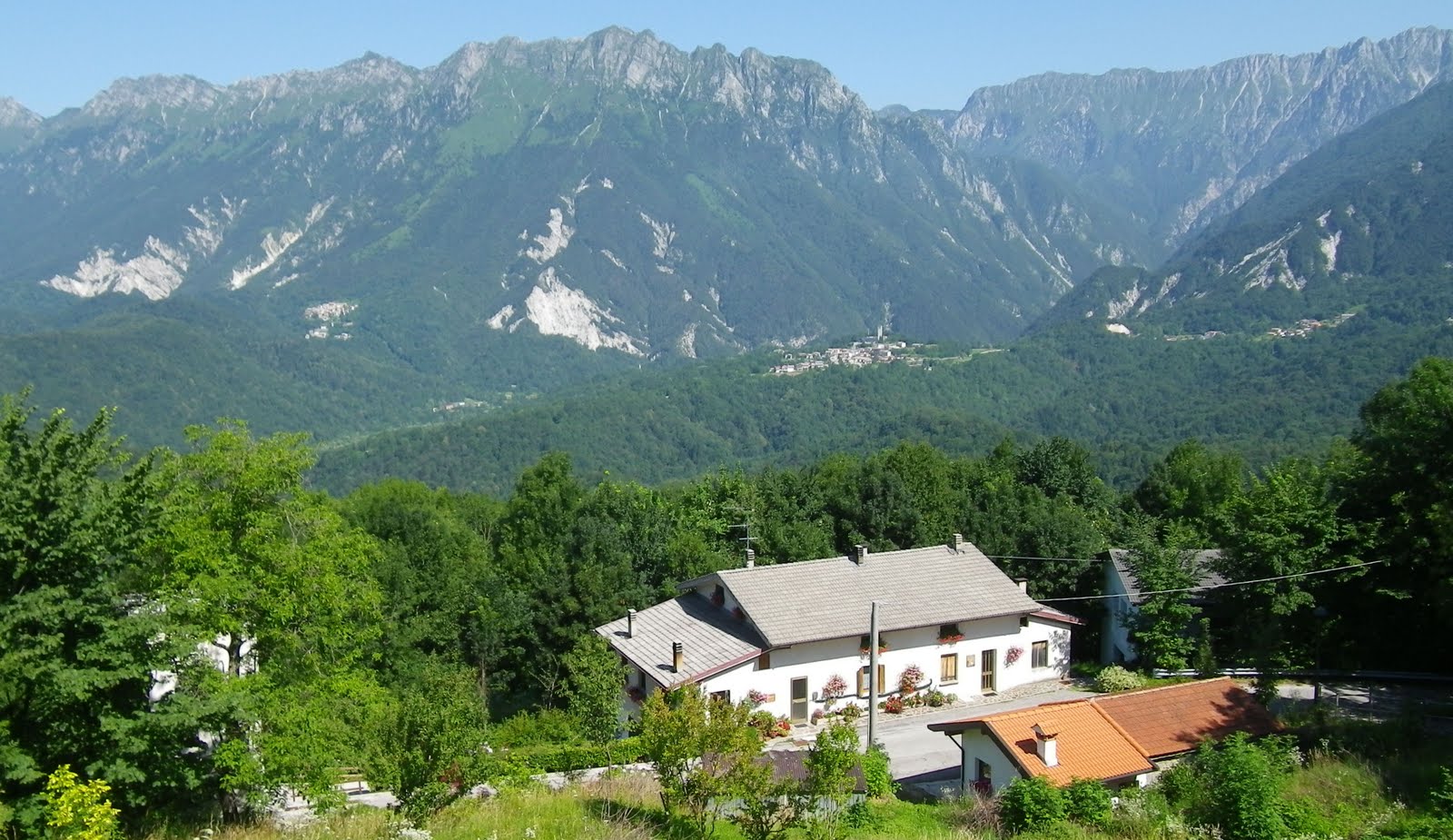
From Villanova- Val Torre below Monte Musi ridge

Monte Lonza fortress atop Monte Bernardia

Alpini monument and beacon

View of forest and vineyards to the south 

Elevation showing the average 10% gradient up to Monteaperta,
and the easy ascent to Monte Bernardia

From Val Cornappo, up to Monteaperta, and across to Villanova

Villanova to Monte Bernardia and descent

Wednesday, July 6, 2011

Mezzomonte, Val de Croda, Rifugio Bornass

No time for a long ride today so I tried to string together a few local climbs.  A heavy rain last night  cleared away the clouds, so it's sunny and mild.  I warmed up with a ride down Via Pedemontane past Polcenigo to Coltura (50m), and then climbed up to Mezzomonte (475m). 

Next I descended back to Polcenigo and climbed up past Budoia to Dardago.  From here a nice steady climb up Val de Croda to end of pavement at 535m.

Then I returned to Via Pedemontane and climbed past Aviano to Costa (205m).   From here I climbed past Madonna della Monte to Rifugio Bornass (767m).  Descending down the switchbacks toward Pedemonte gave me a chance to test my new brake pads.  My old Campagnolo pads were finally roasted after 3 years, so yesterday I switched them out for some aftermarket pads I bought awhile ago.  They worked ok, but not as powerful as Campy- they seem to require a bit more distance to stop.  On the fast stretch with double chicane, I got up to about 50 mph before hitting the brakes hard when rapidly approaching a  tornante and got a loud squeal from the front brake.  No problem, they'll work fine until new Campy pads arrive in the mail.

Good workout, close to home on a lovely sunny morning.  Love it here!  

Elevation of the 3 climbs

Mezzomonte and Val de Croda climbs

Rifugio Bornass climb and descent to Pedemonte


Sunday, July 3, 2011

Passo di Giau da Forno di Zoldo

Il Giau is one of the "must ride" climbs of Dolomiti Bellunesi.  Stupendous scenery, a challenging ascent, well-paved switchbacks on the descent- it's got it all. Today the weather forecast looked good so I thought I'd give it a try.  

I left early and drove up Val Cellina (beautiful fog bank covered Lago Vajont valley below Erto).  After Longarone I continued up Val Mae to Forno di Zoldo (827m).  Here I began biking toward Dont at a frosty 12℃.  The climbing quickly defrosted me and I reached Forcella Staulanza (1773m), with Monte Pelmo looming above at 3168 meters.  Now you begin an easy descent to Selva di Cadore, and the turn off for Il Giau at 1332m.  

I love the climb up Passo di Giau from Selva di Cadore: 29 tornanti through grassy meadows along a tumbling mountain stream, surrounded by spectacular peaks.  The gradient is a fairly constant 9.1%, so I stayed seated, except to stretch my back a couple of times.  Higher up the wind gusts picked up, which occasionally created the illusion of coming to a standstill (or rolling backwards) at this low speed.  But eventually I crested the summit (2236m).  Quite crowded up here on a July Sunday morning, with motorbikes, cars, tour buses and even a few cyclists mulling about.  The wildflowers were quite pretty but I'm afraid I was beginning to freeze up here and didn't stay long enough to photograph them.

The descent was fun, fast and curvy.  Reaching the bottom, I began the longish ascent back up Forcella Staulanza, which felt good because it thawed me out.  Cold again on the descent from the forcella to Forno di Zoldo.  I think I got a touch of hypothermia toward the end- I was suddenly convinced I had missed the towns of Dont and Forno di Zoldo where the car was parked and was headed for Longarone.  Luckily I soon spotted my car and came back down to earth.     

If you come to the Dolomiti on holiday try to include Passo di Giau in your itinerary- it's a  really special place.

Looking south from Fusine

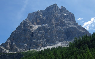
Monte Pelmo 3168m from Palafavera

Monte Civetta 3220m from Palafavera


Horses snacking with Monte Civetta in background

View down valley from Santa Fosca 1424 meters


From the switchbacks of Passo di Giau- looking south
Looking up toward Il Giau
Wider view

Mountains to southwest from Passo di Giau

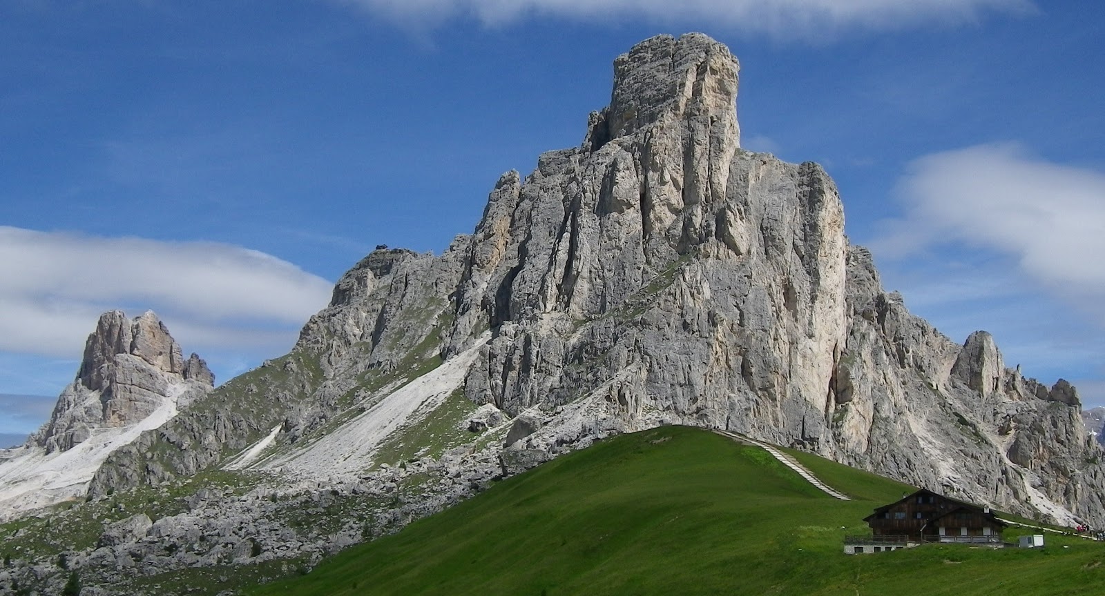
Peak atop Il Giau

Mountains to north


Panorama north-northeast

Panorama to east 


From the pass looking west

Looking west from the pass

Close up of peak atop Il Giau

Close up of  Monte Marmolada 3205m

Monte Pelmo from Forcella Staulanza

Elevation


Friday, July 1, 2011

Kolovrat - Livek

Last month I visited the Italian side of the World War I battlefield Kolovrat.  Today I decided to check out the Slovenian side of the ridge, as well as the valleys far below.


It was quite windy and cool when I started riding at Ponte San Quirino, just east of Cividale.  I warmed up on the flatish road to Clodig, but instead of heading up the climb to Drenchia like before, I turned right at Clodig toward Lombai.  This route climbs the opposite side of the Cossiza gorge, and is somewhat less steep but still a good workout.  After reaching the gorge rim around 630m, this route follows the rolling topography to 795m.  Here you turn right toward Kolovrat and Rifugio Solarie, ascending steeply until Passo Solarie (960m).  

After crossing the Slovenian boundary, you make a left turn marked Livek (going straight takes you to Kambresco).  Moments later, another junction, where you turn left for Kolovrat (going straight takes you to Tolmin).  The road for Kolovrat ascends, somewhat steeply but not bad.  Soon you reach the rolling ridgeline and follow it along the frontline fortifications of a century ago.  There are occasional tunnel/trench entrances marked with signs.  At the midpoint is a flat path across Passo Zanuso to the Italian side of the ridge.  There are beautiful views of the Soča River valley and surrounding mountains all along the route.

I continued to a highpoint of 1140m, and then began descending, first gradually and then more rapidly.  The road is quite rough, so I held onto my brakes (plus it was cold and I didn't want to freeze).  There were some steep pitches here (maybe 18%), so climbing it will be a challenge (especially from Idrsko in the valley, at 209m)  Eventually I reached Livek at 693m and turned toward Italy.  This is a nice rolling pass which then descends steeply to Cepletischis (550m).  Here begins the wonderful descent through the Alberone gorge, which I previously rode after climbing Matajur.  Great fun!


Monte Matajur from south rim of Cossiza gorge 

Slovenia hills to the south of Passo Solarie

Soča River valley to southeast

Soča River to the north

Slovenian mountains to northeast of Kolovrat

The mountain range continues toward the east

Goats cavorting in pasture above Livek

Livek with Monte Matajur looming above

The taller Julian Alps farther north; Kobarid in foreground,
site of pivotal Battle of Caporetto

Looking back toward Livek from Italian border


Profile of elevation

Note the steep gradients descending toward Livek

Map of the ride