Showing posts with label Monte Pizzoc. Show all posts

Saturday, July 11, 2015

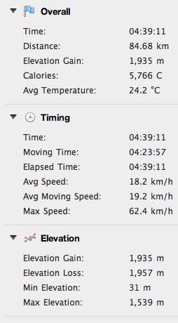
Monte Milifret - Mezzomiglio MTB


I've been meaning to ride this for years and finally got around to it.  It completely blew away my expectations.  The first step was to climb Monte Pizzoc.  Just for fun I decided to MTB up from Osigo to Campo Cadolten.  I'd ridden it from Sonego last year and was curious how the Osigo route compared.  Climb through Osigo and after the 1st switchback on Via Cansiglio turn off onto Via Pravinera.  This is steep concrete and dirt road, as from Sonego.  At 900 meters you reach Chiesetta di Sant'Antonio, then keep on grappling up a little sun-exposed canyon till you reach the altopiano of Cadolten.  Beautiful green pastures surrounded by tall beech and spruce.  At the Pizzoc road, continue up to end of pavement above 1500 meters.  

Take the gravel road toward Rifugio Citta' di Vittorio Veneto then continue on toward La Croda (bar).  The markings aren't too clear here but luckily I looked up while scratching my head and saw a MTBer on a grassy ridge above.  I found the trail (unmarked except for some Fregona Trails streamers) and crossed the rising grassland.  Now it steepens and you begin technical climbing up the west face of Monte Milifret (which means I was carrying my bike).  My hopes were rising and soon I reached the place I've been wanting to see for so long: the cliffs at the top of the gorge climbing from Vittorio Veneto to Lago di Santa Croce.  I tiptoed out to the edge and it is essentially vertical for maybe 800 meters down.  Wow!

I now pushed/rode the bike along a trail that traverses the eastern side of Monte Milifret.  Still high but now you're traversing slopes above the forest rising from Cansiglio altopiano.  The trail gradually gets easier (less bouldery) and enters red spruce forest with many exposed roots.  At a junction leading to Pian de la Pita I finally got confirmation: I was on the ridge trail Sentiero delle Piaie Longhe Milifret.  This was my goal because last year I tried riding the lower trail H3 from Mezzomiglio and it was an impassable mud bog.  This higher trail was much better.

The trail widens a bit though still rocky and rooty so I was able to ride pretty well.  It then begins descending gradually so I stayed on the brakes.  The woodland abruptly ends and you enter the rolling grassland above Mezzomiglio.  I followed the path and then a gravel road I remembered from years ago, eventually heading toward the junction with the gravel road toward Palughetto.

This joins the main road across Piancansiglio to La Crosetta, then the descent toward Vittorio Veneto and the car.  Must return and explore this area more.  Great snowshoeing in winter too.     


Chiesa San Giorgio, Osigo
Chiesetta Sant'Antonio

Interior of chiesetta


View from above of Cadolten altopiano

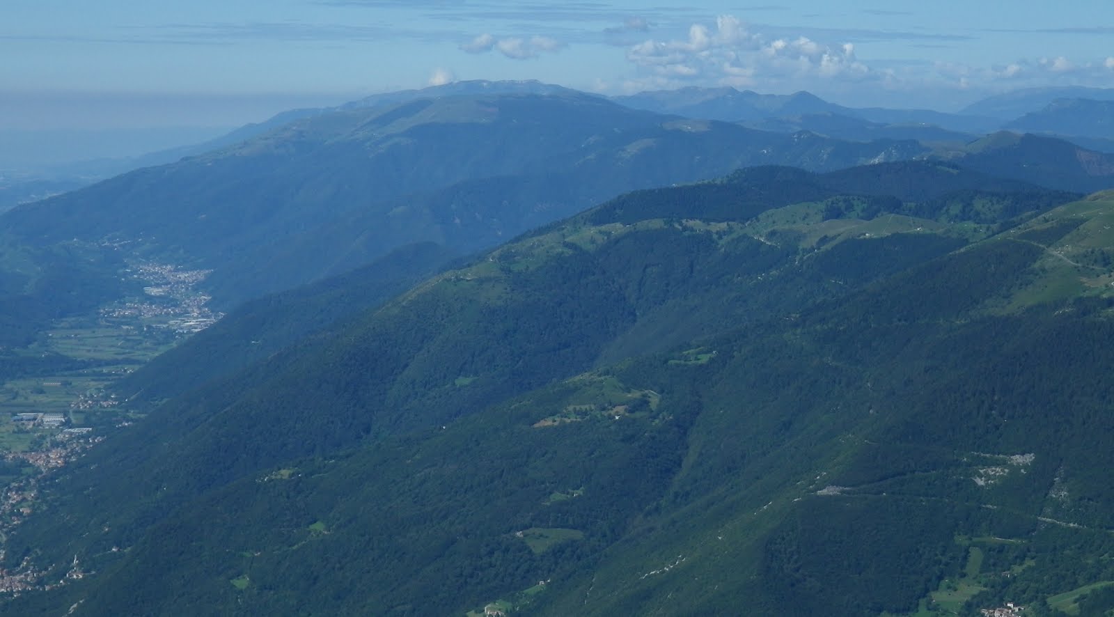
Monte Pizzoc from Monte Milifret

Fadalto, Lago Morto, Monte Faverghera

Lago di Santa Croce and Monte Dolado

Monte Milifret cliffs

Trail through the red spruce forest

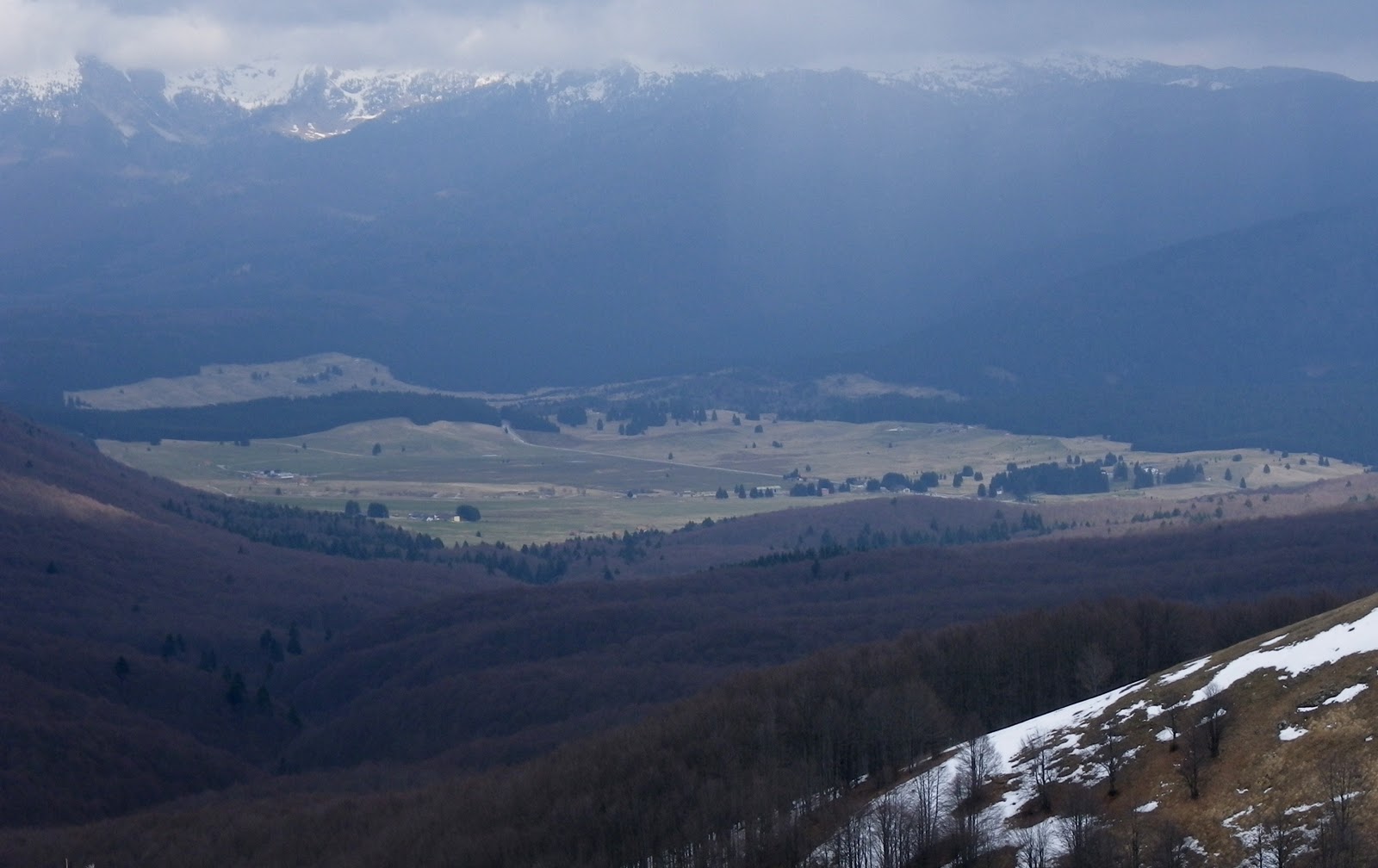
The grassy alto piano above Mezzomiglio

Sunday, July 27, 2014

Monte Pizzoc

Our weather has been stormy off and on so I tried to work in a short local ride this morning.  On the road bike I cruised down to Sarone and headed up to La Crosetta at 1100 meters.  From here a little dip down toward Il Cansiglio and a left turn toward Monte Pizzoc.  This beautiful road climbs through a forest of large beech trees up to around 1400 meters, where the forest opens into alpine pastures, then on up to 1550 meters where the road ends.  Great views up here even with the cloudiness.  Descent and ride home were fun too- didn't even get cold.  And best of all- no rain.

View west toward Vittorio Veneto, prosecco area,
and Monte Cesen in distance

Northwest: Col Visentin, Bellunese dolomiti

To east: Il Cansiglio grassy altopiano, Monte Cavallo in distance

Wildflowers at summit

Looking down at the Cadolten area I recently rode the MTB to from Fregona


Friday, April 4, 2014

Casa Cadolten MTB

This is a new MTB route up to Il Cansiglio.  It begins in Sonego, a frazione di Fregona, near the left turn for Grotte Cagliaron.   Instead of turning left go straight up the hill on Via Col de Casal.  This is an old dirt road that is so steep they have concreted much of it so the rain doesn't wash it away.  It's so steep after awhile I couldn't climb seated even in the lowest gear, 24x36.  I could climb standing in 24x36 on the concrete but the dirt was too loose to get traction.  So I climbed seated for a few hundred meters, stopped to hyperventilate, then climbed seated some more till I had to stop again.  It was a killer.

Luckily the weather was perfect, cool and not too sunny, which helped a lot.  Finally the road reaches a flattish area around 1200 meters.  The road continues in a rolling profile now, with more concrete on the steeper bits.  Reached my destination Casa Cadolten, a Corpo Forestale outpost.  A little further through the faggio forest I reached the road to Monte Pizzoc and Il Cansiglio.  I put all my cold weather gear back on and descended to La Crosetta and then down to Sarone.  Got scary on the descent when I rounded a curve and some deer were in the road- locked up the rear tire which fishtailed a bit.  The deer hopped over the guardrail and escaped.  Good ride home, though quite warm, so I stripped down to shorts and thin shirt.  I will try this in the opposite direction next time, maybe climbing up the branch from Osigo.   

Just above Sonego, maybe 400-500 meters high

Turn off for descent to Osigo around 650 meters;
today instead I headed uphill

Sant'Antonio chapel around 970 meters
Col Visentin from near Sant'Antonio

Higher up the landscape changes to grassy hilltops


Looking back you see the box canyon you've been climbing up

Finally levels out a little at the trailhead for sentiero 1036a

Casa Forestale Cadolten

High above is Monte Pizzoc

Snowy junction at 1300 meters


The steep section 


Sunday, May 12, 2013

Monte Pizzoc da Villa a Villa

Heavy rains yesterday washed all the haze from the sky, and this morning was crystal clear.  I headed through Caneva to Villa a Villa and began the climb.  This is probably the prettiest of the southern approaches to il Cansiglio, as well as the least-travelled and shadiest.  Despite the shady stretches I was very hot until 750 meters, where I submerged into a thick, dark, and cool beech forest.  This wonderful environment continues to 950 meters where you join the road coming up from Sarone.  The beech forest also continues, though the trees are a bit further apart. 

After La Crosetta you descend briefly and then turn left toward Monte Pizzoc.  They've paved this road recently so it's very smooth.  The high beech forest is even more spectacular, with tall, thick trees and mossy karst-stone understory.  Around 1400 meters the forest gives way to alpine meadows.  Now big thunderheads were forming overhead, but still with beautiful clear views across the plain to the Adriatic coast curving from Istria to Venice.  Quite cold up here- everyone was wearing parkas with hoods. 

I descended rapidly to Sarone then it rained until I reached Polcenigo.  It actually felt pretty good, maybe because I was still euphoric.  My wet clothes dried out on the remaining ride home, keeping me from overheating.  Great ride!


Gorgeous alpine meadows

The plains below stretching east, Adriatico in background

Grassy meadows of Piancansiglio, backed by Monte Cavallo group

Prosecco valley stretching west from Lago Revine toward Valdobbiadene

Vittorio Veneto, the prosecco zone, Il Montello,
Venice laguna in background

Thunderheads getting bigger, time to descend


Thursday, May 24, 2012

Monte Pizzoc da Villa di Villa

This climb is really 2 climbs in one. The first, from Villa di Villa to La Crosetta gains 1037 meters in 15 km. After a short descent the second, Monte Pizzoc gains 438 meters in 6.5 km, reaching altitude of 1549 meters.

I warmed up on Via Pedemontane to Caneva, then headed toward Sarmede. At Villa di Villa you just keep heading uphill. You climb along the rim of a cava or open pit mine and then enter a zone of cespugli or scrubby trees. They give a little shade here and there, quite welcome on this hot morning. Finally around 700-800 meters altitude you enter a deeply shaded forest of beech and spruce trees. Always feels like cool, refreshing twilight along this stretch. The pavement through here is pretty torn up- better suited for a mountain bike. At 980 meters you join the well-paved road coming up from Sarone-Caneva, and continue through the shady woods until La Crosetta at 1118 meters.

After a short downhill stretch you turn left and hit the steep start of Monte Pizzoc climb. They have repaved much of this road since I was last here and it's excellent, both to climb and descend. Before you had to dodge crumbling pavement, craters etc which made fast descending terrifying. This is one of the prettiest forests around here- very tall, wide beech trees with lots of space between them. The trees give way to alpine meadows at 1350 meters, with great panoramas on clear days. You continue grappling up the slope until 1530 meters where pavement ends. I continued on dirt to the flat summit at 1549 meters.

The fast descent felt great. I continued down to Sarone, where it was quite hot, and on toward home.


Terraced meadows at 450 meters

The hazy valley of Revine Lago and Cison di Valmarino

Col Visentin 1763m

Il Cansiglio with Monte Cavallo in background

Beautiful area between Vittorio Veneto and Monte Pizzoc
 I need to explore this

Rode clockwise

1450 meter climb in 22 km
(including the short descent after La Crosetta)


Tuesday, August 16, 2011

Monte Pizzoc

Monte Pizzoc is another favorite local ride- rising from 31 meters up to 1536 meters, with challenging gradients, and beautiful scenery.

I left shortly after 7 AM riding the rolling hills down to ristorante Trota Blu and the turn off for Sarone.  The climb from here up to Malga Coda del Bosco (870m) has mostly southern exposure, so leave early on sunny summer days.

2 guys passed me on the middle of the climb, then slowed down.  I rode behind them up past the malga, then passed them.  This section is shaded by dense beech forest, and feels much cooler.  I reached the little pass La Crosetta (1118m) and continued downhill for a kilometer for the turn off for Monte Pizzoc.  The 2 guys passed me again, so I rode behind them awhile.  They turned off at Via Zuel (1280m) while I continued toward Pizzoc, so I thought they were gone.   A few minutes later they passed again.  What the heck?  Anyway they gradually slowed down again when the road got steeper around 1350 meters, so I ended up catching them again.  Very strange.

I continued briefly past end of pavement up to a nice flat look out area.  I was taking pictures when a very friendly man with his wife asked if I wanted him to take my picture.  I thought he might want one of them as well so I could send it to them later, but no.  He was very kind.

I descended briskly (fun but scary during vacation season, as people now have bigger cars, SUVs etc which take up most of the road, particularly in switchback turns).   At the bottom I felt pretty good and made it home (20km) fairly quickly, despite the heat.  Great ride!


Piancansiglio meadows, backed by mountains to the east

Sorry about the helmet hair

Tall peaks of Dolomiti Bellunesi 

Looking up Strada del Prosecco, from north end of Vittorio Veneto,
past Lago Revine and Tovena toward Valdobbiadene

Left background Monte Cesen (1750m), with Monte Grappa peeking from behind;
right foreground Monte Viscontin (1763m), with Pian delle Femene and Pian dei Grassi meadows 

Family of asini hanging round the watering hole

Campanule in alpine meadows of Pizzoc

Close up of campanule


Tuesday, March 29, 2011

La Crosetta to Monte Pizzoc

After raining all night it was clear and sunny this morning.  I cruised down Via Pedemontana to Sarone (50 m) and headed upward.  I remained seated for most of the climb up to La Crosetta at (1127 m), with many stretches of 10-12%, and a few pitches at 13-14%.  It was sunny and hot for the first half, then a big black cloud appeared and it cooled off.  Even had a little light sleet, but not bad.

After La Crosetta there's a short downhill, and the climb to Monte Pizzoc begins.  They've repaved the first half km, which is quite steep and previously had a lot of loose stone and pavement.  Much better now.  Then the road climbs up through beautiful old beech tree forest with signs marking several biogenetic zones. Around 1400 meters this beautiful environment ends, and you enter alpine meadows.  They are covered in tufts of grass, which look a little like Cousin It of the Addams Family.  Some snow persisted in the fields along the road, and several of the round cattle ponds were still frozen over.  At 1540 meters the pavement ends.  I got a few pictures, but not the greatest because of the clouds and haze.

Very cold on the descent.  Warmed up a little around 600 meters when the sun came out.  After rejoining Via Pedemontana I spun all the way home.  Felt pretty good- didn't bonk because I drank plenty of fluids.  I will sleep very soundly tonight.

Lago Revine west of Vittorio Veneto

Clouds and mountains above Piancansiglio

Gradient to La Crosetta then to Monte Pizzoc

Satellite foto of climb to La Crosetta

Climb from La Crosetta to Monte Pizzoc