Showing posts with label Kobarid. Show all posts

Sunday, June 22, 2014

Valli del Torre - Soča River Loop

I drove to Nimis (200 m), parked the car, and began pedaling up Val Cornappo.  After a couple of kilometers I took a left toward Ramandolo.  Very quickly the road begins snaking through vineyards at a steady 7-9%: it would be wise to do a longer warmup.  The gradient finally flattens at Chialminis (660 meters) and I descended stepwise to Villanova, Lusevera, and Vedronza (310 m).

Here you begin a very gradual easy climb up Valli del Torre, then head east to Passo Tanamea (839 m).  Very fun descent with fast chicanes along Rio Bianco and Torrente Uccea to the bridge on the Slovenian border (540 m).  Another climb out, this time to 700 meters, followed by fast descent to Žaga (330 m).  This is the main road along the Soča River, so quite busy on a Sunday with motorcyclists, vans hauling trailers full of rafts and kayaks etc.  Beautiful views of the surrounding mountains, though overcast and hazy.

At Kobarid I turned away from the river and headed west toward Val Natisone.  Shortly afterward, I turned right toward Breginj.  Very peaceful easy climb: I could hear the chorus from the church at Cred- very different harmonies than I'm used to hearing in the US.  The road heads north on the flank of Stol, a tall long ridge separating the area from the Soča River.  After Breginj at 608 meters you head steeply down toward the Natisone on a very rough road.

Crossing the bridge at 381 meters you start the last climb.  First you reach Platischis (625 m), then Passo Sant'Antonio (758 m), afterwards dropping down to Campo di Bonis and reascending to Taipana (739 m).  Long fast descent  to the Cornappo and then to Nemis.

Good workout- now I'm exhausted.


Ramandolo vineyards

View from Villanova

Torrente Torre toward Monte Musi

Torrente Torre toward Tarcento

Wild valley of Učja River  

Mountains above Žaga

Mountains northwest of Žaga

Breginj church


Natisone River flowing south


Sunday, September 22, 2013

Planina Zaprikraj MTB

A couple of years ago I reached the summit of Kolovrat and ogled the luscious Soča  River valley.  I noticed a beautiful church half way up a mountain above Kobarid and always have wanted to go visit.  Today was my chance.

I drove to Ponte San Quirino in Val Natisone and biked across the Slovenian border to Kobarid.  Immediately after you cross the Soča on Ponte di Napoleone turn left and head up hill.  This is a wide smooth road with well-engineered switchbacks for an easy gradient.  At 530 meters you reach the little town of Drežnica with its spectacular church, Sacro Cuore.  Somehow this escaped the artillery bombardments from both sides during World War I.  After crossing a forested ridge you enter a gorgeous grassy meadowland surrounding the village Drežniške Ravne around 600 meters.   Take a right onto the road marked Planina Predolina.

This is a narrow paved road and quite steep.  It reminded me of the road from cimitero di Mezzomonte to Col de Palse.  The difference being the pavement here ends at 700-800 meters, and you're climbing a dirt road.  Not too bad because any time the gradient gets up over 10% they've concreted the road so you have few traction problems.  When I say over 10% sometimes it's way over, like 16-17%.  I stayed seated on almost all of this thanks to the easy mountain bike gearing.

Finally around 1100 meters the dirt road levels out some.  You cross through a gate, then cruise downhill over a cattle grate near a farm.  A hiking path to the left goes to Krasji Vhr, 1773 meters.  The right road goes up and to the left above the farm, through a gate, then continues to Planina Zaprikraj around 1250 meters, and further down to Planina Predolina at 1190 meters. These are meadowy areas with many World War I ruins.  I saw a tunnel entrance and some very cool trench type fortifications.  They were a bit dark for my camera so please look at the professional pics at http://www.potimiruvposocju.si .

The ride back downhill was quite fun.  Disc brakes are excellent- maybe I'll get them on my next road bike (in the year 2020).  Kobarid was pretty crowded with tourists now but I eventually made it through there.  Then a good "cool down" on the road back through Val Natisone.  I want to return here soon and try some variations of this ride.


Sacro Cuore at Drežnica 

Close-up Sacro Cuore

Hay drying rack at Drežniške Ravne

Meadows around Drežniške Ravne

Looking back at  some of th grasslands I crossed on the climb,
with mountains across Soča River in background

Adorable baby asino at 1000 meters 

Friendly dark chocolate horse sharing her paddock with asini

High up the slope a flock of grazing sheep

The farm on the way to Planina Zaprikraj

Monte Krn (2244m) above on the right

Planina Predolina, with Monte Javoršček (1557m)

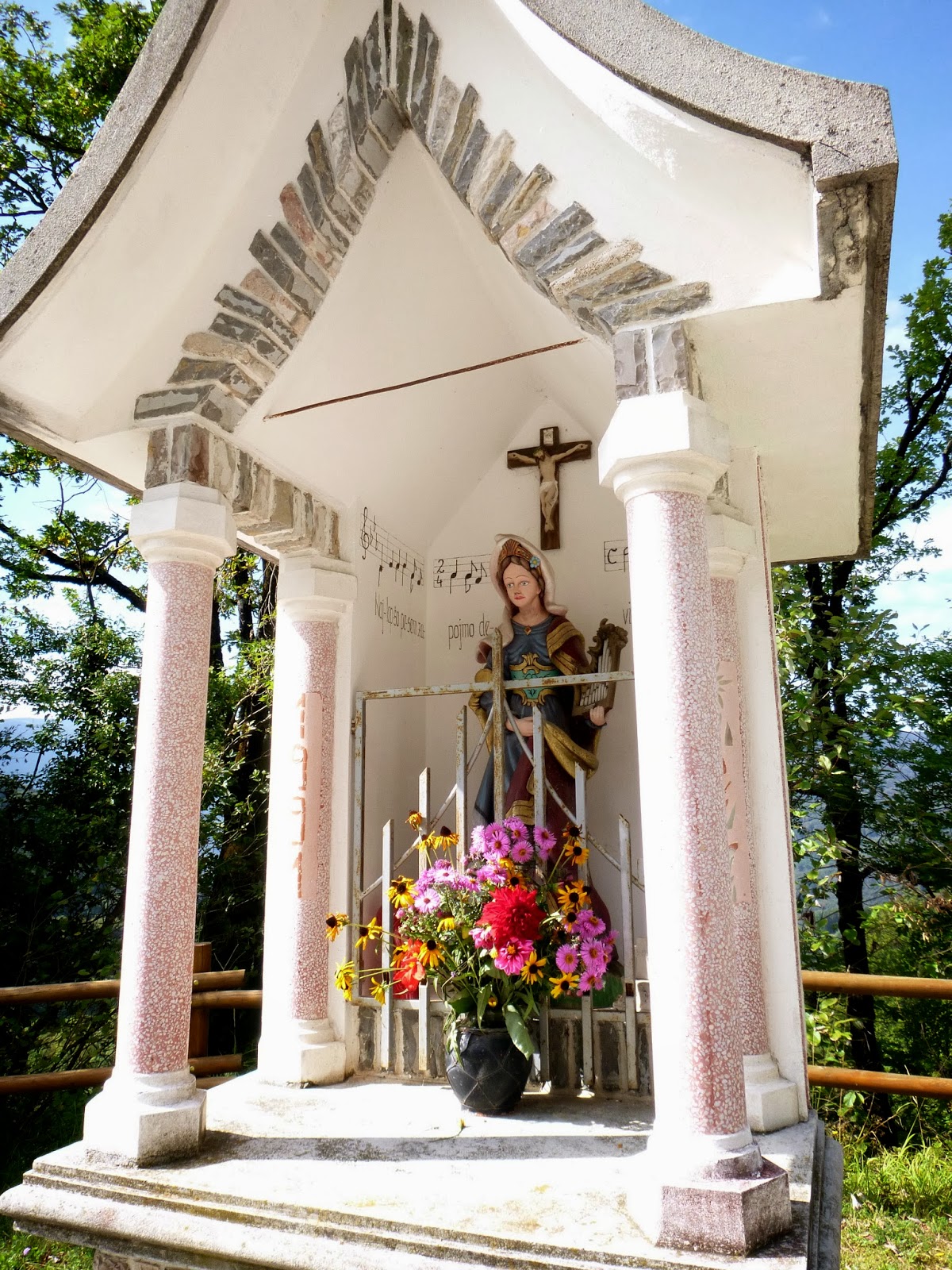
Cappelletto with musical staff showing the tune to the hymn


Sunday, June 30, 2013

Krn

Last week we visited the Tuscan coast for a few days, with no bike riding but plenty of walking.  So I was a little rusty today but after a nice warm up along Val Natisone from Ponte San Quirino to Kobarid, Slovenia I felt good as new.  At Kobarid I found the road that crosses the Soča River on Ponte di Napoleone, then followed the river to Ladra, where the climb begins.  Up through Smast and Libušnje and then Vrsno.  Here the road coming up from Kamno intersects, and a steep half kilometer of 15% begins.  

When the grade eases up, the road starts traversing almost level for about 2 km, with some beautiful shady beech forest to cool you off.  This comes to an end at a stream crossing, and you hit a kilometer of killer 13%-17% average gradient up to Krn.  This was the toughest part of the climb.  Above Krn the steepness lessens to a mere 9-10% average for a couple of km till end of pavement at Planina Kuhinja.  From here you can hike up to the top of Monte Krn (2245 meters)- see http://www.hribi.net/izlet/planina_kuhinja_krn_/1/150/280 .

I coasted back down and after Kobarid I felt rested so I rode fast as I could back to Ponte San Quirino.  This is a wonderful climb and I'll be back to try some variants soon.  

Looking back at Val Natisone from road to Ladra 

Beautiful church at Libušnje above Soča River

Vrh nad Peski, 2176 meters
Maselnik, 1903 meters

View down the Soča valley toward Gorizia

Monte Matajur, 1385 meters 

Monte Krn on left, 2245 meters

View north up Soča gorge from Ponte di Napoleone

View to the south


Tuesday, July 19, 2011

Kolovrat da Kobarid

Drove to Ponte San Quirino east of Cividale, and rode up beautiful Valli del Natisone to Slovenia.  Wide smooth road through the forested hills along the river, completely deserted at 7 AM today.  Maybe later in the day it's more crowded.   Very easy rolling warm-up- I think it gained only about 100 meters in 20 km.  Once in Slovenia the valley opens into wide green meadows, morning mist rising, foals following their grazing mothers.  I stopped to take a picture and heard some scurrying in the brush- a pair of yearling deer appeared.  This area of Slovenia is really gorgeous.

You leave the Natisone River behind and now approach the Soča River (Isonzo in Italian) at Kobarid.  This town was the site of a big turning point in World War I.  The Germans (and Austro-Hungarians) found a weak spot in the Italian defenses and broke through.  The entire Italian army then had to fall all the way back to the Piave River (in Veneto) to establish a new defensive line.  I skirted the west side of Kobarid and arrived in Idrsko.  Here the climb to Kolovrat begins.   

From Idrsko (210m) up through Livek to Kolovrat the road gains 930 meters of elevation in just over 10 km.  The first 4 km to Livek (690m) are the worst, with numerous stretches above 14%.  I stood on these steep sections, panting and gasping.  Luckily it was quite overcast so I didn't overheat.  On a bright summer morning this sun-exposed slope could be tough.

At Livek the road actually gets flat for a few moments.  Beautiful houses with wooden balconies covered in geraniums here.  Now the road turns upward again, but for the most part stays between 10-13%.  Still hard, but I could remain seated and breathe.  Near Monte Kuk the road tops out at 1148m.  Now it continues rolling up and down along the ridge of Kolovrat.  A small cadre of cows grazing along the narrow road were blocking the way, so I tried to gently encourage them to gather on one side or the other.  They got spooked and started trotting along the road.  I tried to reassure them of my harmless intentions ("I don't even eat hamburgers!") but couldn't sway them.  Eventually a gap opened and I accelerated through.  Felt bad about making them move several hundred meters down the road, but hopefully they found some good forage there as well.

Now the road curves west and climbs up into Italy at Solarie.  I began a wonderful counter-clockwise circuit along the side of Drenchia's bowl-shaped valley, then through Cras and steeply down the smooth, steep switchbacks to Clodig.  From here a gentle downhill ride to Ponte San Quirino.   Great climb and a fun ride.


Sorry for lack of fotos- camera battery died before Kobarid.

Misty cliffs above meadows in Slovenia

Little deer in woods near the meadow's edge 

Broad meadows stretching west from Kobarid toward Italy

Little farm below hillside

 4 km of 11% average gradient Idrsko to Livek

3 km of 10% average grade Livek to Kolovrat

14% stretches up to Livek / 12-13% bits up to Kolovrat

Map of climb from Walks of Peace in Soča Region


Map of the ride