Friday, August 12, 2011

Monte Rest from South and North

Monte Rest is another wonderful local climb.  I decided to climb both the south and north approaches today instead of riding a loop to save time.  They are two quite distinct ascents.

After a long warm-up through Meduno (313m) and over the rolling hills to Tramonti di Sopra at 407m, the climb proper begins.  Beautiful switchbacks through the forest, streams brimming from the recent rains, and wildflowers covered with butterflies- this is a fantastic ride.  At Passo di Monte Rest (1060m) the road crests in a lovely spruce forest, and begins the plummet to Torrente Tagliamento (512m).

After reaching the river, I crossed the bridge and followed the flattish road along the riverbank for a kilometer or so.  I then turned back toward Monte Rest and started the ascent of the north side.  This climb is a bit more rugged, with short erratic switchbacks, but no less beautiful than the south side.  The streams, waterfalls and big trees are spectacular, to say nothing of the views of Val Tagliamento and surrounding peaks.

After the pass I zoomed down slope, with a few stops for fotos.  There were more bikers ascending the climb now, unlike earlier this morning.  I continued home and felt pretty good, completing 112 km with 1777 meters of climbing.

Both approaches to Passo di Monte Rest are excellent climbs and highly recommended.             


Looking west up Val Tagliamento  

Northeast down Val Tagliamento 

From the Tagliamento bridge

Cascade of Rio Grasia

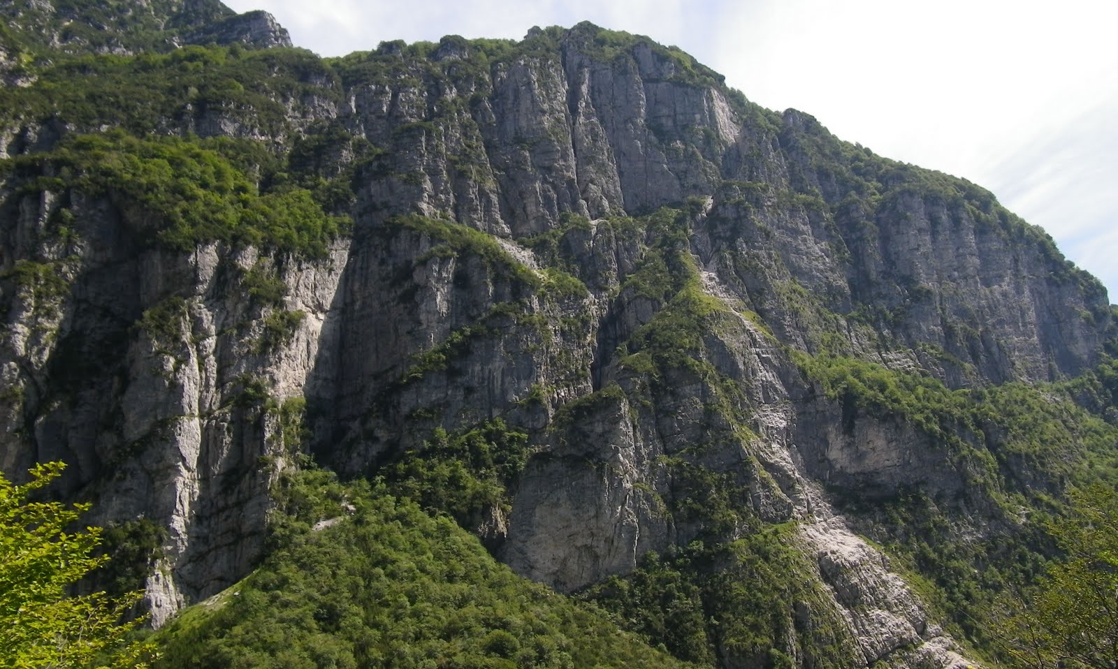
Monte Rest's west cliff face towering above

The cliff face continues to the southeast

From a few hundred meters lower, the base
of the cliffs supporting the upper cliffs far above

Light orange butterfly

Brownish butterfly with spots

Cascade Torrente Viellia

Beautiful black and white zebra butterfly with reddish-orange lower wings 

Close up of pretty zebra butterfly

Elevation profile

The north climb, up from Torrente Tagliamento

South climb from Tramonti di Sopra

Wednesday, August 10, 2011

Tre Cime di Lavaredo

I've dreamed of climbing Tre Cime di Lavaredo ever since I heard of it.  For weeks I've been checking the weather daily, looking for a rain-free day at Misurina.  Today was the first one, so I jumped at the chance.  

I drove past Auronzo to Palus San Marco, a tiny settlement in the beautiful Somadida spruce forest.  From here I rode the bike up a 536 meter climb to the turn off for Misurina (if you go straight the climb continues to Passo di Tre Croci (1805m)).  This warm up was bit more difficult than I planned, with quite a few stretches of 10-12% gradient, but it definitely succeeded in warming me up.  After the turn-off, the Misurina road continues upward for another 100m to Misurina at 1752m.   A nice flattish stretch here, through pastures with bell-wearing cows and small light-brown horses with blond manes.  Tourists lured these horses to the fence and petted them, fed them apples, etc.  The flatness continued along the pretty lake (which I tried to focus on rather than the tourist places on the other side of the road.  

Leaving town you turn right toward Rifugio Auronzo,  at the base of Cime di Lavaredo.  After some easy riding, you hit the first climb, a 500m ramp averaging 12.4%.  That put me in the red zone and I was gasping etc.  I concentrated on standing on everything above 12%, using my back and glute muscles to push my legs downward,  pulling up on the bars on each downstroke, and  getting as much air in my lungs as possible with each inhalation (belly breathing, pulling ribcage upward).   Not sure I'm coordinated enough to do all of this at once, but maybe with practice it will all become part of my muscle memory. 

Toward the top of this ramp I arrived at the end of a long traffic jam.  There were no cars coming from the opposite direction so I passed the stationary line of cars.  Several drivers decided not to wait and tried turning around, blocking the road from edge to edge.  So I hopped off and walked along the road edge around the chaos for about 50 meters.  I reached a spot where I could restart laterally and then head back up the steep road, continuing past the line of waiting cars.  The jam stretched over the top of the hill, round the bend for a km to the toll plaza.  Cars and motorcycles must pay to use this road, but luckily bikes are free.

Shortly the steepness recommences as you grind up the slopes between tornanti ends.  At 1844m you cross a little bridge, and the road steepens a bit more.  For the next 4 km the average gradient is 11.7%, with some stretches above 16%.   I saw only one other bike ascending, a mountain biker whom I passed, but a few cyclists rode past descending.   One shouted "Hai fatta!" in encouragement.  Eventually you reach a large parking area for Rifugio Auronzo.  There is a short ramp to the rifugio, which is quite crowded with tourists.  If you continue straight up the parking lot you reach another ramp to an overlook area directly beneath Cima Ovest (2973m).  Awesome panoramas from here, and the air was so clear it seemed you could reach out and touch the surrounding peaks.  A hiking path circles the Tre Cime, so next time I'll try to bring some shoes and a bike lock.

Despite the bright sun, I soon got chilly with temps in the teens and gusty winds.  It's a wonderful descent with wide, smooth pavement, but a bit crowded in August, so you must anticipate cars cutting across the switchback ends, coming over the centerline in curves, etc.  I must have gotten an early start, because now a horde of cyclists were grinding up the hill.   The coda at the toll plaza was as long as ever and now almost completely stationary, because once the rifugio parking lot capacity is reached, they only admit one car when another car leaves.  After Misurina the glide down to Palus San Marco was very peaceful. 

I highly recommend this climb-  beautiful scenery, a great road, and challenging ascent.


Monte Cristallo (3221m) from the climb above Palus San Marco
Lago di Misurina, with my target in the distance
Cima Ovest (2973m) and Cima Grande (3000m)
Croda Rossa (3146m)- love the red rock
The panorama to southwest
Close up of Monte Cristallo
Lago di Misurina
Lago di Auronzo
Close up of Croda Rossa
Dolomite spires to southeast
Rifugio Auronzo below Cime Ovest and Grande
Close up of vertical rock walls Cima Grande
Campanule (bluebells) and cardo (thistle)
Map of the ride
Close up from Col San Angelo to Rifugio Auronzo
Altimetria from www.salite.ch

Friday, August 5, 2011

Pala Barzana - Monte Valinis - Orton

Today instead of a big climb far away I tried a series of local climbs.  

The first is Pala Barzana (842m).  I rode from home to Montereale, up through the tunnels and into a fog bank near the turnoff for Andreis.  It had been clear and sunny only moments before at Montereale and Lago Ravedis.  Ascended along Torrente Alba, which was surprisingly full of white water from all the rain.  Usually this time of year most streams are reduced to a trickle.  I continued climbing through Bosplans, and finally around 700m the sun burnt through the fog.  Through the trees I could see a sea of fog in the valley below.  Topping the pass, I headed down the twisty curves through beautiful spruce forest.  This wonderful area is only minutes by car from home.

Eventually I reached Poffabro, then descended down Val Muié, through Navarons to Torrente Meduna.  I climbed out of the gorge and rode the rolling hills to Meduno (320m).  Here starts the second climb, up to Monte Valinis at 970 meters. 

This is a great climb, starting with switchbacks up to Borgo del Bianco, then ascending along lovely open meadows, finally reaching the ridge at 630m.  After a bit, you turn upward through a dense stand of tall spruce trees, like columns in a cathedral.  Sunlight filtering through the boughs high above, like shafts of light through stained-glass completes the effect.  This section of the climb is steep- gaining 250 meters in 2.5 km.  Higher up it eases somewhat, till end of pavement at Forchia Tamer (940m).  Passing through the cow gate you can continue up a rough gravel road to the edge of the precipice where parapendio gliders leap off.  Colorful wildflowers and butterflies cover the alpine meadows.  

I descended to the ridge line, and then turned right toward Campone.  This is a terrible descent with loose pavement, rocks, very steep.  But the views are great, and you soon reach the bottom, joining the main road through Campone (430m).  It's a pretty town at the base of Monte Celant, stretching along Torrente Chiarzó.  At the end of town starts another little climb, up to Piani di Clauzetto (675m).  It's not too steep, with lots of stream crossings.

From the Piani you descend to Pradis di Sotto (528m, big cave here) and then begins the last climb of the day, Orton, with high point just outside of town at Cristo (723m).  This is a scenic road through meadows, then a large stand of thick-trunked beech trees.  Rough descent to Clauzetto, then great twisties down Val Cosa to Travesio.

More or less flat from here to Sequals, Arba, Campagna, and home.  I messed up and corrupted the file while downloading from my Garmin, but I remember seeing it was 104 km in about 6 hours, with 1950 meters of climbing.  

Monte Raut from Borgo del Bianco, above Meduno

Close up Monte Raut above Poffabro

Over the pass at Pala Barzana- the bigger mountains west
of Val Cellina

Torrente Meduna near Cavasso Nuovo

View northeast from Monte Valinis

Monte Celant 1093m

Monte Pala 1226m

View of meadows Monte Valinis

Tuesday, August 2, 2011

Pian delle Streghe

Pian delle Streghe (Plain of the Witches) is named for an old folk legend.  Not clear on all the details, but blonde witches from the North came to the altopiano and danced, dressed in campanule (bluebells) and gigli (lilies).  And the name has stuck.

I biked from Arta Terme to Sutrio (again), but this time headed to a town called Cercivento.  Beautiful place with carved wooden balconies covered with geraniums.  Just before the church, took a right on a narrow road and began to ascend.  It continues climbing at a 9% average gradient for the next 9km.  The road winds like a snake all over the steep slopes of the mountain.  Except for the beginning and end, most of the route is immersed in dense spruce forest, cool even on this sunny August day.  Not much traffic, though we did have a blockage from a logging truck parked in the road while loading.  The driver backed up the hill a bit (no mean feat with a loaded truck towing a trailer) and the 2 waiting cars squeezed by on the narrow edge of the precipice.

Around 1400 meters the forest became less dense and eventually opened into steep meadows with cows clanking bells.  Pavement ends around 1500m, but I continued up the strada sterata up to 1630m.  Lovely panorama here.  With a mountain bike you can continue to the Strada delle Vette, and either descend to Sella Valcalda (Ravascletto) or traverse to the end of the road ascending from Comeglians to Monte Crostis.

I descended slowly, gripping my brakes as the road is too twisty to safely build up speed.  The pavement is generally good, but there are some bad craters that could crash you if you hit them too fast. Back in Cercivento I finally released the brakes and pedaled back to Arta Terme fast as possible to rewarm my legs.


Monte Zoncolan, left, above the ski area

View south down valley of Torrente But from 1400m 

Looking east up the valley of Torrente Chiarsò 

Headwaters of Torrente But to the northeast

Timau on road to Passo Monte Croce Carnico and Austria

Monte Coglians (2780m) to north

Mt Arvenis, left, and Mt Zoncolan, right
Looking down at Pian delle Streghe from 1630m


Little waterfall falling from Monte Tenchia (1884m)

Cows with clanking bells having lunch

Wood carving of the strega.  Like the hat. 

University of Udine experimental herb garden; not sure what
these big yellow flowers are nor what herb they produce 

Pieve di San Martino at Cercivento


Altimetria from www.salite.ch

The climb satellite view