La Crosetta's a perennial favorite- an 1100 meter altitude gain, tortuous curves and continuously varying gradient lead to surprises every time I climb it. Today was particularly nice because the temps were hovering around 0℃ with no wind, so overheating wasn't a problem- just open a zipper or strip off a layer. At the top the road was clear but the ground had a dusting of snow, so I decided against continuing up Monte Pizzoc.
The descent was fun as ever, followed by the 20km ride home on Via Pedemontane. This will probably be my last climb from Sarone to Il Cansiglio this year. Maybe I'll return in March or April.
Flock of sheep near da Regina between Range and Budoia
I looked back through the blog and found I'd climbed Pala Barzana (842m) from the east only twice this year. I shouldn't neglect it like that. So this cold crisp morning I took a spin up through Bus di Colvera, then Poffabro (506m) and over the pass. It was very quiet and beautiful- no cars at all from Poffabro to Bosplans. There was frost on all the curves so I descended very slowly. I don't know if it was because I was frozen, but felt like I was going very fast through the 4km tunnel from Barcis to home.
Probably the last ride over the pass in 2011. I'll try to visit more often next year!
Monte Raut (2025m)
Monte Castello (1983m)
Andreis (480m) and surrounding peaks
Monte Castello and companions from different angle
Mountains to the west of Val Cellina in background
One last ascent of Col Alto before the snows arrive. Sunny and cold out- a perfect day. I cruised down to Pedemonte (164m) and headed up. I was baking by the time I reached Pra de Plana (418m), so I stopped and stuffed my jacket in my pocket. Onward up the steep parts till I finally reached Rifugio Bornass (767m), then onward to Castaldia at 1090m. Here I deviated from the main road to traverse the narrow mountain lane to Col Alto (1368m). Beautiful up here in autumn- for some summer pictures of walking the dogs up here see The pups do Col Alto
After a moment enjoying the peace and quiet, I bundled up and shot down the hill. No cars to slow me down so the curves were quite fun. A quick ride to warm back up on the foothill road home. See you next April!
The bright band on the horizon is the Adriatic Sea
(taken from Castaldia, 1090m)
Looking east toward Slovenia
The 3 peaks above Piancavallo- Monte Tremol (2017m),
Cimon del Cavallo (2251m) and Cimon dei Friulani (2183m)
Narrow mountain lane winding through karst stone and beech forest
The torrential rains have finally stopped. We were very lucky though, with no flood victims as in Genova. We escaped with only some landslides; among them the popular cycling road on Piancavallo from Madonna del Mont to Rifugio Bornass (see http://www.bdc-forum.it/showpost.php?p=3224222&postcount=1 ). So I decided to celebrate with a ride in the pre-alps.
I parked at Faedis, north of Cividale, and prepared to ride. Then I noticed I'd forgotten to transfer the seat bag (with spare tire tube and levers) from my commuter bike to the Merckx. I thought about returning home but decided I would trim the ride back to the single climb to Valle-Pedrosa (instead of including Plan del Jof as well). That way I'd only have to walk or roll on the flat tire back to the car if I got a flat.
After warming up to Campeglio (134m), I turned left and began the moderate climb (8-10%) through the forest up to Colloredo (273m). Here the forest opens into hillside vineyards basking in the sun, and for a few hundred meters the road is flat. Then you return to the forest and hit a steep wall, which forced me to stand immediately. After a hundred meters or so the grade slackens to 10-12% for maybe 40 meters, then tilts upward again. This repeats a number of times in a series of stair steps continuing for perhaps 3km. There is a brief flat around 600m, then the grappling starts again. These steep ramps carry you up 350m in 3km at an average 11.5% gradient. The pavement is excellent with plenty of shade for summer climbs.
At the top you reach Valle (735m), a deserted town this time of year but full of vacationers in summer. I did hear someone working on a house. There is an adjacent town, Pedrosa, but the turn off was covered in big rocks for a hundred meters and I didn't want to risk flatting. The views up here would be spectacular on a clear day, but it was quite hazy today. I headed down the narrow backroad toward Faedis with trepidation- maybe it would be covered with rocks which could cause a flat. Surprisingly it was very good pavement and mostly free of rockfalls, though it was completely covered with leaves. Nice descent down pretty forested slopes into Canal di Grivo. Here you join the road coming down from Canebola which I originally intended to climb today. Shortly I was in Faedis and returned to the car.
Dusted off the Trek 1220 my friend Clint gave me a few years ago and headed for school in Pordenone, 28 km away. It was overcast and quite cool, but I soon heated up and started shedding layers and stuffing them in my rucksack ( I need to install a rack). The bike rode quite smoothly and felt fast on the slight downgrade.
After San Quirino I foolishly went into a little roundabout too fast and slid down. No damage done- I'll blame the tires, which are quite old. Maybe they've lost their grip (or have I?) I soon arrived at the school, took out my cell phone to check the time, and realized I had arrived an hour early. Now what to do- I decided to try to find a dog park near the Noncello River which a young lady in my class had mentioned. It was fun riding around town- there are bike lanes everywhere, but I'm afraid I've gotten rusty on the rules. An older fellow on a city bike with pushrod brakes dinged his bell at me so he could pass as I was gawking at the city sights. Later I was crossing the river on a 4-lane street bridge, and noticed there was an adjacent bridge only for bikes. A passing motorist hooted his horn to emphasize my transgression. I finally found the park which is in the river bottom of the Noncello. Very pretty- I'll have to bring the pups down here for a walk someday.
Back to school, then after the 2-hour class I started home. It's a gentle upward gradient, only 270 meters in 28km, but it's just enough to give you some resistance to push against. Excellent training- hope we'll have many more dry days so I can commute in coming months. I arrived home after another 1.5 hours, plenty of time to shower and eat before my annual MRI at the Cro. My radiologist decided not to use contrast dye, saving me €200. All in all, a good day.
Our school, Odorico Mattiussi (named for a local priest who visited China in 1300,
our version of Marco Polo); pic taken on a sunny day a few weeks ago
The best compromise between light traffic and distance
I could come up with
Castelmonte is a sanctuary/fortress between Cividale and Slovenia. At 618 meters it's visible for miles from surrounding valleys and mountains. Like Monte Grappa there are many routes of ascent, and you can try a different one on every visit. Since today was a holiday (Tuttisanti) I thought the main road from Cividale might be crowded with pilgrims and visitors, so I decided to take the backroad from near Albana.
I parked by a lovely vineyard/villa (Il Roncal at 130m) and headed through a gently rising forest. Very pleasant. Then around 6 km it started to get steep- definitely felt above 13% at points (GPS was blocked by the mountain so not sure). This mellows after awhile and you resume with beautiful autumn forest riding. Eventually at 7.5 km you join the main road coming up from Cividale and soon reach the sanctuary. On a bike or on foot you can continue up the pavement to the top of the hill. It was hazy but I could still make out snowy Monte Canin to the north, Monte Matajur to the east and many surrounding hillside towns.
From here I descended on the road toward Valli del Natisone briefly until the right turnoff to Podresca. Now you ascend a bit up to 627 meters, then start a long descent down through the woods to Podresca, on Torrente Judri and the Slovenian border. This is a beautiful little hidden valley between two heavily forested ridges, mostly uninhabited upstream, but soon decorated with patches of vineyard on the widening river plain. By the time you reach Albana the vineyards are quite expansive. Here you turn onto the road for Cividale, which turns away from the river, ascends slightly into the forest, and returns to the area of vineyards were I began the ride. Lovely place- I'll try to get back often.
Red orange yellow green foliage
Castelmonte's sumac-covered walls
A gate to keep invading infidels out
Can you tell I liked the sumac?
Not sure what sort of tree this- berries and braided-looking
smooth bark
Set out this morning intending to climb Pala Barzana (842m) from Poffabro. I rode through Maniago, then the fantastic gorge of Bus di Colvera, and up Val Colvera. A few months ago when I descended from Pala Barzana the main road was closed from Pian della Merie to Poffabro, and traffic was diverted through Valdifrini. So today just before Poffabro I decided to take the deviation through Valdifrini in case the main road was still blocked. The narrow lane has been recently repaved and is quite nice. Still steep as the dickens for about a half kilometer though- as you can see below, it surpasses 16% at points. I was compelled to stand which was a good test of my back's recovery- didn't feel any pain.
At the junction with the main road another surprise. They were having some sort of timed car race over Pala Barzana to Poffabro, so no one was allowed to turn westward. Luckily I had arrived a few minutes before the start, so they let me ride east through Pian dell Meria to Poffabro. It was a lovely autumn day with the leaves turning color so I still enjoyed my ride. Especially pleasing was the roar of white water through Bus di Colvera following recent heavy rains. And I made it home early enough for a nice hike with the pups on our local pista ciclabile. Nice Saturday!
Torrente Colvera roaring through Il Bus
Autumn leaves along the old road above Bus di Colvera
Water-carving rock in progress
Forest of Monte Jouf above west wall of Bus di Colvera
I wish I had a more exciting story to tell about my injury, like this fellow:
But my accident was quite lame. I'm on a drug to control my brain tumor, and among other side-effects it causes postural hypo-tension, similar to standing up too quickly and feeling dizzy, but worse. So a few weeks ago I woke up in the middle of the night and got up to go to the bathroom. The stairs are adjacent to the bathroom door, and I apparently blacked-out and plummeted down the stairs (15 in all). I came-to lying on the ground floor, with a loud ringing sound in my head. Marilyn was woken by the clatter and helped me back to bed. The next morning I was sore all over, with bruises, knots and lumps everywhere. The worst was my mid-left back which was very sore. I took it easy, hobbling around stiffly and felt a little better after a couple of weeks, though sadly unable to ride on those cool, clear October days. One day I took an easy flat bike ride to Maniago and Vajont, which went well, and took the dogs on some long walks around the local pista ciclabile. They are great physical therapy aides.
Finally today I felt fit enough to try a bit of climbing. I decided to try the longish gradient up Val d'Artugna, which starts easy and very gradually steepens to 8%, then 10% and more, before slacking a bit past the barrier above Il Chalet restaurant. Pavement ends around 560 meters. I did not push myself at all, nor did I stand on the steeper bits because I wanted to avoid pulling upward with my left side. No problems noted.
I'll be trying to commute to class in Pordenone (14 miles) when the weather cooperates. I put street-shoe pedals on the old Trek, and may even add a rack and fenders if I get inspired (it has mounting eyelets). It's a slightly upgrade ride home and should help strengthen my weakened back muscles.
Pian dei Buoi is a lovely meadowy area on the shoulders of the Marmarole Group above Lozzo di Cadore, with fantastic views of surrounding peaks.
I left early and arrived around 0800 at Lozzo di Cadore (753m) on the Piave River north of Longarone. The climb starts almost immediately, but luckily I lost my way and warmed-up briefly riding around the town. The initial section is not too steep, and many people were taking their morning walks on this pleasant narrow lane through the forest.
Soon the road steepens to 7-10%. Felt great in the cool morning air- really a wonderful climb. It continued like this for around 10km, until the deteriorating road surface gives out completely and it becomes a dirt road at 1700 meters. Still it's rideable with a skinny-tired road bike- no problems.
Now the road enters the beautiful rolling meadows of Pian dei Buoi (Plain of Oxen). I continued on the dirt road a bit further until the trailhead for Rifugio Ciareido, where a family of asini were enjoying their sunny morning. The dirt road reportedly continues for another 6 km to Col Vidal (1880m), a pre-WW I fortress said to have spectacular 360-degree views. I'll have to try to reach the end of the road next year, as I was in a hurry to get home for a prior commitment.
The descent was quite rough- can't get up much speed because of bad pavement, drainage channels, narrowness and twistiness. But the ascent and scenery are so good it makes the descent worth enduring. I'll certainly be returning in 2012.
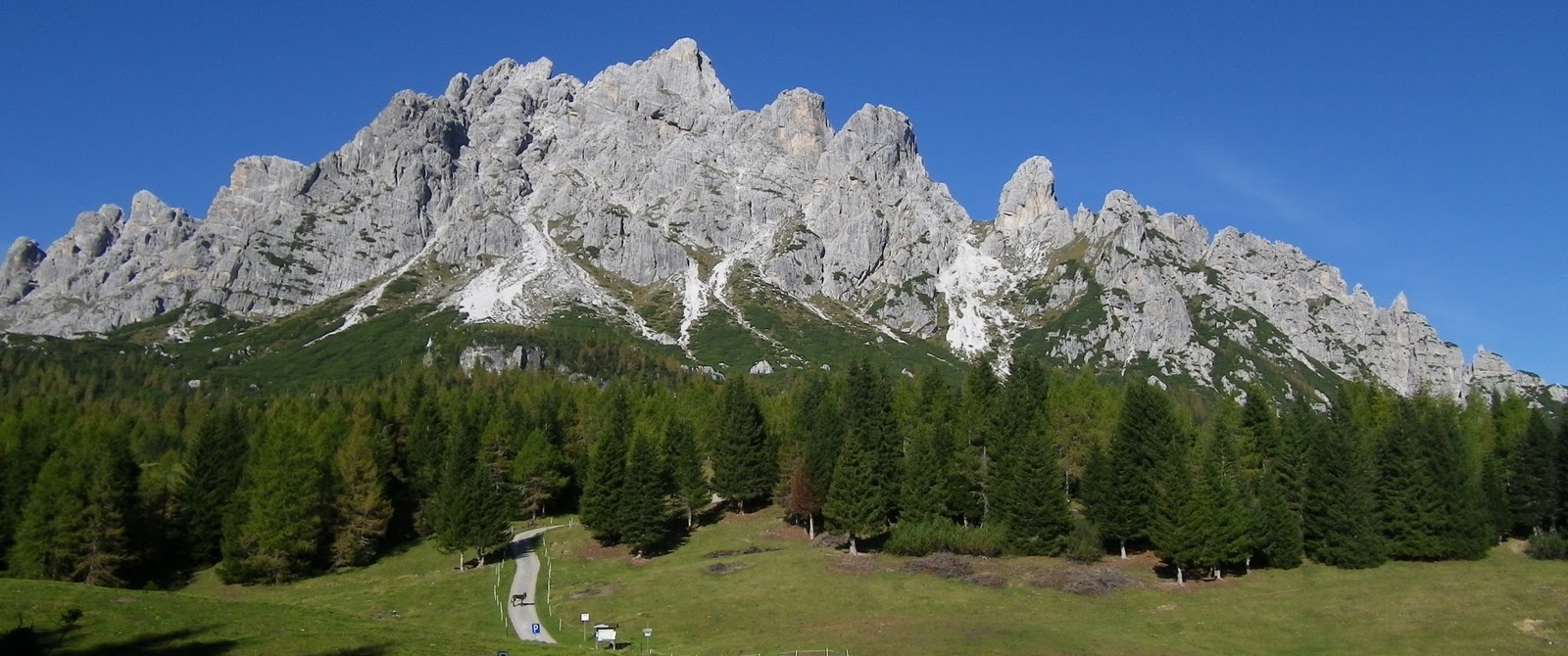
Monte Antelao (3264m)
Marmarole Group (2932m)
Monte Ciareido (2504m)
Pian dei Buoi meadows and distant mountains to northeast