Saturday, August 8, 2015

Großsee

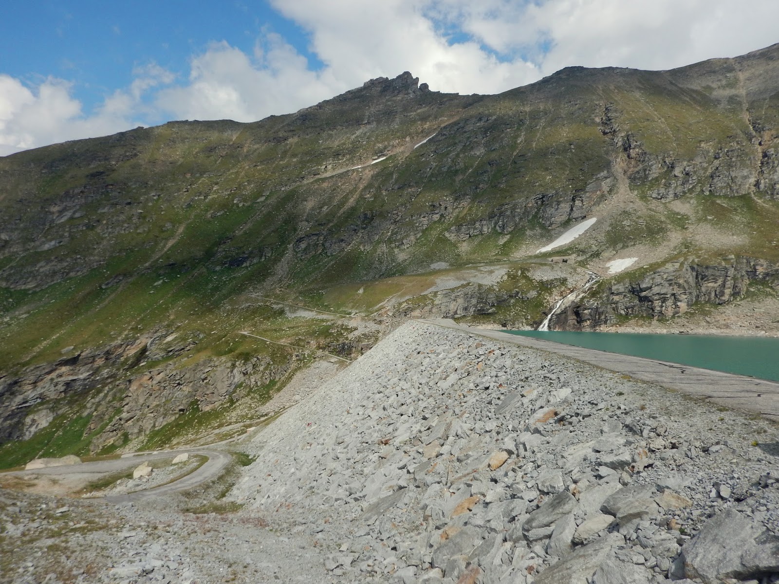
I drove up to Timau and over Passo Monte Croce Carnico into Austria.  Just before Lienz I hung a right toward Grossglockner.  I drove up the approach as far as Mörtschach then hopped on my bike.  I warmed up on the main road until Döllach and then found the little side road for Zirknitz.  This farm and forestry road winds high into the mountains, eventually reaching the dam at Großsee.  It was quite steep and difficult but it's definitely pedabile.  I was contemplating descending slightly then climbing up to the other side of the dam which has some pretty switchbacks, but thunderheads started rumbling in the distance.  Luckily I made it back to the car with only a couple of sprinkles, but it rained most of the drive home.  

From the pastures above Zirknitz

Zirknitztal cascading through a granite chute

The second wooden bridge

Gorgeous terrain with waterfalls

Großsee from the dam

The dam with sheer mountain slopes to the west

Kegelsee glacier lake; lots of fat marmots shrieking at intruders

Spectacular range to the east.   

Kegelsee's cirque

This climb reduced my legs to rubber


Wednesday, August 5, 2015

Pert

I've heard good things about this swimming hole on Torrente Arzino, but always forget to visit.  Today  I chose a rolling, saliscendi route to the river, which is harder for me than a single long climb.  I've heard the continuous variation prevents you getting in rhythm.  Sounds plausible.

After the tunnel from Montereale I climbed over Pala Barzana then down to Poffabro, continuing down Valmuie to Navarons.  After the lakeside I headed up toward Campone and Piani di Clauzetto.  Now down again to Pradis di Sotto caves.  Back up to Pradis di Sopra then down to Pielungo.  At the riverside I headed south to Pert and into the river.  The cold water felt great on my feet ( wearing my SPD sandals).  Back up to the main road to Anduins, Pinzano and home.  Now I'm knackered.   


Cemetery from 1917 battle in the days after the Kobarid route

German graves (the Germans came to help
Austria Hungary which was losing on the Izonzo Front) 

Italian graves (Italy was desperately trying to halt the German
advance which threatened to sweep across Italy)

Looking north up the gorge of Torrente Arzino

Pert: note the deep water along the low-lying  cliff face

You can see the blue-green deeper water extends quite a way along the cliff

Looking back toward Pert from the main road above


Monday, August 3, 2015

Zoufplan MTB

Another climb in Carnia, near Zoncolan, Crostis, Paularo.  In 2011 I climbed up to 1670 meters here on the Merckx but could't ride the dirt road higher.   Today on MTB I continued to Zoufplan and onward along a trail which traverses the steep precipices below Cimone di Crasulina.  I've seen GPS tracks and descriptions of MTBers connecting with Panaramica delle Vette, the road from Crostis which has a paved spur descending to Ravascletto.   I was mostly pushing the bike along here to avoid plummeting.  Then I reached a sheer rocky slope I knew I couldn't cross with the bike.  I turned back and retraced my steps.

Met an older couple of hikers on the way back toward Zoufplan and when I told them my plight the fellow mentioned he'd done it by descending a ways and carrying the bike on his shoulder.  He pointed out the path a bit below.  I believe he could do it because this guy was huge, like the strongman at the county fair in an old movie.  I know there's no way my scrawny self could do it hauling a bike.  I may try coming from Crostis or Ravascletto next time and ascend the ridge from the west.


Monte Avernis, meadows on left where I biked last week

Monte Paularo on the right, where I climbed the other day;
below is valley road to Timau and Passo del Croce Carnico

Alpine lakes in the valley below Zoufplan

Monte Coglians, highest peak in Friuli 2780 meters

To north, peaks above Timau and  Austria

Tough climb; the max grade is erroneous


Saturday, August 1, 2015

Valvasone

I haven't been down to our southeast much lately.  I'm trying to remedy that oversight.  This morning I rode down to Cordenons, then the road east toward Arzene.  Shortly afterward I reached Valvasone, a pretty town with some very old buildings.  I wandered around taking pictures, then left town headed toward Vivaro.  There is a guado (ford) on this road (also on the road from Cordenons) but they are bone dry.  The surface is hard-packed so no problem on a road bike.  At Vivaro I took the long straight road to Vajont and home.  This route is very flat, which felt great after all the climbing lately.


Erasmo Valavsone

Giulietta's balcony at Palazzo Pinni

Gate tower entering center of Valvasone

The castle (pardon my thumb)

View of arched portico

Barbican of castle 

Campanile towering over
narrow medieval streets

The town church

Thursday, July 30, 2015

Passo San Boldo - Nevegal

From Vittorio Veneto I pedaled the road bike up over Passo San Boldo and its crazy cliff-face switchback/tunnels.  Then down toward  San Antonio Tortal, where I planned to take the main road to Valmorel.  But from the corner of my eye I saw a sign for Pianezze on a road heading steeply upward and had to try it.  It was a beautiful ride through tall fir trees interspersed with large grassy meadows  A km or two was unpaved but the hard-packed dirt was perfect for a road bike. 

You end up in Pianezze, but it turns out you're in a bowl valley so you must climb steeply to get out.  Luckily the pavement has resumed so you can get traction.  Near Pranolz you reach the main road which carries you through Melere down to Valmorel.  You now descend steeply to Val Lamon, through Tassei and again up steeply through Piandelmonte to Ronce.  Here you follow another hard- packed dirt road winding through the forest to Nevegal.

Fast descent on the main road to Quantin, right turn by cemetery down to Roncan, then right toward Cornolade and Lago Sante Croce, Fadalto and Vittorio Veneto.  Wonderful ride but hard because of all the saliscendi.  Quite a workout.


Passo di San Boldo

View near San Antonio Tortal of Dolomiti Bellunesi 

View northwest from road for Pianezze 

Rifugio at Pianezze 

From above Valmorel looking north


View from Cornolade road of beautiful Alpago and surrounding peaks


Steep climb from Tassei to Ronche


Tuesday, July 28, 2015

Monte Arvenis MTB

The famous climb for Zoncolan leaves Ovaro passing a turn off to the right marked Lenzone.  After leaving the village of Lenzone Via Monte Arvenis begins climbing very steeply up the forested mountainside.  Surprisingly the road is paved, roughly in places but no problem for a road bike.  The gradient is the problem, as on Zoncolan.  Before long I was in 24-36, like Sisyphous pushing my wheel up the precipice.  It levels out around 1500 meters, pavement ends and you pass by Malga Arvenutis.  The dirt road comes to a junction where going straight takes you to Malga Arvenis Alta.  Instead I went right, climbing up to 1600 meters, a wide grassy altopiano.  Soon you arrive at Malga di Claupa and take the rough dirt road climbing to your right, around and over Monte Tribil. The high point at 1716 meters has views stretching to the Tagliamento River and beyond.  After Monte Cucasit the road begins descending, ever steeper and rougher down a bouldery uneven rocky road till you  finally arrive in the meadows of Aiers.  Having survived the wilderness roads, I rewarded myself with a fast descent through the forest on narrow paved lanes to Tarlessa and Trava to Chiassis, where I'd parked the car along the old road from Villa Santina to Ovaro.    Great ride, with many variations.


View from Monte Arvenis road looking west

Malga Claupa 1634 meters

View was from Monte Tribil 1716 Meters

Westward traverse along the grassy monts

View toward Tagliamento to east

Arrival in Aiers, having survived the rocky descent

Pretty Aiers meadows

Church above Trava

Tough climb


Sunday, July 26, 2015

Keen SPD sandals

To be honest I was a little unclear on the concept of a sandal with bike cleats when I heard of it.  It's generally cool here so hot feet isn't a big problem.  Then our heat wave of the century arrived and wouldn't go away.  I was riding up at Monte Pizzoc a couple weeks ago and a guy on a mountain bike stopped to ask directions.  I noticed he had some kind of open shoes and thought that might be cooler.

So I started researching and this brand (Keen) seemed well recommended.  I bought some and finally installed the cleats today.  I'd also just changed the front brake pads so thought I'd combine the ops ck.  

These sandals work great and are nice and cool.  I'm thinking they'd also be good for stream crossings, which usually leave you riding with squishy socks for hours afterward.  I'll still use the Alp X's for hard climbs but for moderate rides these will be perfect. 


SPD cleat


Nice tread

Outboard side

The inner side