Saturday, July 25, 2015

Casera Teglara MTB

Two "new" trails in Val Arzino.  From San Francesco I rode up the highway toward Sella Chianzutan. At the first switchback, turn left on gravel road and cross the bridge over the river.  The road climbs maybe 60 meters along the mountainside above the river heading upstream. You can see Pozzis through the fir trees. You descend and join the trail from Pozzis, then continue to Cascate del Arzino.   Surprised by the volume of water in the falls: 30 km away we are having a drought.

Soon you join the paved road toward Sella Chiampon.  Once you arrive take a left onto a gravel road with several trail signs, one for Casera Teglara (CAI 826).  It begins ascending steeply with concrete in some stretches and doesn't let up.  This beautiful fir forest has very little development and few visitors.

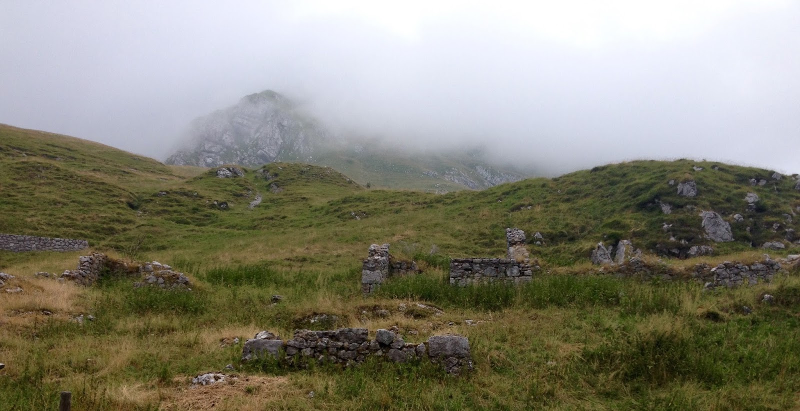
I finally arrived at Casera Teglara in the grassy highlands, where a shepherd was directing his dogs herding sheep.  Quite stormy looking so I soon departed.  A few hundred meters downslope a strong gust-front blew through the trees and I was certain I'd get soaked.  But it held off until I was on the paved road toward San Francesco where I got a light shower.  Fantastic ride.  


Upper cascata del Arzino

Downstream

View toward Malga Vallon about 1200 meters

Casera Teglara 1570 meters

The flock

View to south

View north

Looming thunderheads


The climb


Thursday, July 23, 2015

Torrente Mesaz MTB

Lago del Vajont is a popular tourist area, with the towns of Erto and Casso in the aftermath of a horrific dam disaster 50 years ago.  Usually I follow the main highway on the north shore of the lake, but today I revisited the isolated south shore road.  They've paved the last remaining dirt sections, but otherwise it is as remote and beautiful as ever.  

After Passo Sant'Osvaldo I descended to the turn off for the south shore, sharply to your left.  It descends, crosses Torrente Tuara and then follows the shore line along forested slopes.  There are a few tiny settlements where people grow hay and raise farm animals.  

Eventually you cross Torrente Mesaz and head uphill along the lake.  I missed my turnoff for the trail at first and continued around Lago del Vajont within 2 km of the junction with the main highway.  Realizing my error I turned  around and found trail CAI 905: a large flat-stone paved lane heading steeply upward.  The stonework soon ended and it became a steep gravel road.  Great workout.  After a few km it ends where the foot trail descends to Rifugio Citta'.  Good views from here of Mesaz gorge, Erto and surrounding peaks.  Highly recommended.  


Warming up on road to Cimolais

Upper Vajont lake basin

View northwest of Erto and peaks

Beautiful gorge of Torrente Mesaz


Bridge over Torrente Mesaz

Middle Vajont lake (water backed up behind landslide)

View from end of trail, looking down Torrente Masaz,
across remnant of lake basin toward Erto


Monday, July 20, 2015

Casera La Pala MTB

This is another climb from the south shore of Lago di Barcis up the precipice of Monte Longa.  Today  I started from Portuz, immediately after the dam.   The road is briefly paved, then turns to dirt/gravel with concreted steep bits.  Like the road from Vallata the landscape is beautiful: tall fir trees immersed in shade on the north-facing slope.  The road switchbacks to and fro until 1200 meters where you reach Casera La Pala.  It's a hiking/snowshoeing hut, very quiet and private, high on the mountainside.

From here I explored some, then rode to Casera Monte Longa, a similar place.  It was my destination a few weeks ago though I never made it all the way to the casera.  Today after visiting the hut I headed down a shortcut to the descent road.  I'd been warned in Fred's blog about nettles along the path and he was right: they stung the heck out of me.  But I did determine that this was not a good shortcut when biking: far too steep and narrow for carrying or pushing a bike. 

The descent was wonderful with lots of gravel switchbacks, then at 700 meters the steep paved road.  Arriving at Vallata by the lake, I recrossed the dam, through the tunnels and home.   Beautiful ride.  Will try some more of the other dirt roads up here soon: there are several more I've never ridden. 


Casera La Pala


Monte Ciastelat from Casera Monte Lunga

Casera Monte Longa


The steep climb from Portuz to Casera La Pala


Saturday, July 18, 2015

Monte Paularo MTB

Paluzza is north of Tolmezzo on the road to Austria.  If you turn east you climb along Torrente Pontaiba through Treppo Carnico and Ligosullo.  There's a turn off to your left here for Castel Valdajer, built in 1460.  It's a beautiful area with tall fir trees and fantastic views of surrounding mountains through the gaps.  After the castle, pavement ends and the road turns to hard-packed dirt/gravel.  In fact I road biked here in 2010 all the way to 1400 meters where the road got too rough.

Today on the mountain bike I went much higher, leaving the forest and entering grassy alpine landscape.  Continue switchbacking up to 1800 meters and after the alpine lake you'll see trail signs for Monte Paularo.  I pushed the bike up this last stretch to 2043 meters.  Great panoramic views from here, as well as World War I trenches.  I rolled the bike back down and headed on the trail for Malga Pramosio.  

I've read several accounts of riding this loop and they make it sound like this middle section is no problem, but I had to push my bike most of the way from Monte Paularo to Malga Pramosio.  It was a narrow hiking path with lots of bouldery sections, and steep ascents alternating with steep descents.  I'm guessing the writers of those accounts were expert riders because I could only ride about 20% of it, mostly toward the end.  Eventually it descends down to Malga Pramosio at 1520 meters.  There's a huge stone quarry below it, which I inadvertently rode to.

The long descent back to Paluzza is a switchbacking gravel road with summer weekend traffic heading up toward the malga.  Then you ride briefly down the main road from Austria until Paluzza.  This is a great ride but next time I'll return from Monte Paularo back down the road to Castel Valdajer.  Much easier and quicker.


New steeple on Ligosullo church;
Monte Zoncolan in background 

Creta Grazaria (above Sella di
Cereschiatis north of Moggio)

Castel Valdajer

Waterfall along the switchbacks
above Castel Valdajer

Looking south toward Monte Tersadia

Alpine Lago di Dimon

West toward Dolomiti peaks

Monte Dimon from top of Monte Paularo

Deep gorge north of Monte Dimon

WW I trenches atop Monte Paularo

Another view of trenches

Malga Pramosio

Climb from Treppo Carnico to base of Monte Paularo summit


Wednesday, July 15, 2015

Casera Venchiareit MTB

I attempted this ride last November but rain turned me back at 1400 meters.  Today I warmed up on the climb to Passo Monte Rest, then turned left onto a gravel road.  Almost immediately it starts climbing up gravel and concrete switchbacks.  After passing some tall cliffs you climb onward to 1443 meters where you start heading down.  It descends steeply for quite a while, and  I was starting to worry.  Finally at 1100 meters I reached the turnoff that climbs up to my destination at 1350 meters.

The roads are unmarked and aren't on Gaia's GPS open source maps.  I did have my Tabbacco map so I tried to meld the two together.  After 3 or 4 dead ends I reached what I think was the correct road. It had a barrier across the road, marked "Private," etc so I turned around.  That's as close as I can get on a bike. 

Now back down to 1100 meters and then the toughest climb of the day: 2.2 km averaging 11% with some 15% ramps.  I was fried by the time I got back to 1440 meters.  Luckily it's mostly downhill from there on, turning to pavement at Passo Monte Rest then switchbacking down to Tramonti di Sopra.

Fun ride.  I think I'll try parking the bike at 1400 meters next time and hiking up to Monte Costa di Paladin. 


View of Tagliamento River and mountains toward Tolmezzo

Close up of Tagliamento

Monte Rest peeking over a ridge

Very big cliffs along the trail

Mountains to north


Killer climb


End of the public road


Monday, July 13, 2015

Banjšice

Slovenia's Banjšice Plateau is one of the prettiest, least-crowded places I've ever been.  Today I tried a new route, following the Soča River from Gorizia to Kanal, then turning onto the back road for Avče, a dolce climb through shady forest to Kal Nad Kanalom, a village on the rolling grassland of this alto piano.  From here I continued crossing the rolling terrain, through a bit of jumbled karst forest, down to Lohke and Bate.  At Bate I began the same long, steep descent to Grgar I rode last March, though without the ice this time.  There's a little climb from Grgar up to the road for Solkan, which then descends even more steeply to the Soča River.  

Wonderful ride: I know I'll return before long.      

The climb up from Avče

Kal Nad Kanalom pretty village

Look back across the rolling plain toward the Julian Alps

View south toward Lohke

Lohke northeast panorama

Lohke toward southeast


Saturday, July 11, 2015

Monte Milifret - Mezzomiglio MTB


I've been meaning to ride this for years and finally got around to it.  It completely blew away my expectations.  The first step was to climb Monte Pizzoc.  Just for fun I decided to MTB up from Osigo to Campo Cadolten.  I'd ridden it from Sonego last year and was curious how the Osigo route compared.  Climb through Osigo and after the 1st switchback on Via Cansiglio turn off onto Via Pravinera.  This is steep concrete and dirt road, as from Sonego.  At 900 meters you reach Chiesetta di Sant'Antonio, then keep on grappling up a little sun-exposed canyon till you reach the altopiano of Cadolten.  Beautiful green pastures surrounded by tall beech and spruce.  At the Pizzoc road, continue up to end of pavement above 1500 meters.  

Take the gravel road toward Rifugio Citta' di Vittorio Veneto then continue on toward La Croda (bar).  The markings aren't too clear here but luckily I looked up while scratching my head and saw a MTBer on a grassy ridge above.  I found the trail (unmarked except for some Fregona Trails streamers) and crossed the rising grassland.  Now it steepens and you begin technical climbing up the west face of Monte Milifret (which means I was carrying my bike).  My hopes were rising and soon I reached the place I've been wanting to see for so long: the cliffs at the top of the gorge climbing from Vittorio Veneto to Lago di Santa Croce.  I tiptoed out to the edge and it is essentially vertical for maybe 800 meters down.  Wow!

I now pushed/rode the bike along a trail that traverses the eastern side of Monte Milifret.  Still high but now you're traversing slopes above the forest rising from Cansiglio altopiano.  The trail gradually gets easier (less bouldery) and enters red spruce forest with many exposed roots.  At a junction leading to Pian de la Pita I finally got confirmation: I was on the ridge trail Sentiero delle Piaie Longhe Milifret.  This was my goal because last year I tried riding the lower trail H3 from Mezzomiglio and it was an impassable mud bog.  This higher trail was much better.

The trail widens a bit though still rocky and rooty so I was able to ride pretty well.  It then begins descending gradually so I stayed on the brakes.  The woodland abruptly ends and you enter the rolling grassland above Mezzomiglio.  I followed the path and then a gravel road I remembered from years ago, eventually heading toward the junction with the gravel road toward Palughetto.

This joins the main road across Piancansiglio to La Crosetta, then the descent toward Vittorio Veneto and the car.  Must return and explore this area more.  Great snowshoeing in winter too.     


Chiesa San Giorgio, Osigo
Chiesetta Sant'Antonio

Interior of chiesetta


View from above of Cadolten altopiano

Monte Pizzoc from Monte Milifret

Fadalto, Lago Morto, Monte Faverghera

Lago di Santa Croce and Monte Dolado

Monte Milifret cliffs

Trail through the red spruce forest

The grassy alto piano above Mezzomiglio

Wednesday, July 8, 2015

Monte Grappa da Caupo

This is the 5th route up Monte Grappa I've tried, and the first ascending from the north.   This climb has a completely different character from the others.  The others cling to the cliffs along the southern escarpment, exposed to the sun.  This one is nice and shady, an important plus given the record-setting heat wave we've been enduring.  It helped that I started early, pedaling away from the car park in Fonzaso at 0630.  At the village of Caupo the climb begins.

The first third of this 28km climb is in lovely forest, long sweeping switchbacks rising to 1000 meters at an average gradient of 8%.  A great workout, and mostly free of the crazy gradients on the southern side.  Then the terrain changes, and you're traversing an undulating zone for 5 km.  It's a bit of a break, but it still rises generally with a constantly varying gradient to keep you on your toes. 

The final 8km are more familiar if you've climbed Monte Grappa before.  Treeless alpine grassland, exposed rock faces, steeper ramps.  It averages over 6%, with 170 vertical meters of counter-slopes and a few steep bits in the 16-17% range.  

Today clouds were blowing across the summit, rapidly changing from sun to white-out.  I apologize for the lack of photos- it was a tough day to take pictures.   The ride down was fun, especially the lower stack of switchbacks.  I will try this again- it's my favorite Grappa route so far.  


The Italian Ossuary at the summit

Memorial to the Partigiani, guerrillas who fought against the Fascists in WW II


Monday, July 6, 2015

Brake check Osservatorio Astronomico

Last month I canned the front brake from my Merckx to fix my old Trek1220 so I could donate the bike to a teacher at school.  I looked for a replacement online and the best value I could find was a Campy Veloce front caliper for €17.   It arrived and today I installed it, probably the simplest thing to put on a bike.  I needed to function check it so I headed for the nearest climb, the Grizzo to Osservatorio Astronomico road, starting a mere 5 km from our house.   It's fun to climb and frankly I was a bit psyched from watching Purito rocket up Mur de Huy in the Tour de France 3rd stage.

At the end of pavement (679 meters) I turned around and headed down.  It was a blast and the brakes worked great, at least as well as the 2006 Chorus brakes the used Merckx originally came with.  The only shortcoming I noticed was squealing once the pads were roasted, so I'll try toe-in or changing to Chorus pads I have on hand.  

Fun ride- I should do this everyday!


It's a good climb, and only 3 miles from home