Thursday, July 12, 2012

Monte Dolada, La Carota-San Martino sterrata

Monte Dolada is a sort of benchmark for me.  The first time I tried it a couple years ago I couldn't do it- had to stop, rest and hyperventilate several times.  Then last year I did a little better but remember struggling badly.   Today wasn't easy but I never felt overwhelmed, just kept gasping  and grappling away till the top.  

I arrived at Vittorio Veneto early (0630) and started the warm up to Sella di Fadalto.  Quite windy and cool- some windsurfers with parasail kites were hydrofoiling across Lago Morto- they must have been freezing.  Then around the west side of Lago di Santa Croce, past La Secca, take the right turn toward Tignes.  From here steeply upward to Pieve d'Alpago, and higher still to Plois (850m).   Now you head up a narrow farm road through the meadows with a half km of 15% average gradient.  Finally it levels out briefly at La Carota rifugio (1025m) and you can catch your breath while rolling toward the next challenge, a series of long steep switchbacks, the steepest being 1.5 km averaging 13.8%, with no chance to catch your breath.  The agony ends at 1494m, a parking lot for Rifugio Dolomieu.

I rolled back down, bunny hopping drainage channels every 20 meters it seemed.  When I reached the level spot near La Carota on a whim I headed down the backroad toward San Martino.  I had attempted this from the opposite end last year but flatted on the rocks and with no 2nd spare, gave up.  The ride from this end was considerably easier, with even a paved stretch at each end, and also briefly in the middle where it ascends a short wall.  It is also generally downhill in this direction (except for the wall).  It crosses a little bridge over the gorge of Torrente Tesa, which separates Pieve d'Alpago to the west from Chies d'Alpago in the east, then eventually becomes a paved farm road which descends to San Martino (866m).

Fun curvy descent through Lamosano and Cornei to Puos d'Alpago.  Great ride, though I wouldn't advise doing the road from La Carota to San Martino with 23mm slicks- something wider and knobbier would be better.


Early morning Lago di Santa Croce with Monte Dolada in background  

Closer shot of lago and Monte Dolada

Campanile of Pieve d'Alpago, with lago and Col Visentin in background

Lago from Rifugio Dolomieu.  See fungus on tree branches to right-
looks like Spanish Moss in Alabama, but with smaller tufts

Bowl shaped conch of Alpago, looking east

Close up of Alpago villages, meadows, forests 

Monte Teverone (2436m)

Monte Dolada's rocky cliffs, upper left

Cliffs of Montagna del Vescovo

Monte Teverone from near San Martino

Lago and Col Visentin from near San Martino


Rode clockwise

Monte Dolada climb on left, La Carota-San Martino sterrata center 


Monday, July 9, 2012

Pale di San Martino Loop

Pale di San Martino (2982m) first caught my eye while descending Passo Duron toward Agordo last year.  With its spires and towers and sheer cliffs it seemed like a craggy castle from Lord of the Rings floating in the sky above Agordo.  Then I read several accounts of rides around the Pale, similar to Sella Ronda's circling around Gruppo Sella.  When I looked closer at the climbs I realized riding it clockwise would be easier than counterclockwise, so I chose the easy route.

I started by warming up from Cencenighe (774m) toward Agordo.  The long busy Listolade tunnel is on the route, but they've retained the original road along the river bypassing the tunnel (just watch for falling rocks).  At Agordo (611m) turn right toward Passo Cereda.  You're going to Forcella Aurine first, but the 2 passes are close together, like Falzarego and Valparola, so they just list one.  The climb is very gentle and an excellent warm up.  Gorgeous views of little villages with flowers in window boxes, rolling green meadows, and towers of the Pale high above.  Clouds were already forming around the peaks so didn't get many pictures.

After Forcella Aurine (1299m) you descend briefly and continue along false flats to the start of the climb to Passo Cereda.  This one was a bit steeper, but still not bad.  After the pass (1369m)  a steep curvy descent toward Fiera di Primiero, with great panoramas of Vetta Feltrine across the valley.

At Fiera di Primiero (716m) turn right toward Passo Rolle.  This was the longest continuous climb I recall ever doing- 22km.  The gradient is easy (averaging 5.6%) but the unending effort is quite tiring.  Traffic was pretty heavy until San Martino di Castrozza (1452m), but luckily most people stay in these tourist centers, leaving the mountain roads to the rest of us.  I had a flat tire here, which was both annoying and restful at the same time.  Around 1800m the beautiful spruce forest thins out and soon you're climbing a stack of switchbacks up a grassy bald (1973m).  Wanted to take a foto of the Swiss  cows (with bells) munching on the grass and multicolored wildflowers but worried I would spook the cows being so close.

Great looping switchback descent, soon returning to spruce forest with white water streams.  Take another right at the Passo Valles sign (1552m) and begin a gradual climb through wonderful Parco Paneveggio (see http://www.parcopan.org/it/gallery.html) .  This would be a great place to picnic, walk along white water streams, etc.  After 3 peaceful km the inevitable steepness begins, never extreme but much 9-12%.  Again you exit the forest and enter the treeless pass area, topping out at 2033m.  Now begins the long descent, first steep and fast (85kph) to the junction with San Pellegrino climb, then down to Falcade and eventually Cencenighe.  There's another long fairly busy tunnel (galleria le Anime) just above Cencenighe, but I used the old road bypass along Torrente Cordevole, like last year.  It also has a shorter, carless tunnel, which they've now installed lights in for hikers, bikers.  This is great because last year I was terrified riding through the blackness here (you couldn't see daylight from the tunnel entrance or exit because of curves).

Great ride, though tiring.  Now I've got to build the endurance to climb it counterclockwise.    


Farmhouse on road to Forcella Aurine,
with Pale di San Martino above

Vetta Feltrine (2334m) mountain range above Fiera di Primiero

Southern end of Pale di San Martino above Passo Cereda

Grassy bald of Passo Rolle

Shrinking glaciers of Pale di San Martino, smaller every year for decades.
Continued global warming will likely eradicate them soon.

Torrente Travignolo in Parco Paneveggio

Cloudy spires of the Pale from Falcade


Saturday, July 7, 2012

Val Resia

I rode up the lower portion of Val Resia last year on the way to Sella Carnizza, but I keep reading hints of more little roads to remote villages, climbs, scenery.  Today it's time to go exploring.  From Riesutta I headed up the little valley and soon arrived at the turn off for Sella Carnizza, Uccea and Slovenia.  Instead this time I continued straight toward San Giorgio, which Jerry had mentioned visiting over at www.cycloclimbing.com.  I thought the road up the gorge might continue from there, so I followed it through San Giorgio and up a steep hill where it ended at someone's house (480m). 

I returned back to San Giorgio and found a left turn marked Stolvizza.  This road descended down switchbacks to Torrente Resia, which it crossed and arrived at another intersection. Right for Udine, left for Stolvizza.  I headed left, flat along the river briefly, then began climbing.  At Stolvizza (560m) I turned right onto the road marked Coritis, further still up the gorge.  At first you descend, finally crossing Torrente Resia again at 480m.  Coming out of this low spot is a crazy series of short steep tornanti.  After that the road just keeps getting steeper and finally levels briefly at the tiny village of Coritis (565m).  The Ediciclo guide mentioned the pavement ended here, but no it keeps going.  The climb goes on and on, 700 meters, 800 meters until at 890m I could turn the pedals no more.  I stopped and continued on foot, past 900 then 1,000 meters where the road grew ever worse, finally turning into big river rocks embedded in cement.  I finally gave up even trying to walk, but this road does continue, and would be rideable on a mountain bike.  Not sure where it ends but it's very close to the Slovenian border.

I walked down past the cemented big rocks until asphalt resumed, and rode clutching the brakes because the road surface was so bad until 800 meters or so.  The descent does have some uphill parts, but not too bad by comparison.  Rather than returning via San Giorgio you can follow the river all the way back to Resiutta.

Fun ride through a beautiful remote place.  Recommended!

Torrente Resia from near Resiutta

Looking downstream from the bridge below San Giorgio

 View upstream from bridge between Stolvizza and Coritis

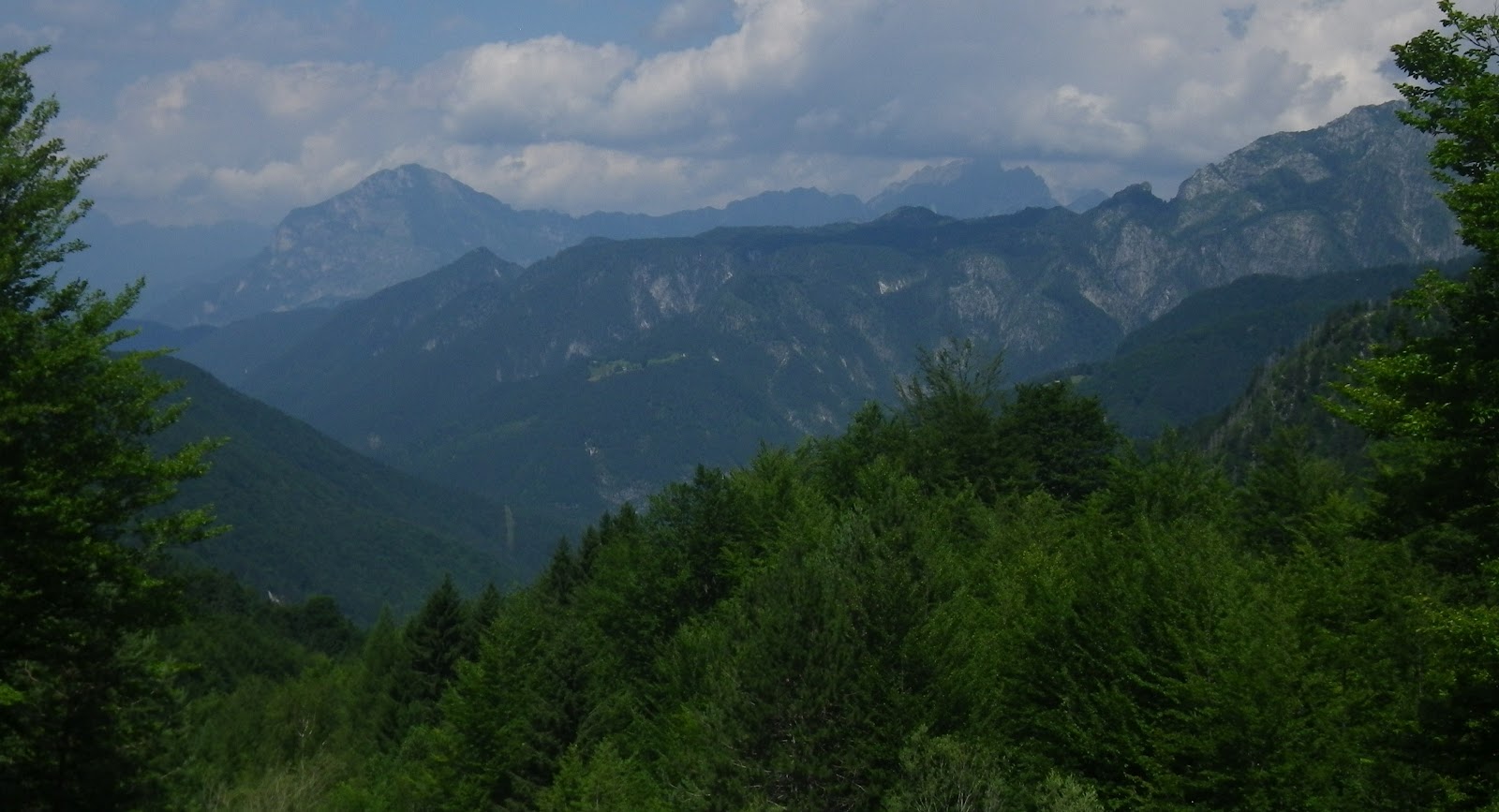
Ridge to north dividing Val Resia from Val Raccolana

River rocks in cement pavement at 1000 m.

Another summit in the north ridge

View west toward Val d'Aupa peaks north of Moggio

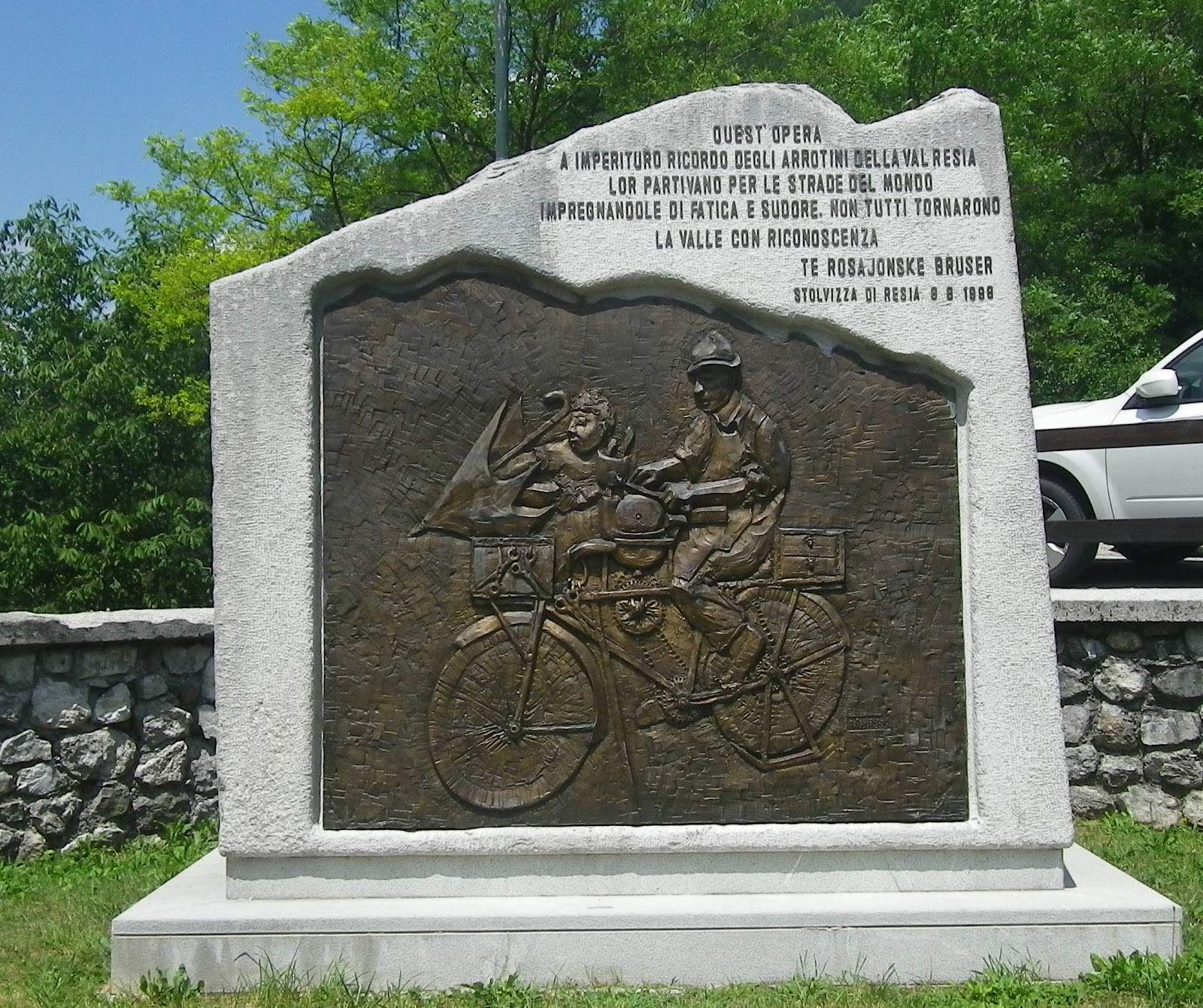
Love this large bronze of knife-sharpener's bike.

View of San Giorgio's Slovenian-style church steeple

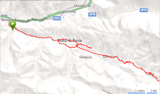
Overview of ride

The diversion through San Giorgio to Origne

The main climb

Close up of short, steep tornanti climbing toward Coritis

The steep section of death at the end

Note the amount of gradient greater than 13% from Stolvizza to 1000m

15% gradient last 1.25 km 

Final 4km of 11.3% average gradient 

Wednesday, July 4, 2012

Monte Grappa da Alano di Piave

Monte Grappa has more optional routes than any climb I know.  There are so many possibilities they even have an event called Monte Grappa Challenge where people try to do 5 (or more)  different climbing routes in one day.  I climbed starting in Pederobba last year, so today just for fun I tried it from Alano di Piave.  I drove to Pederobba so I could get some flattish km in before the start.  Along the river at Fener, turn left toward Alano, head up the gentle climb through town, and follow the signs for Passo del Tomba or Monte Tomba.  This is a mostly shady climb up a forested gorge.  The worst stretch is 5km of average 10% gradient, which wore me out pretty good.  I caught up with another biker and commiserated about how hard it was and he said it was especially hard at age 72!  Ok, time for me to stop whining.

At 861meters you join the road  from Pederobba, along the ridge and across the flowered meadows of Passo del Tomba.  After some fairly easy ascending along a cliffside road, you reach a scalinata di tornanti exposed to the sun, gaining 253 meters in 2 km, for an average gradient of 12.65%.  I was in full vapor lock toward the end of this at 1174m, gasping and wobbling but I never stopped.  A brief false flat was followed by another ramp up to 1445 meters at La Vedetta.

Now a nice break, descending 10% slopes to Val delle Mure, a wonderful grassy valley with a herd of Holsteins drinking at their favorite pond then heading upward to graze.  Climbing out of here you pass through some World War I tunnels and more beautiful meadows.  After some cliffside riding you turn toward Monte Grappa and make the final push up to memorial at 1732m.  I parked my bike and walked up to the two massive ossuaries, interment of the remains of thousands of Italian and Austro-Hungarian soldiers killed during the endgame of the war.  

The descent is much easier of course, except the climb back up to La Vedetta from Val delle Mure.  I skipped the descent back to Alano, returning directly to Pederobba for the drive home.  And now the difficult task of choosing which of the routes to try next. 


Above Alano del Piave; they've included the
flat starting/ending sections in their calculation

From summit- looking down the route of the ascent from Nardo to north

From summit toward northwest

Westward view from summit

Looking down at the route I climbed

View east toward Val delle Mure

Beautiful rock formations above Valle San Liberale

Wild boar round up tomorrow morning


Counterclockwise ride

The climb from Passo del Tomba to summit

Close up of scalinata di tornanti of death


2 km of 12.65% average gradient 

Note the amount of gradient above 10% for almost 3km