Saturday, September 3, 2011

Giro di Lago del Vajont

North of here in the mountains there's a strange lake.  It has the fourth tallest dam in the world (262 meters), a little pond a kilometer upstream from the dam, and in between, a mountain sitting where the lake is supposed to be.  In 1963 when they filled up the lake, it undermined the base of steep Monte Toc (1921m) to the south, and half of the mountain collapsed into the lake.  The water was instantly displaced and killed over 2,000 people in surrounding villages and downstream at Longarone, on the Piave River.

I've driven or ridden many times along the main road on the north shore of the lake, but always wondered about the little villages I can see on the opposite shore.  Today I decided to check it out.  After the easy climb up Valcellina to Cimolais, and the brief ascent over Passo San Osvaldo (827m), I arrived in the valley at the top of Lago del Vajont.  I rode along the north shore by Erto and on toward Casso.  There was a turn off to the left marked Pineda.  It climbs across the huge mass of rock and dirt which split off from Monte Toc, along the heavily-eroded hillsides where the surging water gouged tortuous channels into the earth.  Then finally it reaches 800m, begins to descend and enters another world.


Instead of sun beating down on scrubby trees and arid grass, you're now immersed in cool green forest as you descend steeply to Pineda, a small group of farmhouses.   Then you cross a high bridge over a gorge with white water stream.  I guess this would all have been underwater if the lake had remained.  You ride through several unlit tunnels, luckily short or with side openings to admit light.  Eventually you arrive at Liron, a semi-level location on the hillside with meadows.  As I approached I noted an older man on a bike balancing a 20-foot long skinny tree on his shoulder (maybe 4 inches in diameter at the fat end) while pedaling along the twisty narrow lane.  By the time I caught up he had already dismounted and was carrying the tree uphill to the back of his house.  Those are some amazing bike handling skills.

After more forest riding you arrive at Prada, another big meadowy area overlooking the gorge.  Continuing, you ride a hundred meters or so of dirt and gravel, then the pavement resumes before reaching Marzanna.  You begin to descend and the road becomes permanently strada sterrata, though no problem even with 23mm tires.  Along here I encountered the only other cyclist on the giro di Lago del Vajont, a pretty girl on a mountain bike.  After some more short tunnels you arrive at a modern concrete bridge over Torrente Vajont.  Took some pictures here and after a brief climb out, arrived back on the main north shore highway east of Erto.  Easy ride home from here.

Definitely want to try this again, possibly the other way round.  It would be a great workout climbing the section near Pineda.

Remnant of the lake, viewed from atop the
landslip which now fills the basin

Close up of lake remnant, with mountains
above Cimolais in background  


Tributary entering from the south,
viewed from high bridge after Pineda

Meadow at Liron

Big meadows at Prada

The eroded gorge of Torrente Vajont
before it enters the lake basin

Torrente Vajont tumbling westward toward the lake

The town of Erto on the cliffside to the right

Monte Toc (1921m), with shining rockfaces marking
the landslip's origin  

Satellite view of Giro di Lago del Vajont

Left- Passo Sant Osvaldo, center- hilltop above Pineda


Thursday, September 1, 2011

Malga Monte Fara

Malga Monte Fara is very close to our home, but I never knew until a mountain biker I was chatting with, Ermiono, mentioned it.  Today was my first chance to ride it.

Quite stormy off-and-on this morning but there was a brief gap in the weather so I went for it.  Up through the long tunnel to Andreis, then along Torrente Alba and up the road through Bosplans.  There is a scout camp in the valley below and apparently they have a brass and woodwinds band, which sounded pretty good in the natural amphitheater of surrounding cliffs.   I continued climbing to their accompaniment up to 650 meters, where a gravely, washed-out road turns off to the right, with a wooden sign pointing to Malga Monte Fara. 

After making your way through the initial gravel stretch, it improves a bit- now a narrow, roughly paved lane with lots of loose gravel washed down by the rains.  It's not bad if you can keep traction on the loose material covering the steep incline.  I stood on the steeper parts, feathering the force applied to my rear tire as required.  But below 13% I tried to stay seated to keep some weight on the rear wheel.

I reached a small group of hikers.  The lady in back heard me panting, turned and saw me, then announced "Attenzione! In arrivo una ciclista a dietro" like it was a race.  Then the other hikers cheered me on "Coraggio!" "Bravo!" etc.  That was fun.   

Eventually I reached a homemade gate of sticks tied together to keep the sheep and goats from escaping.  I closed it behind me and continued to the malga at 950 meters.  I descended very slowly because of the surface and rejoined the main road above Bosplans.  I didn't even think about descending the way I came, instead heading upward for Pala Barzana.  Soon the black clouds to the north began drizzling on me, but it felt good as I climbed through the dense forest to Pala Barzana.  From here I rode downhill gingerly because of the damp pavement and spruce needles in the road.

The rain picked up as I neared Pian delle Merie.  Luckily the road was closed for repair and there was a deviazione through Val di Frina, which is a bit shorter.  They've paved this road since last I tried it,  much nicer now.  Below Poffabro the deviazione ended and I sped through Val Colvera and the tunnels toward Maniago.  Here it was dry, so I slowed some and headed toward Montereale.  But the rain resumed near Maniago Libero, and continued over the bridge at Ravedis, through Montereale and almost all the way home.  

I'll try this again on a clearer day this Fall and try to get some fotos of the lovely rock formations above Andreis as well as the meadows on Monte Fara. 


Rustic gate


The malga at 950 meters and grazing sheep

Tabacco map showing the turn off after Bosplans

Malga Monte Fara left, Pala Barzana right

Some of the steep, loose slopes


Satellite shot


Max speed is wrong- caused by loss of GPS signal in tunnels

Sunday, August 28, 2011

Passo Duran North & South

Passo Duran connects Val Zoldo, Forcella Staulanza, Passo di Giau, etc with Agordo and its nearby passes.  I decided to ride it both ways, rather than concoct a lengthy loop to avoid reclimbing it.

I parked at Forno di Zoldo to get a little warmup before Dont (we had a cold front pass through last night and it's suddenly quite nipply).  I recommend warming up, because the road after Dont immediately climbs at 15% for a half kilometer.  I stood in the pedals for this, and it wasn't bad with fresh legs and lungs.  The road winds through some lovely small towns as it ascends above the spruce forest of Torrente Moiazza gorge.  After the last of these towns (1250m), you start a 4km series of steepish tornanti to the pass at 1605m.  This stretch averages 9-10%.

The pass is gorgeous, with big rocky summits towering on both sides.  There is a rifugio and steep meadows with cows.  I donned my windjacket and headed down toward Agordo.  This road widens a bit so you can build up some speed, then passes through a series of little villages as it winds down to Agordo.

Agordo is a tourism center, maybe a little too touristy this time of year.  I did find a pedalata to watch, which is fun because families on all sorts of bikes participate.

I never did thaw out from the descent, even in the full sun down in Agordo, so decided I needed to recommence climbing to generate some heat.  I headed up and soon found myself behind an older fellow (60s-70s), who was mashing maybe a 39-23 gear up the 9-10% grade.  I spun my feeble 34-29 and stayed far enough back not to disturb him.  I stopped to remove my jacket and next I saw him far ahead on a long straight stretch.  Later he had stopped on a short 13% ramp and I wobbled by.  Near the pass I stopped to shoot some pictures and he caught back up again, still pushing that fat gear.  We chatted a bit- he was from Genova, which I hear is very hilly.  I noticed his bike was a Shock Blaze and mentioned they were made near here at Colle Umberto, TV.  He had bought it in Genova and didn't know where it was from.  Anyway, he was just getting started, planning to ascend Forcella Staulanza next, then cruise back to Caprile and Agordo.  I only pray that I'm in such good shape in 10-20 years.

Rode the steep twisty downhill to Dont, then down to Forno di Zoldo, and drove home.  I'll be back- too pretty to stay away!


Lago di Vajont nebbia at 6 AM on the drive to Longarone 

Monte Moiazza (2868m) above Passo Duran

Pale di San Martino (2812 m) from below Duran

Dolomite columns of Monte Agner (2872m) from below Passo Duran

Monte San Sebastiano (2420m) left, Monte Tamer (2547m) right

Close up of the cathedral facade of San Sebastiano

Climb from Dont left, climb from Agordo right

Dont to Passo Duran

Agordo to Passo Duran


Friday, August 26, 2011

Passo di Fedaia

A wonderful climb to Passo di Fedaia (2057m), ascending along Torrente Pettorina, up grassy slopes and onto the shoulders of Monte Marmolada.

I started in Caprile (998m), though leaving from Alleghe might give a better warmup.  The road climbs  up through several picturesque villages with flower-bedecked wooden balconies.  The last town, Sottoguda (1250m) offers you a choice of continuing on the main road, or entering a narrow chasm along Torrente Pettorina called Serrai di Sottoguda.  This is a fantastic, quiet place, immersed in shadow and the sound of tumbling water.  No cars allowed, and I was the only biker (bikes allowed to ascend only).  It's quite steep toward the end, grappling up the gorge to Malga Ciapela (1450m).

Here you rejoin the main road, which steepens into a long straightish ramp climbing 400 meters in 3 and a quarter kilometers (over 11% median gradient).  This section is called Capanna Bill, and is famous for high speed descents (over 100kph).  A girl in a tank top came flying down this, and I was impressed that the wind chill didn't bother her- an hour or so later when it was warmer I descended with zipped-up jersey and felt cold.

After this the switchbacks begin, including the steepest sections of 17-18%.  All told the 6 kilometers from Malga Ciapela to the pass average well over 10%.  They're completely exposed to the sun, so get an early start if climbing in summer.

The top of the pass has wonderful views of Monte Marmolada (3342m) directly above, with the last glacier in the Dolomiti, whose runoff is collected in a lovely blue lake.  It's a fascinating area, and sufficiently large that even the August touristic hordes didn't spoil the place.

I headed down the tornanti and stopped to photograph a flock of sheep coming up the pass.  I felt like I was flying down Capanna Bill but reviewing the data later, was actually going a little slower than descending Piancavallo.  This time I bypassed Serrai di Sottoguda and went instead through the short tunnel and high bridge over the gorge.  Later I stopped and took some pictures of Torrente Pettorina descending through the forest and meadows.  There's a wonderful hiking/biking path along here that runs all the way from Alleghe to Sottoguda.

I'll definitely be returning here again someday.  Lovely place!


The tall, narrow gorge of Serrai di Sottoguda

Monte Sassolungo (3181m) to the west 

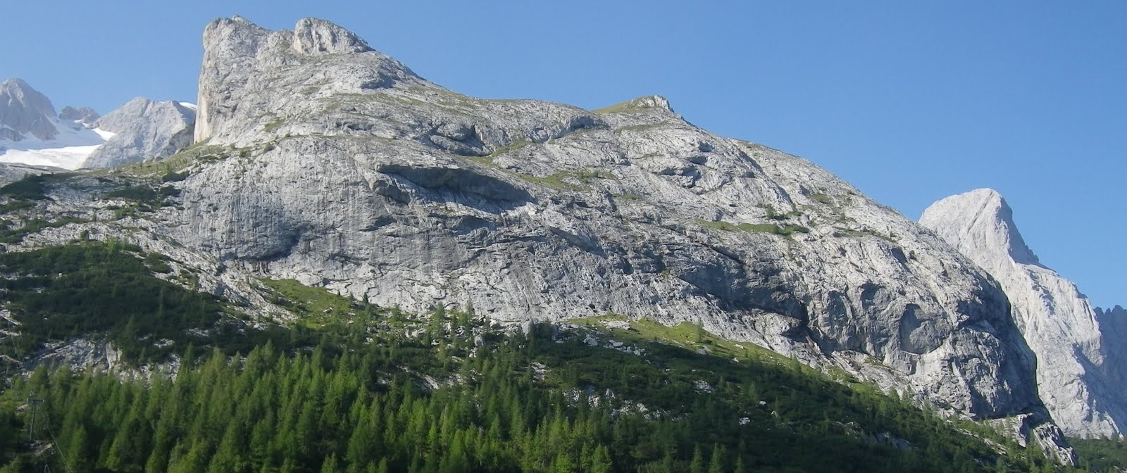
Dolomite dome on Marmolada

Marmolada glacier amid peaks

Glacier runoff in gorgeous blue-green lake

Dolomite tower on ridge to the north

Monte Padon (2510m) to the northwest

Marmolada rock formations above lake


Close up of glacier-carved teeth on Marmolada

Peak on Marmolada facing east

Close up of the peak

Another of Marmolada's massive formations

Flock of sheep ascending Passo di Fedaia

Shepherdess getting mama goat started milking for thirsty baby goat 

Asini enjoying their friends, the sheep and goats

Torrente Pettorina below Serrai di Sottguda

The view back toward Passo di Fedaia from Bosco Verde


GPS track of ride


From start through Serrai di Sottoguda to Malga Ciapela


The upper half above Malga Ciapela