Wednesday, August 24, 2011

Passo San Pellegrino - Passo Valles

Passo San Pellegrino is on the western border of Belluno province and Trentino Alto Adige.  It's a longish pass, starting at Cencenighe Agordino (774m) and climbing 18 km to San Pellegrino at 1918m.

At the start there is a long tunnel "delle Anime," which is narrow (given the trucks and buses that traverse it), poorly lit, and runs steeply upward for 1140m.  So I opted to follow the advice of the Ediciclo guide and bypass the tunnel using the old road along the river, which has a shorter, unlit tunnel of its own.  At first there were lunettes allowing natural light in, but these stopped after awhile, and a curve in the tunnel behind left me completely in the dark.  I stopped for a moment so my eyes could adjust, and then I could make out a faint glow far ahead.  I rode slowly toward it, and as the tunnel continued to turn, I eventually could see the opening at the far end.  I need to get a tiny headlight for these occasions.

It's a nice climb up the valley through the little towns of Canale d'Agordo, Falcade, and Falcade Alto.  After these the road heads into dense spruce forest with a series of short steep switchbacks, increasingly more difficult until you hit a healthy stretch of 18%.  After that the gradient mellows to 8-10% until the passo.

The passo is a lovely meadow area , though there are numerous ski lift operations and tourist places along the road.  I found a little side road marked Rifugio Cima Uomo and rode into the pretty meadows a bit- very nice once you get away from the main road.

Returning to the main road, I coasted down the hill until 1400 meters, and then on an impulse turned uphill toward Passo Valles.  I had no idea how far away this was nor how high, but thought I'd climb till I was tired.  The pass turned out to be about 7 km away, and 2032 meters high.  The meadows here were even more spectacular, stretching for miles.

Now I was tired and coasted back down the hill to Cencenighe Agordino.  It was much warmer when I arrived down there around noon (in the high 30's).  These are wonderful climbs in great scenery- try them if you're in the area.

Note: installed a new Michelin Lithion 2 tire on the back wheel yesterday before the ride.  The previous Krylion (installed January 2011) was worn down to the threads almost all the way round the circumference.  Decathlon was out of Krylions (which rode well and resisted punctures), but had Lithion and Vittoria (can't remember the model but they had red tread).  Will see how long these last.

West from Passo San Pellegrino toward Moena

Mountain ridge to north of Passo San Pellegrino

Wildflowers along the descent

Close up of wildflowers

The meadows to east of Passo Valles

Rocky peak above the meadows

The thinning forest transitions to grassland

View to southeast from Passo Valles

Falcade and Falcade Alto from the Passo Valles climb

Falcade close up

GPS track of climbs

Altimetria Passo San Pellegrino

Altimetria Passo Valles


Monday, August 22, 2011

Monte Zovo

Monte Zovo (1943m) is in northern Belluno province near Austria, not far from il Sorgente del Piave.  I thought I would knock out a couple of climbs while I was there- surely one wouldn't be enough.

After driving to San Stefano di Cadore I rode the bike east toward San Pietro.  I turned left off the main road and followed the steep (8.6% average) grade to Costalta for 4.3km.  Costalta is a very pretty hillside town with lovely wooden homes, balconies covered with flowers.  From here a flattish road clings to the side of a gorgeous steep valley, to the site of an old sawmill, and now the real climb begins.  

The next 2 kilometers you gain 283 meters, averaging 14.2%.  I was hanging in there, gasping and blubbering until a baita just below Capella Santa Anna, when the rear wheel lost traction on loose pebbles and I quickly got my foot down to avoid falling.  There was no re-starting here on 20% gradient, and I was knackered anyway.  I rested a moment then put on my cleat covers and walked about 500 meters.  I caught my breath by the time I reached the junction of the road from Valle, and rode the final few hundred meters to the rifugio.  The road becomes dirt here and is part of a mountain biking, horse-riding park in Val Visdende.  This makes me want to fix up the old mountain bike more than ever.

After returning to Costalta I followed a great road that traverses the mountain side all the way around to Costa, the Strada Panoramica del Comelico, immersed in tall spruce trees, with fantastic views of the valley and surrounding peaks.   At Costalissoio I unwittingly followed Strada Provenciale 30 Dir instead of continuing on the more-level panoramica to Costa.  So, after a fun descent to Campitello (976m), I began the ascent to Costa.

This climb rises through San Nicolo di Comelico to Costa at 1346m, averaging 8.8% gradient.  I rode around the pretty town of Costa awhile, looking for the turn off for Monte Zovo- turns out it was at the last tornante before town (unmarked).  

The Monte Zovo road has recently been repaved and the surface is perfect, though watch out for the drainage grates.  It is open to the blazing sun, and steep, gaining 450 meters in about 4km.  I stopped to walk 3 times when the gradient was too steep/I was too weak.  Awesome views from end of pavement at 1837m, and the summit (1943m) after a km of strada sterrata is said to be even better.   

Easy roll down to San Stefano and drive home.  Must return and ride this again!


San Pietro from Costalto

Costalto (1324m)

Danta (1398m) across Val Padola from Costalissoio 

Candide (1212m) from Costa (1346m)

Falling water along Strada Panoramica del Comelico

Wildflowers along Strada Panoramica del Comelico


Close up of wildflowers

They got the tortuous right

Left Rifugio Forcella Zovo (1600m), right Monte Zovo (1837m)
Rifugui Forcella Zovo, from www.salite.ch


Monte Zovo, from www.salite.ch


Steepness of Rifugio Forcella Zovo climb


Close up of Rifugio Forcella Zovo

Close up Monte Zovo

Saturday, August 20, 2011

Col Alto da Pedemonte

This is the closest big climb to my house (about 7km away).  It starts at Pedemonte (160m) and finishes 15.6km later at Col Alto (1374m).

The bottom 11km portion is wide and smooth with great switchbacks, averaging around 8%.   After Castaldia (1090m), the top 4.6km is a narrow mountain lane through alpine meadows, averaging about 6%, with some steep ramps in the last km or so.

Today was a beautiful August weekend, so lots of cars heading for Piancavallo on the main road.  I went by a couple of riders who were also climbing, while dozens of early risers zoomed downhill.  But after turning off at Castaldia the mountain lane was mostly deserted.  A lady on a trekking bike asked me if the road downhill went to Piancavallo.  I told her to take a right at Castaldia.    Shortly afterwards her husband rolled by, so hopefully they found their way.

Great descent- very fast and fun.  On the ride back home two older guys, tucked-in and clutching their bikes' aerobars, passed me going up hill by Hotel Royal.  They were fast!

Edited to add:  Later in the afternoon Marilyn wanted to go for a walk, but it was too hot where we live (300m), so we put the dogs in the car and drove up toward Col Alto.   We hiked a ways along Viale delle Malghe, a trail which connects numerous hikers' shelters along the mountains' crest.  Beautiful wildflowers, karst outcroppings, alpine trees, views of the pianura.  And the dogs had a blast.


Thursday, August 18, 2011

Monte Prat da Pielungo

This is another series of smaller local climbs, this time Pala Barzana, Orton and Monte Prat.

Climbing Pala Barzana I passed Bosplans and saw a fellow ahead on a steep straight stretch.  I stood in the pedals and soon caught up.   He was an older gentleman on a mountain bike, and we started talking.  He was very friendly and described his plan for today- after Pala Barzana (842m) ) he would climb the strada sterrata to Monte Jof, then descend to Maniago.  He was familiar with all the climbs I told him about, and even told me about a new one I'd always passed and presumed was an abandoned road.  His name is Ermiono.  Hopefully our paths will cross again someday.

Fun descent as always down the curves to Poffabro and then to Navarons.  After passing Lago Tramonti, I turned right toward Campone, and then over Piani di Clauzetto (675m).  Here a lovely lady was standing by her bike, waiting for someone.  A little further along I encountered who she was awaiting- an older man, flat on his back, cranking a handbike up this slope.  I said Bon di and he responded.  What courage it would take to climb a narrow public road on your back!  Not to mention the upper body strength.  That's determination!

After Pradis I climbed over Orton (699m) and then headed down through Pielungo to Val d'Arzino.  This is one the most beautiful roads I've ridden.  I need to go back in the car and hike down to the waterfall I glimpsed through the trees.  Quite loud, so I'm guessing it's big.

I rode briefly north on the Val d'Arzino road, then turned right on an unmarked road just before a bridge.  This is a paved forest road up to Monte Prat (894m).  I didn't see a soul on this 11 km climb, neither biking, hiking, nor driving.  Even the herd of pigs in the road on a previous visit were now absent.

I zoomed down the wonderful descent to Forgaria, and over the rollers to Pinzano, Valeriano, Lestans.  Made it home a little over 6 hours after departing.  Good ride!

Campone

World War I cemetery near Orton

Val Tochel meadows at 894m

East peak of Monte Cuar above Val Tochel

Pala Barzana, Piani Clauzetto, Orton, Monte Prat


Tuesday, August 16, 2011

Monte Pizzoc

Monte Pizzoc is another favorite local ride- rising from 31 meters up to 1536 meters, with challenging gradients, and beautiful scenery.

I left shortly after 7 AM riding the rolling hills down to ristorante Trota Blu and the turn off for Sarone.  The climb from here up to Malga Coda del Bosco (870m) has mostly southern exposure, so leave early on sunny summer days.

2 guys passed me on the middle of the climb, then slowed down.  I rode behind them up past the malga, then passed them.  This section is shaded by dense beech forest, and feels much cooler.  I reached the little pass La Crosetta (1118m) and continued downhill for a kilometer for the turn off for Monte Pizzoc.  The 2 guys passed me again, so I rode behind them awhile.  They turned off at Via Zuel (1280m) while I continued toward Pizzoc, so I thought they were gone.   A few minutes later they passed again.  What the heck?  Anyway they gradually slowed down again when the road got steeper around 1350 meters, so I ended up catching them again.  Very strange.

I continued briefly past end of pavement up to a nice flat look out area.  I was taking pictures when a very friendly man with his wife asked if I wanted him to take my picture.  I thought he might want one of them as well so I could send it to them later, but no.  He was very kind.

I descended briskly (fun but scary during vacation season, as people now have bigger cars, SUVs etc which take up most of the road, particularly in switchback turns).   At the bottom I felt pretty good and made it home (20km) fairly quickly, despite the heat.  Great ride!


Piancansiglio meadows, backed by mountains to the east

Sorry about the helmet hair

Tall peaks of Dolomiti Bellunesi 

Looking up Strada del Prosecco, from north end of Vittorio Veneto,
past Lago Revine and Tovena toward Valdobbiadene

Left background Monte Cesen (1750m), with Monte Grappa peeking from behind;
right foreground Monte Viscontin (1763m), with Pian delle Femene and Pian dei Grassi meadows 

Family of asini hanging round the watering hole

Campanule in alpine meadows of Pizzoc

Close up of campanule


Sunday, August 14, 2011

Monte Cesen: Casere Budui to Rifugio Mariech

Monte Cesen towers 1750 meters above the Piave River valley and the prosecco vineyards stretching from Valdobbiadene toward Vittorio Veneto.  I rode a couple of climbs up the mountain last fall, but wanted to try a combination of the two.

From Vittorio Veneto (130m) I cruised up the rolling Strada del Prosecco to Combai (420m).  Lots of riders out on this lovely Sunday morning (also day before Ferragosto holiday).  Shortly after Combai I took a turn-off marked Osteria Madean.  The road starts out at 8% gradient, cloaked in thick chestnut tree forest.  After 3 km it steepens noticeably, varying from 9-12%.  The pavement is pretty torn up, so descending would be particularly difficult.  Around 1000 meters the shade starts thinning out and soon disappears- the exposed slopes were hot.   At 1200 meters the road levels out till Casere Budui.  Nice views of the grazing cows on the grassy slopes above, and lovely music from their bells.  Instead of turning around to descend, I continued on a long traverse to Pianezze at 1076 meters.  Lots of great views of the plains below, though it was hazy.  

At Pianezze I began the ascent to Rifugio Mariech.  This is a great road, never too steep, with good pavement, and even a row of trees along the southern exposure to keep it cool.  Great views of the grassy slopes of Monte Cesen from this climb- it's really pretty this time of year.  I reached the rifugio at 1510 meters, amid flocks of vacationers mulling around.   Soon I headed down the fantastic descent to Valdobbiadene (252m).  Below Pianezze the road is engulfed in dense forest, steeply winding down the switchbacks.  Fun!

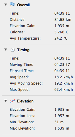
From Valdobbiadene you climb a series of hills through the prosecco vineyards to Combai, and then a gradual rolling descent to Vittorio Veneto.  This was a great ride- maybe next time I'll try it the other way round.


Video of the Monte Cesen Bovine Bell Choir


The grassy slopes between Casere Budui and Pianezze

Meadows above Pianezze, with cloudy Monte Grappa in background

Looking down at the  traverse road heading toward Pianezze

The road climbing to Rifugio Mariech (upper right);
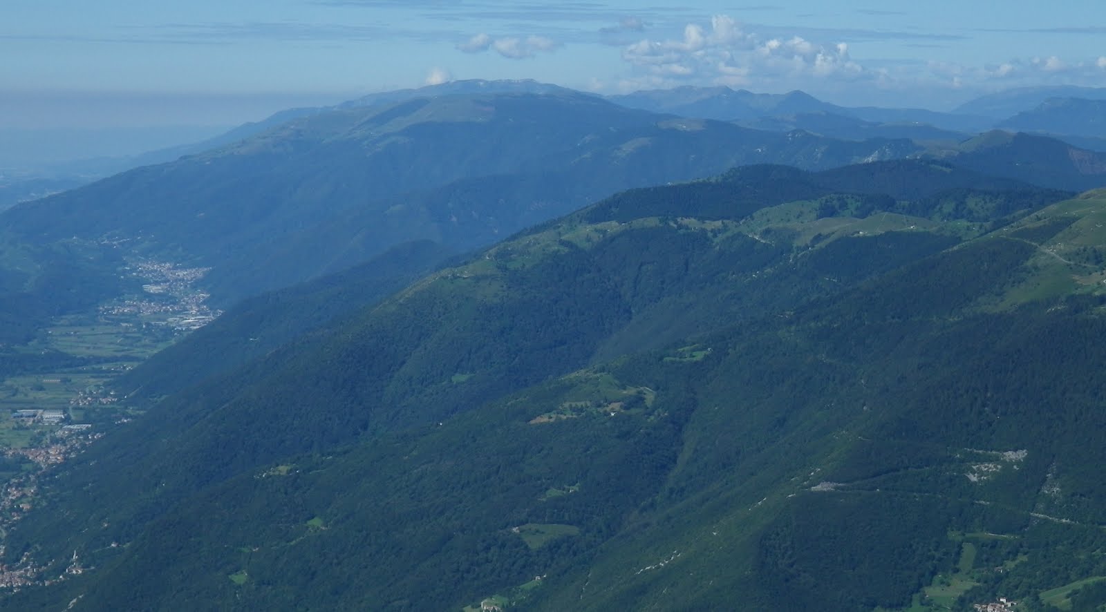
Valdobbiadene and Piave River in the haze on left

Climb to Casere Budui, left, and Rifugio Mariech, right 

Steepest point on Casere Budui climb and Rifugio Mariech climb

Counterclockwise loop