Wednesday, June 15, 2011

Monte Grappa da Pederobba

After reading about Monte Grappa on Italian Cycling Journal and www.cycloclimbing.com I got curious and decided to check it out.  The closest climb I've done previously was Valdobbiadene to Rifugio Mariech (1510m) on Monte Cesen.  So I thought I'd ride from Valdobbiadene to nearby Pederobba and start the climb there.

Left home at 5:30 AM and arrived in Valdobbiadene a couple hours later.  I noticed the signs weren't too clear on which way to go, so I decided to drive to find the way, rather than getting lost on the bike.  After driving around aimlessly awhile, I saw a road for Padova which crossed the Piave River so I took that. Luckily this went through Pederobba, so I parked and started the climb.

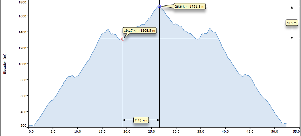
This is an odd climb because it's actually 3 climbs strung together.  The first, from Pederobba (213m) to Passo del Tomba (861m), ascends 11 tornanti through cool shady forest.  The average grade on the tornanti section is about 9%, with 3 steep ramps in a row near the top, one at 18%.   This ends in a natural meadowy area at the passo (grazing is forbidden, so lots of wildflowers), with some gorgeous views of the surrounding countryside.  The view ahead was more troubling- the second climb up the slopes of Bocca di Forca and Monte Palon to La Vedetta at 1445 meters.

After a short descent you begin 5km of tornanti averaging 11%, with stretches of 15-16%.  It's mostly exposed to the sun, so it would be very hot later in the day in summer.  This is the hardest part of the climb.  Eventually the gradient eases a bit, with fantastic views down the sheer slopes to the pianura.  The cliff walls along the road have dozens of tunnel openings, which seem to lead upward to fortifications along the cliff tops.

Now another descent carries you away from the cliffs to an area of lovely rolling meadows, Pian della Bala (1300m), surrounded by mountains.  I was lucky and managed to traverse the lane before a herd of Holsteins wearing bells crossed on their way to pasture.  Dozens (hundreds?) of cowbells ringing in unison sounded like a large gamelan orchestra.  I will try to record this with my camera next time- really striking.

The mountain lane winds through an area with many World War I landmarks and hikers exploring them.  Now it traverses cliffs above heavily eroded slopes, then climbs more tornanti up the final push to Monte Grappa, at 1732 meters.  This section has an overall gentle average grade of 5.5%, but the steepness is skewed toward the final 3.3 km, which averages 10%.  At the top clouds were swirling, the huge WW I monuments silent in the cold wind.  I donned my windjacket and photographed some of the spectacular scenery.

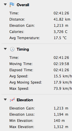
The descent was fun- a welcome rest after all the grappling.  I had to re-ascend the 10% grade from Pian della Bala back up to Monte Palon,  but it wasn't that bad.  Reached the car again about 4 hours after starting, including stops to take pictures.  

I would definitely recommend this climb.  The scenery is wonderful and constantly changing- from dense spruce forest to rocky cliffsides, verdant alpine meadows, and finally a stark, windy summit.  All of this interspersed with dozens of historical sites from World War I.  Really fantastic ride. 


Monte Palon ascent (1445m) looming ahead from Passo Tomba (861m)

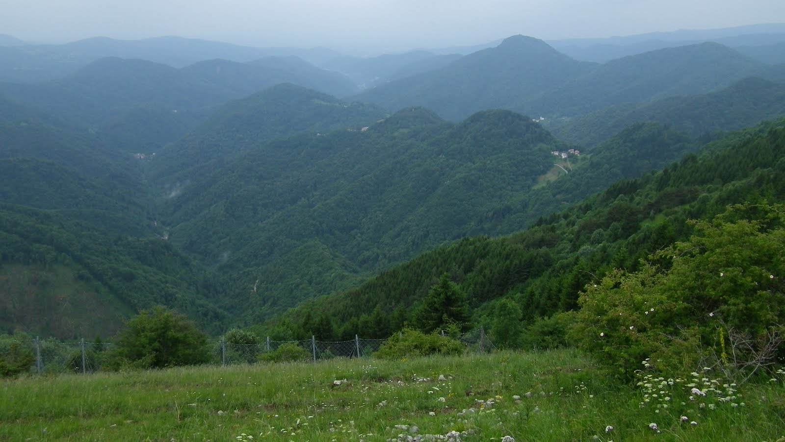
Colline Asolane rise from the plain south of Passo Tomba 

The slope of Monte Palon with tornanti

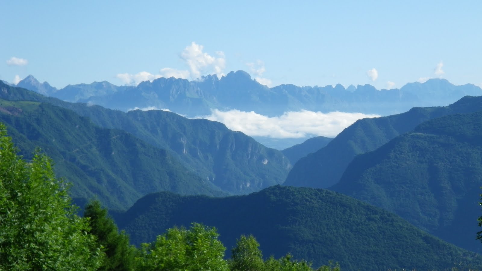
 Dolomiti Bellunese to the north 

Goat sign at junction with climb from Paderno del Grappa
(Salto della Capra)

WW I memorial at summit

Ossuary with remains of the fallen from the battles on Monte Grappa

View of the beautiful alpine meadows of Pian della Bala


Cool peaceful spruce forest on the tornanti of
Passo Tomba


9% average grade on tornanti climbing to Passo Tomba

11% average on the tough tornanti up Monte Palon

Easy average grade on climb to Monte Grappa,
but the top 3 km are 10%

Some of the steep 16-18% stretches


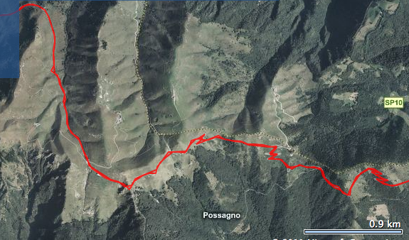
Aerial view of the climb

The beginning- from Pederobba up Monfenera to Passo Tomba

Passo Tomba meadows and the first series of tornanti up Bocca di Forca

Traverse of Monte Palon to La Vedetta (1445m)

Beautiful alpine meadows of Pian della Bala

The windblown expanse of Monte Grappa's summit (1732m)


Tuesday, June 7, 2011

Kolovrat

Kolovrat ridge is a mountainous fortification dug by the Italians in WW I.  It faced Austrio-Hungarian forces to the northeast, with a network of roads on the southwest side of the ridge to supply the artillery emplacements through tunnels.  Today I visited the Italy-facing side of Kolovrat via the spectacular bowl-shaped valley of Drenchia.

I left very early because of rain in the forecast, and started the ride from Ponte San Quirino east of Cividale at 7 AM.  The ride up  the valley of Torrente Cosizza was very green and cool.  A herd of cows rang their bells while munching fresh grass.  As I rounded a curve entering Clodig, a gaggle of geese in the road stopped me in my tracks.  The leading goose seemed to be looking into the parabolic mirror alongside the road- not sure if he was looking at himself or the other geese.  I weaved around the gaggle and continued.  

After Clodig I turned left for Drenchia and the narrow lane soon pitched upward.  It continues steeply (averaging 10%) for the next 3 km, through a dense mixed forest of beech, oak, and chestnut trees.  The pavement was damp; on the steeper parts the rear wheel slipped when climbing out of saddle.  This section ended at Trusgne and the road became rolling to almost level.  On the right, views of the conch valley of Drenchia captured my attention- tough to keep your eyes on the road here. 

After completing a semi-circle along the eastern escarpment of the valley, I reached the turn-off for Rifugio Solarie.  This short road starts with a half kilometer averaging 11.7%, then gradually decreases in steepness. The rifugio at 956 meters didn't seem like the end of the road.  In fact, it continues into Slovenia and then descends to Tolmin.  This would be a good climb to try from the Slovenian side.

But my attention was drawn to a small lane climbing to the north.  Signs along the road described the events here at Kolovrat in WW I.  Cave-like tunnel entrances disappeared into the ridge.  Breathtaking views of Val di Cosizza and the rolling mountains to the south (with a backdrop on clear days of the shimmering Adriatic Sea).  The lane continues climbing to 1200 meters altitude.  After 4 km pavement ends, but you could continue on the strada sterrata carefully and reach the paved road to Livek and Idresca in Slovenia.  This would be a great climb in the opposite direction.

After returning to Rifugio Solarie, I descended via the road to Lombai. The rain held back well into my descent, but finally cut loose and started pouring above Clodig.  Luckily the forest was so dense that I didn't get very wet.  Then on the open 12 km stretch from Clodig to Ponte San Quirino, the bike and I got a true bagno gratis.  I neglected to bring dry clothing to change into, so drove home wrapped only in a blanket.  Luckily I wasn't stopped by the police for anything and no tour buses pulled up alongside me at a light.


View of the bowl valley of Drenchia

Peaks along south flank of Val di Cosizza

From Kolovrat ridge road, misty mountains to the south

After 4km pavement ends on the small road along Kolovrat ridge;
still looks rideable with a road bike though 

Paved road coming up from Livek in Slovenia  

Above Rifugio Solarie, the main road continues
to Tolmin in Slovenia
10% average section above Clodig

A good workout as well as beautiful scenery


Sunday, June 5, 2011

Artigianato su due ruote


To celebrate the Giro d'Italia stage passing through Aviano (and up Piancavallo), local collectors staged an exhibition of antique bikes, gadgets, jerseys, etc.  The Craftsmanship on Two Wheels show was held at a local historic site, Palazzo Menegozzi.  Great exhibit- especially enjoyed the old work bikes: a postino's bike, a fireman's bike and a knife sharpener's bike.


Moser time trial frame

Early gear changer on Bianchi bike

Lovely Colnago Master Olympic bike

Gelateria on wheels

Heavy duty postino's bike.  Love the helmet.

Pompiera (fireman's) bike

Knife sharpener's bike, with chain-drive grindstone.
These are still in use.

Ottavio Bottecchia's track bike 

Fagin track bike- the frame tubes have been flattened to reduce  drag


Monte Matajur

Just east of Udine, Monte Matajur straddles the Italy-Slovenia border.  It is part of the Prealpi Giulie, which lie to the south of the higher Alpi Giulie peaks like Mangart and Triglav.   Matajur stands out as the tallest of these prealps at 1641m (though the paved road I climbed today ends at 1320m). 

To avoid the afternoon rain I left home at 6AM, and drove just east of Cividale to Ponte San Quirino.  After an easy warm-up through beautiful Valli di Natisone to Savogna (212m), I climbed through dense beech forest to Ieronizza, and then Stermizza (691m).  The trees shade this twisty narrow lane as it winds back and forth up switchbacks, continuing to Montemaggiore (945m).  This is the first flat spot in 8 km, but don't get comfortable, because you're about to head upwards again.  

This upper road is newer and wider, with very consistent gradient, so it feels easier.  Or I may have been experiencing some kind of fatigue-induced euphoria- not sure.  The landscape here changes to open alpine-meadow.  At 1320 meters you reach Rifugio Pelizzo, which is a restaurant with lodging.  There's also an astronomical observatory.  Lots of hikers here, both Italian and Slovenian.  The summit appeared to be socked in with dense clouds but the hikers weren't deterred.  

I put on my windjacket and headed down.  At Montemaggiore I turned left instead of returning through Ieronizza, and rode steeply down through Masseris.  This road was a real delight- very well paved, steep with long straights, sweeping tornanti, and a double chicane thrown in just for fun.  This descent alone makes the climb worthwhile- definitely will be returning!


On the way home I was starving so I stopped at Vogrig panificio and bought a focaccia for me and a gubana for Marilyn.  Delicious!


The alpine landscape and cloudy summit

Hazy view down Valli di Natisone

Beautiful alpine wildflower

Over 10% average gradient to Montemaggiore.

Steep spot above Montemaggiore.  Ediciclo cites max gradients
 of 17-18% and I'm inclined to believe them- they use an inclinometer, 
while my Garmin only estimates gradient. 


Ascent on left, beginning of descent on right

Wonderful fast descent- recommended!

Altimetria from www.salite.ch


Tuesday, May 31, 2011

Vršič - Passo del Predil

The Julian Alps of northeastern Friuli don't end at the border- they continue into Slovenia.  In fact some of the most spectacular mountains of the range are in Slovenia.  Today I traveled an itinerary through the heart of the Slovenian Julian Alps.  It really is one of the loveliest places I've ever been.

I left home at 6 AM and arrived in Tarvisio (705m) at  8 AM.  The road starts out rolling, without a flat warmup.  Finally after crossing the border the road flattens out and I got some spinning time in.  At Kranjiska Gora (810m), a ski resort, I turned right and headed uphill, into Triglav National Park,  toward the pass of Vršič.  It starts out gently enough, riding through dense red spruce forest  along the tumbling river Piscnica, then steepens and begins a series of 24 switchbacks.  These aren't too bad, varying constantly in steepness.  The one oddity is the switchback ends, which are paved with 5 cm cubes of porphyry stone pavé.  I've ridden old tunnels paved with these in Italy but never tornanti.  After about the 6th one I got used to it- not that bad when climbing but they would definitely put a damper on descending.

Higher up the spruce forest yields to some large open sunny gaps, with incredible views of the surrounding peaks.  Just shy of the pass at 1611 meters, a flagman held us up (there were a few cars and motorcycles waiting).  Finally he waved us on, and the wide flat pass was pretty hectic- a bike race (with some pro teams- I saw some Radobank and Omega Pharma riders/team cars)  and also numerous quadracycles (are these called ATV's in the US?).  I got away from this racket as quickly as possible.

Down the other side of Vršič, toward Trenta the road is equally curvaceous (with another 20-something switchbacks, though the ends are paved with asphalt, not stone).  It's a bit steeper and would be a tougher climb.  Again, eye-popping vistas of Mangart and other surrounding peaks, and the deep gorge of Isonzo and Coritenza Rivers.  At 785m you cross a roiling whitewater stream called Soča, source of the Isonzo River.  So clear and beautiful- I could have stayed and explored for hours.   

It's a long rolling slightly-downhill ride through Trenta and along the river to the junction before Boveč (450m).  Here you turn right on the road for Passo del Predil.  This heads gently uphill along the Coritenza River, up to the beautiful meadows of Log Pod Mangartom (643m).  Saw a little flock of sheep lying under a shade tree, with a cute little black lamb only a few weeks old.

The road continues upward averaging 8% or so to Passo del Predil (1156m).  The road is exposed to the sun much of the way, and rock-faces along the road intensify the heat.  Wouldn't want to try this in July-August in the afternoon.  I was able to do this climb seated (other than standing to stretch), which surprised me as I had been struggling earlier on Vršič.

After re-entering Italy, the descent was blocked for about 15 minutes by some paving work, so another waiting crowd of German motorcyclists, cars, tour buses, etc.  Lovely view of Lago del Predil on the way down  Then a long mostly straight downhill through the massive scar of an old open pit iron mine along the river Slizza.  Probably the biggest heap of mine tailings I've ever seen- a man-made mountain that stretches for miles.  Finally reached the car at 1 PM and made it home by 3 PM.  


Gotta try this ride in the opposite direction soon- the scenery would seem all new, climbing where I descended before and vice versa.  And then there's the ascent of Monte Mangart....


Porphyry stone pavement of the 24 tornanti- slow to a crawl when descending

Monte Mangart (2676m)

Clear water of Soča river

Soča river with Monte Mangart far above in background

Beautiful meadows of Log Pod Mangartom, surrounded on all sides by peaks

Looking back down Coritenza river valley

Old Austrian fortress at Predil

Mountain backdrop to the Predil fortress

Gradient from Kranjiska Gora to Vršič

Gradient from Boveč to Passo del Predil

8.5% average grade up Vršič

8% average grade up Passo Del Predil

Satellite foto Kranjiska Gora to Vršič

Vršič to Soča river

Boveč to Passo del Predil