Friday, July 16, 2010

Sella di Cereschiatis - Passo di Pramollo

Woke up at 0400 to beat the heat again, but headed off in a new direction. I drove northeast to Moggio Udinese (306 meters), and then hopped on the bike. Rode in the morning coolness through secluded, beautiful Val d'Aupa. The first 12 km are an easy gradient, but then it heads upward for 6 km, averaging 7% until the sella at 1066 meters. The sella is in a lovely forest.

The descent is equally fascinating- thick forest, large grassy meadows, views of surrounding peaks. It will be fun to ride in the opposite direction some day so I'll have more time to look around.

At Pontebba (560 meters) the descent ends and another climb starts- to the Austrian border at Passo di Pramollo (or Nassfeldpass in German) at 1530 meters. This is a harder climb- averaging 7% for 13 km. It has a couple of long stretches at 10% and higher. Also more exposed to the sun, so even at 10 in the morning the heat was palpable. But it also has great views, and at the top a little lake called Stausee. Lots of grassy hillsides at Nassfeldpass and pretty views. I rode a little ways into Austria, but turned back when the road started to head down.

After rapidly descending back to Pontebba, I headed down SS13 toward Moggio. This is an excellent road and the traffic was very light- most uses the parallel autostrada. It winds down through the mountains following Fiume Fella. Spectacular peaks all around.

I highly recommend this loop- the views are well worth the effort.


Creta Grauzaria (2066 m) from Val d'Aupa


North side of Creta Grauzaria from the climb toward the sella


Close up of the teeth of Creta Grauzaria


Distant peaks from the descent of Sella Cereschiatis


Mountain views from the Sella descent


Alpine meadows by Studena Alto


Stausee at Nassfeldpass


Stausee at Nassfeldpass and Monte Cavallo (2239 m)


Gartenkofel (2195 m) on Austrian side of Nassfeldpass


Looking back down Val di Bombaso from 1250 meters


Rio Bombaso; everytime I saw the name on a sign, Mr Bombastic started playing over and over in my head


Elevation of the 2 climbs


Wednesday, July 14, 2010

Sella Ciampigotti - Cima Sappada

I set my alarm for 0400 to escape the sweltering heat of the pianura today. I drove and arrived at Comeglians (540 meters) about 0800. Biked across the Torrente Degano, and headed up the beautiful Val Pesarina in the opposite direction from a couple weeks ago (see pics from the descent).

After a long cool climb in the shade, I arrived at the junction with the road from Sella di Razzo, over Forcella Laverdet to San Pietro di Cadore. Unfortunately the section to Forcella Laverdet and San Pietro di Cadore has been semi-permanently closed for a few years due to landslides. It's a shame because it's much shorter and looks like a wilder, less built-up area.

So I rode up toward Sella di Razzo (1739 meters). The road was closed briefly because of falling rocks while some men worked on the steep slope above the road. One guy was rappelling and fastening down some kind of heavy netting. Another guy in a precariously perched backhoe was moving earth, and creating mini-landslides. After awhile he paused, let the landslides play out, and shouted to the traffic stopper to let me pass. He grunted and waved his hand, so I weaved through the boulders in the road and carried on.

After Sella di Razzo I continued across the grassy meadows to a similar pass, Sella Ciampigotti (1790 meters). Why there are 2 passes about the same height so close together I have no idea. In any event, they're both absolutely gorgeous, covered with wildflowers, cool clear air, the sound of cowbells tinkling in the distance, and panoramas in every direction you look.

I then descended down the rough pavement, round switchbacks, etc toward Pelos di Cadore in Veneto. A large group of cyclists stretched out over a couple kilometers was climbing in the opposite direction. I think maybe they were Austrian or German- several blonde girls among them.

At the end of this descent you arrive in a fairly busy road, lots of tourists, tour buses, plus the usual trucks. For this and other reasons I'll mention, I wouldn't recommend riding this section (Pelos to Sappada) in the Summer. Probably much nicer on a Sunday in Spring or Fall.

Shortly you arrive in a 4.5 km tunnel. I don't mind tunnels, especially if they are well lit and maintained, but this one was neither. It had some dim fluorescent tubes every 50 meters or so- not enough to see the pavement without a headlight. Also a rough drop off at the edge of pavement into a sort of narrow gutter, and then a raised walkway (maybe 10 cm high). This is a bike accident waiting to happen. So if I go back (on a Sunday in Spring or Fall) I'll bring a bright headlight (I have an old Niterider from commuting days).

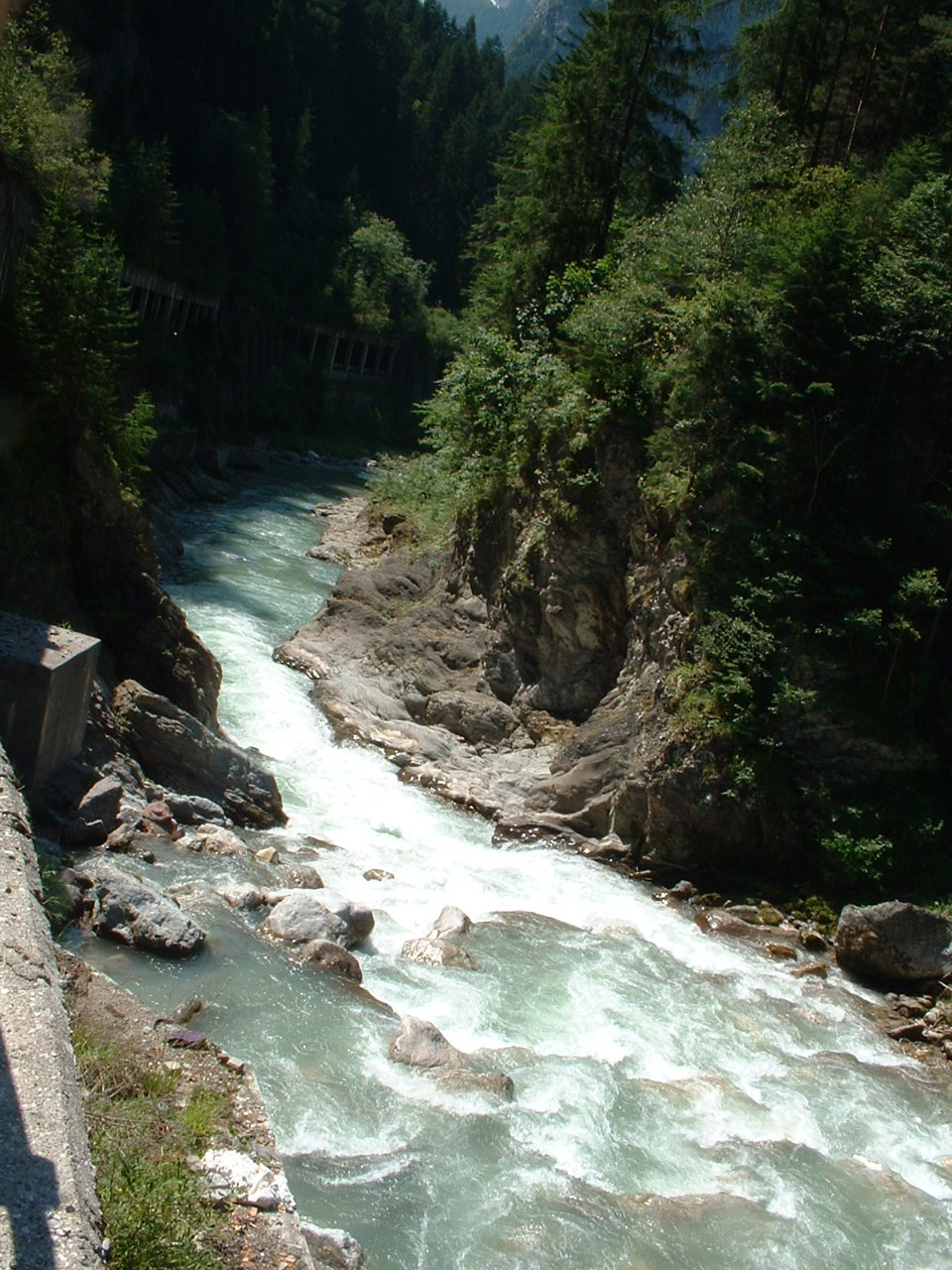
I made it through in one piece, rode through Santo Stefano di Cadore, a pretty meadowy town surrounded by mountains, and then headed up the Forra di Piave. This is a beautiful narrowing of the Piave River, with cool-looking rapids. Next town is San Pietro di Cadore, another nice town.

The next town, Sappada is not so nice in Summer- but I bet it's awesome in Spring or Fall. It's been made into a tourist strip, a several mile long shopping/snacking street mall. It's a shame really.

I rode through it as quickly as possible, then continued climbing along the edge of the Piave River canyon to Cima Sappada (1290 meters). Lovely views here.

I was delighted to return to the sanity of Carnia in Friuli- dense forest, quiet, fresh air. Exciting descent to Forni di Avoltri- lots of switchbacks, then a long straight stretch of 15%. Felt a little like free-fall. Forni is a beautiful town, followed by a short 1400 meter tunnel (well lit, good pavement). Now you are in the wild green Val Degano, threading the switchbacks down to Comeglians.

Great ride, with the caveats mentioned. I'll try the Forni di Avoltri - Cima Sappada climb soon, but I'll turn around at the top and come back down the way I came.


Waterfall above Torrente Pesarina


Monte Pieros (2314 meters)


Close up Monte Terza Grande (2586 meters)


Brave road workers preventing landslides


Sella di Razzo with mountains in background


Monte Terza Grande above Selle di Razzo


Close up mountains above Sella di Razzo


Sello di Razzo looking down Val Frisone


Monte Tudaio (2417 meters) above Sella Ciampigotti


Looking down Val Pesarina from Sella Ciampigotti


Farm above Sella Ciampigotti


Mountains of Marmarole


Forra di Piave


Downstream rapids in Piave river


Rapids upstream in Piave River


Looking from Acquatone down the Piave gorge


Rio Acquatone shooting out into space before plummeting down the Piave gorge


Elevation


Monday, July 12, 2010

Lago Cà Selva- Cà Zul

The little climb up the Torrente Silisia gorge to Lago di Cà Selva is one of my favorites. Its wild rock and pines remind me of Silverwood Lake in southern California (minus the manzanita). The music of the river far below graces this otherwise silent place.

After climbing up the gorge and descending almost to the dam, I tried something new. There is another mountain lake a few miles north called Cà Zul. The only road is via two construction tunnels from 1961 when the dam was built. They are unlit, very narrow, over one mile long each, and have water pouring down the walls. This fellow describes them.

I thought I'd bring along a light and see if I could ride through them. The concrete pavement wasn't bad at first, and they have the invading water routed through drains under the pavement. It was absolutely pitch black- the only light was my little Cateye headlight illuminating a little spot a few feet ahead of my wheel. I thought maybe I could make it. After a few hundred meters the sound of water pouring down the walls grew much louder, and the concrete floor turned very rough and rocky. With a mountain bike it might be possible, but no, I couldn't ride it. I turned around and looked back at the white dot of the entrance. It seemed so far away.

When I re-emerged at Cà Selva I was very happy to be back in the open air. After enjoying the view of the lake, I headed back down the gorge and home. It was noon now on the plain and quite hot. Felt so good getting home and taking a soothing soak.

There's another option to visit Cà Zul, a hike from Tramonti di Sopra. I'll try that soon.


Noisy rapids far down in the gorge


Monte Raut from behind (from the north)


Entrance to the black hole


Looking back toward sunlight, fresh air, life


Mountains west of the lake


The dam


Map of the 2 lakes


The route up Torrente Siliais

Saturday, July 10, 2010

Monte Pizzoc da Sarone

Last month I climbed Monte Pizzoc (1567 meters) from Vittorio Veneto , but the top was engulfed in clouds. Today it was clear so I headed back, changing the climb starting point to Sarone (48 meters) instead of Vittorio Veneto.

This approach is much more exposed to the sun on the lower section, so even though I left home at 0620 , it was already hot while climbing. Fortunately it's quite shady higher up, so I survived. After cresting the climb of Il Cansiglio at La Crosetta (1118 meters), I descended briefly to the starting point for Monte Pizzoc.

The climb begins with a 11% ramp with very broken up pavement. This ends not long later, and it becomes a nice mountain road- a beautiful easy climb through gorgeous beech tree forest. At around 1300 meters you leave the forest and enter treeless alpine pastureland. Wonderful landscape- tufted grass, exposed eroded rock, little circular glacial pools (with lily pads or similar aquatic plants growing on them). The views of surrounding mountains, Piancansiglio, Piave River Valley, and the plain were fantastic, despite the haze.

On the way down, I went by dozens of cyclists headed up the mountain (many on mountain bikes) from La Crosetta where they had parked their cars. Even saw a few guys climbing up from Sarone/Caneva. A couple of the guys looked old enough to be my father. I pray I'm fit enough to climb like that when I reach their age.

I took it very easy on the descent and had a great time. Even the remaining climb in the noon heat from Sarone (48 meters) to home (305 meters) didn't spoil the fun. Recommended!


Northwest toward Belluno and surrounding mountains


Pastures and forest of Piancansiglio; background- Monte Cavallo


Lago Revine and the valley toward Valdobbiadene


Vittorio Veneto


The alpine pastures of Monte Pizzoc


Asini hanging out by the watering hole


Exposed eroded dolomite, tufted grass atop Monte Pizzoc


Lovely beech forest on the slopes of Monte Pizzoc


Looking down at the wooded altopiano of Piancansiglio