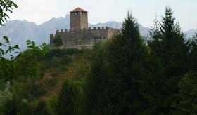
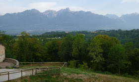
This beautiful road continues to the border of Veneto and an old survey marker from the days when Veneto first became part of Italy. Soon you arrive at the casa forestale (1268m) on Monte Candaglia, with great panoramas of the Dolomiti Bellunese, Monte Pizzoc, and the expansive grassy meadows of Piancansiglio. After a brief descent on the paved road, I took the bumpy gravel road marked variously Val Bona, Col di Piave, and later Pian di Landro. This road passes through densely forested wilderness for miles before finally leveling out, crossing Pian di Landro and arriving in the big meadowy expanse of Val Menera. Here cows were grazing under the sun, which was a welcome sight because I had gotten so cold on the long, slow shady descent I was shivering, despite wearing a wind jacket.
Soon you arrive at the main road and Pian Osteria. From here it's an easy ride across Piancansiglio, up through the woods to La Crosetta, and down the mountain to Sarone. Legs felt a little fried on the rolling hills of Via Pedemontane, but before long I was home. This is a great ride and I'd love to try some of the many variations soon.
 |
| Looking back at Col delle Palse from the ridge road |
 |
| Turn right at 1181 meters toward Cansiglio, Candaglia (concrete road) |
 |
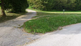
| Near Col de S'cious: turn right here for Candaglia |
 |
| Ceppo marking border between Veneto and Austrian empire |
 |
| Number of the ceppo |
 |
| Dolomiti Bellunese from casa forestale Candaglia |
 |
| Monte Teverone (2328m) to north |
 |
| Piancansiglio (Col Visentin antennas peaking over the ridge on left) |
 |
| The turn off below Candaglia to Val Bona/ Val Menera |
 |
| Gorgeous Val Menera meadows |
 |
| Looking back across Pian di Landro toward eastern ridge |


