Zoncolan is the most revered Friulian climb; recent Giro d'Italia stages ending at Zoncolan have further heightened the mystic. Most of this awe is focused on the hors catégorie western side, starting from Ovaro. Yet the easier eastern climb from Sutrio was actually the first Giro d'Italia ascent of Zoncolan (in 2003), and it's quite challenging.
I drove north of Tolmezzo to Arta Terme, then warmed up on the easy gradient to Sutrio (534m). Crossing the bridge I arrived at a staging area where many riders park before attempting Zoncolan. Here I turned left and immediately headed upward at 8%. I remained seated on this lower section, which traverses a beautiful spruce forest up a series of long switchbacks. The road is wide and well-paved, with a fairly constant gradient averaging 8.3% for 8.7km. I only encountered one rider headed upward, a middle-aged lady on a mountain bike. I was very impressed that she was attempting this difficult climb- quite courageous. She advised me to go "piano, piano" so I tried to keep my enthusiasm in-check.
This section ends at a ski resort parking area around 1300m. Quite a few tourists up here this time of year, many from other countries in Europe. There was no indication of a road continuing to the summit, so I asked some Civil Defense folks and they pointed upward.
After briefly winding through the ski area, this narrow mountain road hits a stretch of 16.4% gradient, with 18.5% at points. I climbed this standing, panting like a train. I passed 2 young ladies hiking up, and tried to say "Bon di" and they laughed and politely returned the greeting. The next segment of very short, steep tornanti also averaged about 16%. I greeted 2 ladies hiking, who asked if it was "facile o dura." I croaked out "Dura" and they laughed. Their companion was at the next tornante; he laughingly consoled me that this stretch was very easy and the worst was to come. Unfortunately he was right. I held out hope and panted and gasped my way higher. Then a section of 18.4% average gradient, with bits above 20%. I was on my last legs here, wheezing and braying like an asino. I thought I might have to stop, but wouldn't have room to restart and clip in, so I'd have to roll all the way down to the previous wide spot, and then reascend this wall. So I struggled on, and then spotted some little buildings at the summit, and they seemed not too high up, so maybe the gradient was going to ease. Sure enough it did, and I lived. This 4 km upper climb has a 13% average gradient.
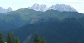
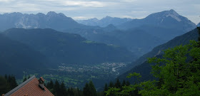
At the top (1745m) were some tourists who had driven up. I took a few pictures of the nearly 360-degree panorama. I headed down and soon saw the lady on the mountain bike- she was almost to the top. I encouraged her, "Appena!" and "Brava!" then continued downward. The ski resort area was becoming even more crowded with tourists/cars. Now I headed down the wonderful wide smooth road, round the switchbacks and down the straights, felt like I was flying. That was fun. Soon, back to Arta Terme and home.
I'll try this again and see if the top is easier next time. And maybe next year- the climb from Ovaro....
 |
| The road from Ovaro nears the summit |
 |
| View to the southwest |
 |
| Monte Crostis and Panoramica delle Vette road |
The valley from Paluzza to Ligosullo to Forcella Duron

View east-southeast toward the Julian alps |
 |
| Dolomiti Bellunesi to west |
 |
| Arta Terme down the valley of Torrente But |
 |
| 8.3% average gradient lower climb |
 |
| 13% average gradient of upper climb |
 |
| A couple of memorable spots on the upper climb |


