Pages

Monday, January 31, 2011

Andreis - Barcis backroads

Decided to do a little exploring around Andreis and Barcis today.  Headed to Montereale, over Lago di Ravedis, through the 4 km tunnel, and then turned toward Andreis.  Before Andreis, I took a left turn up the steep twisty climb through Prapiero and Alcheda.  A large black Irish wolfhound sauntered toward me and I told him how bravo he was and he decided not to bite off my leg- just sniffed it instead.  A young lady with baby said Bon di to me and scolded the naughty dog.  Then the road was roadblocked because of a big slump which dropped a section of pavement down the hill.  I bypassed the slump with a bit of mountain biking and ended back on the road.  The road descended rapidly, then crossed Torrent Ledron on a narrow bridge, followed by a killer climb up to Andreis (just shy of 20%).

I stopped by the raptor recovery center, where injured birds are nursed back to health.  The views from up here were spectacular in every direction.  Cruised back down to the main road along Torrente Alba.  I tried one more little road, which after a nice climb ended in a dead end.

Back down the main road to the bridge under SP251, to the chasm where the Alba, Molassa, and Cellina rapids join in a jumble of water-carved rock.  Here I took the back road over Dint, a hill the highway tunnels under.  At Lake Barcis, I rode through town, then turned up toward Roppe.  On the steepest bit (maybe 18%?) I encountered another large dog, this time a very fluffy Teruvian.  His owner scolded him and he aborted the attack on my leg with inches to spare.  Good boy!

I was hoping to get some photos of the lake from above but there are so many trees at this level it wasn't possible.  I'll come back and hike up a bit higher above the tree-zone to get some pics.


Monte Raut 2025m

Monte Castello 1923m

Monte Corta 1760m

Peaks along west escarpment of Val Cellina

Raptor recovery center above Andreis

Ice fall at chasm of Torrente Alba

Grade of the ride 

Elevation profile

Route above Andreis

Route above Barcis


Saturday, January 29, 2011

Canal di Cuna

I was planning to ride up Val Meduna to Tramonti di Sopra, but I noticed on the map a little paved road heading into the hills from Tramonti di Mezzo.  Turns out there is a hidden valley at the top of the road, with an historic abandoned village- see Canal di Cuna.  I set out to discover how far up the valley I could go.

After an hour of riding into 20 kph headwinds I arrived in Meduno.  Then up and down some rolling hills until reaching Lago dei Tramonti.  After the lake, the road heads up a lengthy stretch of 10-12% until Tramonti di Sotto, then you turn right toward Tramonti di Mezzo.  Here you turn right again onto a tiny road marked Canal di Cuna.  It's very narrow and rough, but not too steep at first.  Beautiful views (and sounds) of Torrente Chiarchia in the adjacent gorge.

Around 430 meters elevation, the road turns away from the torrente, and heads decidedly upward: 12 tornanti in 3 km gaining 350 meters elevation.  A couple of particularly steep stretches exceed 20% grade.  I tried standing for this whole 3 km, panting and gasping up the switchbacks.  For added fun, tire-swallowing drainage grates cross the road at intervals, with pine straw, tree limbs, and fallen rocks to boot.  I almost made it to the top, but finally vapor-locked at 727 meters.  After hyperventilating awhile, my bright-light-at-the-end-of-a-tunnel hallucination faded away, and I was back in the middle of a steep road.   No way to start and clip in at this angle with less than 2-meter wide pavement, so I donned cleat covers and walked.  The grade flattened out a bit at 750 meters- if I only could have lasted another 23 meters!

Shortly after, the road turns to dirt and stone.  Next time I'll try to ride up here with some sneakers in a knapsack, and hike on up to Forchia Zuviel 890 meters, then down toward the abandoned village at San Vincenzo.  From the website, sounds like there are great views of the surrounding peaks from Canal di Cuna.

Rode down the steep bits carefully, then rode fast as possible from Tramonti di Mezzo toward home.  The headwind from this morning was now at my back- felt like I was flying.


Torrente Meduna, with Monte Valcalda in background

Torrente Chiarchia 

Val Meduna from the road to Canal di Cuna

Torrente Chiarchia and Val Meduna


The grade up to Selva Piana, with two +20% stretches

From Tramonti di Mezzo to Selva Piana

Val Meduna from above


Sunday, January 23, 2011

Spilimbergo

Cloudless calm day with temps around 0℃.  Rode down the slightly down-sloping farmroad to Tesis for an easy warm up, then turned east on the new road from San Foca to Spilimbergo.  It's smooth, wide, and has bridges over the Cellina, Colvera, Meduna and Cosa- avoiding the guadi (fords) where the old road crossed the riverbeds.  These were impassable after heavy rains, and the pavement often was swept away, making them dusty and rough the rest of the year.

South of Spilimbergo, the new road ends and a well-paved but narrower main road takes you to  Spilimbergo.  I thought I'd go around on the bypass, but a car was going straight so I couldn't turn, so rather than waiting a few seconds, I rode into town.  Very pretty old town.  It's famous for its mosaic makers (who have mosaics around the world- I remember one in Washington DC).   Also has lovely old buildings in the centro, and a castello (which I'll have to get some pictures of next time- got a late start today).

Rode home on the main road to Maniago (not too busy because big trucks are forbidden on Sundays).  Nice flat ride, good workout.

Large mosaic covering exterior wall of Chiesa di San Giuseppe e Pantaleone


Tower in the old city walls in Spilimbergo

Tuesday, January 18, 2011

San Foca - Cavasso Nuovo

After my near-death bonk on Sunday, I decided to take an easy flat ride today.  Headed down through San Leonardo toward San Foca, when a fog bank hit around 170 meters.  Very dense and wet.  I turned east at San Foca, crossed the Magredi della Cellina, and entered Vivaro.  It was so foggy I actually got turned around in Vivaro and started to go the wrong way.  Luckily I got back on track for Tesis.  The very gradual climb to Tesis was just enough to get me out of the fog- it's sunny again!

After Tesis, Arba and Colle, I turned west again at Cavasso Nuovo.  Rode fast as possible, down through Maniago, Ponte di Ravedis, and Montereale.  

Probably would have been better to avoid the fog by going via Campagna to Arba.  But then I wouldn't have been dazzled by the sunlit, gleaming scenery after emerging from the fog.

Waiting for Friulian bullet train to cross

Monte Rest from Arba

Monte Rest (1780 m) from Orgnese


Sunday, January 16, 2011

Tarzo - San Lorenzo

Sunny and warm for January (10℃) so time to hit the road.  Thought I'd ride through the  prosecco vineyards in the hills above Conegliano to Soligo di Pieve.  Along the way, I passed hundreds of cyclists lured out by the fine weather.  Several bike club rides, with huge herds of bikers packed together, a few junior cycling race teams out for a training ride (with team car loud speaker goading them on), and countless small pacelines, pairs and lone wolves (like me).  I rode a bit faster than usual, which I paid for later.

At the Cadoro store in Vittorio Veneto, I turned left toward Cozzuolo.  It's a nice climb up a couple hundred meters, briefly levels out in the vineyards, then dives down to the intersection for Corbanese.  From here a long climb up toward Corbanese- the turn off for Soligo di Pieve was allegedly somewhere along here, but I never saw it.  I'll have to print out a trip-tic next time.

At Corbanese I turned right toward Tarzo.  Before I got to town I saw a turn off signed Panoramica Tarzo-San Lorenzo.  I jumped on this, and was rewarded with a lovely ride through a little side valley covered in vineyards.  The road is quite steep in some sections, hitting 15%.  Then it joins the main road from Tarzo to San Lorenzo, which is a better constructed road.  There are switchbacks to keep the steepness down as you wind through the forest to Passo di San Lorenzo (417 meters).  A junior cycling team and team car were gathered at the pass, waiting for stragglers to finish the climb up from Vittorio Veneto.  Maybe from there they descended to Tarzo.

The road then winds down more switchbacks to San Lorenzo village, then down a set of roughly paved switchbacks to Vittorio Veneto.  I rode through town and then through Anzano for a change of scenery.

The ride home up Via Pedemontane Occidentale was rough- I had burnt up too much energy on the outbound leg, had only half a water bottle left and 20 miles of rolling hills to go.  I gradually wound down and bonked, crawling home in first gear.   A couple of glasses of mango tea with lite salt and honey perked me up enough to go on a nice walk in the woods with Marilyn and the pups.  Lots of people out for walks, enjoying the beautiful day.


Monte Altare (left), Monte Pizzoc in background

From the road to San Lorenzo, looking west toward Tarzo 

Pian delle femene

Prosecco vines on road to San Lorenzo

Looking down at San Lorenzo village


Grade from Vittorio Veneto to Tarzo - San Lorenzo


Friday, January 14, 2011

Val Cellina

Finally the sun popped out today so time to ride.  Got a late start (*see below) and  I had promised Marilyn I'd be home to take the dogs for a walk by 1400, so couldn't go too  far.

I rode up through Montereale, across Lago di Ravedis, through the long tunnels to Lake Barcis.   Very little traffic, sunny, cold but not freezing, and no wind.  After Barcis I continued up through the river gorge, crisscrossing on bridges above the white water. It's a nice steady upgrade.

A couple of changes since my last time here.  They're building a narrow suspension bridge below Contron- maybe this will give access to trails on the upper east bank of the Cellina.  Also they've finished the new stone arch bridge near the junction of the main road and the cutoff for Claut.

At the junction my time was running out so I turned around.  Rode fast as possible all the way home.  It's downhill almost all the way- great fun.

*Got a late start because a couple of days ago, I heard a pssst sound and went out on the porch- the rear tire tube blew after sitting there for a week.  I matched the hole up to the previously damaged sidewall (from Passo di Pura last fall).  So I put on a new Michelin Krylion tire this morning.  Pro Race 3's ride great but aren't made for the torn-up roads I ride.

Also, having reloaded my Garmin firmware last week, today I had problems getting the GPS to work.  Took a few stops, resets, etc to get it going, wasting more time.  Next time I'll leave earlier and ride to Passo San Osvaldo or Claut.  


West escarpment of Val Cellina reflected in Lake Barcis

Looking farther north along the escarpment

Looking southeast toward Monte Raut 

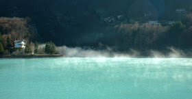
Fog creeping up the gorge, over the dam, onto Lake Barcis

Crep Nudo (2200 m)

Map


Wednesday, January 5, 2011

Val Muié - Val Colvera

Tomorrow the rains return, so had to get one last ride in.  I left at noon but the temp was still -1℃.  Had on neoprene overboots, Gekko Gear pants, and triple gloves, so didn't get cold.

Cruised through Fanna and Cavasso Nuovo then up Val Meduna.  After some rolling hills, dove down and crossed the Meduna River, then the steepish climb up to Navarons.  After a bit more climbing, you reach Val Muié, a mostly uninhabited valley connecting the Meduna with Val Colvera.  It's a heavily wooded, curvy, rolling ride, silent except for rushing Torrente Muié far below.  It ends with a steep climb-out to Poffabro, where folks were setting up a bonfire for tonight- the annual bonfire/burn-the-witch-in-effigy festival every village has on Epiphany eve.  Everybody drinks cups of hot wine and enjoys the warmth of the fire.

I then rode down Val Colvera, and stopped in Bus di Colvera gorge to snap some pictures of ice and white water.  Then down the hill to Maniago, through the piazza to Maniago Libero, across the Cellina at Ravedis, and home through Montereale.  Fun ride!


Road thru Val Muié 


Setting up the Falò below Monte Raut

3-meter icicle over road in Bus di Colvera


Waterfall Bus di Colvera

Falling water Bus di Colvera


Monday, January 3, 2011

Alta Livenza

Decided to stick to the plains on this cold sunny day.  Rode south on the slight downgrade to San Quirino, then west through Roveredo, Ceolini, Vigonovo to Fiaschetti.  Stopped to take some pictures of the Livenza River from the bridge near Fiaschetti.

There's a little climb at Fiaschetti to Sarone, which I've passed by hundreds of times but never ridden.  It's a nice easy ascent gaining maybe a hundred meters through the houses and shops of Sarone.  Here it joins the road coming down from Il Cansiglio and descends to Via Pedemontane Occidentale.

I stopped at La Santissima to get a picture of the spring where the Livenza River starts.  Hard to see in the picture, but the river is coming up from out of the ground at the base of the mountain.   A few kilometers further is Gorgazzo underwater cave, with an enormous flow of water from deep in the mountain gushing out.  These two waterways merge near San Floriano nature park, in the colline of Polcenigo.  Great places to visit if you're ever in the area.

Maybe someday soon I'll ride again to Villa Varda south of Brugnera, where the Livenza flows crystal-clear through the grounds of the villa, with large bunches of bright green aquatic grass swaying with the current.  Really beautiful place.  From there the river flows to the Adriatic Sea, forming the estuary at Caorle.


Fiume Livenza near Fiaschetti, looking south

Fiume Livenza looking north toward the mountains

La Santissima spring, source of the Livenza

Water gushing from Gorgazzo underwater cave soon joins the Livenza