Thursday, March 31, 2011

Orton - Monte Valinis

Warm sunny day.  Got a late start because I was doing some early landscaping.   Rolled down through Arba and Sequals to Travesio and started the climb for Clauzetto.  Soon the road was closed for work, with the deviazione heading up through Celante.  It's a narrow, steep mountain road through wildflower-covered woods.  Traffic was very light, as everyone opted for the main road through Anduins instead.

Below Domanins I rejoined the road to Clauzetto.  Climbed the switchbacks up the escarpment to 590 meters at Clauzetto, then continued up the mountain road to Orton (723 m).  From here I descended quickly to Gerchia at 530 meters.  The climb from there to Piani di Clauzetto isn't too steep, with lots of weird eroded karst formations, and cute baby goats to watch. At 675 meters, you reach the top, then descend through a pretty valley down to Campone.

Continuing from Campone down Val Chiarzo, you quickly reach the left turn-off at 408 meters.  This is a famously bad/steep road, with sections of 16% grade and a rough roadway with lots of loose rocks and branches.  It's quite a challenge to maintain traction and avoid falling.  The surrounding forest is beautiful if you can steal a glance- beech trees and karst formations.  This finally ends at Forchia Piccola (663 m) where you join the road coming up from Meduno.  Turning left, you immediately head up a steady 10% for several km, through fir and beech trees.  This road is a little better than the first one, and even has a long repaved stretch, where you can fly on the descent.

Pavement ends at 940 meters.  I kept going on the very rough rock road (lots of large stones to thread through and over).  I reached the grassy meadow at end of road, where several cars with hang-gliders and parapendio were parked.  I didn't go to the edge of the cliff to look down, but was quite startled when a parapendio suddenly appeared, riding an updraft straight up from the cliff face.  He tried to land but couldn't lose sufficient altitude to set down, so he said "Noch einmal" (yes, he was close enough to hear) and headed round again.  This time he managed to get his feet on the ground.

I headed carefully down the rocky road, then zoomed down the curvy paved road to Meduno.  The ride home is fairly flat, but there was a bit of headwind to contend with.  Overall a very good workout, with 1486 meters of climbing in 90 km.


Monte Rossa (1369 m) from Orton

Parapendio trying to land on Monte Valinis (around 980 m)

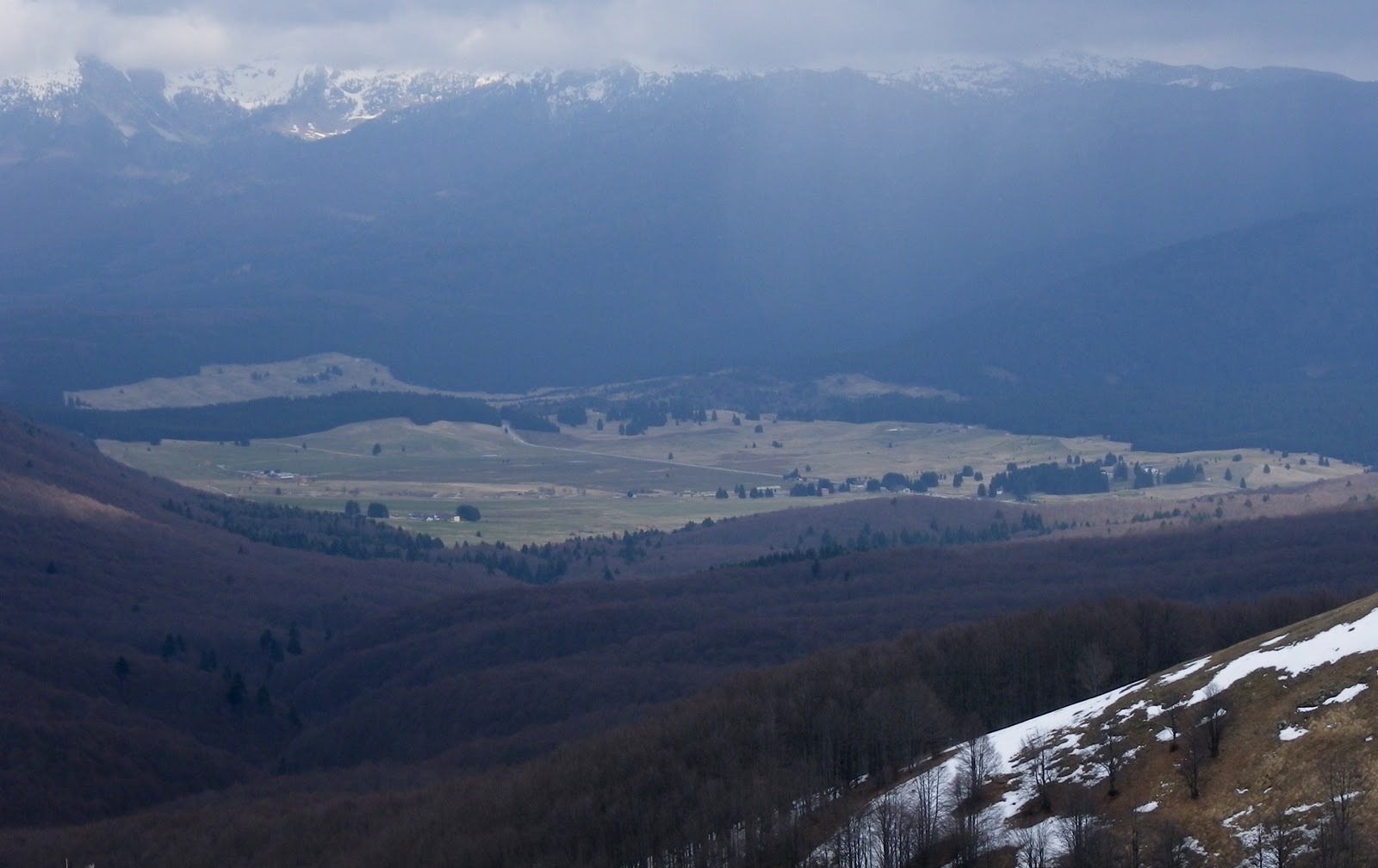
Orton (723 m), Piani di Clauzetto (675 m) and Monte Valinis (988 m)

The gradient to Clauzetto, Orton, Piani di Clauzetto,
and finally Monte Valinis (note 16% stretches)

The detour via Celante to Clauzetto
The climb to Orton, descent to Gerchia, and climb to Piani di Clauzetto

Monte Valinis- note cliffs below end of the road, where
parapendio take off and land

Tuesday, March 29, 2011

La Crosetta to Monte Pizzoc

After raining all night it was clear and sunny this morning.  I cruised down Via Pedemontana to Sarone (50 m) and headed upward.  I remained seated for most of the climb up to La Crosetta at (1127 m), with many stretches of 10-12%, and a few pitches at 13-14%.  It was sunny and hot for the first half, then a big black cloud appeared and it cooled off.  Even had a little light sleet, but not bad.

After La Crosetta there's a short downhill, and the climb to Monte Pizzoc begins.  They've repaved the first half km, which is quite steep and previously had a lot of loose stone and pavement.  Much better now.  Then the road climbs up through beautiful old beech tree forest with signs marking several biogenetic zones. Around 1400 meters this beautiful environment ends, and you enter alpine meadows.  They are covered in tufts of grass, which look a little like Cousin It of the Addams Family.  Some snow persisted in the fields along the road, and several of the round cattle ponds were still frozen over.  At 1540 meters the pavement ends.  I got a few pictures, but not the greatest because of the clouds and haze.

Very cold on the descent.  Warmed up a little around 600 meters when the sun came out.  After rejoining Via Pedemontana I spun all the way home.  Felt pretty good- didn't bonk because I drank plenty of fluids.  I will sleep very soundly tonight.

Lago Revine west of Vittorio Veneto

Clouds and mountains above Piancansiglio

Gradient to La Crosetta then to Monte Pizzoc

Satellite foto of climb to La Crosetta

Climb from La Crosetta to Monte Pizzoc

Saturday, March 26, 2011

Mezzomonte - Val d'Artugna

Needed a quick ride this morning so I could take Marilyn shopping in the PM.  Then it dawned on me- I've climbed Mezzomonte and the road from Dardago up Val d'Artugna many times, but never together on the same day.  So  I headed down Via Pedemontana Occidentale toward Coltura.  Many dozens of cyclists out today- good showing for a Saturday.

Shortly after Coltura (50 m) the road to Mezzomonte hits a wall of average 10% (though the Garmin showed a stretch of 16%), which I climbed standing.  This mellows after a few hundred meters to 9%.  A family was planting olive trees on newly-terraced land below the road here- those will be beautiful.  The road continues steeply through a series of 11 switchbacks, reaching 420 meters in 4.2 km, averaging 9%.  Excellent workout!  From here the road gently rises to 475 meters and pavement ends.  An old guy at the bar (having first ombra of the day at 1030) said "Sei contento?" because I was smiling after the climb.

The ride down was fast and great fun because of the fine pavement and lack of rocks, limbs, etc.  I headed back up Via Pedemontana toward Budoia, taking it easy till Dardago.  Here I turned left and headed up the gentle slope (average 7-8%), enjoying the woods and the wildflowers.  Quite a few folks out hiking, walking their dogs, etc.  After the Chalet restaurant, the road becomes a steeper, narrow mountain lane, finally turning into a gravel road at 580 meters.

Rode down fast, enjoying the long downhill straight stretch.  From Budoia to home wasn't bad- took it easy on the climbs so didn't get too worn out.  This is a good medium ride if you live in the area- 1397 meters of climbing in about 50 km and under 3 hours.
  
Road to Mezzomonte: 9th tornante by taverna (335 m)

Crode di San Tome- beautiful cliffs above Torrente Artugna

Crode di San Tome wider view

The tornanti up to Mezzomonte

Beautiful, peaceful climb up Val d'Artugna

Mezzomonte left, Val d'Artugna right

The gradient up Mezzomonte


Thursday, March 24, 2011

Val Muié - Lago di Selva

Got a late start- so chose a medium-sized ride.  Headed up through Bus di Colvera to Poffabro.  From here, a beautiful uninhabited descent down Val Muié to Navarons.  After a short jaunt north along the Meduna River, I turned left at the dam of Lago dei Tramonti.  Followed the east shore of the lake for awhile, then crossed the bridge over Torrente Silisia to Chievolis.

Now the climb starts, gaining 130 meters in the first 1.5 km- about 8.7%.  There is a 2 km rolling stretch next, losing and regaining altitude repeatedly.  Then another short climb of about 1 km, gaining another 100 meters (roughly 10%).  The road is carved into the side of the steep gorge of Torrente Silisia, one or two hundred meters below.  You can hear the rushing white water below, particularly at one narrow rock chute where the sound comes closer to thunder.  I'd love to hike down there someday- that would be awesome.

After descending to 500 meters at Lago di Selva, you cross the high dam, and the road turns to dirt.  Looks like a nice MTB ride.  The lake is surrounded by mountains, most spectacularly to the southeast, where the back of Monte Raut (2025 m) looms.

The ride back was fun- I returned via Meduno instead of Poffabro.  Quite a few cyclists out for a weekday- but it's unseasonably warm for March:  20℃ (or 68℉).  If it could only last!

Waterfall and rapids far below in the gorge of Torrente Silisia

Thundering white water in chutes of Torrente Silisia gorge

Forca della Media (1492 m) north of lake

Monte Corda (1463 m) north of lake

Gradient from Lago dei Tramonti to Lago di Selva

Elevation from Lago dei Tramonti to Lago di Selva 

Val Muié is red line at bottom.
Climb to Lago di Selva red line at top.


Tuesday, March 22, 2011

Lago di Barcis - Colalto


This is a wonderful climb from Lake Barcis (400 m) up the Val Caltea to Piancavallo and Colalto (1374 m).  It is mostly uninhabited, without traffic, and completely silent, except for white water rushing down the rocks of Torrente Caltea.  Surrounding the road is beech tree forest with moss-covered karst boulders strewn everywhere.

The first 8 km, up to around 900 meters, is the steepest part of the climb (around 8% average).  After that it settles down to around 5% average, though don't get too complacent as there's a 10% stretch around 1100 meters.  Above 900 meters there was snow along the sides of the road, but it was well-plowed and never a problem.

After reaching the altopiano I tried the backroad up through Colalto- unfortunately it is still snowed over after the summit.  So I descended on the main road down to Pedemonte, very fast and fun.

This is a great ride and I recommend it to anyone who likes quiet forest and falling water.


Mountains to northwest reflected on Lake Barcis

Torrente Caltea waterfall 

Monte Caulana (2068 m) and Monte Il Piz (1756 m)

End of plowed road at Colalto (1374 m)

Map of the climb

Sunday, March 20, 2011

Il Cansiglio da Farra d'Alpago

A week of rain has ended, and I set out today on the road to Vittorio Veneto.  Literally hundreds of cyclists were on the roads- some in packs and some in smaller groups.  I passed a tired fellow near Sarone and he drafted on me to Caneva.  It felt nice to help someone out.  After Vittorio Veneto I headed up to Lago Santa Croce.  Beautiful reflections of surrounding snowy peaks.   
I stopped to snap some pictures (with new waterproof camera), and when I restarted, a fellow passed me.  I jumped on his wheel and hurried to keep up.  This may have saved a little time, but I would pay later for this needless expenditure of energy.  Shortly, I arrived at Farra (400 meters) and turned right toward Tambre.  Almost immediately, I hit a wall of 13%.  Instinctively I stood on this, but stopped after a few hundred meters to get pictures of a patch of unusual flowers along the road.  From here the road continues climbing for 4 km at average 9.3%, till it reaches the village of Valdengher at 863 meters.   
The road descends and climbs again repeatedly, first to Spert, then on to a deviazione for road work, which includes a 13% stretch.  Back on the main road, you descend to a bridge over Rio Perosa, then up a long stretch of 10-12% through fir trees to Campon.  Down again now to the meadows of Pianosteria, and finally Il Cansiglio.  Beautiful clear day, but a bit windy here on the altopiano.
After another little climb through fir and beech forest to La Crosetta (1120 meters), the long descent begins.  No snow now (it’s all melted in the past 2 weeks), and the roads to Monte Pizzoc and Villa di Villa appeared clear.  The descent of 1070 meters in 16 km took about 25 minutes.  Very fun.
The 20 km ride home on Via Pedemontane was again a struggle- I ran out of tea in my Camelbak, and my legs felt kind of rubbery.  This stretch took about an hour.   Just in time to walk the pups (helps flush lactic acid out of leg muscles).  Great ride- and sets the stage for climbs to Monte Pizzoc (1565 meters), Monte Dolada (1490 meters) and beyond.


BTW, you can easily bypass the steep 4 km climb out of Farra by continuing on the flat to Puos and Cornei- 7 km further, but more gentle climb via Tambre and Spert.  See Lago Santa Croce - Il Cansiglio


Belluno mountains reflected in Lagos Santa Croce 

Monte Teverone (2348 m) and Crep Nudo (2200 m)

Beautiful alpine wildflower (dente di cane)

Put camera on ground to shoot this close up from below (maybe 7 cm away) 

Monte Venal (2212 m) and Monte Messer (2230 m)

Monte Guslon (2195 m) Monte Castelat (2208 m)
Cima delle Vacche (2063 m)

Piancansiglio with snowy Monte Pizzoc in distance (1565 m)

Gradient from Farra, through Spert, Campon, Piancansiglio

Map of climb


Thursday, March 10, 2011

Piancavallo da Pedemonte 2011

This is the biggest climb very close to home- only about 4 miles down the road.  It starts at only 145 meters and climbs an average 9.6% grade to Rifugio Bornass at 6.6 km.  A fellow passed me on this steep section, mashing a big gear and bobbing his torso up and down so violently his chin almost hit his stem on every pedal stroke.  Not sure how this increases power, but he definitely was ascending more rapidly than I.  At Rifugio Bornass (767 m) he was done climbing, just circling in the small parking lot to cool down.

I continued upward only slightly less-steeply to Castaldi at 10.9 km, with average grade of 8.5%.  Here at Castaldia (1090 m) there's a turnoff for Colalto (1374 m), but I thought it might be snowed over so I continued on the main road.  At 14 km I arrived at Piancavallo, which is still covered in snow.  I went around the altopiano and checked out the road down to Barcis- looked clear to me, but the signs say it's closed.  Maybe I'll try it from the other end soon.  I thought about cruising up the short climb to Colalto to see if it was snowed over, but was too tired.

I rode down as fast as possible.  The road was very clean- no cinders or loose pebbles like last Spring.  It only took about 12 minutes to descend 14 km and 1100 meters altitude.  Now that was fun!

The road down to Barcis

The snowy meadows from Piancavallo down to Pian delle More
Lots of crosscountry ski trails here  

Satellite foto from Pra de Plana (lower right) to Castaldia (upper left)